The best walks and hikes around Embalse de Santa Teresa
4.8
(4)
24
hikers
7
hikes
Hiking trails around Embalse de Santa Teresa in the province of Salamanca, Spain, traverse a landscape shaped by the Tormes River and its reservoir. The region is characterized by clear waters, gentle hills, and agricultural areas. Hikers encounter a mix of holm oaks, scrublands, and cultivated fields, offering expansive views of the water and surrounding rural charm.
Best hiking trails around Embalse de Santa Teresa
- The most popular hiking route is Church of Gilbuena – Church of San Miguel Arcángel…
Last updated: July 13, 2026
3
hikers
6.14km
01:37
60m
60m
Easy hike. Great for any fitness level. Easily-accessible paths. Suitable for all skill levels.
4.0
(1)
3
hikers
8.63km
02:16
70m
70m
Moderate hike. Good fitness required. Easily-accessible paths. Suitable for all skill levels.

Sign up for free
2
hikers
11.4km
02:59
80m
80m
Moderate hike. Good fitness required. Easily-accessible paths. Suitable for all skill levels.
5.0
(1)
3
hikers
17.3km
04:59
440m
440m
Moderate hike. Good fitness required. Mostly accessible paths. Sure-footedness required.
2
hikers
9.91km
02:52
260m
250m
Moderate hike. Good fitness required. Easily-accessible paths. Suitable for all skill levels.
Get access to more routes and recommendations from other explorers.
Sign up for free
Already have an account?
Our route recommendations are based on thousands of hikes, rides, and runs completed by other people on komoot.
Start today with a free account
Your next adventure awaits.
Login or Signup

Tips from the Community

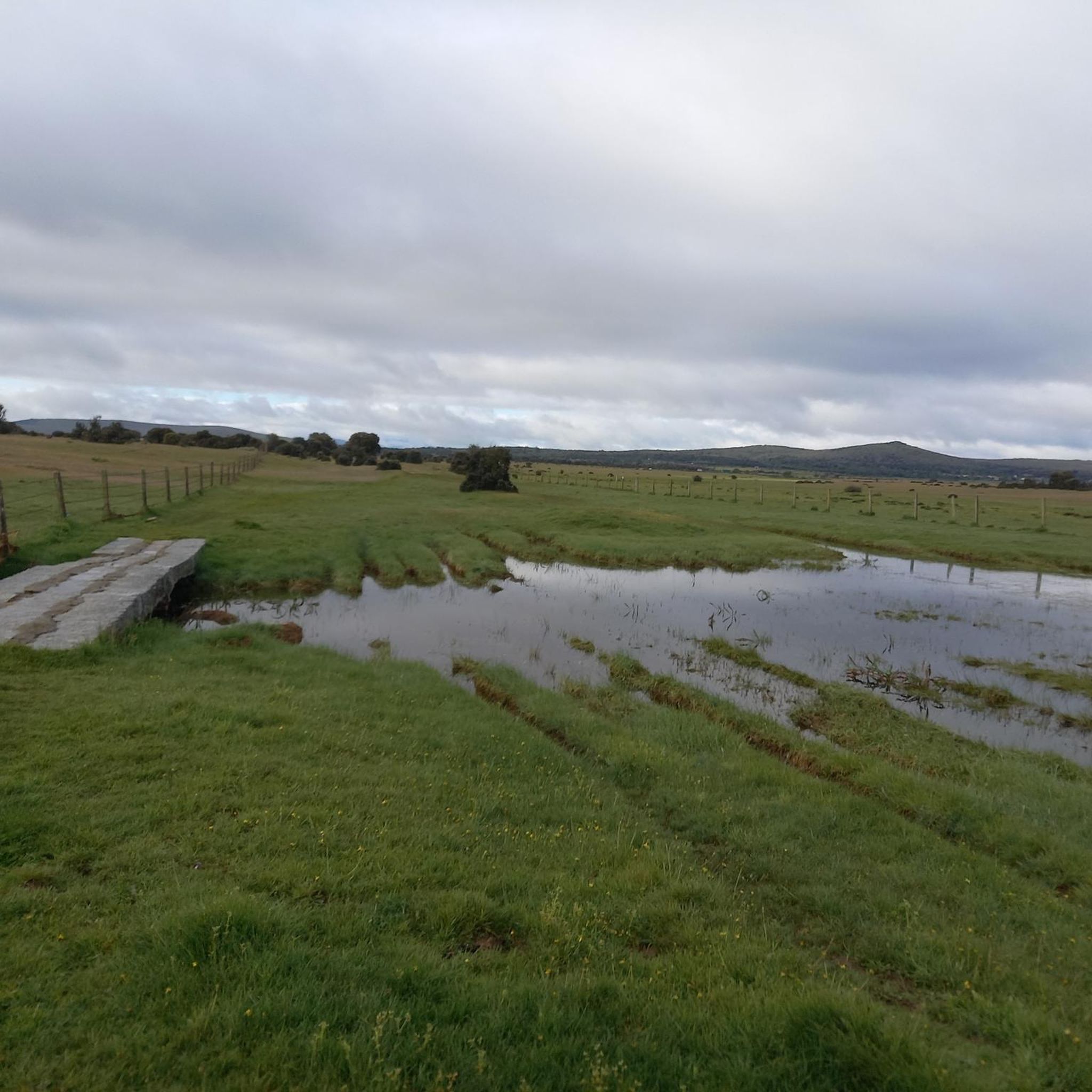
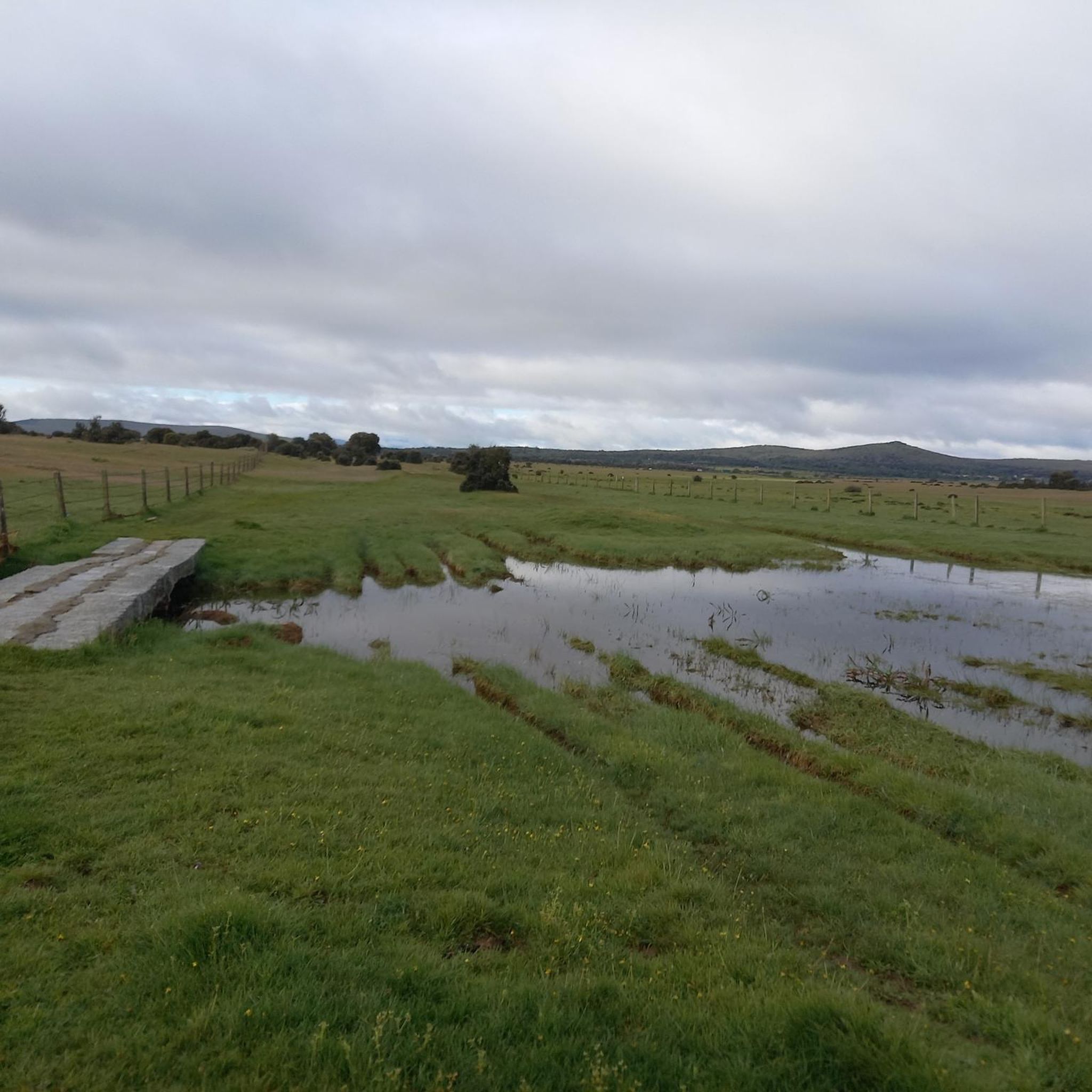
The Tondo path is part of the western Cañada Real Soriana. This section runs through a beautiful oak grove that offers refreshment and some shade in the summer.
0
0

This is the tourist and gastronomic area of Guijuelo, considered the birthplace of acorn-fed Iberian ham with Protected Designation of Origin (PDO Guijuelo). More than 150 ham and cured meat producers are concentrated here. The cold, dry climate of the Sierra de Béjar favors a slow, natural curing process, giving the ham a sweeter, more unctuous flavor.
3
0

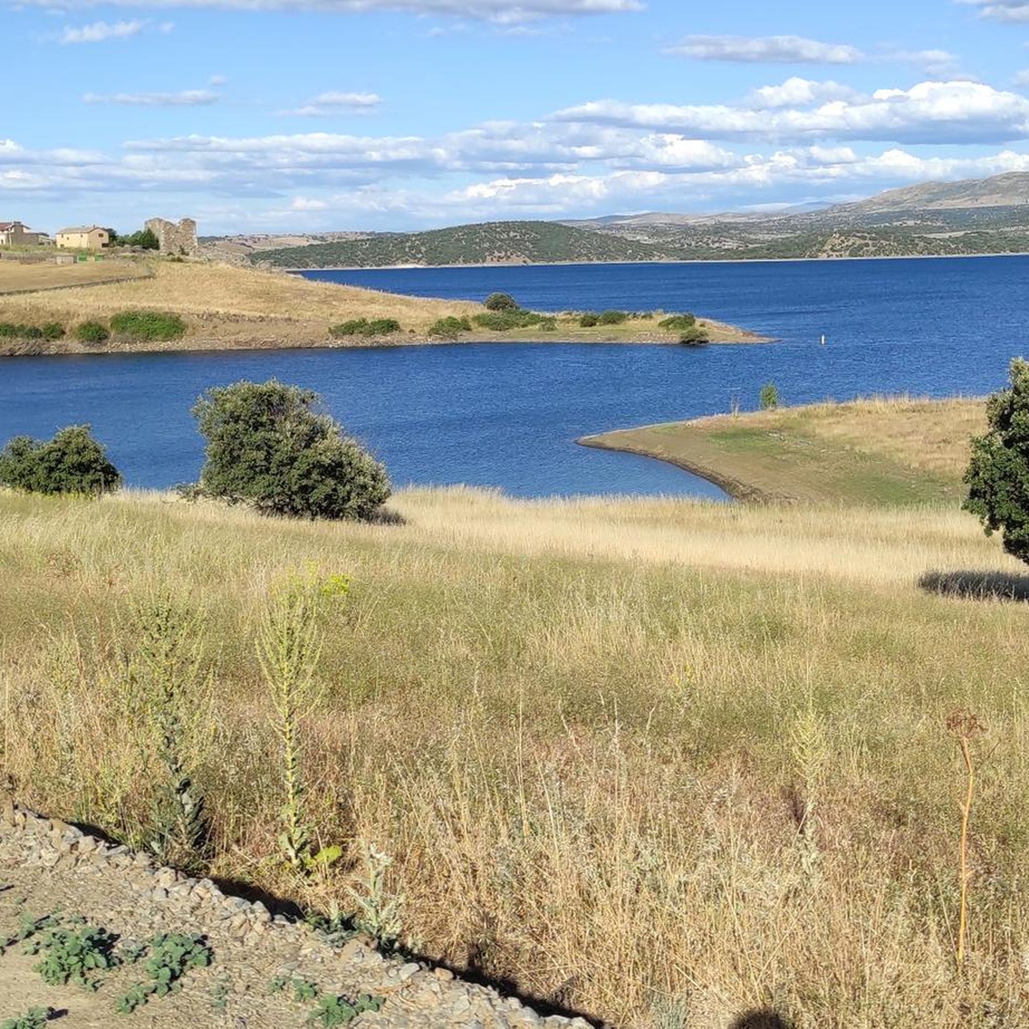
The Tormes leaves the rocky outcrops and becomes a reservoir.
0
0
A curious tower. Defensive, controlling the Tormes and Valvanera fords? A pleasant surprise.
0
0

Beautiful oak forest, ideal for a summer day in Castile
0
0

You cannot leave Guijuelo without eating its famous ham! The town is famous for the high quality of its hams and sausages from Iberian pigs. Although the meat comes largely from Extremadura and Andalusia, here it finds the perfect place for its curing, thanks to a characteristic cold and dry climate.
2
1

The Salamanca town of Puente del Congosto, located a few kilometers from the entrance of the Tormes river in charro territory, owes its name to the gorges and channels that the erosion of the water has been causing. The origin of the town dates back to the 11th century.
0
0
Frequently Asked Questions
How many hiking trails are available around Embalse de Santa Teresa?
There are several hiking routes available around Embalse de Santa Teresa, with komoot listing 4 distinct tours. These routes offer a mix of experiences, from reservoir-side paths to holm oak woodlands.
What is the general difficulty level of hiking trails in Embalse de Santa Teresa?
The hiking trails around Embalse de Santa Teresa are generally considered moderate, with 3 moderate routes and 1 easy route listed. This makes the area accessible for a range of hikers, from beginners to those looking for a more challenging walk.
What kind of terrain can I expect on hikes around Embalse de Santa Teresa?
You can expect a varied landscape featuring gentle hills, holm oak woodlands, scrublands, and cultivated fields. Many trails offer expansive views of the reservoir and the surrounding rural charm of the 'dehesa salmantina' with its pastures and oak trees.
Are there any notable natural features or viewpoints along the hiking trails?
The Embalse de Santa Teresa itself is a central natural feature, offering clear, cold waters and tranquil settings. You'll find viewpoints overlooking the reservoir, and the landscape is characterized by holm oaks and almond trees. The area is also an important meeting point for migratory birds, especially cranes.
What kind of wildlife might I see while hiking?
The Embalse de Santa Teresa is known as an important meeting point for migratory birds, particularly cranes. Bird observation routes are even offered in nearby Pelayos and Guijo de Ávila, combining hiking with wildlife viewing opportunities.
Are the hiking trails around Embalse de Santa Teresa suitable for families with children?
Yes, with a mix of easy and moderate routes, the area offers options suitable for families. Shorter, less strenuous paths can be found, allowing families to enjoy the natural beauty and reservoir views. For example, the Torre de Santibáñez de Béjar loop from Santibáñez de Béjar is a moderate 10.4 km route that could be a good option for active families.
Can I bring my dog on the hiking trails around Embalse de Santa Teresa?
Generally, dogs are welcome on trails in rural areas like Embalse de Santa Teresa, but it's always advisable to keep them on a leash, especially when passing through agricultural lands or near livestock. Always clean up after your pet to maintain the natural environment.
Is parking available at the trailheads around Embalse de Santa Teresa?
Given the rural nature of the area, parking is typically available in or near the towns and villages that serve as starting points for trails, such as Medinilla or Mataherrero. Look for designated parking areas or suitable roadside spots.
What is the best time of year to go hiking around Embalse de Santa Teresa?
The spring and autumn months are generally ideal for hiking around Embalse de Santa Teresa, offering pleasant temperatures and vibrant natural scenery. Summers can be hot, while winters are cooler but still offer opportunities for hiking, especially on clear days.
Are there many circular hiking routes available?
Yes, many of the hiking routes around Embalse de Santa Teresa are circular. For instance, the Oak forest of the Sierra de Tonda loop from Mataherrero and the Medinilla Church loop from Medinilla are both popular circular options, allowing you to start and end in the same location.
Are there places to eat or stay near the hiking trails?
Yes, towns and villages around the reservoir, such as Salvatierra de Tormes, Guijo de Ávila, and Pelayos, offer rural accommodations and campsites. You can find local establishments for food and drink in these areas to refuel after your hike.
What do other hikers say about the trails around Embalse de Santa Teresa?
The area is highly rated by the komoot community, with an average score of 4.5 stars from over 2 reviews. Hikers often praise the tranquil natural setting, the expansive views of the water, and the characteristic 'dehesa salmantina' landscapes.
Are there any longer hiking options for experienced hikers?
For those seeking a longer challenge, the Church of Gilbuena – Church of San Miguel Arcángel loop from Medinilla is a moderate 13.9 km trail that takes around 3 hours 51 minutes to complete, offering a substantial walk through rural landscapes and past local churches.
Most popular routes around Embalse de Santa Teresa

Get inspired with the komoot mobile app


Explore more
Browse the best Hikes in other regions.
