The best gravel rides around Froidestrées
4.8
(10)
32
riders
7
rides
Gravel biking around Froidestrées offers routes through a landscape characterized by former railway lines, greenways, and rural terrain. The region features gentle elevation changes, making it suitable for various skill levels. These trails often follow converted railbeds, providing relatively flat and consistent surfaces for gravel cyclists. The area's natural features include open fields and sections of woodland, typical of the French countryside.
Best gravel bike trails around Froidestrées
- The most popular gravel bike trail is Axe Vert de la Thiérache…
Last updated: July 7, 2026
5.0
(1)
10
riders
25.6km
01:19
130m
130m
Easy gravel ride. Great for any fitness level. Mostly paved surfaces. Suitable for all skill levels.
5.0
(1)
5
riders
31.6km
01:35
130m
130m
Easy gravel ride. Great for any fitness level. Mostly paved surfaces. Suitable for all skill levels.

Sign up for free
5.0
(3)
4
riders
43.0km
02:27
330m
330m
Moderate gravel ride. Good fitness required. Mostly paved surfaces. Suitable for all skill levels.
5.0
(2)
6
riders
44.6km
02:17
230m
230m
Moderate gravel ride. Good fitness required. Mostly paved surfaces. Suitable for all skill levels.
2
riders
52.6km
02:53
330m
330m
Moderate gravel ride. Good fitness required. Mostly paved surfaces. Suitable for all skill levels.
Get access to more routes and recommendations from other explorers.
Sign up for free
Already have an account?
Our route recommendations are based on thousands of hikes, rides, and runs completed by other people on komoot.
Start today with a free account
Your next adventure awaits.
Login or Signup




Tips from the Community


At the height of Neuve-Maison, in the direction of Guise
0
0

The Ohis railway viaduct was built around 1885, then destroyed during the First World War and rebuilt just after. 27 meters high and 187 meters long, it has 13 arches. The Busigny-Hirson line, which was completely closed in 1978, used to run through it.
0
0

Fantastic fortified church that has survived several wars.
1
0

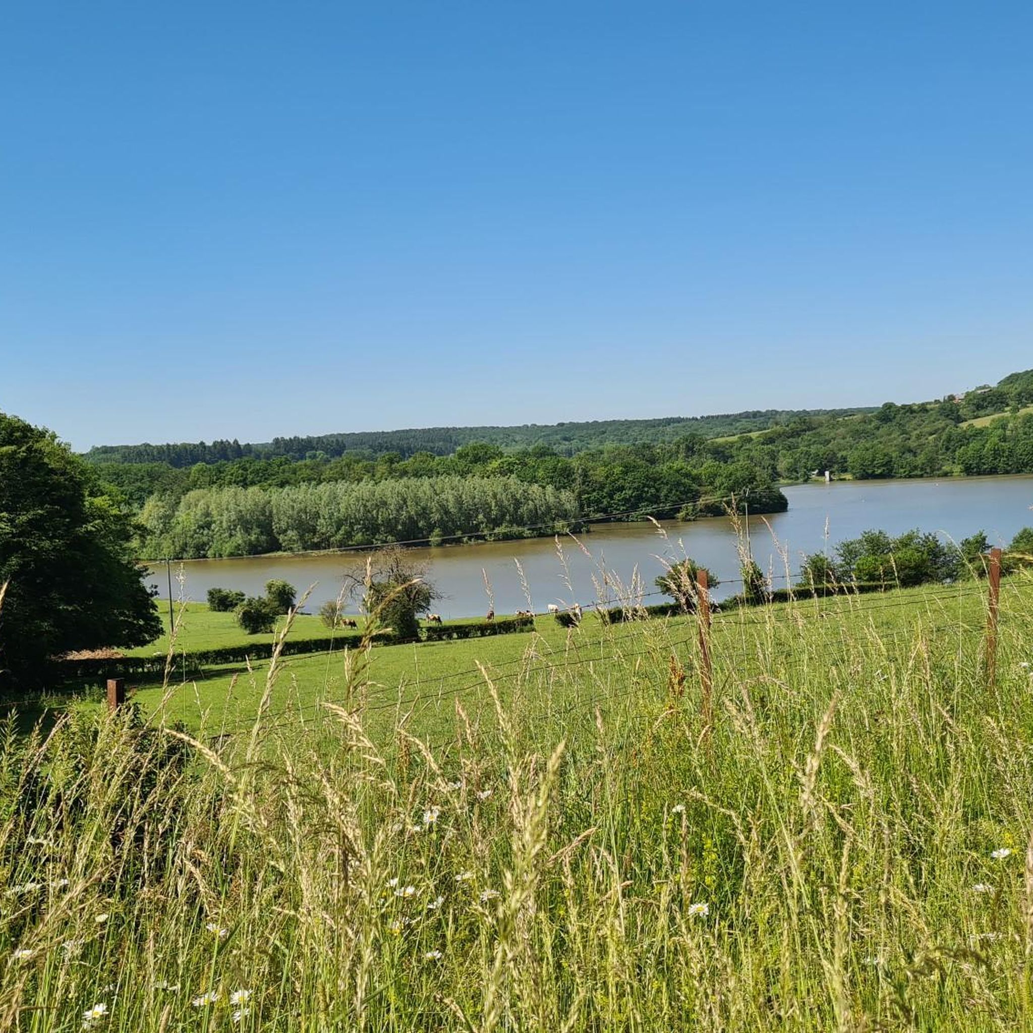
The straight road at an altitude of 290m provides a beautiful panorama.
1
0
The Ax Vert de la Thiérarche is a former railway line that has been converted into a cycling and walking path. The trail of almost 40 kilometers runs from Guise to Hirson, via Autreppes, and offers a pleasant and peaceful environment for walking, cycling and horse riding. The path runs along the banks of the Oise River and offers beautiful views of the natural and cultural heritage of the Thiérache.
2
0
The Église Saint-Martin de Wimy is a Catholic church located in the municipality of Wimy, in the east of the Aisne department. The church was built in the 16th century and is one of the finest examples of a fortified church in the region. The church has a massive donjon with a square plan and a double-pitched roof, flanked at the front by two enormous towers five meters in diameter, all in brick, except for the base of the towers in sandstone. The rest of the church, which extends behind the donjon, is a parallelogram of stone, with numerous restorations in brick. The church has been listed as a historical monument since 1989.
2
0
Locomobile No. 3003, which can be seen at the entrance to the town of Buire and the former railway depot, was manufactured in 1900 by the construction engineer Emile Salmson. Its operating pressure was 7 bars. Property of the Northern Railway Company, it was used to drive the machine tools of the Hellemes Workshops (North). As the SNCF machine tools became autonomous, she ended her career in 1939. It was Monsieur Raclot, director of the Leclerc center, who offered her second youth to the ECO-RAIL association.
2
0
Frequently Asked Questions
How many gravel bike trails are available around Froidestrées?
There are 5 gravel bike trails listed in this guide for the Froidestrées region, offering a variety of experiences for different skill levels.
Are there any easy gravel bike trails suitable for beginners in Froidestrées?
While all routes in this guide are rated moderate to difficult, the region's landscape, characterized by former railway lines and greenways, generally features gentle elevation changes. Routes like the Picnic Tables – Old railroad loop from Clairfontaine are moderate and offer a good introduction to the area's terrain.
What is the typical length and duration of gravel bike routes in Froidestrées?
Gravel bike routes in Froidestrées vary in length and duration. For example, the Ohis Railway Viaduct – Former Wimy-Ohis station loop from Clairfontaine is about 23.9 miles (38.5 km) and takes around 2 hours 31 minutes, while the more extensive Axe Vert de la Thiérache – Liessies Picnic Area loop from Rond-Point de Guise covers 75.2 miles (121.0 km) and can take over 8 hours.
Are there family-friendly gravel biking options in the Froidestrées area?
The region's trails, often following converted railbeds, provide relatively flat and consistent surfaces, which can be suitable for families. Routes with moderate difficulty, such as the Ohis Railway Viaduct – Locomobile Salmson No. 3003 loop from Étréaupont, offer a good balance of distance and manageable terrain for a family outing.
What kind of natural features or landmarks can I expect to see along the gravel bike trails?
The trails often pass through open fields and sections of woodland, typical of the French countryside. You can also encounter interesting historical structures like the Ohis Railway Viaduct or explore sections of the Axe Vert de la Thiérache, a significant greenway. The Old railroad sections also offer unique sights.
Are there any circular gravel bike routes around Froidestrées?
Yes, all the gravel bike routes featured in this guide are designed as loops, allowing you to start and finish at the same point. Examples include the Locomobile Salmson No. 3003 – Ohis Railway Viaduct loop from Clairfontaine.
What is the best time of year for gravel biking in Froidestrées?
The French countryside around Froidestrées is generally pleasant for cycling from spring through early autumn (April to October). Spring offers blooming landscapes, while autumn provides cooler temperatures and beautiful foliage. Summer can be warm, so consider early morning or late afternoon rides.
Are there any specific viewpoints or scenic spots along the gravel trails?
Many routes offer scenic views of the rural landscape, particularly along the former railway lines and greenways. The Ohis Railway Viaduct itself is a notable landmark and offers elevated perspectives of the surrounding area.
What should I bring for a gravel biking trip in Froidestrées?
Beyond your gravel bike and helmet, it's advisable to carry water, snacks, a repair kit (including spare tubes), a first-aid kit, and navigation tools. Given the rural nature of some routes, appropriate clothing for varying weather conditions and sun protection are also recommended.
Are the gravel bike routes in Froidestrées dog-friendly?
While the trails themselves are generally open, it's important to check local regulations regarding dogs on specific paths, especially those passing through agricultural land or nature reserves. Always keep dogs on a leash and be mindful of other trail users and wildlife.
Where can I find parking for gravel bike routes in Froidestrées?
Many of the loop routes in this guide start from villages or specific points like 'Rond-Point de Guise' or 'Clairfontaine,' where public parking is typically available. It's recommended to check the starting point of your chosen route for specific parking information.
Are there places to stop for food or drinks along the gravel bike trails?
The routes traverse rural areas, so dedicated cafes or pubs directly on the trails might be limited. It's best to plan your stops in advance, especially in the villages near the start or end points of the routes, or carry sufficient provisions for your ride.
Most popular routes around Froidestrées
Most popular attractions around Froidestrées

Get inspired with the komoot mobile app


Explore more
Browse the best Gravel rides in other regions.
