The best walks and hikes around Forksville
58
hikers
14
hikes
Hiking around Forksville offers access to the rugged terrain of the Endless Mountains, characterized by deep gorges, dense forests, and the winding Loyalsock Creek. The region encompasses diverse landscapes, including the S-shaped valley of World's End State Park and the extensive Loyalsock State Forest. Hikers can explore areas featuring waterfalls, scenic overlooks, and varied elevation changes.
Best hiking trails around Forksville
- The most popular hiking route is Canyon Vista Trail, a 4.1 miles (6.6 km) trail that takes 2…
Last updated: July 1, 2026
20
hikers
6.55km
02:02
230m
240m
Moderate hike. Good fitness required. Easily-accessible paths. Suitable for all skill levels.
26.4km
07:50
740m
730m
Hard hike. Very good fitness required. Easily-accessible paths. Suitable for all skill levels.

Sign up for free
1
hikers
7.16km
02:08
220m
210m
Moderate hike. Good fitness required. Easily-accessible paths. Suitable for all skill levels.
1.51km
00:24
30m
0m
Easy hike. Great for any fitness level. Easily-accessible paths. Suitable for all skill levels.
7.21km
02:07
200m
180m
Moderate hike. Good fitness required. Easily-accessible paths. Suitable for all skill levels.
Get access to more routes and recommendations from other explorers.
Sign up for free
Already have an account?
Our route recommendations are based on thousands of hikes, rides, and runs completed by other people on komoot.
Start today with a free account
Your next adventure awaits.
Login or Signup
Popular around Forksville
Tips from the Community

Sones Pond can be a bit deceiving, at first glance it appears to be a natural pond surrounded by trees. However, it was actually built by the Civilian Conservation Corps in the 1930s. It's a beautiful spot to stop for a rest, or for trying your luck with the fish that are said to bite here often.
0
0

There are a few waterfalls along Ketchum Run Gorge, and most can be seen from the Loyalsock Trail, including the Armstrong-Rode Falls, and numerous others in this shady canyon.
0
0
Worlds End State Park sits within the Loyalsock State Forest, adding 780 acres to the 114,000 acres of the State Forest. The park offers a plethora of outdoor activities from hiking, and biking, to swimming, camping, fishing, and more. Visiting during the Autumn is a treat with the dazzling colors across the forest.
0
0

Loyalsock Canyon Vista is a lookout spot along Cold Run Road that has views of Loyalsock Canyon. This is an awesome view in autumn as the leaves are changing color.
0
0

Enjoy the remote finish line in Worlds End and celebrate with ice cream at Grinduro! Pennsylvania 2022.
1
0
Frequently Asked Questions
What kind of terrain can I expect on hikes around Forksville?
Hiking around Forksville offers a diverse and often rugged experience. You'll encounter deep gorges, dense forests, and the winding Loyalsock Creek. The region, particularly within World's End State Park and the Loyalsock State Forest, features varied elevation changes, from challenging climbs to more gentle paths. Expect natural surfaces, rocky sections, and potentially muddy areas, especially after rain.
Are there any family-friendly hiking options near Forksville?
Yes, there are several options suitable for families. While some trails in the region can be challenging, World's End State Park offers a range of experiences. For a shorter, easier walk, consider the Link Trail, which is just over 1.5 km long. Many trails within the state parks are well-maintained and offer scenic views without extreme difficulty, making them enjoyable for various ages.
Can I bring my dog on the hiking trails around Forksville?
Generally, dogs are welcome on trails in Pennsylvania State Parks and State Forests, including those around Forksville, but they must be on a leash no longer than six feet and under physical control at all times. Always check specific park regulations before heading out, especially for sensitive natural areas or designated swimming spots. Remember to pack out all pet waste.
What are some notable landmarks or viewpoints I can see while hiking?
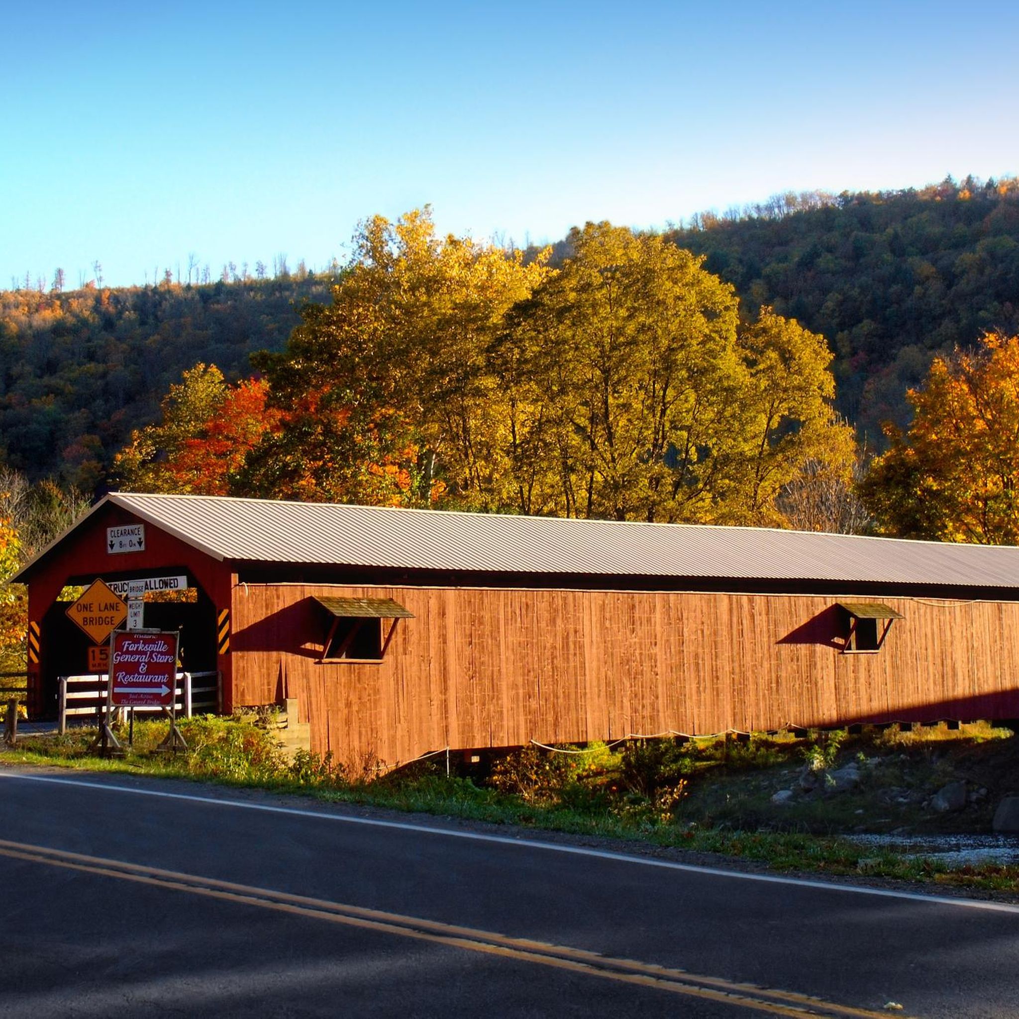
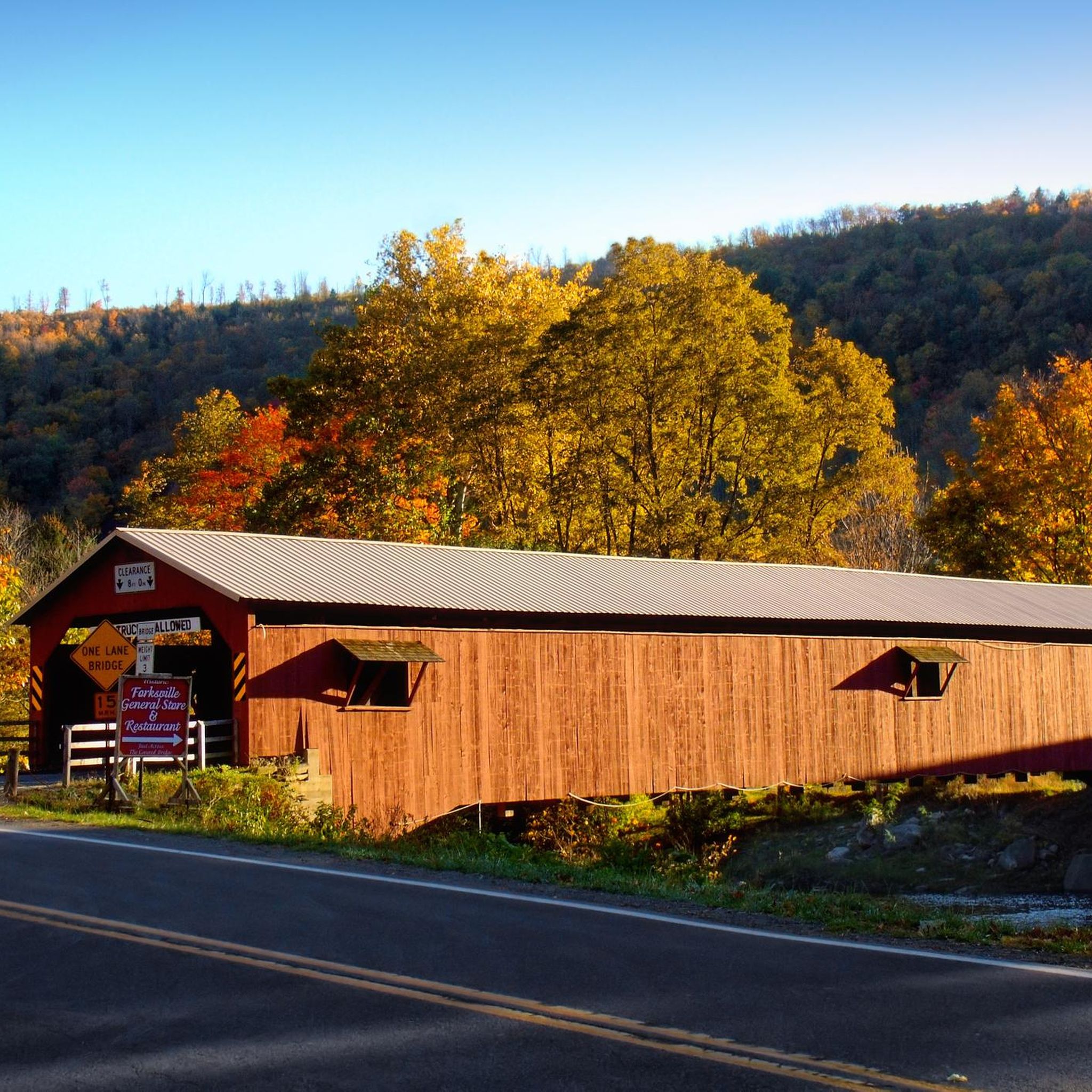
The Forksville area is rich with scenic landmarks. Within World's End State Park, you can enjoy stunning views from overlooks like Canyon Vista and High Knob Overlook. The Loyalsock Canyon Vista along Cold Run Road also provides breathtaking views. Don't miss the historic Forksville Covered Bridge, a local landmark built in 1850 over the Loyalsock Creek.
Are there any waterfall hikes in the Forksville area?
Absolutely! While the immediate Forksville area has beautiful creeks, the most renowned waterfall experience is a short drive away at Ricketts Glen State Park. This expansive park is famous for its Glens Natural Area, which boasts 22 named waterfalls, including the impressive 94-foot Ganoga Falls. It's a must-visit for waterfall enthusiasts.
What is the best time of year to hike around Forksville?
The best time to hike around Forksville largely depends on your preferences. Spring brings lush greenery and flowing waterfalls, though trails can be muddy. Summer offers warm weather perfect for swimming in Loyalsock Creek, but can be humid. Autumn is spectacular, with vibrant fall foliage making the scenic overlooks truly breathtaking. Winter hiking is possible for experienced hikers, offering a serene, snow-covered landscape, but requires appropriate gear and caution.
Are there any circular hiking routes available?
Yes, the region offers several excellent circular routes. For example, the Double Run to Canyon Vista Loop is a moderate 7.2 km path that combines forest sections with scenic vistas. For a more challenging option, the Loyalsock Trail and Link Trail Loop is a difficult 26.4 km route that takes you through varied forest and creek landscapes.
What facilities are available at World's End State Park?
World's End State Park, a major hub for outdoor activities near Forksville, offers a range of facilities. These include a natural swimming hole in the Loyalsock Creek, picnic areas, and access to numerous trails. The park also provides campsites and rustic cabins for rent, making it a great base for extended stays. You can find more information about the park's amenities on the official pa.gov website.
How many hiking trails are there in the Forksville area?
The Forksville area, including its surrounding state parks and forests, offers a vast network of trails. Komoot alone features over 15 hiking routes directly around Forksville, ranging from easy to difficult. When considering the extensive Loyalsock State Forest and nearby World's End State Park, the total number of available trails extends to well over 200 miles of hiking opportunities.
Where can I find parking for trailheads?
Parking is generally available at designated trailheads and within state parks. For trails within World's End State Park, there are multiple parking areas, including those near the park office and popular overlooks like Canyon Vista. When hiking sections of the Loyalsock Trail, look for parking at road crossings or designated access points. Always park in marked areas and be mindful of any specific regulations or permits required, especially during peak seasons.
Are there any opportunities for wild swimming near the trails?
Yes, the Loyalsock Creek, which winds through the region, offers natural swimming opportunities. World's End State Park features a popular natural swimming hole in the creek, which is a refreshing spot during warmer months. Always exercise caution when swimming in natural waters and be aware of currents and water levels.
What is the difficulty level of hikes around Forksville?
The difficulty of hikes around Forksville varies significantly. You can find easy, short trails like the Link Trail, which is relatively flat. Moderate trails, such as the Canyon Vista Trail, involve some elevation gain and can take a couple of hours. For experienced hikers, there are difficult routes like the Loyalsock Trail and Link Trail Loop, which cover long distances and significant elevation changes.
What do other hikers enjoy most about hiking in Forksville?
Hikers frequently praise the rugged natural beauty and diverse landscapes of the Forksville area. Many enjoy the challenging terrain and rewarding views from overlooks like Canyon Vista. The tranquility of the dense forests, the refreshing Loyalsock Creek, and the chance to explore historic landmarks like the Forksville Covered Bridge are also commonly highlighted as favorite aspects of the region.
Most popular routes around Forksville
Most popular attractions around Forksville

Get inspired with the komoot mobile app


Explore more
Browse the best Hikes in other regions.
