The best walks and hikes around Ortigosa De Pestaño
35
hikers
11
hikes
Hiking around Ortigosa De Pestaño offers exploration of the Campiña Segoviana region, situated between the Voltoya and Eresma rivers at an altitude exceeding 860 meters. The landscape features a mix of agricultural fields, river ecosystems, and remnants of holm oak and Pyrenean oak forests. The Vía Verde del Eresma, a natural path, passes through the area, providing accessible routes. This environment provides varied backdrops for outdoor activities.
Best hiking trails in Ortigosa De Pestaño
- The most popular hiking route is Nava de la Asunción – Eresma Greenway loop from Nava de la Asunción, a 8.2 miles (13.2 km) trail that takes 3 hours 20 minutes to complete. This moderate route follows the Eresma Greenway, offering views of the river and surrounding fields.
- Another top favourite among local hikers is Coca Castle – Nava de la Asunción loop from Nava de la Asunción, a difficult 13.3 miles (21.4 km) path. This longer route traverses agricultural landscapes and river valleys, providing a more challenging experience.
- Local hikers also love the Nava de la Asunción loop from Bodón de los Anteojos, a 6.7 miles (10.8 km) trail leading through open agricultural landscapes and river plains, often completed in about 2 hours 45 minutes.
- Hiking around Ortigosa De Pestaño is defined by agricultural fields, river ecosystems, and sections of the Vía Verde del Eresma. The network offers options for easy, moderate, and difficult routes suitable for various ability levels.
- The guide includes highly-rated routes that showcase the best of the region's landscape. More than 30 hikers have used komoot to explore Ortigosa De Pestaño's varied terrain.
Last updated: July 5, 2026
4
hikers
7.74km
01:57
10m
10m
Easy hike. Great for any fitness level. Easily-accessible paths. Suitable for all skill levels.
2
hikers
3.09km
00:49
30m
30m
Easy hike. Great for any fitness level. Easily-accessible paths. Suitable for all skill levels.

Sign up for free
2
hikers
Moderate hike. Good fitness required. Easily-accessible paths. Suitable for all skill levels.
2
hikers
21.4km
05:26
60m
60m
Hard hike. Very good fitness required. Easily-accessible paths. Suitable for all skill levels.
2
hikers
10.8km
02:44
10m
10m
Moderate hike. Good fitness required. Easily-accessible paths. Suitable for all skill levels.
Get access to more routes and recommendations from other explorers.
Sign up for free
Already have an account?
Our route recommendations are based on thousands of hikes, rides, and runs completed by other people on komoot.
Start today with a free account
Your next adventure awaits.
Login or Signup
Popular around Ortigosa De Pestaño
Tips from the Community

Very interesting... especially routes in autumn and spring when it rains so that the transit through the sands of the pine forests is not so complicated.
0
1

Nava de la Asunción is a Spanish municipality and town in the province of Segovia. Originally known as Nava de Coca, it belonged to the village and land community. Later, in 1773, King Carlos III granted it the title of Villa and added “La Asunción” to its name, in honor of the Virgin, patron saint of the town. I hope you found this brief description interesting! 😊
2
0
It was built in the 15th century and is considered one of the best examples of Spanish Gothic-Mudejar. Property of the Casa De Alba, transferred to the Ministry of Agriculture of Spain since 1954.
8
0

Population located north of the capital of the province, Segovia. It is a nucleus located between the two rivers, the Río Edesma and the Río Voltoya.
1
0
Green way that runs between the towns of Nava de la Asunción and Ciruelos de Coca and that leaves us with beautiful landscapes in the rainy season, where the fields turn green.
1
0
Beautiful castle that is located in the town of Coca and that seems to be part of a movie castle.
1
0

The castle is undoubtedly what stands out the most in this town, although the watchtower is also worth a visit. The guided tour of the castle will simply show us its attractions and is especially fun for the little ones. In the town we will find restaurants, shops and accommodation if necessary
1
1

The Castle of Coca is considered the most impressive building of the Mudejar style. After the Reconquista, many Muslims remained in the country and craftsmen in particular continued to practice their trade under the Spanish rulers. This resulted in a unique fusion of occidental and Arabic architecture in buildings. Special feature: even castles and fortresses were built entirely of bricks.
1
1
Frequently Asked Questions
What kind of hiking can I expect around Ortigosa de Pestaño?
The area around Ortigosa de Pestaño, situated in the Campiña Segoviana, offers mostly gentle hiking experiences through agricultural fields, river ecosystems, and remnants of holm oak and Pyrenean oak forests. The Vía Verde del Valle del Eresma, a natural path with a compacted earth surface, is a prominent feature, ideal for relaxed walks with panoramic views. For more challenging terrain, the nearby Ortigosa del Monte provides access to the foothills of the Sierra de Guadarrama with mountainous trails.
Are there any easy hiking trails suitable for beginners or families?
Yes, there are several easy routes perfect for beginners or families. For instance, the Nava de la Asunción loop from Nava de la Asunción is an easy 7.7 km hike. Another great option is the Laguna de Constanzana loop from Callejón del Valle, which is just over 3 km and features minimal elevation changes.
What are the typical lengths and durations of hikes in this region?
Hikes around Ortigosa de Pestaño vary in length and duration. You can find shorter, easy loops like the 3 km Laguna de Constanzana loop, which takes about 50 minutes. Moderate trails, such as the Nava de la Asunción – Eresma Greenway loop, extend to about 13 km and can take around 3 hours and 20 minutes. There are also longer, more challenging routes, like the 21 km Coca Castle – Nava de la Asunción loop, which can take over 5 hours.
Are there any circular hiking routes available?
Yes, many of the routes in the area are circular, offering convenient starting and ending points. Examples include the easy Nava de la Asunción loop and the moderate Nava de la Asunción loop from Bodón de los Anteojos, which is about 10.8 km long.
What interesting sights or landmarks can I see along the trails?
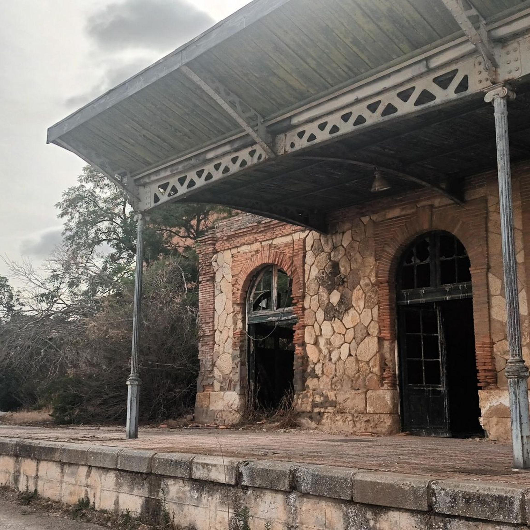
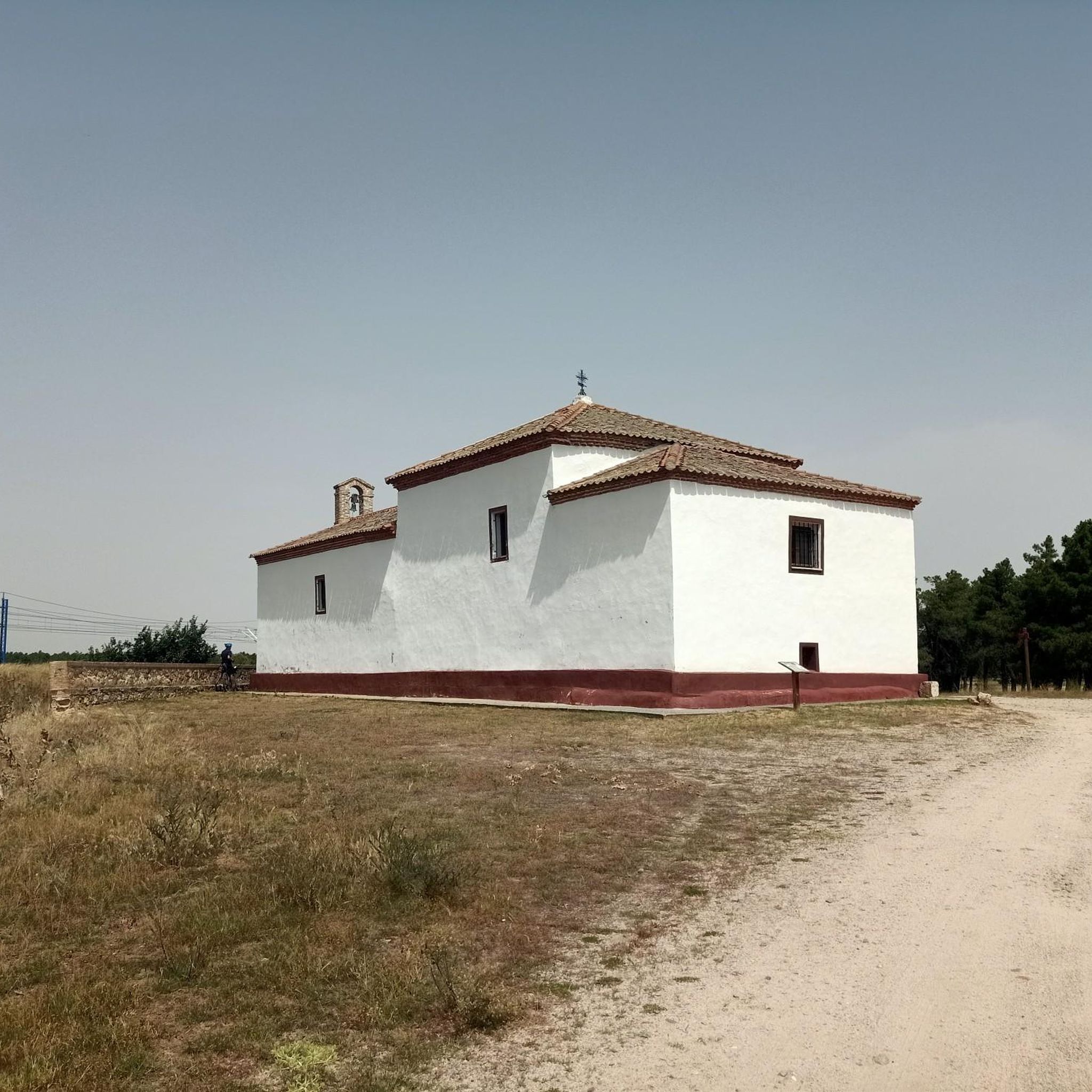
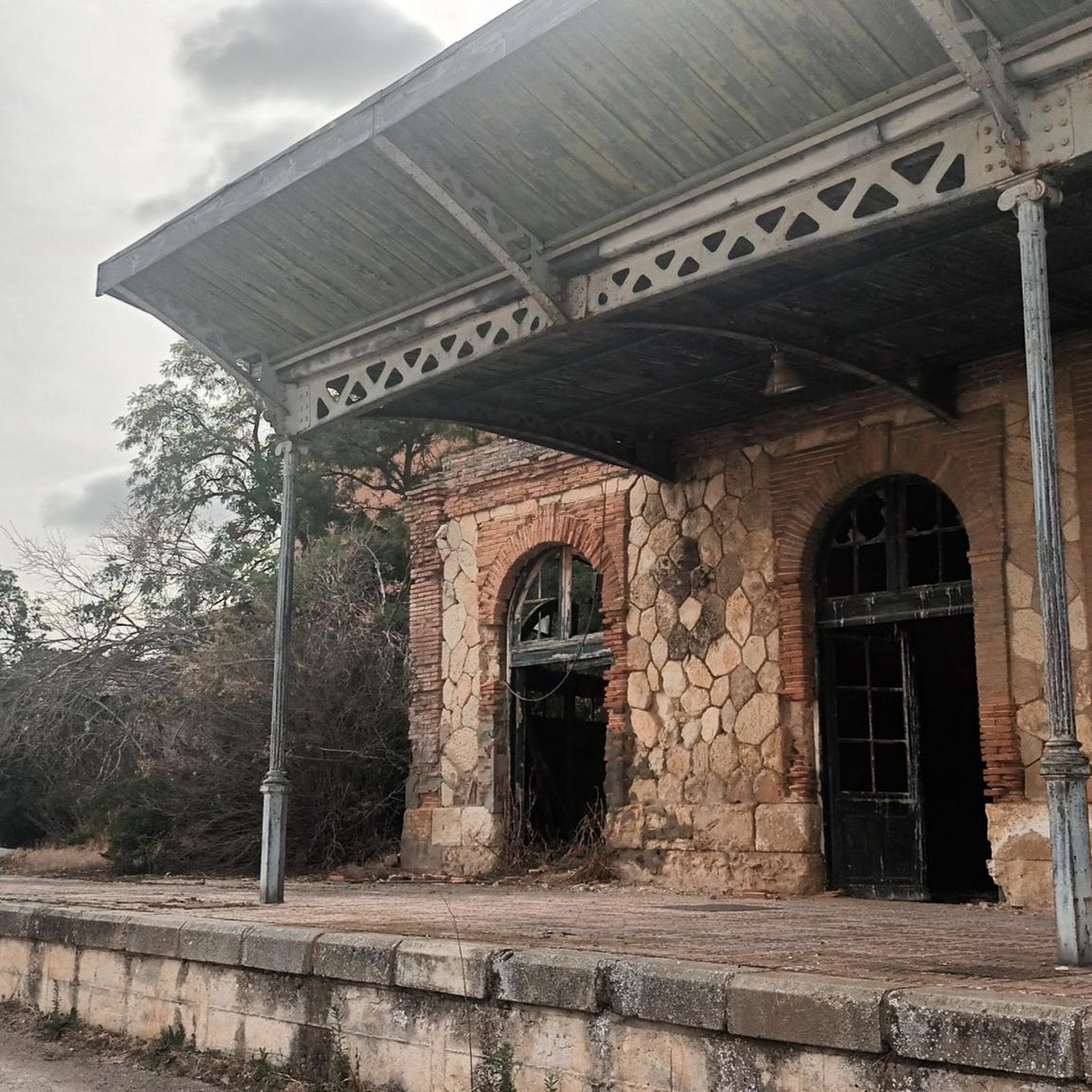
While hiking, you can explore several points of interest. The Vía Verde del Valle del Eresma itself is a highlight, offering scenic views. You might also encounter historical remnants like the Ortigosa del Pestaño — Abandoned Railway Station or the Old Yanguas de Eresma Station. The Hermitage of the Virgin of the Well is another notable religious building in the vicinity.
Is Ortigosa de Pestaño suitable for dog-friendly walks?
The natural and rural character of Ortigosa de Pestaño, with its open fields and riverine paths like the Vía Verde del Eresma, generally makes it suitable for dog-friendly walks. Always ensure your dog is under control, especially near agricultural areas or livestock, and be mindful of local regulations regarding leashes.
What is the best time of year to go hiking in Ortigosa de Pestaño?
The best time for hiking in Ortigosa de Pestaño is typically during spring and autumn. These seasons offer pleasant temperatures and lush landscapes. Summers can be hot, especially in the open agricultural areas, while winters can be chilly. Always check local weather conditions before heading out.
Are there any permits required for hiking in the area?
Generally, no specific permits are required for hiking on the established trails and public paths around Ortigosa de Pestaño, including the Vía Verde del Eresma. However, if you plan to venture into private land or protected areas, it's always advisable to check for any specific access rules or requirements.
Where can I find parking for hiking trailheads?
Parking is typically available in the villages and towns that serve as starting points for the routes, such as Nava de la Asunción. For trails like those along the Vía Verde del Eresma, you can often find parking near the old railway stations or designated access points within the municipalities.
Can I reach Ortigosa de Pestaño by public transport for hiking?
Ortigosa de Pestaño is accessible by public transport, primarily bus services connecting it to larger towns like Segovia. While public transport can get you to the municipality, it's recommended to check specific bus routes and schedules in advance, as services might be less frequent, especially on weekends or holidays. This will help you plan your hike's starting and ending points effectively.
Are there places to eat or stay near the hiking trails?
Ortigosa de Pestaño and nearby villages offer basic amenities including local cafes and restaurants where you can find refreshments and traditional Spanish cuisine. For accommodation, you might find rural guesthouses or small hotels in the immediate vicinity or in slightly larger towns nearby, providing options for an overnight stay.
Most popular attractions around Ortigosa De Pestaño

Get inspired with the komoot mobile app


Explore more
Browse the best Hikes in other regions.
