The 2 Most Amazing Peaks around Molfsee
Mountain peaks around Molfsee are characterized by rolling hills, numerous lakes, and lush forests within the East Holstein Hill and Lake District. While not featuring dramatic mountain summits, the region offers a diverse landscape for outdoor activities. The highest elevations in the area, such as Kieler Berg and Krähenberg, provide elevated points for exploration. This picturesque countryside is well-regarded for its network of hiking trails.
Best mountain peaks around Molfsee
- The most popular mountain peaks is Kieler Berg Summit,…
Last updated: June 28, 2026
Kieler Berg Summit
Highlight • Summit
Translated by Google •
Tip by

Krähenberg Summit
Highlight • Summit
Translated by Google •
Tip by

Sign up now to discover places like this
Get recommendations on the best single tracks, peaks, & plenty of other exciting outdoor places.
Sign up for free
Brommerberg Ascent Marker (Glacial Erratic)
Highlight • Natural Monument
Translated by Google •
Tip by

Start today with a free account
Your next adventure awaits.
Login or Signup
Tips from the Community

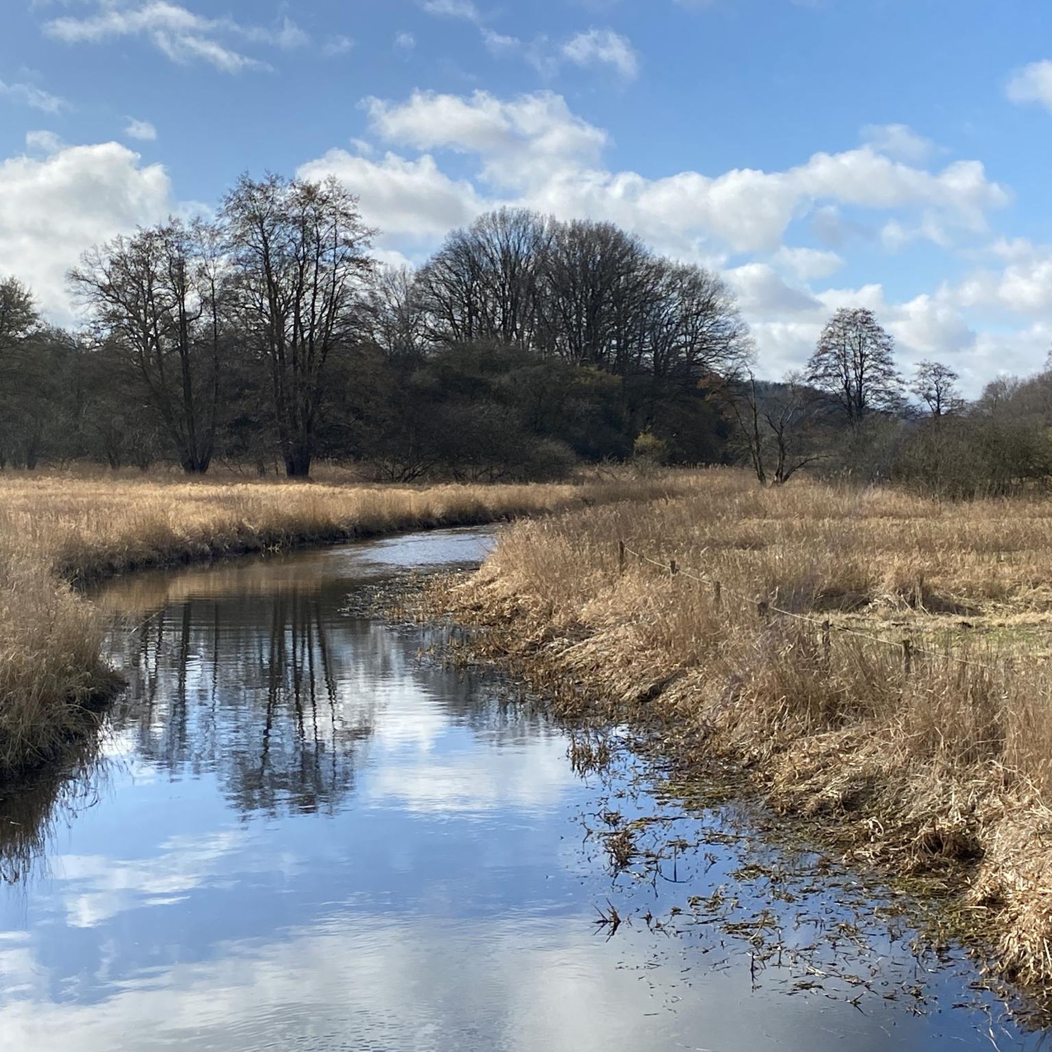
At the giant boulder, walk 50 meters across the forest, and voila, you're at the summit of Brommerberg. The view is quite beautiful and stretches in three directions.
5
0

94m high elevation in the forest. No far-reaching view possible, as it is surrounded by trees. There is a small boundary stone on the "summit"
4
0
94m high, at the top a boundary stone marks the summit in the dense forest, so the distant view is blocked.
5
0
94m high, at the top there is a boundary stone in the dense forest.
2
0

Please do not approach from the north via the trail! Currently a lot of deforestation above and catastrophic underground on the way to the "summit".
2
0

The refuge is no longer there, just a marker stone. Approaching from the north is my favorite, because it is not that steep, on the south side it is flowing down again.
2
0
Unfortunately, once you have made the climb, you are not rewarded with a grandiose view. But the north and south ramps are fun going down.
2
0

At 82 m, the Krähenberg is the third highest elevation in this region. The "summit" is freely accessible and not overgrown by trees, so that one has beautiful views in all directions. You have to leave your bike on the path and walk the rest of the way up to the summit.
3
1
Frequently Asked Questions
What kind of "mountain peaks" can I expect to find around Molfsee?
Molfsee is located in the East Holstein Hill and Lake District, characterized by rolling hills, lakes, and forests rather than traditional towering mountains. The elevated points, often referred to as "summits" in the local context, are modest in height, with the highest being around 94 meters (308 feet). They offer picturesque views and diverse landscapes for outdoor activities.
What are some notable elevated points or "summits" to visit near Molfsee?
You can explore several elevated points in the area. The Kieler Berg Summit, at 94 meters, is the highest in the Westensee nature park, though its summit is densely forested. The Krähenberg Summit, at 82 meters, offers beautiful views in all directions as it's not overgrown. Another interesting spot is the Brommerberg Ascent Marker (Glacial Erratic), which leads to a summit with views stretching in three directions.
Are there good viewpoints among the elevated areas in Molfsee?
Yes, despite the modest elevations, several spots offer good views. The Krähenberg Summit is particularly noted for its unobstructed panoramic views. The Brommerberg Ascent Marker also provides a beautiful outlook.
What kind of hiking trails are available around Molfsee's elevated areas?
The region offers a network of scenic hiking trails through its rolling hills, forests, and along lakes. You'll find routes ranging from easy strolls to more moderate excursions. For example, the "Molfsee Lakeside Trail – View of Molfsee loop" is an easy option, while the "Gardens along the Eider Valley – Path Along the Eider loop" offers a moderate experience. You can find more hiking options in the Hiking around Molfsee guide.
Are there family-friendly options for exploring the hills around Molfsee?
Yes, Molfsee's picturesque hilly countryside is well-suited for families. Many trails are relatively easy and pass through forests and along lakes, providing a pleasant environment for walks with children. The "Molfsee Lakeside Trail – View of Molfsee loop" is a good example of an easy, family-friendly route.
Can I bring my dog on trails near Molfsee's elevated points?
Generally, dogs are welcome on the hiking trails around Molfsee. However, it's always advisable to keep them on a leash, especially in nature reserves like the Naturschutzgebiet Schulensee und Umgebung, and to respect local signage regarding pet regulations.
What is the best time of year to hike the hills and trails around Molfsee?
The Molfsee area is beautiful year-round. Spring brings blooming nature, summer offers lush greenery and pleasant temperatures, while autumn provides vibrant foliage. Even in winter, the landscape can be serene, though some paths might be muddy or icy. The best time depends on your preference for weather and scenery.
What natural features can I expect to see while exploring Molfsee's landscape?
You'll encounter a diverse landscape featuring rolling hills, dense forests, and several picturesque lakes such as Molfsee, Rammsee, and Schulensee. The area is also home to nature reserves, providing opportunities to observe local flora and fauna.
Are there any circular hiking routes that include these elevated points?
Yes, the region offers various circular routes. For instance, the "View of the Molfsee Windmill loop" is a popular option that takes you through the scenic countryside. Many routes in the Hiking around Molfsee guide are designed as loops, allowing you to start and end at the same point.
Where can I find parking when visiting the elevated areas or trailheads in Molfsee?
Parking is generally available near popular trailheads and attractions in and around Molfsee. Look for designated parking areas near nature reserves, lakes, or village centers. Specific parking information can often be found on local signage or detailed route descriptions.
What other outdoor activities can I do near the elevated areas of Molfsee?
Beyond hiking, the varied terrain of Molfsee is suitable for other outdoor pursuits. You can find numerous options for touring cycling, road cycling, and mountain biking. Check out the MTB Trails around Molfsee guide or the Running Trails around Molfsee guide for more ideas.
Are there any cafes or places to eat near the hiking areas in Molfsee?
Molfsee and its surrounding villages offer various cafes and restaurants where you can refuel after your outdoor adventures. Many are conveniently located near popular routes or within a short drive from trailheads, providing options for a meal or a refreshing drink.
Most popular routes around Molfsee
Most popular attractions around Molfsee

Get inspired with the komoot mobile app


Explore more
See even more amazing summits around Molfsee with these guides:
