The best gravel rides in Fish Slough Wilderness Study Area
4
riders
4
rides
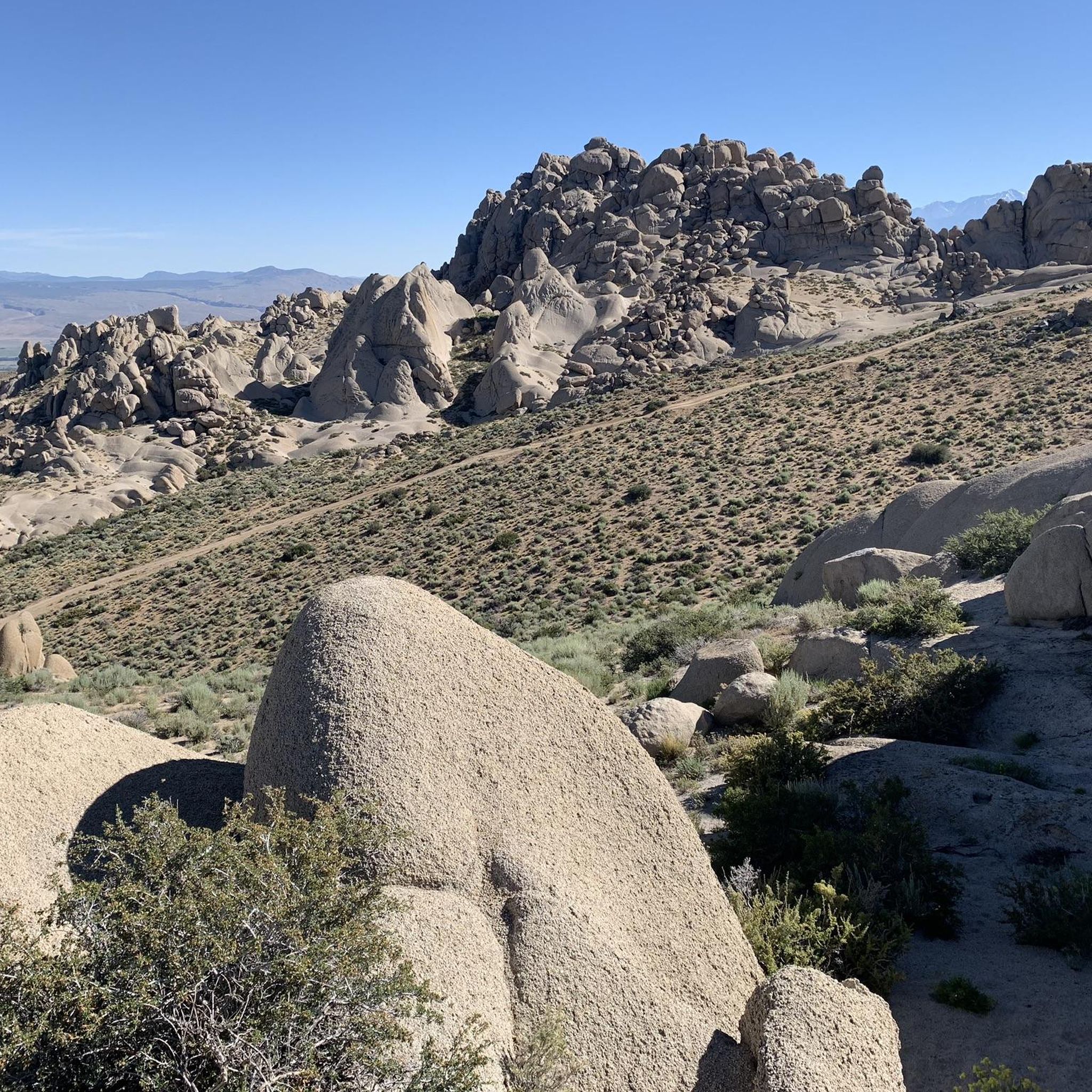
Gravel bike trails in Fish Slough Wilderness Study Area traverse a unique landscape within the Volcanic Tablelands, characterized by ancient volcanic formations and a distinct wetland system. This area, an ecotone where the Mojave Desert meets the Great Basin, features a mix of arid desert, verdant marshlands, and rocky cliffs. Riders can experience varied terrain with views of the Eastern Sierra Mountains to the west and the White Mountains to the east.
Best gravel bike trails in Fish Slough Wilderness…
Last updated: June 27, 2026
54.2km
05:21
380m
380m
This 33.7-mile gravel biking loop near Bishop offers challenging riding through volcanic landscapes and ancient petroglyphs.
2
riders
32.8km
02:15
60m
60m
Moderate gravel ride. Good fitness required. Mostly paved surfaces. Suitable for all skill levels.

Sign up for free
2
riders
51.0km
03:41
220m
220m
Moderate gravel ride. Good fitness required. Mostly paved surfaces. Suitable for all skill levels.
17.9km
01:41
50m
50m
Chalk Bluff Road offers an easy 11.1-mile gravel biking route in the Volcanic Tableland, featuring continuous views of the Owens River and d
47.9km
06:30
2,260m
2,260m
Challenging 29.7-mile gravel biking loop in Inyo National Forest with 7412 feet of climbing and diverse terrain.
Our route recommendations are based on thousands of hikes, rides, and runs completed by other people on komoot.
Start today with a free account
Your next adventure awaits.
Login or Signup
Popular around Fish Slough Wilderness Study Area

Tips from the Community

This spot offers beautiful views of the Owens River with the White Mountains in the background. It’s a great place to end your ride and enjoy a quiet, scenic picnic.
0
0
Fish Slough Road is a solid gravel route just north of Bishop, cutting through open desert, wetlands, and volcanic rock formations. The surface is mostly hard-packed with some washboard and sandy patches—I recommend going with wider tires, and don’t forget water and sun protection. It’s a quiet ride with beautiful mountain views and cool petroglyphs along the way.
0
0
Along Fish Slough Road, this quick detour takes you to a set of ancient petroglyphs carved into volcanic rock. The site is quiet, free to visit, and reached by a short walk from the parking area—no bikes allowed on the loop, but it’s an easy break from your ride. You’ll spot symbols and figures estimated to be over 1,000 years old.
0
0

At 10,860 feet, Silver Peak is just a short detour from the road. There are a few radio towers and cabins at the summit.
1
0

The Buckley Ponds are a hidden gem just east of downtown Bishop along the west side of the Owens River. These ponds have been revitalized over the past decade and now provide warm-water fishing and a peaceful spot to relax. There are a few fishing platforms, and the dirt roads around here are great for hiking, jogging, or mountain biking. The Sierra Nevada Mountains in the background and gorgeous as well.
0
0
Silver Peak is a high mountain at 10,862 feet in Inyo County, with a communication tower at the summit. Enjoy the clear views with a few trees at the top to block the fantastic sights on the Sierra Nevada. The gravel road to the summit features several hairpin turns and steep sections and is one of California's highest roads, where the highest is White Mountain Peak.
0
0
Tackle Silver Canyon Road, a steep, seasonal one-lane fire road connecting Bishop to the high alpine White Mountain Road and the Ancient Bristlecone Pine Forest. This (in full) ten-mile fire road offers a few dirt pullouts for parking before it splits into Silver Canyon Road and Old Silver Canyon Road.
0
0

Chalk Bluff, for which the road is named for, is remarkably a straight, ~5-mile-long, escarpment that forms the south edge of the Volcanic Tableland. Named Chalk Bluff for its light tan-to-white colored, chalk-like rocks, they stand in contrast to the darker, volcanic Bishop tuff boulders that stand atop the escarpment and are popular with rock climbers. The Owens River flows below the Chalk Bluff with the gravel road running between, all making for a truly unique riding experience.
0
0
Frequently Asked Questions
What kind of terrain can I expect on gravel bike trails in Fish Slough Wilderness Study Area?
The Fish Slough Wilderness Study Area offers a diverse landscape for gravel biking. You'll encounter the unique volcanic formations of the Volcanic Tablelands, including Bishop Tuff, and ride through an ecotone where the Mojave Desert meets the Great Basin. The terrain varies from accessible dirt roads, like the 19-mile Fish Slough Road, to areas with verdant marshlands, rocky cliffs, and drier uplands. Some side trails may present slightly more technical challenges.
Are there any easy gravel bike routes suitable for beginners or families?
Yes, there are routes suitable for various skill levels. For an easier ride, consider the Chalk Bluff Road, which is 11.1 miles (17.9 km) long and leads through volcanic formations. This route is generally considered accessible and less technical, making it a good option for those new to gravel biking or looking for a more relaxed experience.
What are the best times of year to go gravel biking in Fish Slough Wilderness Study Area?
The Fish Slough Wilderness Study Area is located in an arid desert environment, so spring and fall generally offer the most pleasant temperatures for gravel biking. Summers can be very hot, and while winters are milder, conditions can vary. Always check local weather patterns before heading out, especially regarding precipitation which can affect dirt road conditions.
What natural features or landmarks can I see while gravel biking in the area?
The area is rich in natural and historical features. You'll experience sweeping vistas of the Eastern Sierra Mountains to the west and the White Mountains to the east. The landscape includes a unique wetland system fed by perennial springs, creating a lush oasis. Keep an eye out for the prominent East Side Bluff, stretching over five miles. You might also discover ancient petroglyph sites and the remnants of the old Keogh Ranch and stage stop along Fish Slough Road.
Are there any dog-friendly gravel biking trails in Fish Slough Wilderness Study Area?
While the Fish Slough Wilderness Study Area is generally open to outdoor activities, specific regulations regarding dogs on trails can vary. It's always best to keep dogs on a leash to protect the sensitive ecosystems and wildlife, especially in areas like the Fish Slough Area of Critical Environmental Concern (ACEC). For detailed regulations, it's advisable to check with the managing authorities, such as the Bureau of Land Management (BLM) or the California Department of Fish and Wildlife, especially concerning the Fish Slough Ecological Reserve (ER) which has specific rules for protecting endangered species. You can find more information about the Fish Slough ER at wildlife.ca.gov.
Where can I park when visiting the Fish Slough Wilderness Study Area for gravel biking?
Parking is generally available at various access points along Fish Slough Road. The road itself is described as accessible, and there are often offshoots to camping areas where you might find suitable spots to park. As it's a wilderness study area, designated parking lots might be minimal, so look for established pull-offs or areas that don't obstruct traffic or sensitive habitats.
What kind of wildlife can I expect to see in Fish Slough Wilderness Study Area?
The Fish Slough Wilderness Study Area is a haven for wildlife, particularly due to its unique wetland ecosystem. It provides critical habitat for migratory birds, making it excellent for birdwatching, especially in the riparian zones where raptors, hummingbirds, and songbirds are abundant. The area is also home to the endangered Owens Pupfish and rare endemic plants like the Fish-Slough Milk Vetch and the Alkali Mariposa lily.
Are there any challenging gravel bike routes for experienced riders?
For experienced gravel bikers seeking a challenge, the area offers more demanding routes. The Fish Slough Road loop, at 33.7 miles (54.2 km) with significant elevation gain, is rated as difficult. Another challenging option is the Silver Canyon and Poleta Canyon Loop, which is 47.9 km long and features substantial elevation changes, providing a rigorous ride through the diverse landscape.
Can I find any loop trails for gravel biking in the Fish Slough Wilderness Study Area?
Yes, there are several loop options available. The Fish Slough Road loop is a popular choice, allowing you to explore the core of the wilderness study area. Another excellent loop is the Keough Hot Ditch (Springs) – Owens River loop from Bishop, which follows waterways and offers a mix of desert and riparian scenery.
What is the general condition of Fish Slough Road for gravel biking?
Fish Slough Road is a primary draw for gravel biking, described as a 19-mile long, three-vehicle-wide dirt road. Its conditions can vary seasonally, from smoothly graded to washboarded. It's generally considered accessible and suitable for gravel bikes, indicating a non-technical terrain. However, always be prepared for changing conditions, especially after weather events.
Are there any amenities or services near the gravel biking trails?
The Fish Slough Wilderness Study Area is a relatively remote location. While there are no direct amenities like cafes or bike shops within the immediate wilderness area, the nearby town of Bishop, California, offers a range of services including accommodation, restaurants, and supplies. It's advisable to carry all necessary water, food, and repair kits for your ride.
How many gravel bike routes are available in the Fish Slough Wilderness Study Area?
There are a selection of four gravel bike routes detailed for the Fish Slough Wilderness Study Area, offering a range of experiences from easy to difficult. These routes showcase the unique volcanic landscapes and diverse ecosystems of the region.
Most popular routes in Fish Slough Wilderness Study Area

Get inspired with the komoot mobile app


