The 4 Most Amazing Peaks around Figueiros
Best mountain peaks around Figueiros are found in central Portugal, a region characterized by mountains, meandering rivers, and forests. This landscape provides various opportunities for outdoor activities. The area features several notable peaks and elevated locations, offering rewarding experiences for visitors.
Best mountain peaks around Figueiros
- The most popular mountain peaks is Serra de Montejunto Watchtower, a viewpoint that offers a beautiful panorama of the region north of the Serra. The Serra de Montejunto Forest Watch Station can be…
Last updated: July 3, 2026
Serra de Montejunto Watchtower
Highlight • Viewpoint
Translated by Google •
Tip by

Top of the eastern side of Montejunto mountain.
Highlight • Summit
A part of the trail that passes through this point is a bit technical with some loose rock, it …
Tip by

Sign up now to discover places like this
Get recommendations on the best single tracks, peaks, & plenty of other exciting outdoor places.
Sign up for free
Cabeço da Silheira
Highlight • Summit
Translated by Google •
Tip by
Cabeço do Monfarinho - Elevation 308 m
Highlight • Summit
Showing Translation
Tip by
Espigão Peak - Elevation 460 m
Highlight • Summit
Showing Translation
Tip by
Start today with a free account
Your next adventure awaits.
Login or Signup

Tips from the Community

The real access trail to Cabeço de Monfarinho does not start at the point indicated on the Komoot map, but about a hundred meters before. Pay attention to the path that will lead you to it.
0
0
The geodetic marker that marks this peak is a few dozen meters from the trail that passes next to it, and is only accessible on foot.
0
0
Locally, these small hills are called "cabeços". Cabeço da Silheira is one of the highest in the region, reaching 200m in altitude. It is therefore natural that it was chosen as the site for the installation of water tanks that supply the region's public water supply network. You can reach Cabeço da Silheira via a small asphalt road (very steep) or via one or two existing trails. If you choose to go along the trails, we recommend a mountain bike.
1
0

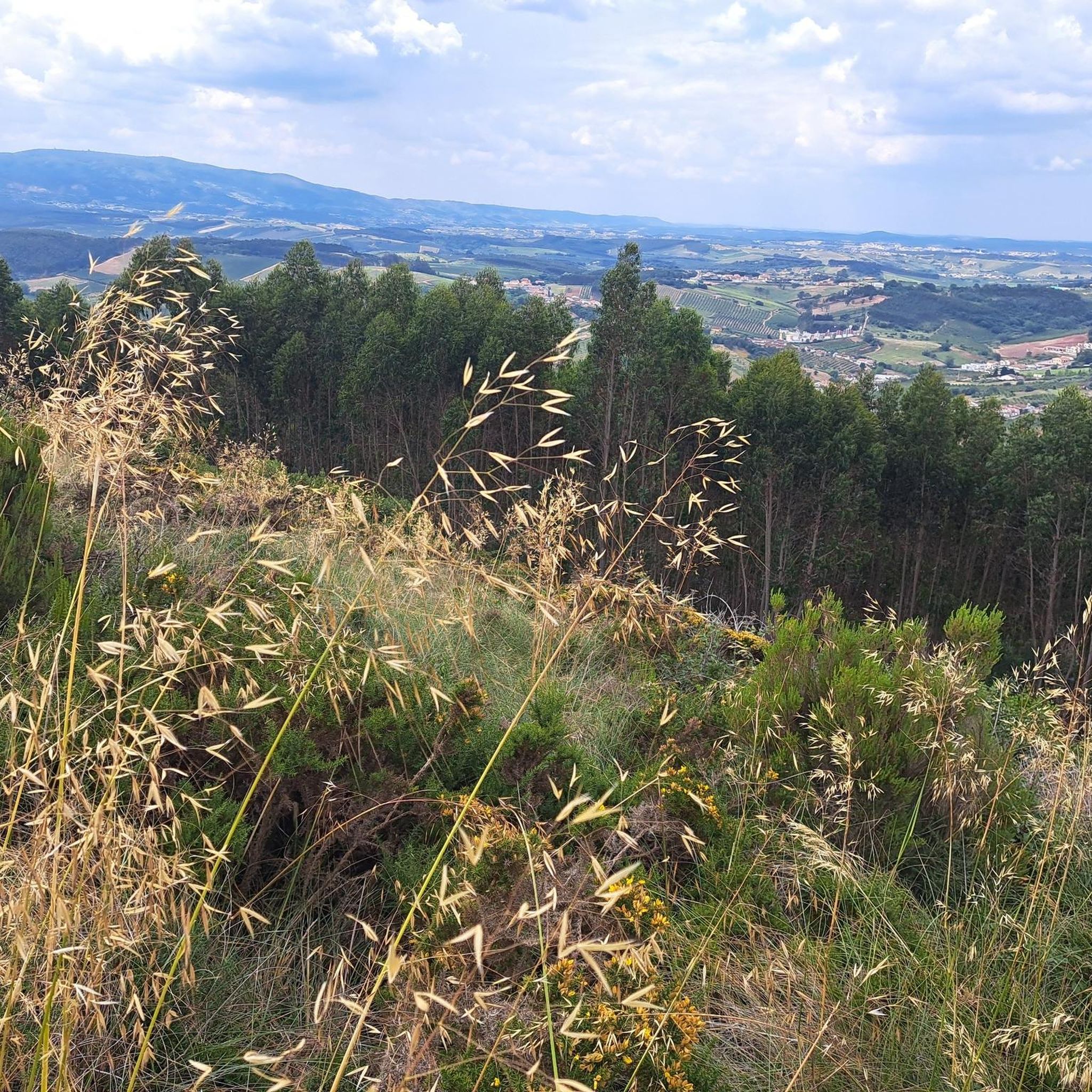
The Serra de Montejunto Forest Watch Station can be accessed via a pastoral trail from the picnic park. It offers a beautiful panorama of the region north of the Serra.
3
0
Usually this is a windy place, but the view is superb. A part of the trail that passes through this point is a bit technical with some loose rock, it may not be very recommended for gravel bikes with thin tires.
2
0
Frequently Asked Questions
What are some of the most notable peaks and elevated viewpoints around Figueiros?
The Figueiros region offers several rewarding elevated locations. Among them are Espigão Peak, reaching 460 meters, and Cabeço de Monfarinho at 308 meters. For panoramic views, the Serra de Montejunto Watchtower provides a beautiful vista of the northern Serra.
What kind of views can I expect from the mountain peaks in Figueiros?
From various peaks and viewpoints, you can expect superb panoramic views of the surrounding region. For instance, the Serra de Montejunto Watchtower offers an expansive panorama to the north of the Serra. The eastern side of Montejunto mountain is also known for its superb, though often windy, views.
Are there challenging trails to reach these peaks?
Yes, some trails present a challenge. The path to the eastern side of Montejunto mountain can be technical with loose rock, which might be difficult for gravel bikes with thin tires. Cabeço da Silheira can be reached via a very steep asphalt road or existing trails, with mountain biking recommended for the latter.
What outdoor activities can I do near the mountain peaks of Figueiros?
Beyond hiking to the peaks, the region offers diverse outdoor activities. You can explore various cycling routes, including challenging gravel trails like the "Óbidos Lagoon – Lagoa de Óbidos Gravel Trail loop" or moderate road cycling routes such as the "Pink House with Bougainvillea – Castelo de Torres Vedras loop". For runners, there are trails like the "Currais e Calçada Trail". Find more details on these activities in the Cycling around Figueiros, Road Cycling Routes around Figueiros, and Running Trails around Figueiros guides.
Are there specific hiking trails in the Serra de Montejunto area?
Yes, the Serra de Montejunto features popular hiking routes. The "Trilho dos Currais e Calçada" is a moderate 8.3 km circular route, typically taking about 2 hours and 32 minutes. Another favorite is the "Chapel of Saint John the Baptist – Curve on the Hillside Trail loop," a moderate 15.8 km path with extensive views and significant elevation changes. You can find more running and hiking options in the Running Trails around Figueiros guide.
What is the best time to visit the Figueiros mountains for hiking?
While specific seasonal recommendations aren't provided, the region's diverse natural beauty, including lush forests and rocky outcrops, suggests that spring and autumn would offer pleasant temperatures for hiking. Summers can be warm, and some elevated areas, like the eastern side of Montejunto mountain, can be quite windy.
Are there any family-friendly or easier mountain walks near Figueiros?
While specific 'family-friendly' designations for individual peaks are not detailed, many trails in the region offer varied terrain suitable for different fitness levels. For a moderate circular route, consider the "Trilho dos Currais e Calçada" in Serra de Montejunto, which is 8.3 km long. Always check the trail difficulty and elevation before heading out with family.
What should I know about accessing the peaks, such as parking or specific entry points?
Access varies by peak. For Serra de Montejunto Watchtower, you can access it via a pastoral trail from a picnic park. For Cabeço de Monfarinho, be aware that the true access trail might differ slightly from map indications, starting about a hundred meters before the marked point. Cabeço da Silheira can be reached via a small, steep asphalt road or existing trails.
Can I bring my dog on trails in the Serra de Montejunto Protected Landscape?
The region is popular for outdoor activities, and while specific dog-friendly rules for the Serra de Montejunto Protected Landscape are not detailed, many natural trails in Portugal generally allow dogs on leash. It's always advisable to check local regulations or signage at trailheads to ensure compliance and respect for wildlife and other visitors.
What is Cabeço da Silheira known for?
Cabeço da Silheira, at 200 meters, is one of the highest 'cabeços' (small hills) in the Figueiros region. It's notable for hosting the water tanks that supply the public water network. It can be reached via a steep asphalt road or trails, with mountain biking being a recommended way to explore the latter.
How long do hikes typically take to reach the peaks around Figueiros?
The duration of hikes varies depending on the specific peak and your starting point. For example, the "Trilho dos Currais e Calçada" in Serra de Montejunto, a moderate circular route, takes approximately 2 hours and 32 minutes to complete. Shorter ascents to individual 'cabeços' might take less time, while longer routes like the "Chapel of Saint John the Baptist – Curve on the Hillside Trail loop" can take significantly longer due to their 15.8 km length and elevation changes.
Most popular routes around Figueiros
Most popular attractions around Figueiros

Get inspired with the komoot mobile app


Explore more
See even more amazing summits around Figueiros with these guides:
