Top 8 Waterfalls around Area H (Canim Lake/Forest Grove)
Waterfalls around Area H (Canim Lake/Forest Grove) are located within the Cariboo Chilcotin Coast region of British Columbia, offering a range of natural attractions. This area is known for its diverse landscapes, including features shaped by ancient lava flows and river erosion. Many waterfalls are accessible, with some trails suitable for families. The region provides opportunities to explore geological formations and river systems.
Best waterfalls around Area H (Canim Lake/Forest Grove)
- The most popular waterfalls is Helmcken Falls, a waterfall that is good to reach on a trail. This waterfall is noted as the fourth highest in Canada, plunging 141 m from the Murtle Plateau.
- Another must-see spot is Dawson Falls, a family_friendly waterfall and viewpoint. Visitors can reach the falls via a trail along the Murtle River in about 10 minutes, with an observation point along the way.
- Visitors also love Baileys Chute, a family_friendly waterfall and viewpoint. This spot is known for its hike, which is not strenuous and takes about 1 hour and 45 minutes.
- Area H (Canim Lake/Forest Grove) is known for waterfalls, natural monuments, and viewpoints. The region offers a variety of waterfalls to see and explore, including those with family-friendly access and intermediate trails.
- The waterfalls around Area H (Canim Lake/Forest Grove) are appreciated by the komoot community, with 21 upvotes and 31 photos shared across the highlights.
Last updated: July 10, 2026
Helmcken Falls
Highlight • Waterfall
(Visit June 3, 2018)
worldwaterfalldatabase.com/waterfall/Helmcken-Falls-2303
Tip by

Dawson Falls
Highlight • Waterfall
Opposite is another observation point; it can be reached from the Pyramid Campground.
In addition to Dawson Falls, there are six other waterfalls along the Murtle River in Wells Gray Park.
(Visit June 3, 2018)
worldwaterfalldatabase.com/waterfall/Dawson-Falls-2305
en.wikipedia.org/wiki/Dawson_Falls
Tip by
Sign up now to discover places like this
Get recommendations on the best single tracks, peaks, & plenty of other exciting outdoor places.
Sign up for free
View of Helmcken Falls
Highlight • Waterfall
Showing Translation
Tip by

The Mushbowl
Highlight • Waterfall
(Visit June 3, 2018)
worldwaterfalldatabase.com/waterfall/Mushbowl-The-2304
Tip by
Baileys Chute
Highlight • Waterfall
Translated by Google •
Tip by

Sign up for free to discover even more waterfalls around Area H (Canim Lake/Forest Grove).
Sign up for free
Already have an account?
Start today with a free account
Your next adventure awaits.
Login or Signup
Popular around Area H (Canim Lake/Forest Grove)
Tips from the Community

At over 140 metres tall, it's easy to see why Helmcken Falls was one of the main reasons for the formation of Wells Gray Provincial Park. While the spectacular waterfall is a main draw during the busy summer season, the area is also popular with ice climbers during winter and the falls are known as the "Yosemite of ice climbing".
1
0

The road to the parking lot from Helmcken Falls is quite bumpy, with lots of potholes, etc. It's no problem with a pickup truck or SUV, and doable with a regular car, but you do have to be a bit careful. The "flying" fish are worth it, though.
0
0


From the Dawson Falls parking lot, a trail along the Murtle River takes you to the Falls in about 10 minutes. About two-thirds of the way, there is an excellent viewing point for the Falls. The water of the Murtle River plunges about 18 meters down a step at Dawson Falls. If you're lucky, you can see a rainbow below the Dawson Falls. Opposite is another observation point; it can be reached from the Pyramid Campground. In addition to Dawson Falls, there are six other waterfalls along the Murtle River in Wells Gray Park. (Visit June 3, 2018) https://www.worldwaterfalldatabase.com/waterfall/Dawson-Falls-2305 https://en.wikipedia.org/wiki/Dawson_Falls
2
0
“Helmcken Falls is the centerpiece to Wells Gray Provincial Park, one of the most powerful waterfalls on earth and one of BC’s prime tourist draws. The Murtle River, which is just a few kilometers upstream, drops over 300 foot (91 m) wide Dawson Falls, narrows to about 75 feet (23 m) wide and surges over the lip of Helmcken Canyon, hurtling 462 feet (141 m) into one of the largest river-sculpted amphitheaters in North America. The bowl behind the falls recedes over 150 feet (46 m) into the cliff and stretches over 500 feet (152 m) wide. Just downstream lies a 50 foot (15 m) lower tier which isn’t usually counted in the total height of the falls but legitimately boosts this to a 500 foot (152 m) tall waterfall. Pictures really do not do this waterfall justice, as there is no way to convey the true power and volume of water spilling off the cliff.” (Visit June 3, 2018) https://www.worldwaterfalldatabase.com/waterfall/Helmcken-Falls-2303
2
0
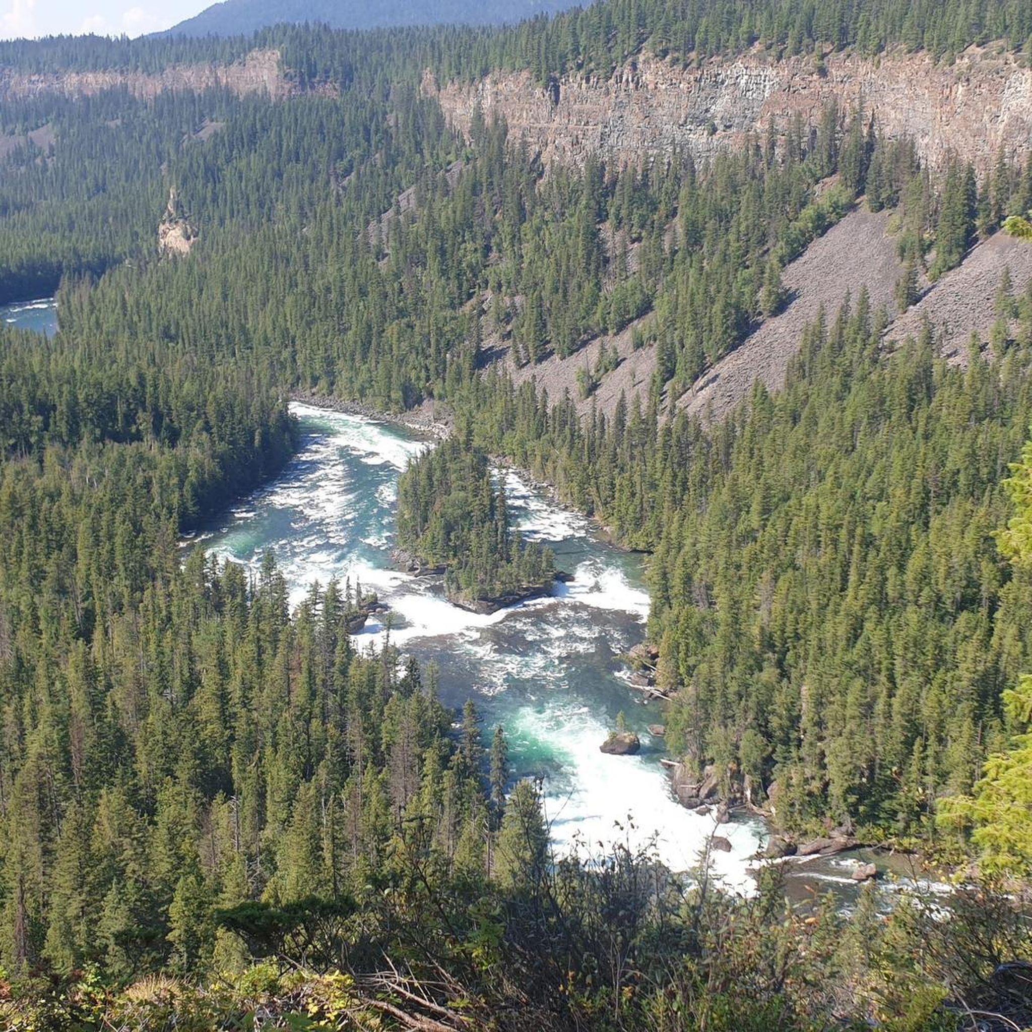
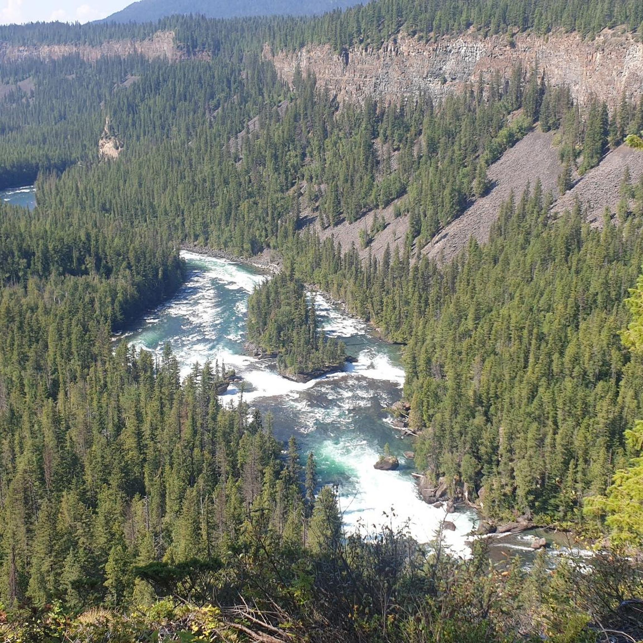
The Mushbowl is a waterfall on the Murtle River and is located between the Dawson Falls and the Helmcken Falls. At the Mushbowl, the riverbed is narrowed by rocks in the middle and on the side. When the river is low, you can get a good view of the waterfall from a cave that is then accessible. (Visit June 3, 2018) https://www.worldwaterfalldatabase.com/waterfall/Mushbowl-The-2304
2
0

Dawson Falls waterfall is only about 10 minutes from the parking lot. It's not very tall, but quite wide. It is ranked 5th in Wells Gray Provincial Park's waterfall rankings.
1
0
The Helmcken Falls falls 141 meters, making it the fourth highest waterfall in Canada. It also ranks first in the ranking of Wells Gray Park's waterfalls. The viewpoint can be easily reached on foot within a few minutes from the parking lot. From there you have an excellent view of the waterfall.
1
0
Frequently Asked Questions
Are there family-friendly waterfalls around Area H (Canim Lake/Forest Grove)?
Yes, several waterfalls in the region are suitable for families. Dawson Falls is easily accessible via a 10-minute trail from the parking lot, with an observation point along the way. Baileys Chute also offers a family-friendly hike that is not strenuous, taking about 1 hour and 45 minutes. Mahood Falls and Canim Falls are also known for their short, easy trails.
What are some easy waterfall hikes near Canim Lake?
For easy access, Mahood Falls is reached via a short 0.5 km trail, with parts even wheelchair accessible. Just 10 minutes further along the same trail, you'll find Canim Falls, also an easy walk to a fenced observation area. Hendrix Creek Falls and Deception Falls also offer short, easy hikes, typically around 30 minutes or less, making them great options for a quick visit.
When is the best time to visit the waterfalls around Area H (Canim Lake/Forest Grove)?
The best time to visit these waterfalls, especially to witness them at their most powerful, is in late spring. This is when snowmelt significantly contributes to higher water levels, creating a more spectacular display.
What unique natural features can I see at the waterfalls in Area H (Canim Lake/Forest Grove)?
The region's waterfalls are often set amidst impressive geological formations. At Mahood Falls, you might see rainbows in the spray within the canyon, and there's a natural bridge nearby. Canim Falls showcases a 4 km long canyon carved by lava flows. The Mushbowl, located between Dawson and Helmcken Falls, features a riverbed narrowed by rocks, and when the water is low, a cave becomes accessible for unique views.
Are there hiking trails near the waterfalls in Area H (Canim Lake/Forest Grove)?
Yes, the area offers various hiking opportunities. You can find easy trails like the one leading to Canim Falls and Mahood Falls, or more intermediate options such as the trail to Helmcken Falls. For more hiking ideas, explore the Hiking around Area H (Canim Lake/Forest Grove) guide.
What are some longer or more challenging waterfall hikes in the region?
While many falls are easily accessible, some offer more extensive hiking. The hike to Helmcken Falls is considered an intermediate trail. For a longer experience, the Baileys Chute hike takes about 1 hour and 45 minutes. You can find more detailed routes and their difficulty levels in the Hiking around Area H (Canim Lake/Forest Grove) guide.
What outdoor activities can I do near these waterfalls?
Beyond waterfall viewing, the Area H (Canim Lake/Forest Grove) region provides opportunities for various outdoor activities. You can find numerous hiking trails, including easy and moderate options, as well as running routes. For specific routes and activities, check out the Hiking around Area H (Canim Lake/Forest Grove) and Running Trails around Area H (Canim Lake/Forest Grove) guides.
What do visitors enjoy the most about the waterfalls in Area H (Canim Lake/Forest Grove)?
Visitors frequently appreciate the sheer power and beauty of the waterfalls, especially Helmcken Falls, which is noted as one of the most powerful on Earth. The accessibility of many falls, like Dawson Falls, and the scenic trails leading to them are also highly valued. The opportunity to witness geological formations carved by ancient lava flows adds to the unique experience.
Are there any waterfalls that are less known or considered 'hidden gems'?
While not widely publicized, Hendrix Creek Falls and Deception Falls offer beautiful, short, and easy hikes that might feel a bit more secluded than the more popular spots. They provide a chance to enjoy the region's natural beauty away from larger crowds.
Can I find information about the geological history of the waterfalls?
Yes, the waterfalls in this region, particularly Mahood Falls and Canim Falls, are significant for their geological history. They are formed by the Canim River flowing over volcanic rock deposits, with the river carving canyons into ancient lava plateaus. This showcases the powerful forces of ancient lava flows and floods that shaped the landscape.
Is it possible to see more than one waterfall on a single outing?
Absolutely. Mahood Falls and Canim Falls are located along the same trail, with Canim Falls just a 10-minute walk further from Mahood Falls. This makes it very convenient to visit both in one trip. Additionally, The Mushbowl is situated between Dawson Falls and Helmcken Falls, allowing for a multi-waterfall experience in Wells Gray Provincial Park.
Most popular routes around Area H (Canim Lake/Forest Grove)
Most popular attractions around Area H (Canim Lake/Forest Grove)

Get inspired with the komoot mobile app


Explore more
Happy to travel a little further afield? Then browse these guides for the best waterfalls around Area H (Canim Lake/Forest Grove):
