Area B (South Fraser Canyon/Sunshine Valley)
Area B (South Fraser Canyon/Sunshine Valley)
The 5 Most Amazing Peaks around Area B (South Fraser Canyon/Sunshine Valley)
Best mountain peaks around Area B (South Fraser Canyon/Sunshine Valley) are characterized by rugged terrain and significant elevation gains. This region, part of the broader Fraser Valley Regional District, offers diverse recreational opportunities. The Fraser Canyon itself is a dramatic geological feature where the Fraser River carves through narrow rock gorges. The area provides panoramic views of the surrounding British Columbia landscape.
Best mountain peaks around Area B (South Fraser Canyon/Sunshine Valley)
- The most popular mountain peaks is Frosty Mountain…
Last updated: May 14, 2026
Frosty Mountain junction
Highlight • Mountain Pass
Tip by

Frosty Mountain/PCT junction
Highlight • Trail
Tip by
Sign up now to discover places like this
Get recommendations on the best single tracks, peaks, & plenty of other exciting outdoor places.
Sign up for free
Needle Peak
Highlight • Summit
On clear days, you can take in views …
Tip by

Zoa Peak
Highlight • Summit
Tip by

View of Frosty Mountain and valley
Highlight • Viewpoint
Tip by
Sign up for free to discover even more peaks around Area B (South Fraser Canyon/Sunshine Valley).
Sign up for free
Already have an account?
Start today with a free account
Your next adventure awaits.
Login or Signup
Popular around Area B (South Fraser Canyon/Sunshine Valley)


Other adventures around Area B (South Fraser Canyon/Sunshine Valley)


Tips from the Community

Needle Peak rises to about 2,095 metres and is reached after a steep forest climb and some light scrambling to the summit. On clear days, you can take in views of nearby peaks like Yak, Guanaco, Zopkios, and portions of the Coast and Cascade ranges. Since the final few hundred metres involve scrambling, check conditions and stop at the exposed ridgeline just below the summit if conditions are wet or if the scramble feels too technical.
0
0

Zoa Peak is a broad, open summit in the Coquihalla Range with fantastic open alpine views, especially toward Thar, Nak, and Zum Peaks. It’s not a dramatic peak, but the alpine vantage is worth the steady climb. The top levels out with scattered boulders and sky that goes on forever—it’s an easy place to linger before heading back down the trail.
0
0

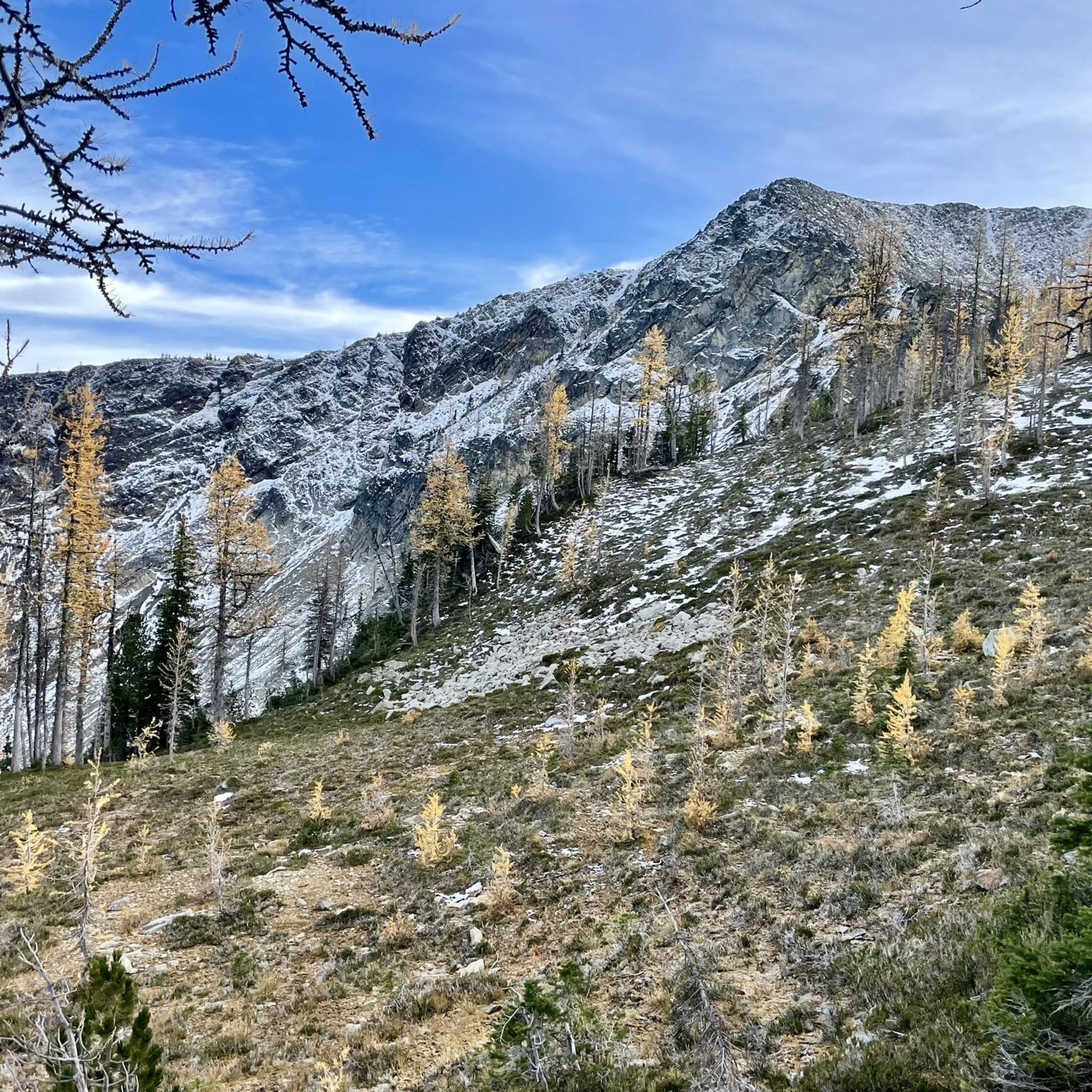
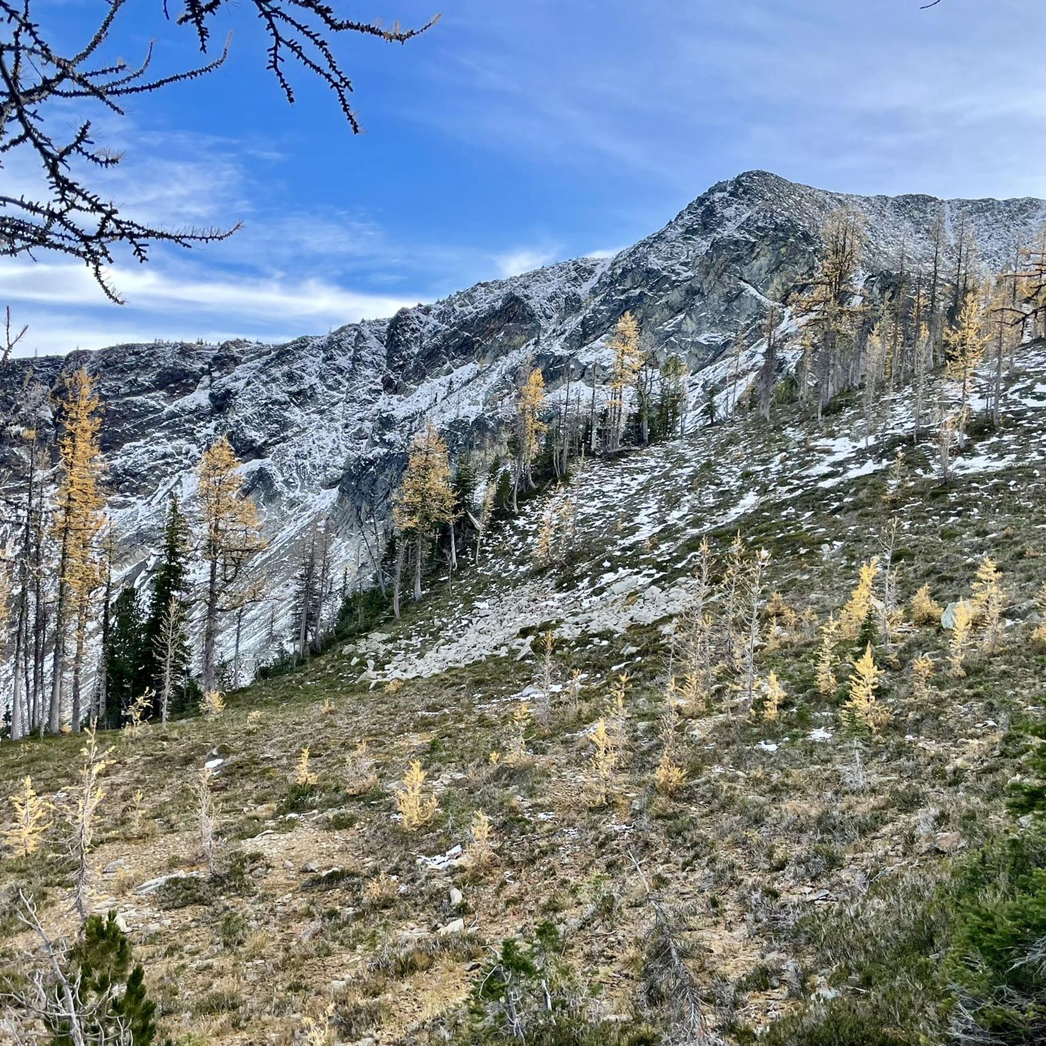
At this point, a little off the main trail, a beautiful view of the valley and, of course, Frosty Mountain awaits you, that especially with a light blanket of snow to bring out all its magic.
3
0
Once you've fought your way up here, a spectacular view of Frosty Mountain and the surrounding mountain landscape awaits. Especially in the sunshine, you can stand it here for a few moments, provided you don't come here in high season, because there's not much space at this crossing. To the actual summit, it's only about 600 meters in distance. However, as it goes over the ridge, it can be dangerous in winter with snow. Then it may be enough to enjoy the view from here.
3
0
The climb from the west is not as steep and arduous as from the east and is the classic walking direction if you hike the loop. Also, you can spend a night at Frosty Creek Camp at about 1,900 meters and climb the summit at 2,400 meters the next day. To spend the night in the backcountry, you'll need a permit that costs 5 dollars a night per person. Also note: In winter and even in fall, Frosty Mountain can be snow covered. So if you are descending to the west, you should have microspikes in your backpack for this case.
0
0
This is where you have to decide: hike down to the Canadian/US-Border to Monument 78 or take the challenge and hike all the way up to Frosty Mountain at 2.300 meters? If you want to climb the mountain, the ascent from here is much more difficult than taking the approach from the other side. But if you make it, you can be even more proud. The ascent to Frosty Mountain stretches about 7.3 kilometers and you will gain approximately 700 meters in elevation. If you decide for Monument 78, it is just 6 kilometers all downhill.
4
0
Frequently Asked Questions
What are the most popular mountain peaks to visit in Area B (South Fraser Canyon/Sunshine Valley)?
The komoot community highly recommends Frosty Mountain Summit for its expansive panoramic views. Other popular choices include Needle Peak, known for its challenging ascent and 360-degree mountain vistas, and Zoa Peak, which offers fantastic open alpine views after a steady climb.
What kind of natural features can I expect to see on mountain peaks in this region?
The mountain peaks in Area B (South Fraser Canyon/Sunshine Valley) are characterized by rugged terrain, significant elevation gains, and offer panoramic views of the surrounding British Columbia landscape. You'll encounter diverse environments, from forested single tracks and alpine meadows to scree and boulders, and dramatic rock gorges carved by the Fraser River.
Are there any challenging mountain climbs for experienced hikers in Area B?
Yes, several peaks offer challenging climbs. Needle Peak involves a steep forest climb and light scrambling to its 2,095-meter summit. Mount Outram is another demanding option, with a 19.5 km trek and 1,760 m elevation gain, requiring good physical fitness and alpine experience. Mount Cheam also presents a steep ascent to its summit.
What is the best time of year to hike the mountain peaks in Area B (South Fraser Canyon/Sunshine Valley)?
The best time to hike the mountain peaks is generally during the warmer months, from late spring through early fall. However, some peaks like Frosty Mountain can be snow-covered even in fall and winter, requiring microspikes. Always check current conditions before heading out, especially for higher elevations and more technical routes.
Are there any moderate mountain hikes suitable for those looking for panoramic views without extreme difficulty?
Yes, Zoa Peak is a great option for a more moderate hiking experience. It features trails ranging from 8.23 km to 9.52 km with elevation gains between 600 m and 660 m, providing panoramic alpine views without the extreme challenge of some other peaks.
What outdoor activities can I do near the mountain peaks in Area B (South Fraser Canyon/Sunshine Valley)?
Beyond peak bagging, the region is a haven for outdoor enthusiasts. You can find various hiking trails, from easy to difficult, as well as running routes. For example, you can explore easy hikes like the Lightning Lake Day Use Area loop or more challenging running routes like the Frosty Mountain Summit loop. Find more options in the Hiking around Area B (South Fraser Canyon/Sunshine Valley) guide.
Are there any specific tips for climbing Frosty Mountain Summit?
If you plan to climb Frosty Mountain Summit, it's recommended to start from Lightning Lake and choose the ascent from the west, as it's less steep. You can also consider spending a night at Frosty Creek Camp, which requires a permit. Be prepared for cold nights and potential snow cover, even in fall, and carry microspikes if needed.
What should I know before attempting the Needle Peak climb?
Needle Peak involves a steep forest climb and light scrambling to the summit. It's crucial to check conditions before you go, especially if it's wet, as the final few hundred meters are exposed. If the scrambling feels too technical, you can stop at the ridgeline just below the summit.
Are there any mountain peaks that offer views towards the USA border?
Yes, from Frosty Mountain Summit, you can enjoy great views to the south towards the USA. Additionally, the hike to Mount Cheam provides incredible panoramic views across the Fraser Valley towards the Canada-United States border.
What are the parking considerations for popular mountain trails in Area B?
While specific parking details for each trail vary, it's important to note that access to some trailheads, such as for Mount Cheam, often requires a four-wheel-drive vehicle due to rugged access roads. Always research the specific trailhead you plan to visit for parking availability and any permit requirements.
What do visitors appreciate most about the mountain peaks in Area B (South Fraser Canyon/Sunshine Valley)?
Visitors frequently highlight the expansive panoramic views from summits like Frosty Mountain Summit and the rewarding alpine vistas from Zoa Peak. The challenging nature of peaks like Needle Peak and the sense of accomplishment after a demanding climb are also highly valued.
Are there any specific permits required for backcountry camping near the mountain peaks?
Yes, if you plan to spend the night in the backcountry, for example at Frosty Creek Camp near Frosty Mountain, you will need a permit. These typically cost $5 per night per person. Always check with the relevant park authorities for the most up-to-date permit information.
Most popular routes around Area B (South Fraser Canyon/Sunshine Valley)
Most popular attractions around Area B (South Fraser Canyon/Sunshine Valley)

Get inspired with the komoot mobile app


Explore more
See even more amazing summits around Area B (South Fraser Canyon/Sunshine Valley) with these guides:
