The 6 Most Amazing Peaks around Norte O Antequera
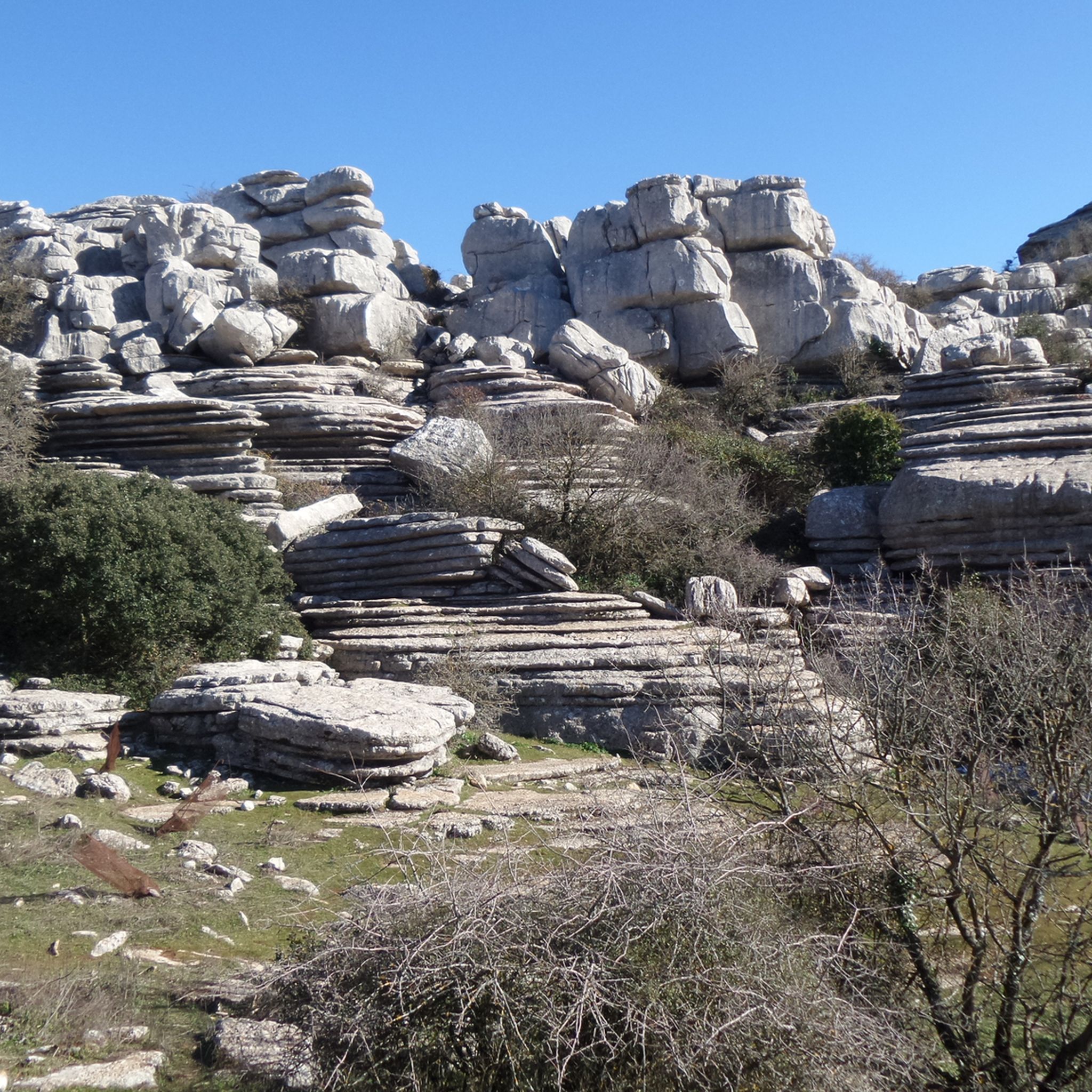
Best mountain peaks around Norte O Antequera are characterized by diverse geological formations and accessible hiking opportunities. The region is home to El Torcal de Antequera, a natural park renowned for its extraordinary karst landscape. This area features unique limestone formations sculpted over millions of years, offering an "otherworldly" terrain. Visitors can explore a variety of peaks and trails that showcase the natural beauty of the Antequera mountains.
Best mountain peaks around Norte O Antequera
- The most popular mountain peaks…
Last updated: May 14, 2026
Ruins of Lagar de Omitale on Cerro Olmo
Highlight • Historical Site
Translated by Google •
Tip by

Ascent to the Summit of El Chorro
Highlight (Segment) • Summit
Translated by Google •
Tip by

Sign up now to discover places like this
Get recommendations on the best single tracks, peaks, & plenty of other exciting outdoor places.
Sign up for free
Pico de Vilo
Highlight • Summit
Translated by Google •
Tip by
Camorro Alto
Highlight • Summit
Translated by Google •
Tip by

Peña Negra Summit
Highlight • Summit
es.wikipedia.org/wiki/Pe%C3%B1a_Negra_(sierra_del_Co)
Translated by Google •
Tip by

Gravel Road to Sierra de Mollina
Highlight (Segment) • Trail
Translated by Google •
Tip by

Tajo Gomer Summit
Highlight • Summit
Tip by

Start today with a free account
Your next adventure awaits.
Login or Signup
Popular around Norte O Antequera

On the road to the sun — bikepacking to southeast Spain
Washington Irving – cycle through the Arab vestiges of Andalusia
The beauty of the Andalusian mountains – Transandalus southern section

Explore the Betic Mountains on two wheels – Altravesur

Andalusia without limits – Tarifa to La Puebla de Don Fabrique on the GR 7
A journey through the Spanish hinterland – cycling across Andalusia

Hike between sea and mountains — Gran Senda de Málaga (GR 249)
Seven days walking along the Gran Senda de Málaga (GR 249)
Hiking around Norte O Antequera
Road Cycling Routes around Norte O Antequera
Other adventures around Norte O Antequera


Tips from the Community

Technical route, good physical condition required. Bring better gloves and wind breaker, as it is very windy on the top
0
0

The peak of Peña Negra is the highest peak of the Sierra de Co in the province of Málaga. The view from up here is spectacular, but the climb and descent are very difficult and not without danger. https://es.wikipedia.org/wiki/Pe%C3%B1a_Negra_(sierra_del_Co)
0
0

Gravel paths outside the Alameda leading to the top of the cone-shaped Sierra de Mollina at 800 masl
1
0

From Cerro Olmedo there are beautiful views of the Vilo peak and the landscape that surrounds it. The circular route through the Bosque de las Morillas is an entertaining itinerary without difficulty.
1
0
These ruins located on the Cerro Olmo plateau offer an ideal place to take a break on your route and enjoy the beautiful scenery.
0
1
The ascent to the top from the town of Alfarnate can be demanding but it does not have any technical difficulties. The views from its top at 1415 meters above sea level are amazing and without a doubt it is worth getting here.
3
0

The climb ends at the edge of the Torcal Alto, a fantastic karstic plateau known as Camorro de las Siete Mesas. The layout of the path is clear in this section, it passes through El Sombrero, also called El Platillo in some publications, and shortly after a fork appears. The trail turns to the left and moves away from the cliffs to pass near the summit of Camorro Alto. One option is to continue straight ahead along the ledge of the Cornisa del Diablo, the views and atmosphere are spectacular but there are a couple of exposed steps and a small climb (II) through a channel to get off the ledge. The trail runs through the karstic plateau of the Camorro de las Siete Mesas and turns off again towards the edge of the cliffs to enjoy a fantastic view of the Torcal Bajo and the Antequera plain. The best option is to return back to the main trail and continue west along the old red route. At some points stone landmarks appear.
1
0

Technically easy tour with magnificent panoramic views
1
0
Frequently Asked Questions
What are the most prominent mountain peaks to visit around Norte O Antequera?
The most prominent mountain area is El Torcal de Antequera, renowned for its extraordinary karst landscape and unique geological formations. Within this region, you can explore peaks like Camorro Alto, identified as the highest peak in Antequera, offering unparalleled views. Other notable summits include Pico de Vilo, known for its magnificent panoramic vistas, and Peña Negra Summit, the highest peak of the Sierra de Co.
What unique natural features can I expect to see in the mountains of Norte O Antequera?
The region is famous for its striking karst landscape, particularly in El Torcal de Antequera. This area features unusual and dramatic limestone formations sculpted over millions of years, creating an "otherworldly" or "lunar" landscape. You'll encounter fascinating rock formations, many named for their resemblance to objects, such as "El Sombrero" (The Hat) and "El Vigilante" (The Observer).
Are there family-friendly hiking options in the mountain peaks around Norte O Antequera?
Yes, El Torcal de Antequera offers several well-marked hiking routes suitable for families. The Green Route is an easy, short loop of 1.5 km, taking approximately 45 minutes, making it ideal for families. The Yellow Route is a slightly longer extension, forming a 3 km loop that showcases varied vegetation and impressive limestone rocks.
What is the best time of year to hike the mountain peaks in Norte O Antequera?
While specific seasonal recommendations aren't provided, the region's climate generally makes spring and autumn ideal for hiking. These seasons offer milder temperatures, which are more comfortable for exploring the trails and enjoying the panoramic views without the intense heat of summer or the potential chill of winter.
What kind of wildlife can be observed in the mountain areas of Norte O Antequera?
The natural park of El Torcal de Antequera is home to diverse flora and fauna. It's common to spot mountain goats, which are accustomed to humans but remain wild. Vultures can also frequently be seen circling above the park, adding to the natural spectacle.
What are the difficulty levels of the hiking trails in El Torcal de Antequera?
El Torcal de Antequera offers trails for various fitness levels. The Green Route is easy, while the Yellow Route is a moderate extension. For more challenging experiences, there's the Orange Route, a 3.6 km trail that takes about 4 hours round trip, and the Cornisa del Diablo, which includes exposed steps and a small climb, requiring sure-footedness.
Are there any historical sites among the mountain peaks?
Yes, you can find historical interest among the peaks. For example, the Ruins of Lagar de Omitale on Cerro Olmo are a historical site that offers beautiful views of the Vilo peak and the surrounding landscape, providing an ideal place to take a break and enjoy the scenery.
Where can I find challenging hikes with rewarding views in the region?
For challenging hikes with spectacular views, consider the ascent to Camorro Alto, the highest peak in Antequera. The climb ends near the Torcal Alto, a fantastic karstic plateau. Another option is Peña Negra Summit, the highest peak of the Sierra de Co, which offers a spectacular view but involves a difficult climb and descent. Tajo Gomer Summit also offers a technical route requiring good physical condition.
What outdoor activities can I do near these mountain peaks besides hiking?
Beyond hiking, the region offers opportunities for other outdoor activities. You can find various running trails, including routes like the 'Torcal Alto Ascent Trail'. For cycling enthusiasts, there are gravel biking routes, such as the 'Royal Road of Charles III' loop from Villanueva de la Concepción.
Are there specific viewpoints that offer extensive panoramic views?
Yes, many peaks and areas offer extensive panoramic views. From Pico de Vilo, you can enjoy magnificent vistas from over 1400 meters above sea level. The higher points in El Torcal de Antequera also provide panoramic views that, on clear days, can extend to the snowy peaks of the Sierra Nevada.
What are the parking arrangements for visiting El Torcal de Antequera?
While specific details on parking capacity aren't provided, El Torcal de Antequera is a popular natural park, and visitor centers typically have designated parking areas. It's advisable to arrive early, especially during peak seasons, to secure a spot.
What makes the views from Pico de Vilo particularly special?
The views from Pico de Vilo are considered magnificent and panoramic because the summit reaches over 1400 meters above sea level. The ascent, while potentially demanding, is technically easy, making the rewarding vistas accessible to many hikers.
Can I find any unique geological formations like 'El Sombrero' or 'El Vigilante' on the trails?
Yes, El Torcal de Antequera is famous for its unique geological formations. You can encounter formations like "El Sombrero" (The Hat), also sometimes called "El Platillo" (The Saucer), and "El Vigilante" (The Observer) along the park's hiking routes, particularly the Yellow Route which passes near "El Vigilante".
Most popular routes around Norte O Antequera
Most popular attractions around Norte O Antequera

Get inspired with the komoot mobile app


Didn’t find what you were looking for?
Discover Norte O Antequera’s best peaks and summits by region:
Explore more
See even more amazing summits around Norte O Antequera with these guides:
