Top 7 Gorges around Valdepeñas De La Sierra
Best canyons around Valdepeñas De La Sierra are defined by the deep cuts of the Lozoya River gorges, creating a landscape of narrow valleys and prominent viewpoints. This region features diverse terrain, from winding river paths to dramatic rock formations. The area is known for its natural monuments and trails that follow significant waterways, offering various opportunities for exploration.
Best canyons around Valdepeñas De La Sierra
- The most popular canyons is Cañada de la Caleriza Trail, a trail that…
Last updated: July 3, 2026
Views of the Lozoya River
Highlight • Viewpoint
Translated by Google •
Tip by

Cañada de la Caleriza Trail
Highlight (Segment) • Trail
Translated by Google •
Tip by
Sign up now to discover places like this
Get recommendations on the best single tracks, peaks, & plenty of other exciting outdoor places.
Sign up for free
Vultures' Viewpoint
Highlight • Viewpoint
Translated by Google •
Tip by

Las Cárcavas - Pontón de la Oliva
Highlight • Gorge
Translated by Google •
Tip by

Hoces del Jarama
Highlight • Gorge
Translated by Google •
Tip by

Sign up for free to discover even more gorges around Valdepeñas De La Sierra.
Sign up for free
Already have an account?
Start today with a free account
Your next adventure awaits.
Login or Signup

Tips from the Community

Beautiful views of the Lozoya reservoir
0
0

A good mid-hill path allows you to enjoy the Hoces from El Monasterio de Bonaval to the Medieval Bridge of Valdesotos. In the Caves of the walls, there is a lot of history and prehistory.
1
0

On the Puebla de la Sierra highway you come across this viewpoint over the Puebla river gorge. The landscape is overwhelming. The vertical walls of bare rock stand before the green ridges of the mountains and the sky. It is an ideal place to immortalize with a photograph.
1
0

The Lozoya is an important tributary of the Jarama along whose 91 kilometer route six reservoirs have been built. Right at this point, the valley takes the shape of a canyon due to its proximity to the El Villar reservoir, where the course of the river narrows to a great extent.
4
0
The Cañada de la Caleriza is a winding path that runs along the banks of the Lozoya River. This section coincides with the beginning of the GR 88, which runs through the provinces of Madrid, Segovia and Guadalajara. The Lozoya is a tributary of the Jarama along whose 91-kilometer route six reservoirs have been built.
2
0

Path along the Loyaza river
2
1

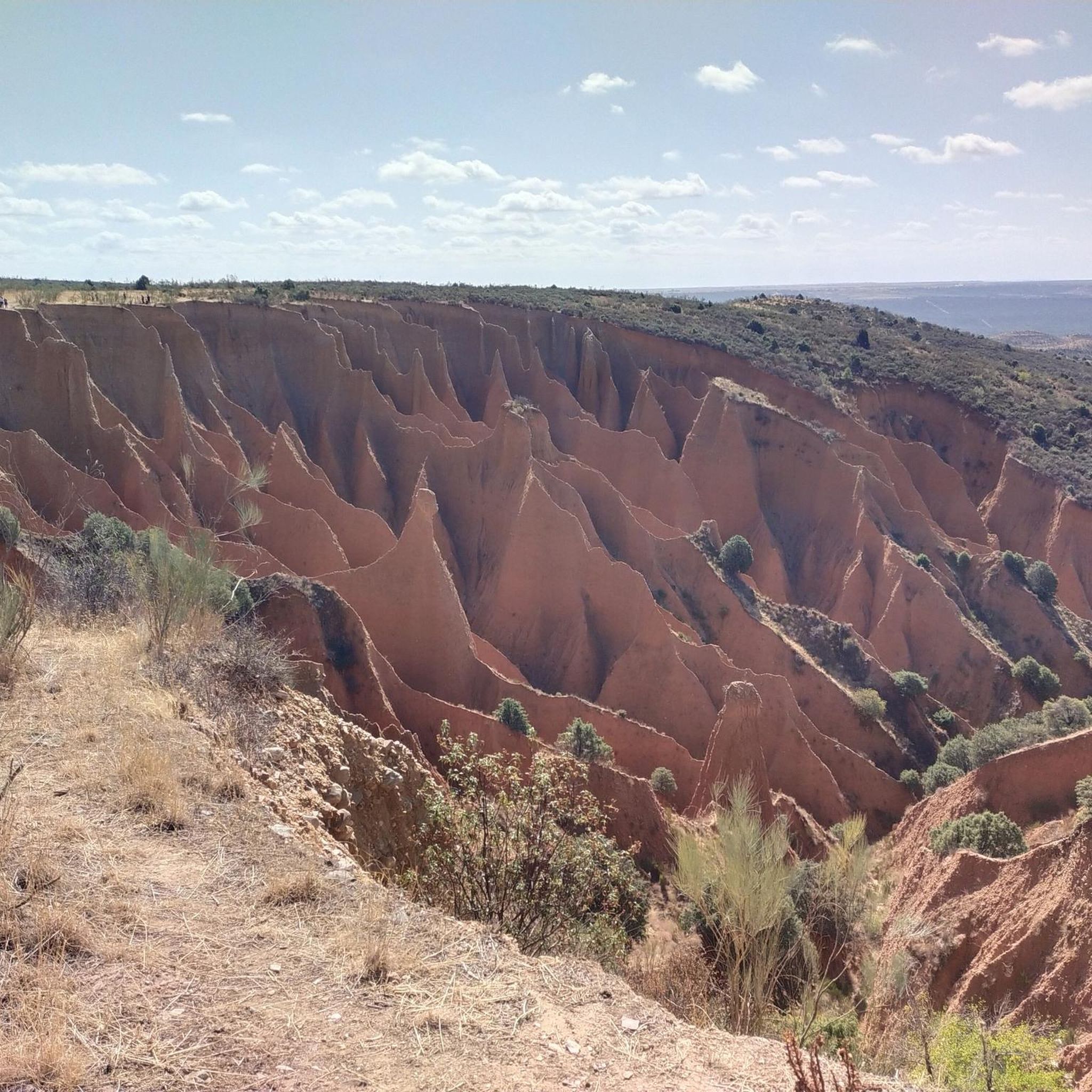
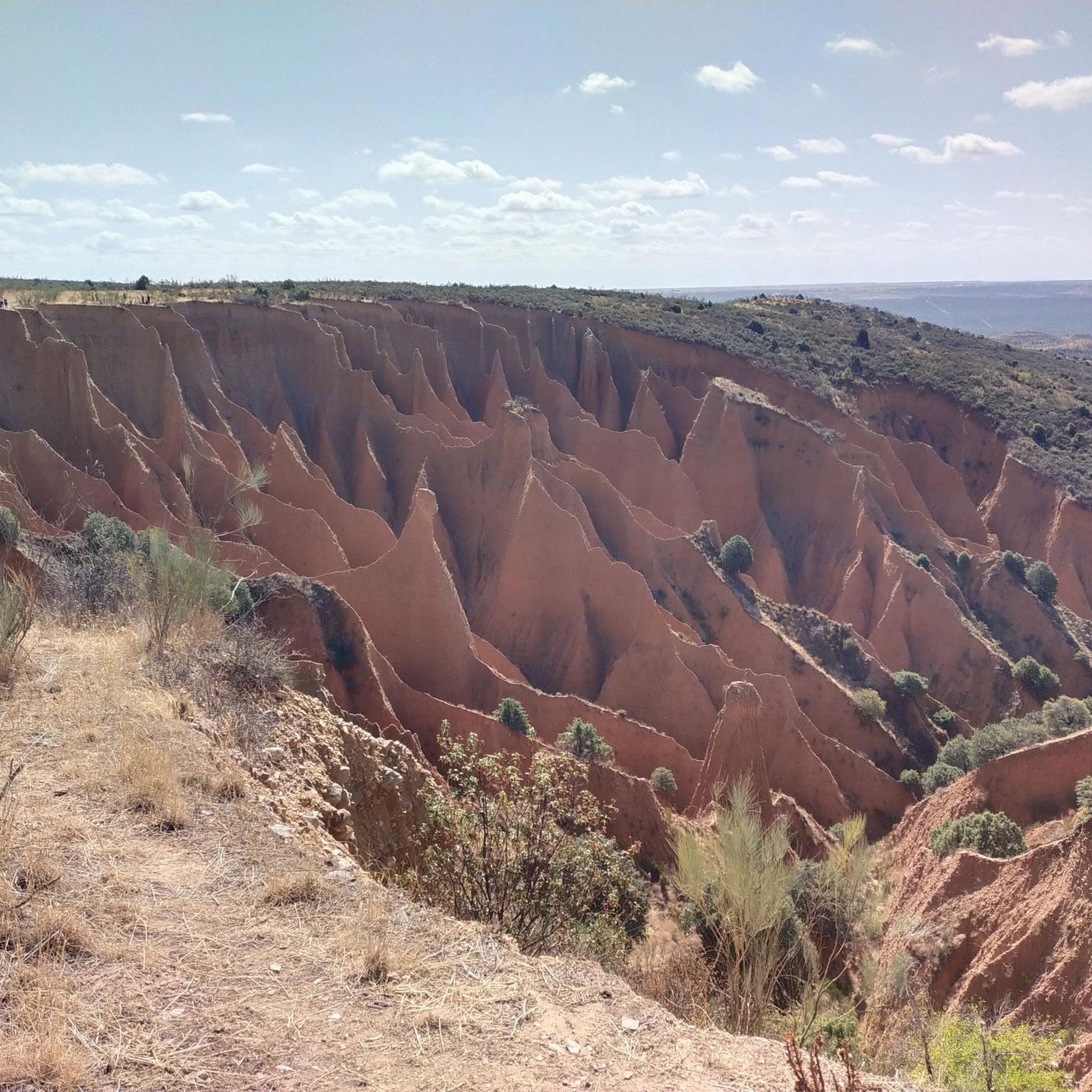
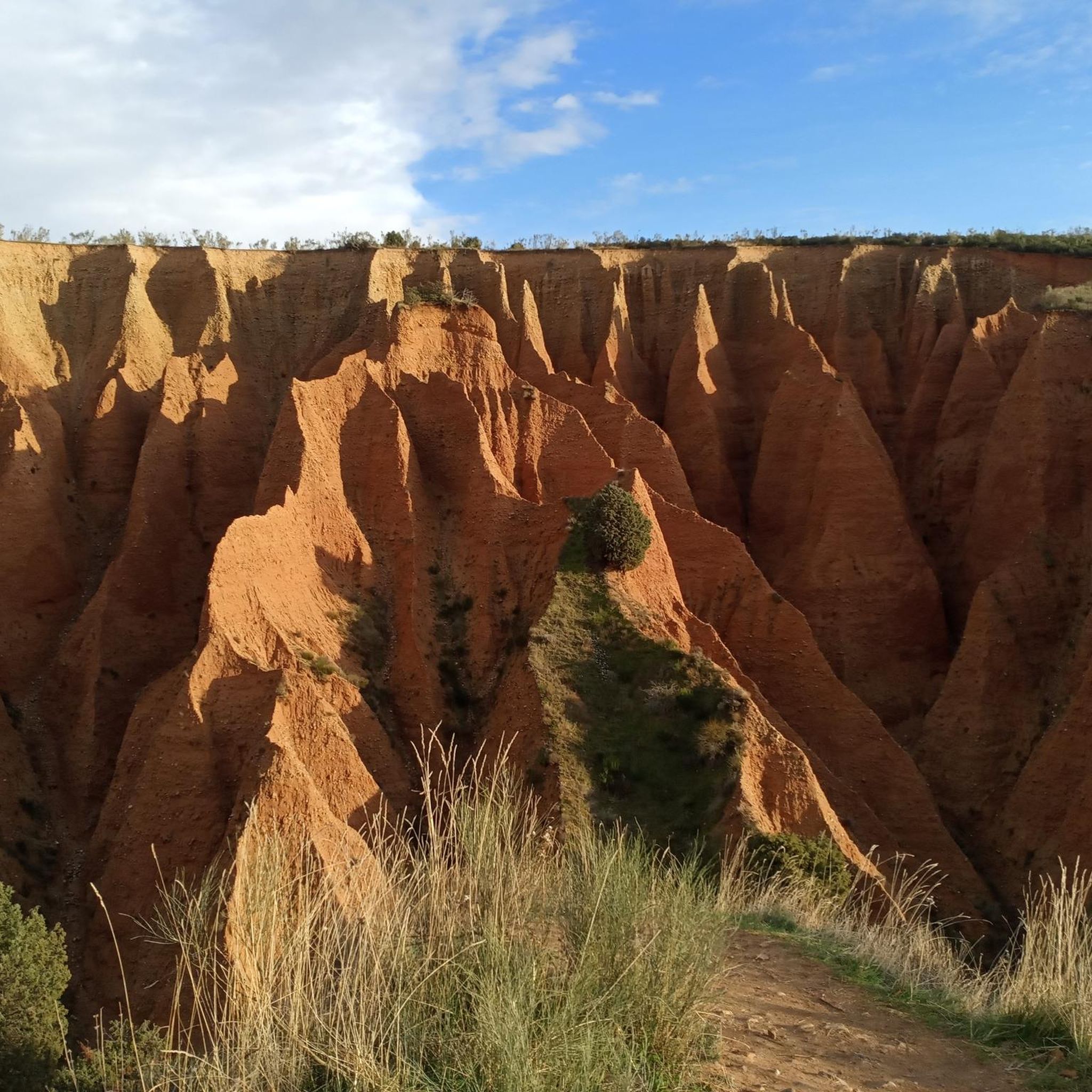
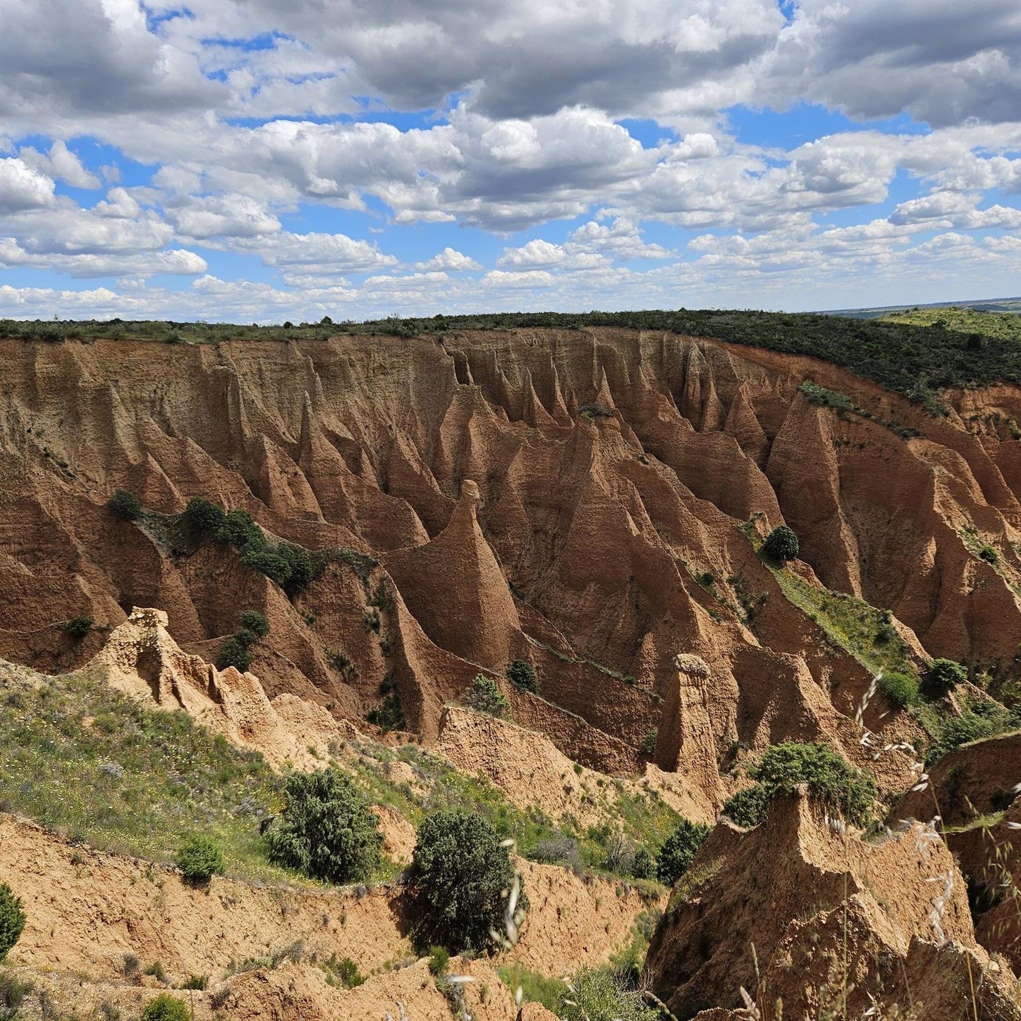
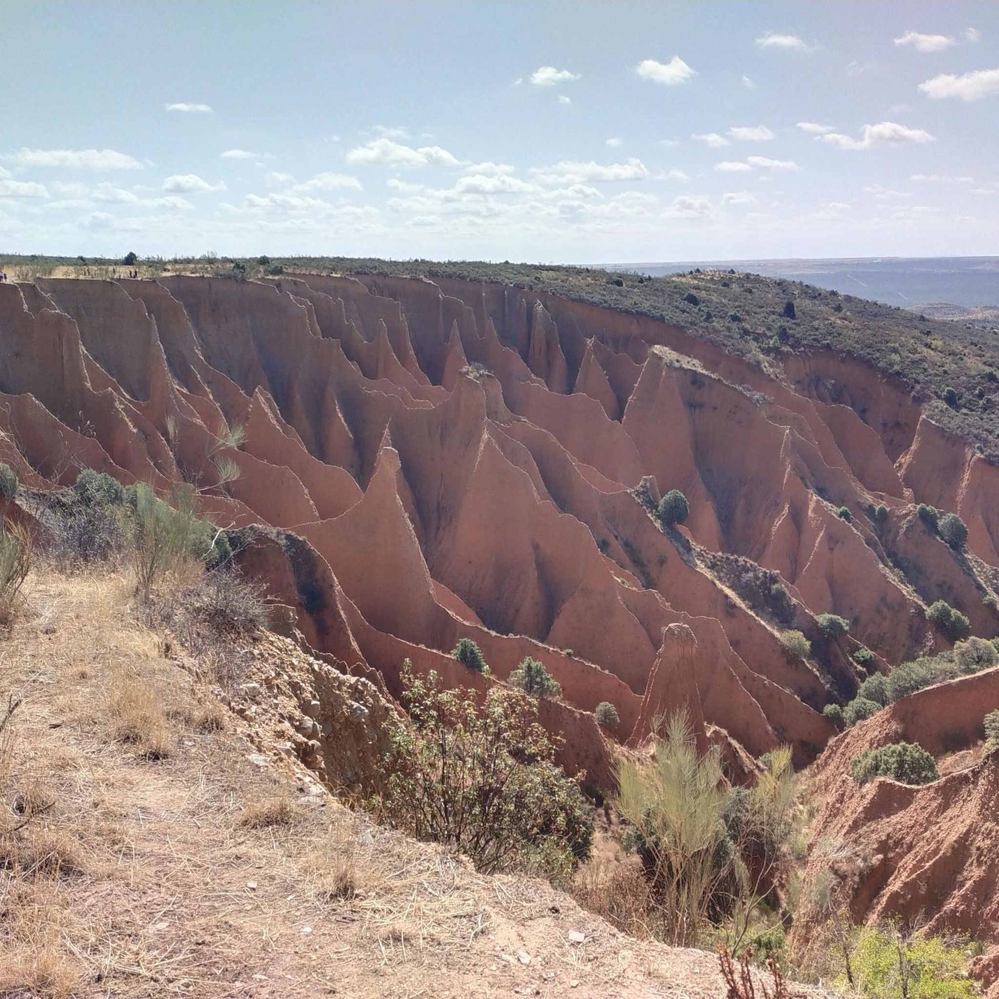
This Martian landscape has been caused by strong water erosion on the clayey slope, forming these ditches that make up a science fiction landscape. It is also beautiful because of the surrounding environment, be careful and respect the signs, there are paths where it is forbidden to ride a bike so you will have to get off it.
2
0

The road here is very winding. The incredible landscape to be photographed.
0
1
Frequently Asked Questions
What are the most notable canyons and gorges to explore around Valdepeñas De La Sierra?
The region is primarily known for the deep cuts of the Lozoya River gorges. Key spots include the Cañada de la Caleriza Trail, which follows the Lozoya River, and Views of the Lozoya River, offering perspectives of the river as it narrows near the El Villar reservoir. Another significant location is Vultures' Viewpoint, which provides views over the Puebla river gorge.
When is the best time to visit the canyons around Valdepeñas De La Sierra?
While specific seasonal recommendations for canyoning aren't provided, generally, spring and autumn offer pleasant temperatures for outdoor activities. Summer can be hot, but the presence of rivers and reservoirs might offer opportunities for cooling down. Winter can be cold, and some routes might be less accessible.
Are there easy or beginner-friendly routes for exploring the gorges?
Many of the trails along the Lozoya River, such as the Cañada de la Caleriza Trail, are described as intermediate, suggesting they are accessible to those with some hiking experience. Viewpoints like Views of the Lozoya River and Vultures' Viewpoint offer less strenuous ways to appreciate the landscape.
What kind of natural features can I expect to see in the gorges of Valdepeñas De La Sierra?
You will encounter dramatic river gorges, vertical rock walls, and green mountain ridges. The area is characterized by the Lozoya River, which forms narrow valleys and feeds into reservoirs. You can also observe unique geological formations like those at Las Cárcavas - Pontón de la Oliva, which feature striking eroded clay slopes.
Are there opportunities for wild swimming in the canyons or rivers?
The Lozoya River is a prominent feature, and it feeds into several reservoirs in the area, such as El Villar and Atazar. While specific wild swimming spots are not detailed, the presence of these waterways suggests potential opportunities for cooling off, especially during warmer months. Always exercise caution and check local regulations before swimming in natural bodies of water.
Are there any historical or cultural sites near the canyons?
Yes, the Patones Gorge Trail is a notable historical site. This path, which connects Patones de Arriba and Patones de Abajo, was once a primary access route to the slate town until the 1930s. It offers geological and landscape value, winding through a limestone and slate ravine.
What outdoor activities can I do near these canyons?
Beyond exploring the canyons themselves, the region offers various outdoor activities. You can find numerous hiking trails, such as the 'Cárcavas de Valdepeñas de la Sierra Loop' or the 'Pontón de la Oliva to La Parra Dam Circular Trail'. There are also options for gravel biking and trail running. For more details on routes, you can explore the Hiking around Valdepeñas De La Sierra guide or the Gravel biking around Valdepeñas De La Sierra guide.
Do I need permits for canyoning or hiking in Valdepeñas De La Sierra?
Specific permit requirements for general hiking or canyoning are not typically needed for most public access areas in this region. However, if you plan to engage in technical canyoning activities, it's always advisable to check with local authorities or guide services for any specific regulations or safety guidelines that might apply to certain routes or protected areas.
Is parking available near the canyon viewpoints and trails?
While specific parking locations are not detailed for every highlight, popular viewpoints and trailheads in natural areas like Valdepeñas De La Sierra typically have designated parking areas or roadside pull-offs. It is recommended to check maps or local signage upon arrival for the most convenient and appropriate parking spots.
What should I wear for exploring the gorges and trails?
For hiking and exploring the gorges, wear comfortable, sturdy footwear suitable for varied terrain. Layered clothing is advisable to adapt to changing weather conditions. If you plan to be near water or engage in any water-based activities, consider quick-drying clothing. Always bring water, sun protection, and a map or GPS device.
Are there any less-known or 'hidden gem' canyons to explore?
While the main gorges are well-documented, the region's landscape is shaped by numerous river cuts. The area around Las Cárcavas - Pontón de la Oliva, with its unique 'Martian landscape' formed by water erosion, offers a distinct and perhaps less conventional canyon-like experience compared to the river gorges.
Can I bring my dog to the canyons in Valdepeñas De La Sierra?
Many natural areas in Spain are dog-friendly, especially on trails. However, it's crucial to keep your dog on a leash, especially in areas with wildlife or other visitors. Always clean up after your pet. Specific restrictions might apply in certain protected zones or on private land, so look for local signage.
Most popular routes around Valdepeñas De La Sierra
Most popular attractions around Valdepeñas De La Sierra

Get inspired with the komoot mobile app


Explore more
Already discovered everything in this region? See additional gorges around Valdepeñas De La Sierra for your next adventure:
