The 6 Most Amazing Peaks around Cùllieri/Cuglieri
Mountain peaks around Cùllieri/Cuglieri are defined by the Montiferru massif, an ancient volcanic complex in Sardinia. This region features a landscape of mountains and forests, offering panoramic views. The area is known for its geological and historical significance, providing diverse ecosystems and coastal and inland vistas.
Best mountain peaks around Cùllieri/Cuglieri
- The most popular mountain peaks is Monte Agudu (Sa Rocca de Tiu Antoni Gana), a summit that rises to almost 900 meters in altitude. On its summit, remains…
Last updated: June 30, 2026
Monte Pertusu
Highlight • Summit
Translated by Google •
Tip by

IGM Trigonometric Point On Mullone
Highlight • Summit
At the top of this point, you can see (already from the repeaters …
Translated by Google •
Tip by

Sign up now to discover places like this
Get recommendations on the best single tracks, peaks, & plenty of other exciting outdoor places.
Sign up for free
Monte Agudu (Sa Rocca de Tiu Antoni Gana)
Highlight • Summit
Translated by Google •
Tip by
Shaded Rest Spot at Badde Urbara Summit
Highlight • Summit
(This is one of the very few trees on the top of Badde Urbara to have been saved from the …
Translated by Google •
Tip by
Monte Sant'Antonio
Highlight • Summit
of nature submerged in the woods and in the Mediterranean scrub. Country churches and archaeological sites abound …
Translated by Google •
Tip by

Sign up for free to discover even more peaks around Cùllieri/Cuglieri.
Sign up for free
Already have an account?
Start today with a free account
Your next adventure awaits.
Login or Signup
Popular around Cùllieri/Cuglieri

Other adventures around Cùllieri/Cuglieri

Tips from the Community

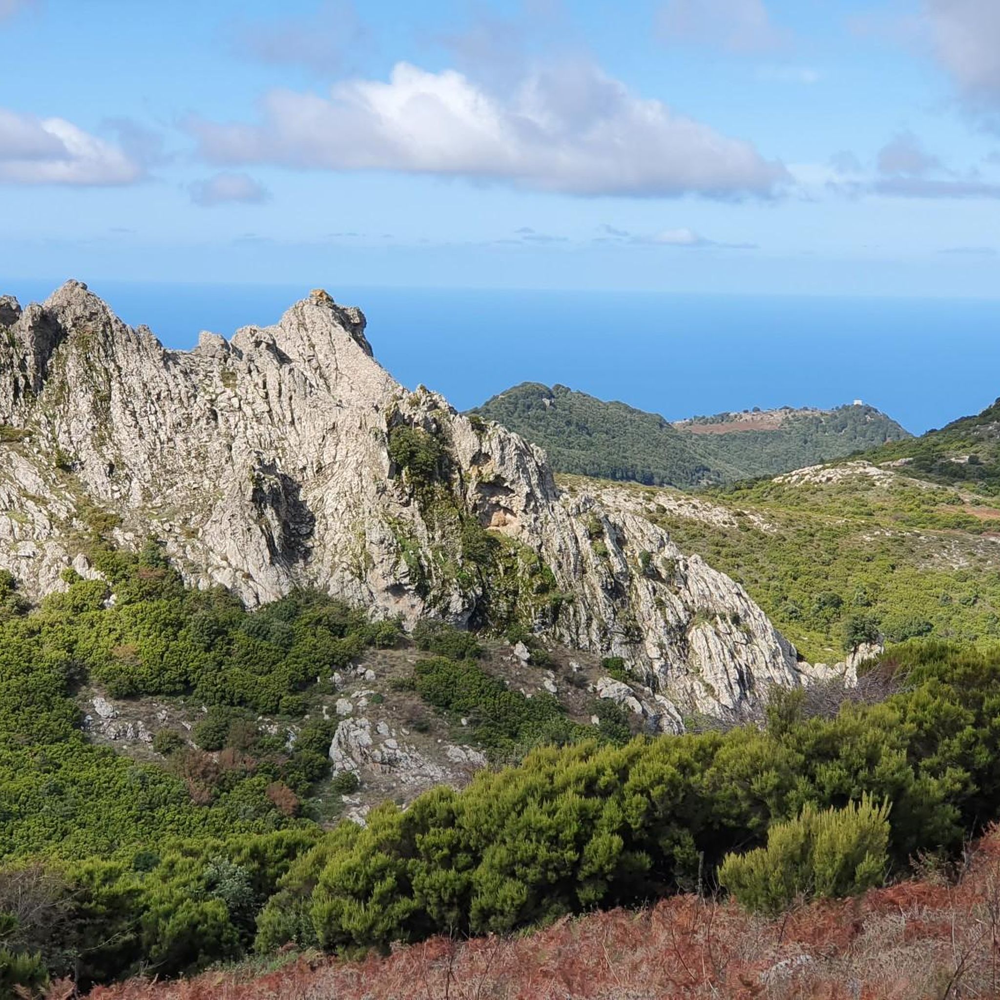
It is located in the municipality of Santu Lussurgiu (OR) A spectacular rocky peak of Montiferru that reaches an altitude of 970 meters. The west side is vertical, while the east side is inclined and climbable. On the summit there are the remains of a megalithic fortification, also known as Rocca 'e su Para, a toponym attributed, it seems, for the use of the fortress by Camaldolese friars as a place of prayer.
0
0

Also known as Monte Agudu, it rises imposingly reaching almost 900m in altitude. On the summit there are the remains of a probable late-Nuragic sanctuary
2
0

Disappointment... we are experienced hikers. We followed the route to the letter and found ourselves on barely marked paths overgrown with vegetation (brambles, thistles). The way back is no better: tarmac road used by many trucks. Hiking to be completely revised because it is impassable on many sections.
0
0
Update April 2024: the orange ribbons that marked the route have disappeared. However, the number of the aforementioned "piles of stone" has increased, making it clear which path to use to get to the top.
0
0
You've reached the top, take a break in the shade. (This is one of the very few trees on the top of Badde Urbara to have been saved from the 2021 fire, and remains one of the few shaded points in the area with the exception of the descent which then takes you back to the provincial road towards Cuglieri. The descent towards Elighes Uttiosos shows this fact very well, as after almost three years the charred skeletons of the trees that once populated this hill can still be found, today replaced only by shrubs).
0
0
Imposing peak, maximum height of 986. From the top you can see a wonderful panorama
0
0

The Monte di Sant'Antonio is a relief of volcanic origin, a suggestive corner of nature submerged in the woods and in the Mediterranean scrub. Country churches and archaeological sites abound throughout the area. Here there is also the statue of the Madonna, of Sant'Antonio di Padova, and a nuraghe is hidden in the thick vegetation.
1
0

A beautiful summit from which you can admire a wonderful view.
0
0
Frequently Asked Questions
What are some of the most prominent mountain peaks in the Cuglieri region?
The Cuglieri region, dominated by the Montiferru massif, features several notable peaks. These include Monte Urtigu, the highest point at 1050 meters, offering expansive views. Monte Entu is distinctive for its conical shape and views of the western coast. Historically significant is Casteddu Etzu, an ancient castle ruin with panoramic vistas. Other popular peaks include Monte Agudu (Sa Rocca de Tiu Antoni Gana), known for its probable late-Nuragic sanctuary, and Monte Sant'Antonio, a volcanic relief rich in nature and historical sites.
What kind of views can I expect from the mountain peaks in Montiferru?
The Montiferru peaks offer breathtaking panoramic views. From Monte Urtigu, on clear days, you can see as far as the island of Asinara to the north and the Sella del Diavolo on the Cagliari coast to the south. Monte Entu provides wide views of Sardinia's western coast, from Frasca and San Marco to Capo Caccia near Alghero. Even from the ruins of Casteddu Etzu, you'll find a spectacular 360-degree panorama of the Montiferru massif and the coastline. Many komoot highlights, such as IGM Trigonometric Point On Mullone and Shaded Rest Spot at Badde Urbara Summit, are specifically noted for their rewarding viewpoints.
Are there any historical or archaeological sites on the mountain peaks?
Yes, the region is rich in history. Casteddu Etzu, also known as Montiferru Castle, is a 12th-century ruin perched on a basaltic hill, offering insights into the Judicate of Torres. On Monte Agudu (Sa Rocca de Tiu Antoni Gana), you can find the remains of a probable late-Nuragic sanctuary. Monte Sant'Antonio also features country churches and archaeological sites, including a hidden nuraghe.
What are the natural features and wildlife found around the Montiferru peaks?
The Montiferru massif is an ancient volcanic complex, evident in the basaltic and trachytic rocks that give the terrain a reddish hue. The slopes are covered in diverse vegetation, including holm oaks, cork oaks, yew trees, and holly. The area is home to a variety of wildlife such as wild boars, foxes, Sardinian hares, and reintroduced mouflons. The area around Monte Entu is part of the "Pabarile" forest complex, highlighting its ecological importance.
What are the hiking difficulty levels for the mountain peaks in Cuglieri?
The mountain peaks around Cuglieri offer a range of difficulty levels. Some routes, like the path to IGM Trigonometric Point On Mullone (Punta del Monte Urtigu), are considered challenging due to unstable terrain, requiring careful navigation. Other highlights, such as Monte Agudu and Monte Sant'Antonio, are rated as intermediate. There are also easier options, such as the 3.5-mile hike to Casteddu Etzu, which provides both cultural insight and scenic beauty.
Are there family-friendly hiking options near the Cuglieri mountain peaks?
Yes, there are options suitable for families. The hike to Casteddu Etzu is an easy 3.5-mile (5.6 km) route that combines historical interest with scenic beauty. For more general hiking, you can explore the Hiking around Cùllieri/Cuglieri guide, which includes easy routes like the "Casteddu Etzu Trail" and "Massabari Waterfalls loop from Monte Ala".
What outdoor activities can I do near these mountain peaks besides hiking?
Beyond hiking, the Cuglieri region offers various outdoor activities. You can find numerous running trails, with options like the "Cuglieri view with Basilica – Cuglieri loop from Cùllieri/Cuglieri" in the Running Trails around Cùllieri/Cuglieri guide. For cyclists, there are gravel biking routes, such as the "Torre Sa Mora – Torre del Pozzo loop from S'Archittu" detailed in the Gravel biking around Cùllieri/Cuglieri guide.
What is the best time to visit the mountain peaks in Cuglieri?
The Montiferru region is generally pleasant for hiking during spring and autumn when temperatures are milder. Summer can be very hot, and paths, especially on peaks like Monte Urtigu, can be exposed, requiring adequate water and sun protection. Winter offers a different experience, but some paths might be more challenging due to weather conditions. Always check local weather forecasts before heading out.
What makes Monte Entu a unique peak in the Montiferru massif?
Monte Entu, reaching 1027 meters, is particularly distinctive due to its unique conical shape, which sets it apart from the surrounding dome-shaped reliefs. Its name, meaning "Mount Wind," reflects its exposed nature. Historically, it has inspired local writers and offers wide views of the western coast of the island. The mountain is characterized by gray basaltic rock with irregular prismatic divisions.
Where can I find a shaded rest spot at a summit in the area?
You can find a welcome shaded rest spot at the Shaded Rest Spot at Badde Urbara Summit. This location offers a place to rest in the shade at the top of Badde Urbara, which is one of the few trees that survived the 2021 fire in the area, providing a rare shaded point.
What is the highest point in the Montiferru massif?
The highest point in the Montiferru massif is Monte Urtigu, standing at 1050 meters (approximately 3445 feet) above sea level. Its summit provides expansive vistas, allowing visitors on clear days to see far across the island.
What are some of the challenges when hiking to Monte Urtigu?
Hiking to Monte Urtigu involves navigating roads that can be a mix of paved and gravel. The paths to the summit can be exposed, requiring adequate water and sun protection, especially during warmer months. The terrain can be unstable, as noted for the path to the IGM Trigonometric Point On Mullone, which requires careful attention to trail markers.
Most popular routes around Cùllieri/Cuglieri
Most popular attractions around Cùllieri/Cuglieri

Get inspired with the komoot mobile app


Explore more
See even more amazing summits around Cùllieri/Cuglieri with these guides:
