Top 12 Huts and Cabins around Mettendorf
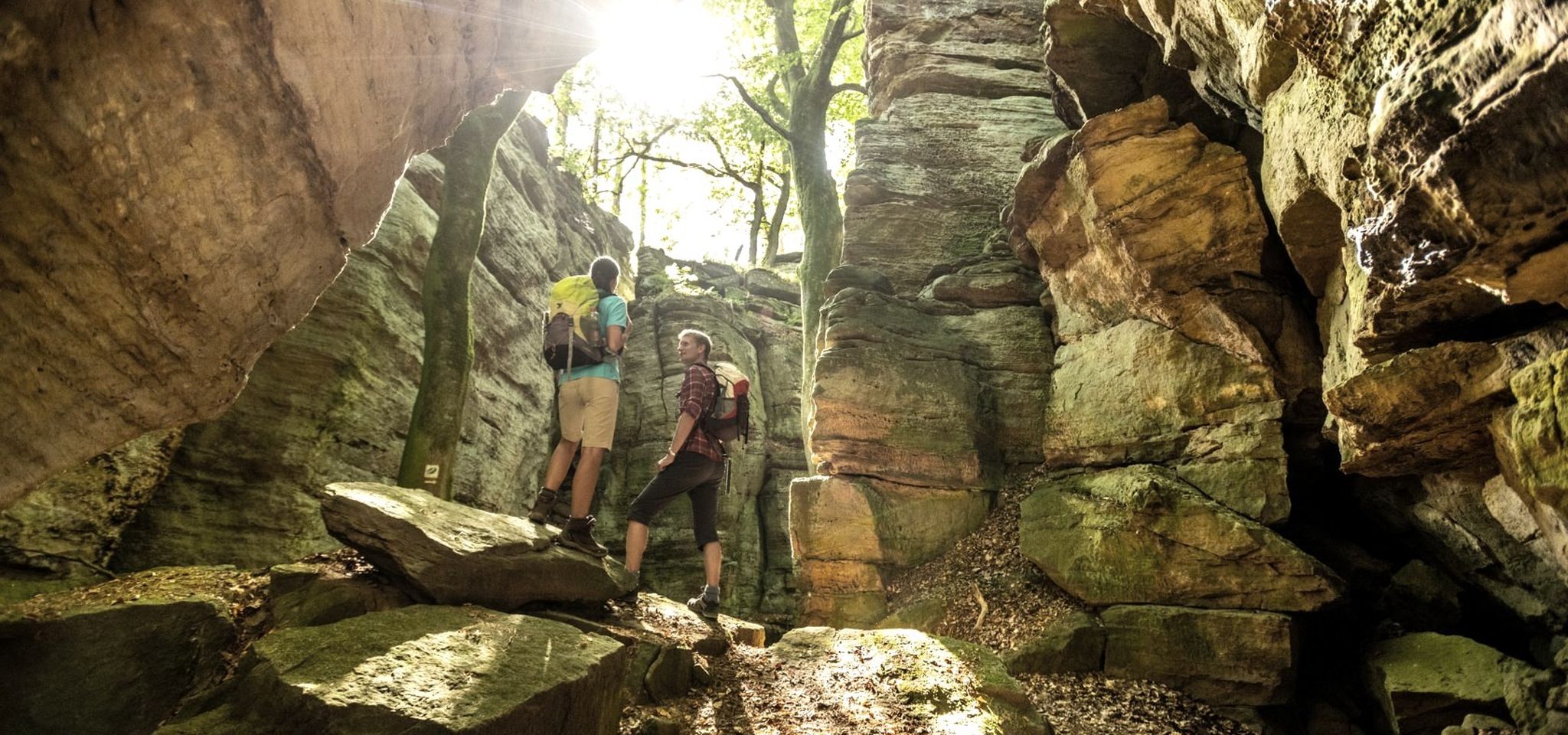
Best huts around Mettendorf are found within the Southern Eifel Nature Park, a region characterized by its unique geological formations and dense forests. The area offers diverse landscapes, including bizarre rock formations and gorge-like passages, providing a varied backdrop for outdoor activities. Mettendorf itself serves as a starting point for exploring these natural features. The region is known for its network of hiking trails that often lead to or pass by various shelters and huts.
Best huts around Mettendorf
- The…
Last updated: May 14, 2026
Maria Theresienstein
Highlight • Monument
The large, sculpted stone was erected during the reign of Empress Maria Theresa of Austria, around the 18th century. It marked the border between …
Translated by Google •
Tip by

View from the Lingelslay Observation Tower
Highlight • Viewpoint
Translated by Google •
Tip by

Sign up now to discover places like this
Get recommendations on the best single tracks, peaks, & plenty of other exciting outdoor places.
Sign up for free
Shelter Unbegangenes Land (Grüne Hölle, Naturpark Südeifel)
Highlight • Mountain Hut
Translated by Google •
Tip by

Shelter and memorial stone at the 7 Ways
Highlight • Mountain Hut
Translated by Google •
Tip by

Abandoned Cabin in Naturpark Südeifel
Highlight • Mountain Hut
Translated by Google •
Tip by

Sign up for free to discover even more huts and cabins around Mettendorf.
Sign up for free
Already have an account?
Start today with a free account
Your next adventure awaits.
Login or Signup

Other adventures around Mettendorf

Tips from the Community

The name dates back to Maria Theresa (1717–1780), Archduchess of Austria and ruler of the Austrian Netherlands, which included the area around Bollendorf in the 18th century. Today, the Maria-Theresien-Stein primarily serves as a waypoint within the ‘Grüne Hölle’ (Green Hell) listening tour. It is integrated into the route guidance and is presented as a stop with scenic and historical significance during the tour.
41
0

For a truly "abandoned" feel, the Bunker Trail near Dasburg offers the best combination of historical ruins and overgrown nature https://www.mycardstatement.com.co
0
0
Text according to the information panel: The large, sculpted stone was erected during the reign of Empress Maria Theresa of Austria, around the 18th century. It marked the border between the lordships of Echternach and Vianden, thus forming the border region between the Duchy of Luxembourg and the Electorate of Trier. The east side of the stone displays the coat of arms of Echternach Abbey: Saint Willibrord with his bishop's staff. The west side, however, bears the coat of arms of the County of Vianden with a rampant lion. On the Echternach side, one can also see the letters A.O. (Abbatia Ordinis – Abbey Order) and E.E. (Echternachensis Ecclesiae – Church of Echternach). On the Vianden side, the letters C.V. (Comitatus Vianden – County of Vianden) can be read. The stone was restored and re-erected in the 1970s. Originally, it stood slightly further south, directly on the historical border. Today it is located on the hiking trail between Bollendorf and Wallendorf.
45
0

Nice little hut for a break or to take shelter in bad weather
0
0

A small hut with a bench stands next to the Maria Theresa Stone. A historic boundary stone from the 18th century. A detailed information panel explains it.
11
0
A small viewing platform offers a view of Bollendorf. Several benches invite you to rest.
5
0

very nice spot in the middle of the forest, but you should know your way around to avoid going in the wrong direction
0
0

You have a nice view from here
4
0
Frequently Asked Questions
What natural features and viewpoints can I discover near Mettendorf's huts?
The region around Mettendorf, part of the Southern Eifel Nature Park, is known for its diverse landscapes, including bizarre rock formations and gorge-like passages. Many huts are situated to offer stunning views. For example, the View from the Lingelslay Observation Tower provides extensive panoramic views over the Sauer valley. You can also find shelters within areas like the 'Green Hell', known for its unique geological formations.
Are there any historical huts or sites to visit around Mettendorf?
Yes, the area features historical sites alongside its natural beauty. A notable example is Maria Theresienstein, which includes a small hut next to an 18th-century boundary stone. This stone marks a historic border and bears the coat of arms of Empress Maria Theresa, offering a glimpse into the region's past.
Are the huts and trails around Mettendorf suitable for families?
Many huts and trails in the Mettendorf area are considered family-friendly. Highlights like Maria Theresienstein and Shelter and memorial stone at the 7 Ways are accessible and offer pleasant spots for breaks. The Waldhütte in Mettendorf, for instance, is reachable within a 30-minute walk from the village square, making it a good option for shorter family outings.
How can I access the huts around Mettendorf, and is parking available?
Access to many huts is typically via hiking trails. For the Waldhütte in Mettendorf, it's a pleasant 30-minute walk from the village square. While specific parking details for every hut vary, Mettendorf itself serves as a starting point, and parking is generally available within the village or at trailheads. Public transport options might be limited directly to remote huts, so planning your route in advance is recommended.
When is the best time to visit the huts around Mettendorf?
The huts around Mettendorf can be enjoyed year-round, depending on your preferences. Spring and autumn offer pleasant temperatures for hiking and vibrant natural scenery. Summer is ideal for outdoor grilling and longer days, while winter provides a unique experience, with some huts like the Waldhütte offering a Swedish stove for warmth, perfect for enjoying fondue after a snowy walk.
What should I consider when visiting Mettendorf's huts in winter?
When visiting Mettendorf's huts in winter, be prepared for colder temperatures and potentially snowy or icy conditions on trails. Dress in layers, wear waterproof and insulated clothing, and sturdy hiking boots. Some huts, like the Waldhütte in Mettendorf, offer heating with a Swedish stove, providing a warm refuge. Always check weather forecasts and trail conditions before heading out.
What kind of outdoor activities can I do near the huts in Mettendorf?
The area around Mettendorf offers a variety of outdoor activities. You can explore numerous running trails, such as the 'Running loop from Bettingen' or 'Running loop from Utscheid'. For mountain biking enthusiasts, there are routes like 'Red Rock at Puhl – Neuerburg Tunnel loop from Mettendorf'. Road cyclists can enjoy scenic routes like 'Enz River Path – Enztal Cycle Path loop from Mettendorf'. You can find more details on these activities in the Running Trails around Mettendorf, MTB Trails around Mettendorf, and Road Cycling Routes around Mettendorf guides.
Are there specific hiking trails that connect multiple huts?
While the guide doesn't explicitly list named multi-hut trails, the region is known for its network of hiking paths. Huts like Shelter and memorial stone at the 7 Ways are located at junctions of several forest paths, suggesting opportunities to create circular walks connecting different shelters. Exploring local hiking maps will help you plan routes that link various huts and viewpoints.
What are some highly-rated huts or shelters to visit in the Mettendorf region?
Beyond the popular ones, visitors appreciate shelters like Shelter Unbegangenes Land (Grüne Hölle, Naturpark Südeifel), which offers a good spot for a break or shelter in bad weather within the unique 'Green Hell' area. The Waldhütte in Mettendorf is also highly regarded by locals for its amenities and versatility for various gatherings.
Are there any lesser-known or unique huts worth exploring?
For those seeking a more rustic or adventurous experience, the Abandoned Shelter on the Rock offers a unique, albeit neglected, spot. While it may not provide full shelter, its location on a rock and the surrounding trail appeal to those looking for less-traveled paths and a sense of discovery.
Are there huts with amenities like nearby pubs or cafes?
The Waldhütte in Mettendorf is well-equipped with a kitchen (two hotplates, sink with non-potable water) and a Swedish stove for heating, making it suitable for self-catering. While specific huts may not have pubs directly adjacent, Mettendorf village itself offers cafes and pubs. It's advisable to check local listings for establishments in the village before your visit.
What is the typical difficulty of trails leading to these huts?
The trails leading to huts around Mettendorf vary in difficulty. Some, like the path to the Waldhütte in Mettendorf, are pleasant and relatively easy walks. Others, especially those in areas like the 'Green Hell' leading to shelters such as Shelter Unbegangenes Land, can be intermediate due to the terrain with bizarre rock formations and gorge-like passages. Always check route descriptions for specific difficulty ratings.
Most popular routes around Mettendorf
Most popular attractions around Mettendorf

Get inspired with the komoot mobile app


Explore more
Find more beautiful huts and cabins around Mettendorf by checking out the top ones in these nearby places:
