Top 18 Huts and Cabins around Wettlingen
Best huts around Wettlingen, a small municipality in the Eifelkreis Bitburg-Prüm district of Rhineland-Palatinate, Germany, are found within the broader Eifel region. This rural area is characterized by its natural landscapes, offering opportunities for hiking trails and exploring the terrain. While Wettlingen itself is very small, the surrounding Eifelkreis Bitburg-Prüm district provides various points of interest, including structures that serve as huts or shelters for outdoor enthusiasts.
Best huts around Wettlingen
- The most popular huts include the View from the…
Last updated: May 14, 2026
Maria Theresienstein
Highlight • Monument
The large, sculpted stone was erected during the reign of Empress Maria Theresa of Austria, around the 18th century. It marked the border between …
Translated by Google •
Tip by

View from the Lingelslay Observation Tower
Highlight • Viewpoint
Translated by Google •
Tip by

Sign up now to discover places like this
Get recommendations on the best single tracks, peaks, & plenty of other exciting outdoor places.
Sign up for free
Charcoal Burners’ Hut Village Irrel
Highlight • Mountain Hut
Translated by Google •
Tip by

Shelter Overlooking Teufelsschlucht
Highlight • Mountain Hut
It's perfectly adequate for a snack break and shelter from the rain.
Translated by Google •
Tip by

Charcoal burners’ huts in the forest youth camp on the Prüm
Highlight • Mountain Hut
Translated by Google •
Tip by

Sign up for free to discover even more huts and cabins around Wettlingen.
Sign up for free
Already have an account?
Start today with a free account
Your next adventure awaits.
Login or Signup
Tips from the Community

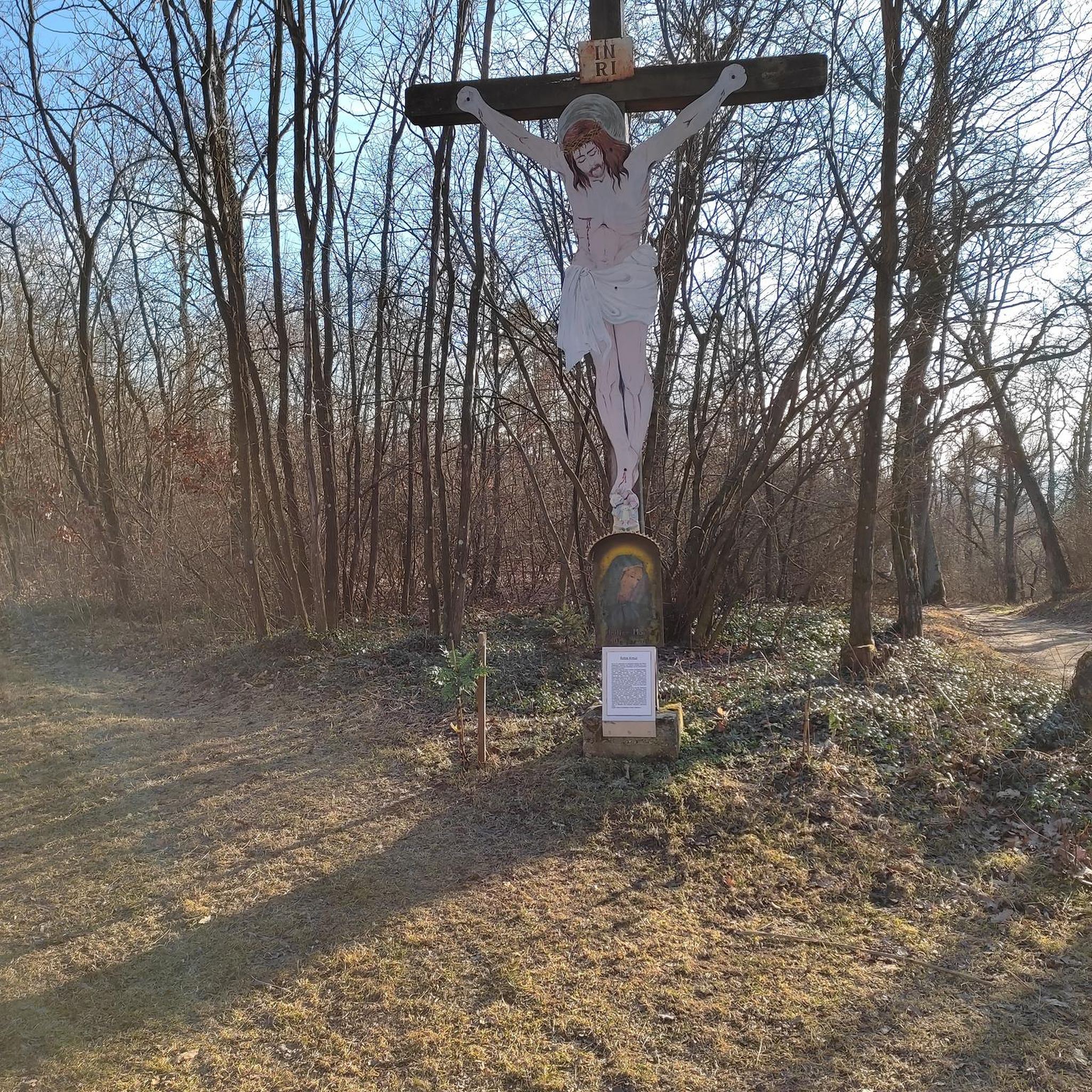
The name dates back to Maria Theresa (1717–1780), Archduchess of Austria and ruler of the Austrian Netherlands, which included the area around Bollendorf in the 18th century. Today, the Maria-Theresien-Stein primarily serves as a waypoint within the ‘Grüne Hölle’ (Green Hell) listening tour. It is integrated into the route guidance and is presented as a stop with scenic and historical significance during the tour.
41
0
Text according to the information panel: The large, sculpted stone was erected during the reign of Empress Maria Theresa of Austria, around the 18th century. It marked the border between the lordships of Echternach and Vianden, thus forming the border region between the Duchy of Luxembourg and the Electorate of Trier. The east side of the stone displays the coat of arms of Echternach Abbey: Saint Willibrord with his bishop's staff. The west side, however, bears the coat of arms of the County of Vianden with a rampant lion. On the Echternach side, one can also see the letters A.O. (Abbatia Ordinis – Abbey Order) and E.E. (Echternachensis Ecclesiae – Church of Echternach). On the Vianden side, the letters C.V. (Comitatus Vianden – County of Vianden) can be read. The stone was restored and re-erected in the 1970s. Originally, it stood slightly further south, directly on the historical border. Today it is located on the hiking trail between Bollendorf and Wallendorf.
45
0

A small hut with a bench stands next to the Maria Theresa Stone. A historic boundary stone from the 18th century. A detailed information panel explains it.
11
0
A small viewing platform offers a view of Bollendorf. Several benches invite you to rest.
5
0
We had early morning fog, so I can't comment on the view. The hut itself is simple, with benches all around. It's perfectly adequate for a snack break and shelter from the rain.
9
0

Cool to see once, but no life to be seen.
0
0

The small shelter offers welcome shelter during a rain shower.
3
0

beautiful witches houses
0
0
Frequently Asked Questions
What types of huts can I expect to find around Wettlingen?
The Wettlingen area, part of the broader Eifel region, features a variety of structures that serve as huts or shelters. These include historical boundary markers like the Maria Theresienstein, observation towers offering panoramic views, and traditional charcoal burners' huts, some of which form small villages like the Charcoal Burners’ Hut Village Irrel.
Are there any huts with historical significance in the region?
Yes, the Maria Theresienstein is a notable historical boundary stone from 1771, marking the border between the properties of Echternach Abbey and the County of Vianden. It bears the coat of arms of Empress Maria Theresa and the Holy Roman Empire. Additionally, the Charcoal Burners’ Hut Village Irrel represents a historical settlement type, traditionally used for accommodation by charcoal burners.
Which huts offer the best views around Wettlingen?
For expansive views, the View from the Lingelslay Observation Tower provides a great vantage point over the Sauer valley. Another spot offering exciting views into the depths is the Shelter Overlooking Teufelsschlucht, which is a simple resting place with benches.
Are there family-friendly huts or locations suitable for children?
Many huts in the area are considered family-friendly. The Charcoal Burners’ Hut Village Irrel, for example, is a settlement of several huts in a forest clearing with a large fire pit, and is located near attractions like the Irrel waterfalls and a dinosaur park. The Charcoal burners’ huts in the forest youth camp on the Prüm also offer a unique, village-like experience that families might enjoy.
What outdoor activities can I do near the huts around Wettlingen?
The region around Wettlingen offers various outdoor activities. You can explore numerous trails for gravel biking, mountain biking, and running. For gravel biking, consider routes like the 'View over Utscheid – Fischbach Chapel loop'. Mountain bikers can find trails such as the 'Forest Trail in the Eifel – Fast Pipe Trail loop'. Runners have options like the 'Altbettinger Turm loop'. You can find more details on these activities and routes in the Gravel biking around Wettlingen, MTB Trails around Wettlingen, and Running Trails around Wettlingen guides.
What is the best time to visit the huts and surrounding area?
The Eifel region, where Wettlingen is located, is generally pleasant for outdoor activities from spring through autumn. These seasons offer favorable weather for hiking, biking, and exploring the natural landscapes and huts. Winter can also be beautiful, but some trails or access might be affected by snow or ice.
Are there any huts that provide shelter or resting places during a hike?
Yes, the Shelter Overlooking Teufelsschlucht is a simple hut with benches, perfectly adequate for a snack break or shelter from rain while exploring the Teufelsschlucht area.
What are the Charcoal Burners’ Huts in the forest youth camp on the Prüm?
These are a collection of seven huts located in a forest youth camp on the Prüm, south of the Irrel waterfalls. Each hut has its own name and they are known for their unique, 'dwarf village' appearance. They were historically used for holiday camps and offer a charming stop for visitors.
What do visitors enjoy most about the huts and the Wettlingen area?
Visitors appreciate the diverse natural landscapes and the unique character of the huts. Highlights like the View from the Lingelslay Observation Tower are praised for their great views. The historical significance of sites like the Maria Theresienstein and the rustic charm of the charcoal burners' hut villages are also highly valued.
Can I find facilities like fire pits or kitchens at any of the huts?
The Charcoal Burners’ Hut Village Irrel is known to have a large fire pit and a kitchen hut with a covered extension, making it suitable for group activities and longer stays.
What kind of terrain can I expect when hiking to these huts?
The Eifel region around Wettlingen features varied terrain, including forest paths, valleys, and some elevated viewpoints. Trails can range from easy to challenging, often involving natural landscapes and some elevation changes, especially when accessing viewpoints or areas like the Teufelsschlucht.
Are there any specific natural features or landmarks near the huts?
Yes, near the Charcoal Burners’ Hut Village Irrel and the Charcoal burners’ huts in the forest youth camp on the Prüm, you can find the Irrel waterfalls, the Prüm river, and the dramatic Teufelsschlucht (Devil's Gorge). The Lingelslay Observation Tower offers views over the Sauer valley.
Most popular routes around Wettlingen
Most popular attractions around Wettlingen

Get inspired with the komoot mobile app


Explore more
Find more beautiful huts and cabins around Wettlingen by checking out the top ones in these nearby places:
