Rio Grande Del Norte National Monument
Rio Grande Del Norte National Monument
Top 6 Gorges in Rio Grande Del Norte National Monument
Best canyons in Rio Grande Del Norte National Monument are characterized by the dramatic Rio Grande Gorge, a deep chasm carved by the Rio Grande. This monument features volcanic basalt flows and ash layers, creating a sudden rift in the high-desert plains. The area offers geological insights and evidence of ancient human activity, particularly along the river. Its rugged landscape includes steep canyons with rivers in their depths.
Best canyons in Rio Grande Del Norte National Monument
- The most popular…
Last updated: July 9, 2026
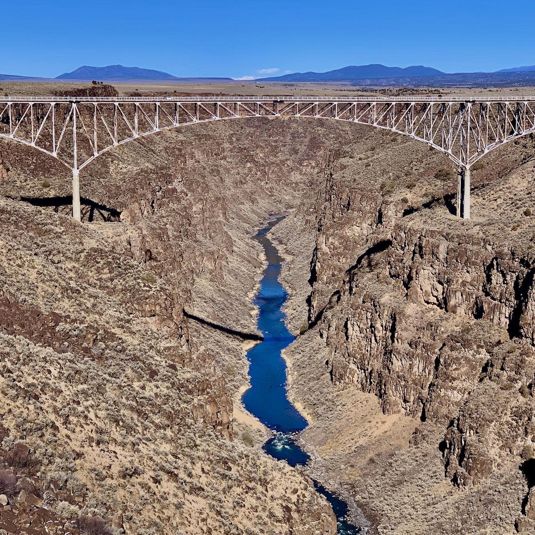
Rio Grande Gorge and Bridge View
Highlight • Viewpoint
Translated by Google •
Tip by

The Slide Trail
Highlight (Segment) • Trail
Tip by

Sign up now to discover places like this
Get recommendations on the best single tracks, peaks, & plenty of other exciting outdoor places.
Sign up for free
Big Arsenic Trail
Highlight (Segment) • Trail
Tip by
West Rim Trail (southern section)
Highlight (Segment) • Trail
Tip by
River Trail
Highlight (Segment) • Trail
Tip by
Sign up for free to discover even more gorges in Rio Grande Del Norte National Monument.
Sign up for free
Already have an account?
Start today with a free account
Your next adventure awaits.
Login or Signup
Popular around Rio Grande Del Norte National Monument
Tips from the Community

Truly a beautiful place.
3
0

The River Trail parallels the Río Grande, connecting the La Junta Trail with the Little and Big Arsenic Trails, allowing you to make a number of different length loops in the amazing Wild Rivers Recreation Area. You get great views of the river and surrounding dramatic cliffs as you hike.
0
0
The Big Arsenic Springs Trail is a popular out-and-back trail located in the Wild Rivers Recreation Area of the Rio Grande del Norte National Monument. This trail starts at the rim of the mesa above the river, and drops quickly, descending about 600 feet down rocky, steep switchbacks to the Rio Grande. This 1.5 mile trail offers truly stunning views down the gorge as you hike. As you draw closer to the end of the trail keep an eye out for some ancient petroglyphs carved on the rocks above you. You can also link this trail with the River Trail if you wish to extend your hike.
0
0
The southern portion of the West Rim Trail leaves from either the West Rim Trailhead (South) or the Petaca Point Trailhead in the Orilla Verde Recreation Area in the Rio Grande del Norte National Monument. This great trail, which runs along the rim of the Rio Grande Gorge, links up to the Northern West Rim Trailhead by the Rio Grande Gorge Bridge and overlook. Along this entire relatively flat trail you get stunning views down into the gorge, across the mesa to the mountains to the north and west, and there are frequently herds of bighorn sheep and other animals along the trail for you to observe.
0
0
This spot, just a short distance from the main parking area and overlook, is a great place to take in the striking views of the Rio Grande Gorge and bridge away from some of the crowds closer to the parking area. This is an amazing spot to snap a few photos before continuing down the West Rim Trail.
1
0
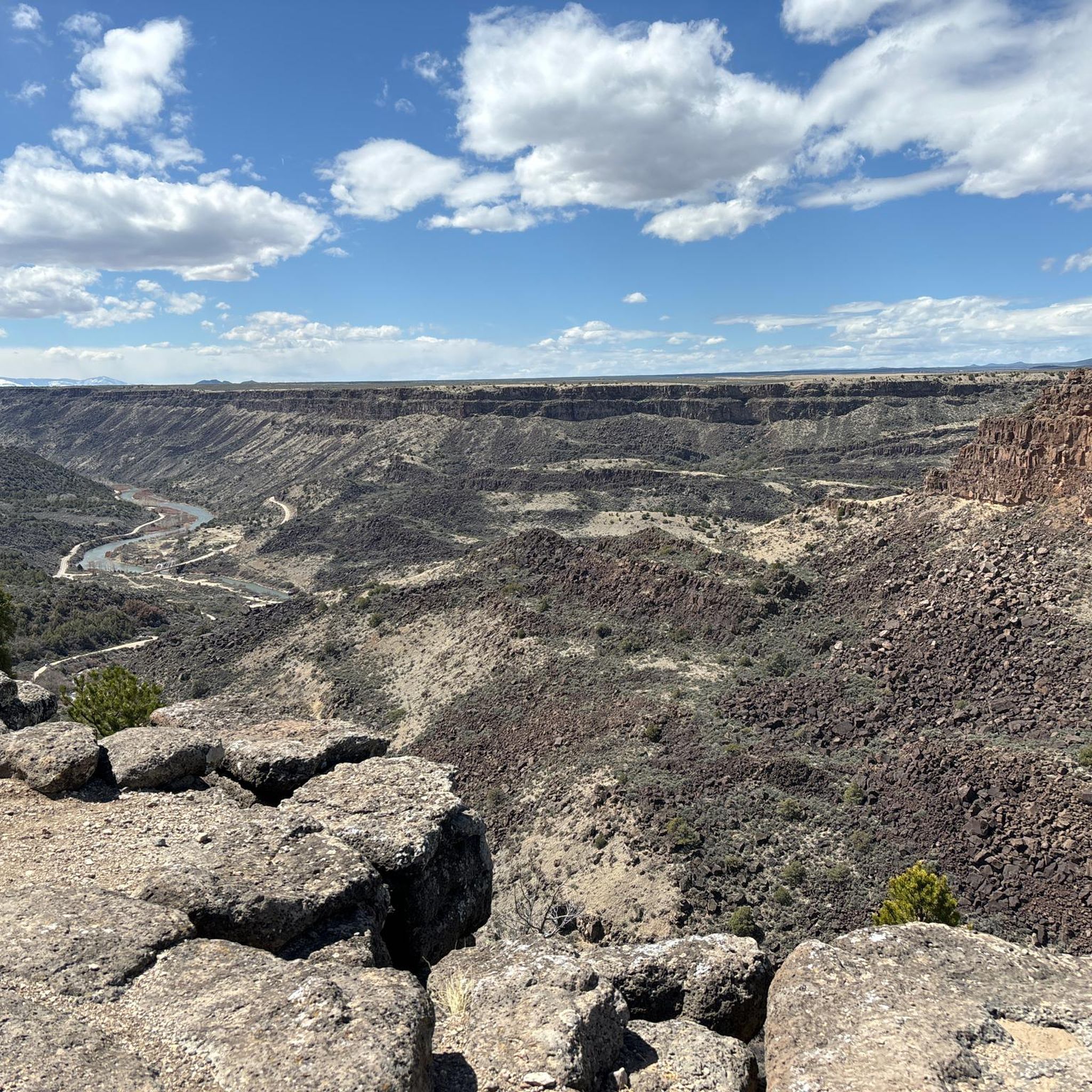
The Slide Trail is a popular trail in the Taos Overlook area of the Rio Grande del Norte National Monument. This trail traverses on a plateau high above the Rio Grande, offering hikers stunning views down steep cliffs over the water. Although this trail is generally pretty flat, there are a few rolling hills, some loose rocks, and there can be steep drop offs to the river below so use caution when hiking. There is also little to no shade along this trail, so be sure to bring plenty of water and sun protection!
0
0
Frequently Asked Questions
What are the most popular trails for exploring the canyons in Rio Grande Del Norte National Monument?
The most popular trails include the The Slide Trail, which offers stunning views high above the Rio Grande, and the Big Arsenic Trail, known for its descent to the river and ancient petroglyphs. The West Rim Trail (southern section) also provides expansive views along the gorge rim.
Are there family-friendly canyon experiences in Rio Grande Del Norte National Monument?
Yes, the monument offers options suitable for families. The Rio Grande Gorge and Bridge View is an easily accessible viewpoint that provides striking panoramic views without extensive hiking. For those looking for a short walk, the La Junta Point in the Wild Rivers Recreation Area is wheelchair accessible and offers scenic views.
What kind of geological features can I expect to see in the canyons of Rio Grande Del Norte National Monument?
The canyons, particularly the Rio Grande Gorge, showcase dramatic geological features. You'll see impressive layers of volcanic basalt flows and ash, revealing the area's powerful volcanic and sedimentary history. The gorge itself is a sudden, deep rift carved by the Rio Grande, often referred to as 'New Mexico's Grand Canyon' due to its scale.
What is the best time of year to visit the canyons in Rio Grande Del Norte National Monument?
Spring and fall generally offer the most pleasant weather for visiting, with mild temperatures ideal for hiking and outdoor activities. Summer can be very hot, requiring plenty of water and sun protection, especially on trails with little shade like The Slide Trail. Winter visits are possible, but conditions can vary, with potential for snow and ice at higher elevations.
What outdoor activities can I do near the canyons in Rio Grande Del Norte National Monument?
Beyond hiking, the Rio Grande and its surrounding canyons offer excellent opportunities for whitewater rafting, kayaking, and trout fishing. Wildlife viewing is also popular, with bighorn sheep, mule deer, and river otters often spotted. For more hiking options, explore the Hiking in Rio Grande Del Norte National Monument guide. If you're interested in cycling, check out the Cycling in Rio Grande Del Norte National Monument guide.
Are there any cultural or historical sites to explore within the canyons?
Yes, the canyons hold significant cultural history. Evidence of ancient human activity, including petroglyphs and prehistoric dwelling sites, can be found throughout the monument, particularly along the river. The Big Arsenic Trail is one place where you can observe ancient petroglyphs carved into the rocks near its end.
How difficult are the hiking trails in the canyons of Rio Grande Del Norte National Monument?
Trail difficulties vary. Some trails, like the Big Arsenic Trail, involve steep descents of about 600 feet down rocky switchbacks to the Rio Grande, making them intermediate. Others, such as sections of the West Rim Trail (southern section), are relatively flat but may have rolling hills and loose rocks. Always check trail descriptions for specific difficulty ratings. You can find more easy options in the Easy hikes in Rio Grande Del Norte National Monument guide.
What should I wear when hiking in the canyons during summer?
During summer, temperatures can be high, and shade is often limited, especially on trails like The Slide Trail. It's recommended to wear lightweight, breathable clothing, a wide-brimmed hat, and sunglasses. Sturdy hiking shoes are essential for navigating rocky terrain. Always carry plenty of water and sun protection.
Are there any loop trails available for hiking in the canyon country?
While many trails are out-and-back, some areas allow for creating loops by connecting different segments. For instance, the River Trail in the Wild Rivers Recreation Area parallels the Rio Grande and connects with trails like the Little and Big Arsenic Trails, offering opportunities to create various loop lengths.
Where can I find more information about the Rio Grande Del Norte National Monument?
For comprehensive information regarding regulations, visitor services, and planning your trip, you can visit the official Bureau of Land Management website for the monument: blm.gov/visit/rgdnnm.
What wildlife might I encounter in the canyons?
The monument provides habitat for diverse wildlife. Keep an eye out for Rocky Mountain bighorn sheep, mule deer, elk, and pronghorn. North American river otters have also been reintroduced and can sometimes be spotted near the river. The West Rim Trail (southern section) is a good place to observe bighorn sheep.
Are there any viewpoints that offer spectacular panoramic views of the Rio Grande Gorge?
Absolutely. The Rio Grande Gorge and Bridge View offers striking views of the gorge and its iconic bridge. The Taos Valley Overlook, situated above the Taos Junction Bridge, also provides expansive scenic views of the canyon and surrounding mountains.
Most popular routes in Rio Grande Del Norte National Monument
Most popular attractions in Rio Grande Del Norte National Monument

Get inspired with the komoot mobile app


