Top 6 Lakes in Joffre Lakes Provincial Park
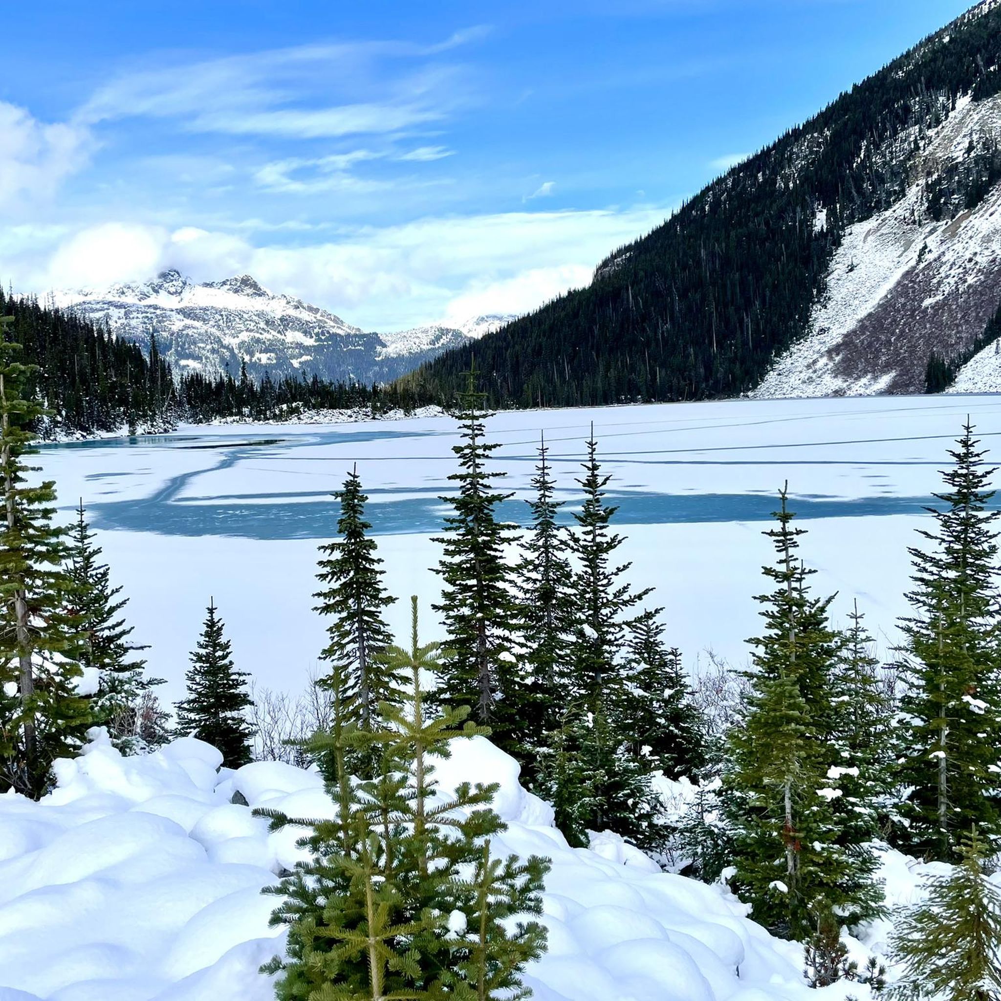
Best lakes in Joffre Lakes Provincial Park are located 35 kilometers east of Pemberton, British Columbia. The park is known for its three glacier-fed lakes: Lower, Middle, and Upper Joffre Lakes. These lakes are characterized by their vibrant turquoise-blue color, which results from glacial silt suspended in the water. The area offers opportunities for hiking, camping, and climbing, attracting visitors due to its scenic glaciers and challenging peaks.
Best lakes in Joffre Lakes Provincial Park
- The most popular lakes is…
Last updated: June 24, 2026
Lower Joffre Lake
Highlight • Lake
The lake receives water from nearby glaciers, mainly …
Translated by Google •
Tip by

Upper Joffre Lake
Highlight • Lake
Tip by

Sign up now to discover places like this
Get recommendations on the best single tracks, peaks, & plenty of other exciting outdoor places.
Sign up for free
Joffre Lakes Trail
Highlight • Trail
Tip by

View of the Base of the Matier Glacier
Highlight • Viewpoint
Tip by
Campsites and climbing route
Highlight • Rest Area
Tip by
Sign up for free to discover even more lakes in Joffre Lakes Provincial Park.
Sign up for free
Already have an account?
Start today with a free account
Your next adventure awaits.
Login or Signup
Popular around Joffre Lakes Provincial Park
Tips from the Community

Mount Matier is the highest peak in the Joffre Group Range in the Coast Mountains. The Matier Glacier lies in the cirque of the mountain range and slopes northward. Meltwater from the Matier Glacier feeds the three Joffre Lakes. Due to climate change, the Matier Glacier is shrinking. On the Joffre Lakes Trail and at the three lakes, only the base of the glacier is visible. (Visit May 28, 2025)
2
0
Access to the Joffre Lakes Trail is located at the top of a pass. Joffre Creek drains west into the Lillooet River, while Cayoosh Creek flows east and empties into Duffey Lake, which drains into the Fraser River. During the summer months, you must register for the Joffre Lakes Trail free of charge – for information, see the following website: https://bcparks.ca/reservations/day-use-passes/#joffre-lakes Registration is required to ensure a manageable number of hikers in the park – a maximum of 500 people per day. The trail leads to the park's three lakes: Lower Lake, Middle Lake, and Upper Lake. The Lower Joffre Lake is just a few hundred meters from the parking lot. Joffre Lakes Park is known for its turquoise lakes and panoramic views of snow-capped peaks; the base of the Matier Glacier is visible. Below the Upper Joffre Lake, Holloway Falls plunge into the depths. The trail ends at Upper Joffre Lake, but it is possible to continue along the western shore to the Joffre Lakes Backcountry Campground and further to the southern end of the lake, where rushing streams carry the waters of the Matier Glacier. (Visit May 28, 2025)
2
0
To the south of Upper Joffre Lake lies the Joffre Lakes Backcountry Campground, with 26 gravel campsites. The trail to the campground runs along the western shore to the restroom facility. With some experience, you can continue to the southern tip of the lake, finding your way through the extensive talus field. The effort is worth it; above the lake, you have fantastic views of the base of the Matier Glacier and, to the north, the peaks of the Cayoosh Range. (Visit May 28, 2025) https://bcparks.ca/joffre-lakes-park/#camping
2
0
Upper Joffre Lake lies at an elevation of 1,570 m and is easily accessible along a shady forest trail. Below the lake, the ascent takes you past the rushing Holloway Falls. There is an elevation difference of approximately 60 meters between Middle and Upper Joffre Lake. The lakeshore offers a stunning panorama, including Joffre Peak and Slalok Mountain, as well as the glacial base of Mount Matier; the mountain peak itself is not visible from here. (Visit May 28, 2025)
2
0
Lower Joffre Lake is part of the Joffre Lakes Provincial Park. Access to the Lake is via the Duffey Lake Road, BC Highway 99. The car park is located at the mountain pass (approx. 1,300 m) between the valleys of Cayoosh Creek and Joffre Creek. Joffre Lakes Park is a protected area, class A park, since 1996. Class A parks are dedicated to the preservation of their natural environments and are open to the public. (Visit June 4, 2018 & May 28, 2025) https://bcparks.ca/joffre-lakes-park/
2
0

So beautiful there Canada, unforgettable!!!!!!!
0
0

The distinctive turquoise color of Lower Joffre Lake is due to the presence of finely ground rock particles, known as glacial flour, which are carried by glacier meltwater. These particles refract light in a way that gives water its bright, unique color.
4
0
It is a place where you can experience up close the majesty of Canada's glacial landscapes, with their unparalleled color and serene atmosphere.
4
0
Frequently Asked Questions
How difficult is the Joffre Lakes trail?
The Joffre Lakes trail offers varied difficulty. The path to Lower Joffre Lake is an easy, flat five-minute walk. The trail becomes steeper and more challenging to Middle Joffre Lake, winding through old-growth forests. The final stretch to Upper Joffre Lake is narrower and rougher, with boulders and roots. The entire round-trip trail is about 10 kilometers with an elevation gain of approximately 370 meters.
What makes the Joffre Lakes so vibrantly blue?
The Joffre Lakes are glacier-fed, and their vibrant turquoise-blue color comes from 'rock flour' (glacial silt) suspended in the water. This fine sediment reflects blue and green light waves, creating the lakes' distinctive hue.
What natural features can I expect to see along the Joffre Lakes trail?
Along the Joffre Lakes trail, you'll encounter three stunning glacier-fed lakes: Lower, Middle, and Upper Joffre Lakes, each with unique views. You'll also see old-growth forests, talus slopes, and magnificent views of surrounding mountains like Mount Matier and Slalok Mountain. A scenic waterfall can be found along the river connecting Middle and Upper Joffre Lakes, and the Matier Glacier is visible from various points.
What is the best time of year to visit Joffre Lakes Provincial Park?
The best time to visit Joffre Lakes Provincial Park and experience the signature blue color of the lakes is from mid-June to late September. During this period, the weather is generally favorable for hiking and enjoying the park's natural beauty.
Do I need a permit to visit Joffre Lakes Provincial Park?
Yes, during the summer months, you must register for a free day-use pass to access the Joffre Lakes Trail. This is required to manage the number of hikers in the park. For information and reservations, please visit the BC Parks website: bcparks.ca.
Are there camping opportunities in Joffre Lakes Provincial Park?
Yes, there are 26 small gravel campsites available for backcountry camping at the south end of Upper Joffre Lake. These campsites are a popular spot, and reservations are often required. Facilities include one pit toilet and a bear-proof food storage unit. You can find more details about camping at Campsites and climbing route.
What outdoor activities can I do near the lakes in Joffre Lakes Provincial Park?
Besides hiking the main Joffre Lakes trail, the park and surrounding area offer opportunities for climbing and exploring various routes. You can find detailed hiking routes, including options like the 'Lower Joffre Lake – Upper Joffre Creek Valley loop' or the 'Rohr Lake loop', on the Hiking in Joffre Lakes Provincial Park guide.
Is Joffre Lakes Provincial Park suitable for families?
Yes, Joffre Lakes Provincial Park can be suitable for families, especially the easily accessible Lower Joffre Lake. This lake is just a five-minute walk on flat terrain from the trailhead, making it ideal for all visitors, including those with young children. The trail to Middle and Upper Lakes becomes progressively more challenging.
Where can I get the best views of the Matier Glacier?
For breathtaking views of the Matier Glacier, head to Upper Joffre Lake. This lake is situated directly beneath the frozen cascade of the glacier, offering a prime destination for photographers. You can also get views of the glacier from View of the Base of the Matier Glacier and from Lower Joffre Lake on a clear day.
How long does it take to hike the entire Joffre Lakes trail?
For an active hiker, the entire 10-kilometer round-trip trail from the parking lot to Upper Joffre Lake and back generally takes around 2 to 2.5 hours to complete without stops. This duration can vary based on your pace and how much time you spend enjoying the views at each lake.
Are dogs allowed on the Joffre Lakes trail?
The provided information does not specify the dog policy for Joffre Lakes Provincial Park. It is recommended to check the official BC Parks website or local park regulations before bringing your dog.
What are some popular photography spots at Joffre Lakes?
All three Joffre Lakes offer incredible photography opportunities. Lower Joffre Lake provides an initial glimpse of the iconic turquoise waters. At Middle Joffre Lake, a log floating in the water is a popular spot for photos, with the pristine turquoise waters fringed by sub-alpine forest. Upper Joffre Lake offers the most stunning views of the Matier Glacier and Joffre Peak.
Most popular routes in Joffre Lakes Provincial Park
Most popular attractions in Joffre Lakes Provincial Park

Get inspired with the komoot mobile app


Explore more
Still not found your perfect lake in Joffre Lakes Provincial Park? Check out the guides of these regions to see even more beautiful places.
