Mt. Shasta Wilderness
Mt. Shasta Wilderness
The 5 Most Amazing Peaks in Mt. Shasta Wilderness
Best mountain peaks in Mt. Shasta Wilderness are found within a region dominated by its namesake volcano, Mount Shasta, in Northern California. This area features several notable peaks, all part of the Cascade Range, known for their volcanic geology. The landscape includes ancient lava flows, glaciers, and diverse forests. It offers varied recreational opportunities and significant natural features.
Best mountain peaks in Mt. Shasta Wilderness
- The most popular mountain peak is Mt Shasta summit 🌋 (4321m), a summit that…
Last updated: June 30, 2026
Mt Shasta summit 🌋 (4321m)
Highlight • Summit
For a winter snowshoe/crampon ascent route via Casaval Ridge and descent via standard Avalanche Gulch route see: komoot.com/tour/9090975
For an AT ski ascent …
Tip by

Avalanche Gulch 🌋 Mt Shasta
Highlight • Climb
Tip by
Sign up now to discover places like this
Get recommendations on the best single tracks, peaks, & plenty of other exciting outdoor places.
Sign up for free
Clear Creek Trail - TrailHead to Springs
Highlight (Segment) • Trail
Tip by
North Gate Trail to Hotlum/Bolam ridge
Highlight (Segment) • Trail
Tip by
Start today with a free account
Your next adventure awaits.
Login or Signup
Popular around Mt. Shasta Wilderness

Tips from the Community

Faint but detectable trail from the North Gate trailhead to the foot of Hotlum/Bolam ridge. The route continues up the ridge, though it's not marked and even less visible, and seasonally partly snow covered into late spring in the upper reaches. Once on it the ridge is quite straightforward to follow.
1
1
This is the complete trail from the Trailhead to the Clear Creek springs. After registering at the trailhead and paying the fee for climbing over 10'000 feet elevation the trail climbs gradually through pine forest along the canyon rim to the source of the creek. The best, and only, source of water along the entire trail. From there several more faint tracks climb steeply to the summit.
0
0
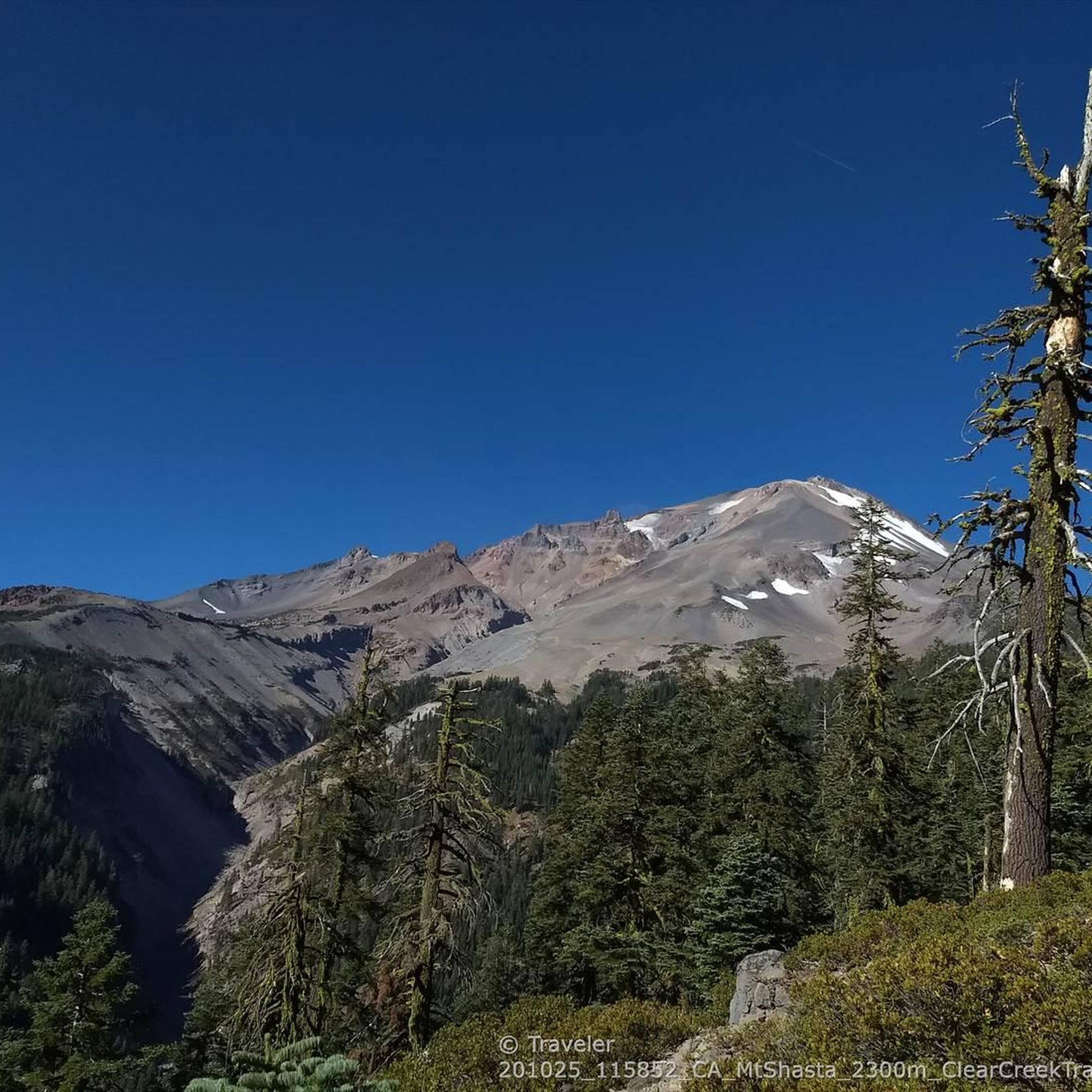
In the fall you can literally hike up to the summit of this tallest free-standing mountain in the lower US via the eastern route without climbing or any snow. The standard Avalanche Gulch route would be too dangerous without snow due to frequent life-threatening rockfall.
2
1
Avalanche Gulch is the standard route to climb Mt Shasta, typically done in spring/early summer as long as snow holds the loose rocks in place that pose a severe rock fall danger (helmets are essential here). Most people camp around 10000 feet at Lake Helen on Day 1 and summit the next morning. For a winter route climbing from Horse Camp via Casaval Ridge and descending via Avalanche Gulch see: https://www.komoot.com/tour/9090975
0
0
Tallest free standing Cascade volcano in California. For a winter snowshoe/crampon ascent route via Casaval Ridge and descent via standard Avalanche Gulch route see: https://www.komoot.com/tour/9090975 For an AT ski ascent and descent via West Face see: https://www.komoot.com/tour/9089213 For the least technical snow-free route via Clear Creek Trail see https://www.komoot.com/tour/277653983
2
0
Mount Shasta (Karuk: Úytaahkoo or "White Mountain") is a potentially active volcano located at the southern end of the Cascade Range in Siskiyou County, California. At an elevation of 14,179 feet (4321.8 m), it is the second highest peak in the Cascades and the fifth highest in California. Mount Shasta has an estimated volume of 85 cubic miles (350 km3), which makes it the most voluminous stratovolcano in the Cascade Volcanic Arc. Shasta dominates the northern California landscape. It rises abruptly and stands nearly 10,000 ft (3,000 m) above the surrounding terrain. On a clear winter day, snowy Mount Shasta can be seen from the floor of the Central Valley 140 miles (230 km) to the south. The mountain consists of four overlapping volcanic cones that have built a complex shape, including the main summit and the prominent satellite cone of 12,330 ft (3,760 m) Shastina, which has a visibly conical form. If Shastina were a separate mountain, it would rank as the fourth-highest peak of the Cascade Range (after Mount Rainier, Rainier's Liberty Cap, and Mount Shasta itself). Mount Shasta's surface is relatively free of deep glacial erosion except, paradoxically, for its south side where Sargents Ridge runs parallel to the U-shaped Avalanche Gulch. This is the largest glacial valley on the volcano, although it does not presently have a glacier in it. There are seven named glaciers on Mount Shasta, with the four largest (Whitney, Bolam, Hotlum, and Wintun) radiating down from high on the main summit cone to below 10,000 ft (3,000 m) primarily on the north and east sides. The Whitney Glacier is the longest, and the Hotlum is the most voluminous glacier in the state of California. Three of the smaller named glaciers occupy cirques near and above 11,000 ft (3,400 m) on the south and southeast sides, including the Watkins, Konwakiton, and Mud Creek glaciers. https://en.wikipedia.org/wiki/Mount_Shasta
1
0
Frequently Asked Questions
What are some of the most prominent mountain peaks to explore in the Mt. Shasta Wilderness?
The Mt. Shasta Wilderness is dominated by its namesake, Mount Shasta, which is the highest peak in the wilderness and the second-highest in the Cascades. Other significant peaks include Shastina, a prominent volcanic cone west of Mount Shasta, and Misery Hill, a sub-summit often encountered by climbers. For less strenuous options with great views, consider Red Butte and Gray Butte.
What makes Mount Shasta a significant destination for mountaineers?
Mount Shasta is renowned for its challenging climbing routes. The Avalanche Gulch is a standard route, though it requires crampons and ice axes due to steep snowfields and ice. More technical routes like Casaval Ridge attract experienced mountaineers. The mountain features seven glaciers, adding to its alpine challenge and beauty.
Are there any challenging sub-peaks or features for experienced climbers near Mount Shasta?
Yes, experienced climbers can tackle Shastina, a significant volcanic cone offering unique perspectives of the main Mount Shasta massif. Misery Hill and Thumb Rock are also notable features on the slopes of Mount Shasta, serving as challenging waypoints for those ascending to the true summit. Casaval Ridge is known as a more technical climbing route up Mount Shasta.
What are some less strenuous hiking options for enjoying views of Mount Shasta?
For rewarding views without the extreme challenge of the main summit, consider hiking to Red Butte or Gray Butte. Gray Butte, for instance, offers a moderate hike through old-growth forests to a summit with panoramic 360-degree views of Mount Shasta and the surrounding wilderness. It's also accessible from Panther Meadows.
What natural features can I expect to see when visiting the mountain peaks in Mt. Shasta Wilderness?
The Mt. Shasta Wilderness is characterized by its dramatic volcanic landscape, including ancient lava flows and seven named glaciers on Mount Shasta itself. You'll find diverse forests with red fir, white fir, sugar pine, and whitebark pine. The area also features a hot sulfur spring and various waterfalls, along with the granitic spires of Castle Crags nearby.
What is the best time of year to visit the mountain peaks in Mt. Shasta Wilderness?
The best time to visit depends on your activity. For mountaineering on Mount Shasta, spring or early summer (when snow holds loose rocks in place) is typical for routes like Avalanche Gulch. For wildflower displays in meadows, July and early August are ideal. In the fall, it's possible to hike to the summit via the eastern route without snow or technical climbing.
Are there family-friendly hiking trails near the mountain peaks in Mt. Shasta Wilderness?
Yes, while some peaks are very challenging, there are easier trails in the wider Mt. Shasta Wilderness suitable for families. For example, the Green Butte Trail Loop, South Gate Meadows Trail, and Old Ski Bowl Trail are considered easy hikes. You can find more details on these and other easy routes in the Easy hikes in Mt. Shasta Wilderness guide.
What outdoor activities can I do near these mountain peaks besides climbing?
Beyond climbing, the Mt. Shasta Wilderness offers extensive hiking opportunities. You can explore trails like the Clear Creek Trail, which climbs through pine forests, or the Gray Butte Trail for panoramic views. The nearby Castle Crags also provide rock climbing opportunities. For more hiking options, refer to the Hiking in Mt. Shasta Wilderness guide.
What permits are required for climbing the higher peaks in Mt. Shasta Wilderness?
For climbing over 10,000 feet elevation on Mount Shasta, a permit is required. You can register and pay the fee at trailheads such as the Clear Creek Trailhead. It's always advisable to check current regulations before your ascent.
Where can I find the best viewpoints to see Mount Shasta and the surrounding wilderness?
Excellent panoramic views of Mount Shasta can be enjoyed from various points, including the Mount Shasta Summit viewpoint. Hiking to the top of Gray Butte also provides stunning 360-degree vistas of Mount Shasta and the surrounding forests. The mountain itself can be seen for hundreds of miles on a clear day.
What should I wear when hiking Mt. Shasta peaks in summer?
Even in summer, conditions on higher peaks like Mount Shasta can be unpredictable. Layers are essential, including moisture-wicking base layers, insulating mid-layers, and a waterproof/windproof outer shell. For routes involving snow or ice, even in summer, crampons and ice axes may be necessary. Always check the weather forecast and trail conditions before heading out.
Are there any hidden gem peaks in the Mt. Shasta area worth exploring?
While Mount Shasta is the main attraction, smaller peaks like Red Butte and Gray Butte offer rewarding experiences with fewer crowds. Red Butte is one of five 'color-themed buttes' surrounding Mount Shasta, and Gray Butte provides a moderate hike with panoramic views, making them excellent choices for those seeking a quieter adventure.
Most popular routes in Mt. Shasta Wilderness
Most popular attractions in Mt. Shasta Wilderness

Get inspired with the komoot mobile app


Explore more
See even more amazing summits in Mt. Shasta Wilderness with these guides:
