The best gravel rides around La Cienega
4.3
(3)
7
riders
3
rides
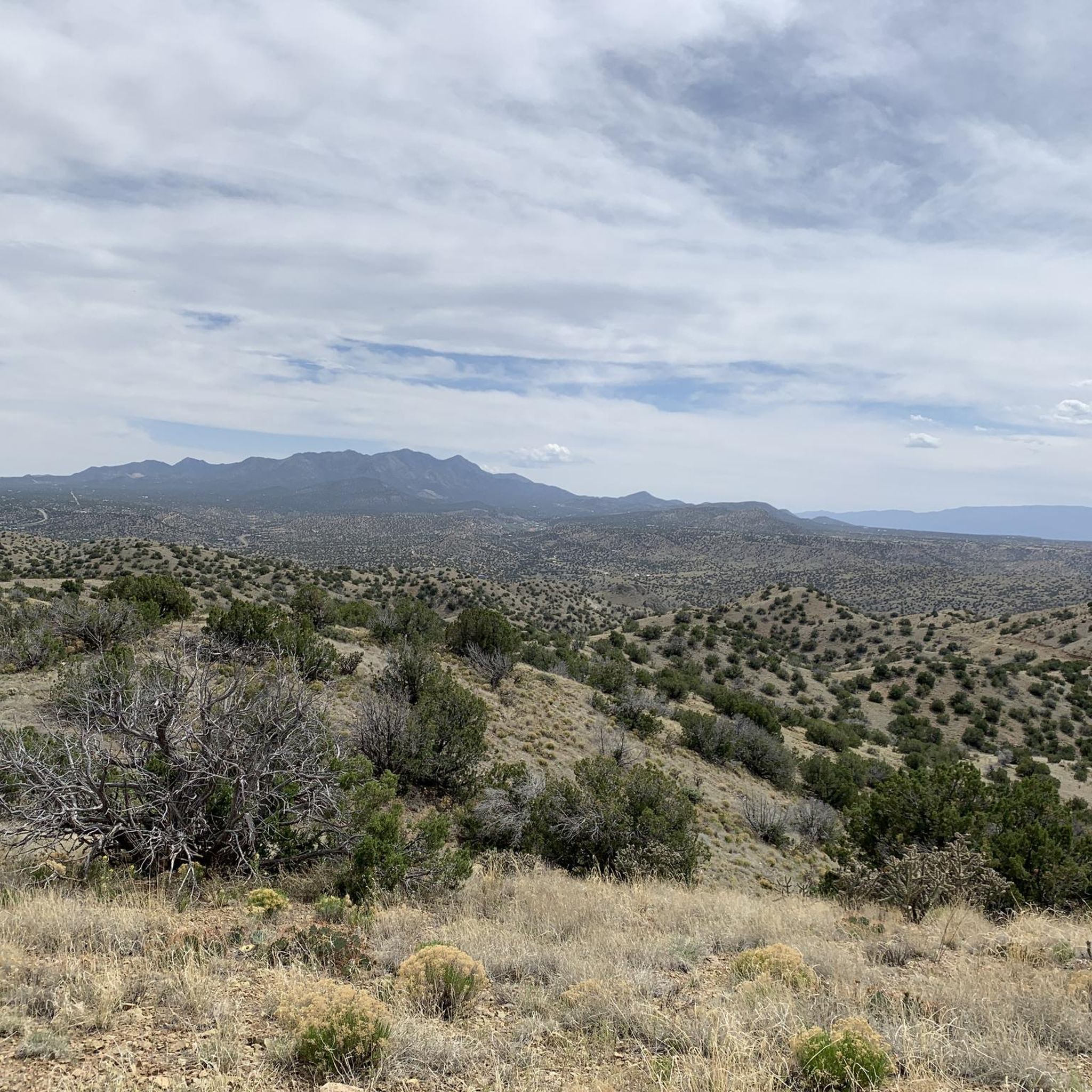
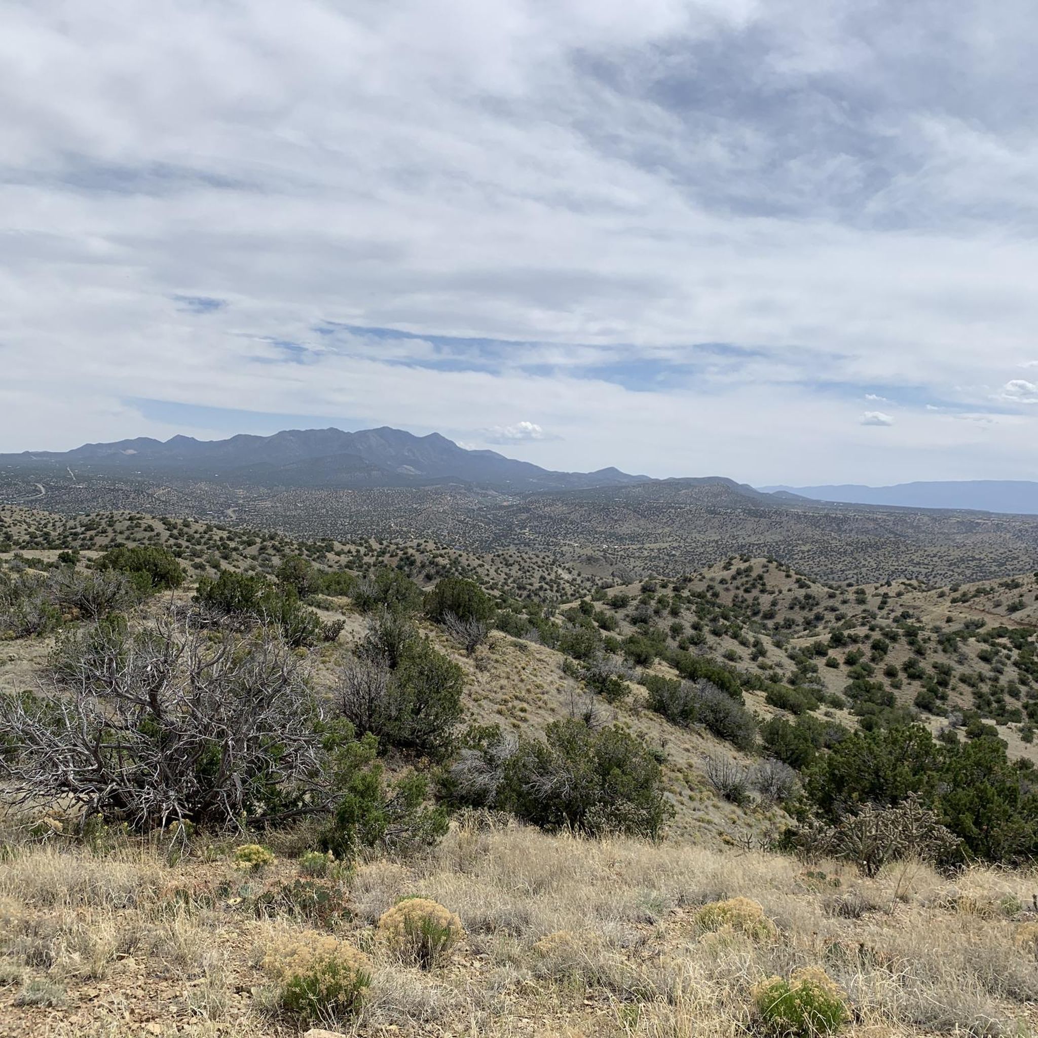
Gravel biking around La Cienega, New Mexico, offers routes through a landscape characterized by its unique "cienega" (marsh or wet meadow) formed by springs and the surrounding semi-arid environment. The terrain includes higher elevations with juniper and piñon, and riparian zones with cottonwood trees along arroyos. This region, situated near the southern terminus of the Rocky Mountains, features unpaved roads and dirt paths suitable for gravel riding.
Best gravel bike trails around La Cienega
- The most popular gravel bike trail…
Last updated: October 1, 2026
4.0
(1)
2
riders
63.2km
05:33
480m
470m
The El Camino Real and Caja del Rio Loop offers a challenging 39.3-mile (63.2 km) gravel ride through a high desert volcanic plateau west of Santa Fe. With 1559 feet…
4.5
(2)
4
riders
40.3km
02:58
340m
340m
Moderate gravel ride. Good fitness required. Mostly paved surfaces. Suitable for all skill levels.

1
riders
50.9km
03:50
420m
420m
Moderate gravel ride. Good fitness required. Mostly paved surfaces. Suitable for all skill levels.
Our route recommendations are based on thousands of hikes, rides, and runs completed by other people on komoot.

Tips from the Community

This is the start of the La Bajada Mesa switchbacks. This is one of New Mexico’s most spectacular natural landmarks. The winding trail has been used for centuries by travelers passing through the area.
0
0
One of several points to access La Cieneguilla Petroglyph Site. The rock art site has thousands of petroglyphs believed to be 400 to 600 years-old.
0
0
Frequently Asked Questions
What kind of terrain can I expect on gravel bike trails around La Cienega?
Gravel biking around La Cienega features a diverse landscape. You'll encounter semi-arid plains, arroyos, and unique lush wetlands, particularly around the 'cienega' itself. Higher elevations offer juniper and piñon, while riparian zones along creeks are lined with cottonwood trees. The routes primarily consist of unpaved roads and dirt paths.
Are there any easy or beginner-friendly gravel routes in La Cienega?
While many routes in La Cienega are moderate to difficult, there are options suitable for those looking for a less strenuous ride. For example, the Arroyo de los Chamisos Trail – Santa Fe Rail Trail loop from Agua Fria is a moderate 27.3 km (17 miles) route that offers a good introduction to the area's gravel paths.
What are some longer, more challenging gravel bike routes in the area?
For experienced gravel bikers seeking a challenge, La Cienega offers several difficult routes. The El Camino Real and Caja del Rio Loop is a demanding 63.2 km (39.3 miles) trail with significant elevation gain. Another difficult option is the Sphinx Overlook – Mao's Milestone loop from Santa Fe County/NM 599, which covers 64.5 km (40.1 miles) and provides expansive views.
Can I find loop routes for gravel biking in La Cienega?
Yes, several gravel routes in La Cienega are designed as loops, allowing you to start and end at the same point. Examples include the Gravel loop from New Mexico Department of Game & Fish, a moderate 40.4 km (25.1 miles) ride, and the Gravel loop from Santa Fe Regional Airport, which is a moderate 49.7 km (30.9 miles) option.
What historical or natural attractions can I see while gravel biking in La Cienega?
La Cienega is rich in history and natural beauty. You can explore sites with evidence of human activity spanning over 5,000 years, including ancient Keres pueblos and significant petroglyphs at locations like the La Cieneguilla Petroglyphs. The area also features the Leonora Curtin Wetland Preserve, a unique marshland oasis. El Rancho de las Golondrinas, a living history museum, is also nearby, offering a glimpse into early New Mexico life. Many routes incorporate sections of the historic El Camino Real.
What is the best time of year for gravel biking in La Cienega?
Given La Cienega's semi-arid climate, spring and fall generally offer the most pleasant conditions for gravel biking, with milder temperatures. Summers can be hot, and while winters are often mild, conditions can vary. It's always advisable to check local weather forecasts before heading out.
Are there any dog-friendly gravel bike trails in La Cienega?
While specific regulations can vary, many unpaved roads and trails in the La Cienega area, particularly those in less developed sections, are generally dog-friendly. However, it's crucial to keep dogs on a leash, carry water for them, and be mindful of wildlife and other trail users. Always check for specific signage or local rules for any given trail or preserve.
Where can I find parking for gravel biking trails in La Cienega?
Parking availability varies by route. For routes like the Sphinx Overlook – Mao's Milestone loop from Santa Fe County/NM 599, you might find access points and parking near NM 599. For trails accessing areas like the Caja del Rio or the Santa Fe Rail Trail, specific parking areas are often designated. It's recommended to check the tour details on komoot for specific starting points and parking suggestions for each route.
Are permits required for gravel biking in the La Cienega area?
Generally, permits are not required for gravel biking on public roads and established trails in the La Cienega area. However, if your route passes through specific preserves, private land, or designated wilderness areas, it's always best to check for any specific access rules or permit requirements. For example, the Leonora Curtin Wetland Preserve has specific visitor guidelines.
What do other gravel bikers say about the routes in La Cienega?
The gravel biking routes in La Cienega are highly regarded by the komoot community, holding an average rating of 4.5 stars. Riders often praise the unique blend of natural landscapes, from the distinctive cienega wetlands to the semi-arid plains, and the historical elements found along the trails.
Are there any cafes or places to eat near the gravel biking routes in La Cienega?
La Cienega is a smaller community, but you can find local establishments for refreshments. For a wider selection of cafes and restaurants, the nearby city of Santa Fe offers numerous options, which are easily accessible from many of the gravel routes in the region.
Can I access La Cienega's gravel trails using public transport from Santa Fe?
While direct public transport options specifically designed for cyclists with bikes to the trailheads might be limited, some regional bus services connect Santa Fe to areas near La Cienega. It's advisable to check the specific routes and bike-carrying policies of the Santa Fe Trails bus system or other regional transit providers for the most up-to-date information.
Most popular routes around La Cienega

Get inspired with the komoot mobile app


Explore more
Browse the best Gravel rides in other regions.
