The best running trails in Bighorn Mountain Wilderness
5.0
(1)
31
runners
5
runs
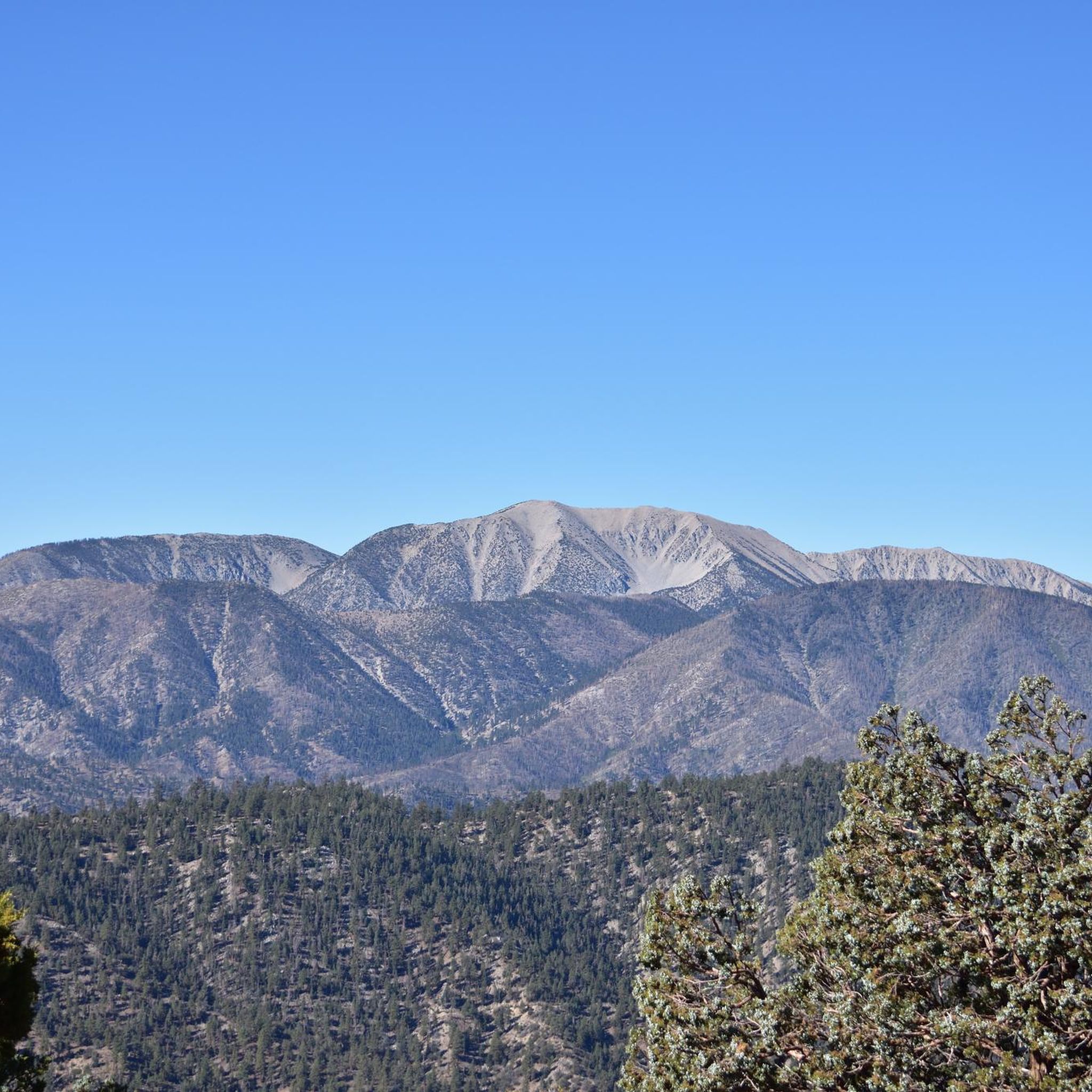
Jogging in Bighorn Mountain Wilderness offers routes through diverse landscapes, from high desert terrain to pine forests. The region is characterized by rolling mountains, Joshua Trees, and varied elevations. Trails often feature a mix of single-track and gravel paths, with some routes reaching higher altitudes, providing opportunities to experience both desert flora and more mountainous environments.
Best jogging routes in Bighorn Mountain Wilderness
- The most popular jogging route is Sugarloaf Mountain Trail – Green Canyon Trailhead loop from Big Bear…
Last updated: June 8, 2026
2
runners
22.4km
02:50
460m
460m
Hard run. Very good fitness required. Sure-footedness, sturdy shoes and alpine experience required.
9
runners
23.5km
03:45
950m
950m
Hard run. Very good fitness required. Sure-footedness, sturdy shoes and alpine experience required.

2
runners
Hard run. Good fitness required. Sure-footedness, sturdy shoes and alpine experience required.
3
runners
11.4km
01:12
110m
110m
Moderate run. Good fitness required. Mostly paved surfaces. Suitable for all skill levels.
3
runners
22.4km
02:35
350m
350m
Hard run. Very good fitness required. Sure-footedness, sturdy shoes and alpine experience required.
Our route recommendations are based on thousands of hikes, rides, and runs completed by other people on komoot.
Start today with a free account
Your next adventure awaits.
Popular around Bighorn Mountain Wilderness
Tips from the Community

Very nice views but a bit dusty
0
0

Here you can ride your bike or walk along the footbridge on Big Bear Boulevard.
1
0

The Stanfield Marsh Boardwalk is a lovely 1.6-mile path along Baker's Pond, located at Stanfield Marsh and Wildlife Preserve. This peaceful boardwalk offers fantastic wildlife-watching opportunities, with views of birds such as ducks, geese, herons, and even Bald Eagles. The preserve, situated at the intersection of Stanfield Cutoff and Big Bear Boulevard, features easy access with parking available at the corner or along the bridge. The boardwalk is also dog-friendly, but biking is not allowed. You can lock your bikes at the parking area, take a break from the saddle, and stroll down the boardwalk.
1
0

You need a decent off-road vehicle to make it up the road to the trailhead. Once you are here you can hike up Sugarloaf, through Green Canyon, south a quarter mile to Wildhorse Spring or up the spur road to a Yellow Post campsite.
0
0
As you ascend the ridge you get fantastic views towards Mount Gorgonio, Grinnell, and the rest of the San Bernardino range.
0
0
There is a small dirt loop at the end of Pine Lane with room for a few cars to park. From here you have access to a network of trails in Sands Canyon. There are plenty of trails to choose from to customize your hike, but the main trail that takes you up to Sands Canyon Road is marked by gravel surfacing.
0
0
The trailhead is up a dirt road that requires 4x4 access. The stream is a great spot to refill water if you have a filter, and the trail is excellent for spotting wildlife. As you approach the summit the trail may not be as well marked and you may have to bushwhack to stay on course.
0
0
Frequently Asked Questions
How many running routes are available in the Bighorn Mountain Wilderness?
There are 5 dedicated running routes in the Bighorn Mountain Wilderness, ranging from moderate to difficult. These routes offer diverse experiences through desert floors, pine forests, and rugged mountain paths.
What is the best time of year for jogging in the Bighorn Mountain Wilderness?
The Bighorn Mountain Wilderness in California is best explored during the cooler months, typically from fall through spring. Summer temperatures can exceed 100 degrees Fahrenheit, making jogging challenging and potentially unsafe. Always check local weather conditions before heading out.
Are there any easy or beginner-friendly jogging routes in the Bighorn Mountain Wilderness?
While the Bighorn Mountain Wilderness offers routes for various ability levels, the listed komoot routes are primarily moderate to difficult. For a moderate option, consider the Big Bear Lake – Wooden path Stanfield Marsh loop from Big Bear City, which is 6.2 km long. However, due to the lack of developed trails in much of the wilderness, beginners should be prepared for varied terrain.
What kind of terrain can I expect on the running trails?
The Bighorn Mountain Wilderness features a unique transition zone. You can expect a mix of yucca and Joshua tree-covered desert floor, stands of Jeffrey pine in higher elevations, and rugged mountain paths. Routes often combine single-track and gravel paths with varied elevation changes.
Are there any loop running trails in the Bighorn Mountain Wilderness?
Yes, several routes are designed as loops. For example, the challenging Sugarloaf Mountain Trail – Green Canyon Trailhead loop from Big Bear City is a 23.5 km loop, and the moderate Wildhorse Meadow Trailhead loop from Big Bear City covers 11.4 km.
What natural features or landmarks can I see while running?
The Bighorn Mountain Wilderness offers opportunities to see unique desert flora like yucca and Joshua Trees, as well as stands of Jeffrey pine at higher elevations. The rugged Bighorn Mountains themselves are a prominent feature, reaching up to 7,500 feet at Granite Peak. Rattlesnake Canyon also divides the wilderness into eastern and western sections.
Is the Bighorn Mountain Wilderness suitable for experienced trail runners?
Yes, experienced trail runners will find challenging options. Routes like the Sugarloaf Mountain Trail – Green Canyon Trailhead loop from Big Bear City, at 23.5 km with significant elevation gain, are classified as difficult and provide a demanding experience. The lack of developed trails in some areas also suits those comfortable with off-trail navigation.
Are there any permits required for running in the Bighorn Mountain Wilderness?
Generally, no specific permits are required for day-use jogging in the Bighorn Mountain Wilderness. However, it's always advisable to check the latest regulations from the Bureau of Land Management (BLM) and the U.S. Department of Agriculture Forest Service, who co-manage the area. You can find more information on the BLM website: blm.gov.
What should I know about wildlife spotting while running?
The Bighorn Mountain Wilderness is home to diverse wildlife, including mule deer, mountain lions, bobcats, and golden eagles. While running, it's important to be aware of your surroundings, especially during dawn and dusk. Maintain a respectful distance from all wildlife and avoid disturbing their natural habitats.
Are there any long-distance running routes available?
For those seeking longer distances, the Sugarloaf Mountain Trail – Green Canyon Trailhead loop from Big Bear City is the longest listed route at 23.5 km (14.6 miles), offering a significant challenge with its difficult rating and elevation gain.
What are the parking options for accessing running trails?
Many of the routes in this guide start from areas around Big Bear City, which typically have designated trailheads or parking areas. For specific routes like the Van Dusen Canyon Trailhead – Holcomb Valley Campground loop, parking is usually available at the respective trailheads. Always check local signage for parking regulations.
What makes the Bighorn Mountain Wilderness unique for running?
The Bighorn Mountain Wilderness offers a unique running experience due to its distinct transition zone, blending high desert landscapes with pine forests. Runners can experience the beauty of Joshua Trees and yucca plants alongside rugged mountain terrain, providing a diverse and often challenging environment unlike many other running destinations.
Most popular routes in Bighorn Mountain Wilderness

Get inspired with the komoot mobile app


Explore more
Browse the best Running Trails & Routes in other regions.
