The best gravel rides around Tilghmanton
4.8
(7)
93
riders
3
rides
Gravel biking around Tilghmanton offers routes through a rural landscape characterized by farmland and quiet country roads. The region provides access to the C&O Canal Towpath, a renowned cycling destination with miles of relatively flat, scenic routes along the Potomac River. Riders can also explore landscapes near the Antietam National Battlefield, which features unpaved sections winding through historic grounds. This blend of natural beauty and historical sites creates varied terrain for gravel biking.
Best gravel bike trails around Tilghmanton
- The…
Last updated: May 12, 2026
5.0
(2)
50
riders
Hard gravel ride. Very good fitness required. Mostly paved surfaces. Suitable for all skill levels.
4.3
(3)
13
riders
41.3km
03:30
190m
190m
Moderate gravel ride. Good fitness required. Mostly paved surfaces. Suitable for all skill levels.

Sign up for free
12
riders
85.5km
07:08
190m
190m
Hard gravel ride. Very good fitness required. Mostly paved surfaces. Suitable for all skill levels.
5.0
(2)
12
riders
23.4km
02:02
140m
140m
Moderate gravel ride. Good fitness required. Mostly paved surfaces. Suitable for all skill levels.
6
riders
38.0km
03:05
130m
130m
Moderate gravel ride. Good fitness required. Mostly paved surfaces. Suitable for all skill levels.
Our route recommendations are based on thousands of hikes, rides, and runs completed by other people on komoot.
Start today with a free account
Your next adventure awaits.
Login or Signup
Popular around Tilghmanton


Tips from the Community

Little Pool Primitive Campsite is a great spot tucked under the trees with just the basics: a picnic table, fire ring, and seasonal treated water. It’s free to use—no reservation or payment required—and includes a portable toilet but no other services. Little Pool, adjacent to the camp area, adds a picturesque touch, and if you’re lucky, you can catch a glimpse of trout surfacing in the early morning light.
0
0

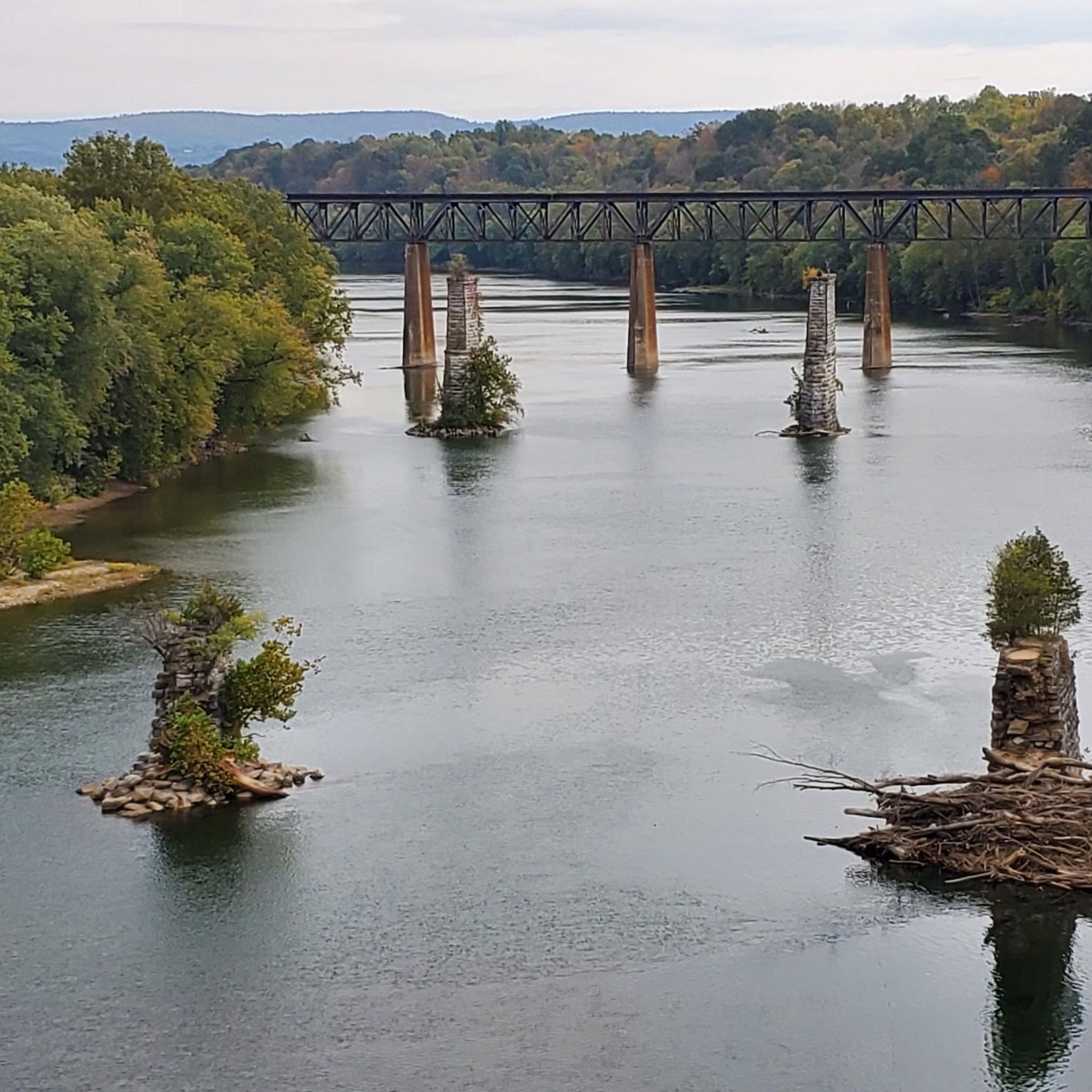
A paved elevated boardwalk stretches out along the water, giving you a fantastic view of the Potomac River. This spot can get pretty popular on summer weekends.
0
0

Dam No. 4 is located around mile 84 of the C&O Canal Towpath. Built in 1856, this dam was crucial for maintaining water levels for canal operations and remains an impressive structure along the river. The area around the dam is known for its scenic views and wildlife.
0
0
The Antietam Aqueduct was built in 1834 to carry canal boats over Antietam Creek. It is over 140 feet long and is one of many such aqueducts along the C&O Canal.
0
0
The Antietam Aqueduct, located at mile 69.4 of the C&O Canal Towpath, is a three-arch stone aqueduct that once carried the canal over Antietam Creek. Built in 1834, it is constructed from limestone quarried nearby and remains one of the best-preserved aqueducts along the canal. During the Civil War, it was near the site of Confederate troop movements before and after the Battle of Antietam in 1862. Though it suffered some damage over the years, it has been fully restored and now serves as a scenic and historic stop along the towpath, offering great river views and picnic spots.
0
0
Shepherdstown, West Virginia, is the oldest town in the state (founded in 1762) and has a fun, vibrant college-town atmosphere. Located along the Potomac River at mile 72 of the C&O Canal Towpath, it is home to Shepherd University, giving it a lively college-town vibe with great cafés, restaurants, and shops. Rich in Civil War history, it played a role in the aftermath of the Battle of Antietam, as wounded soldiers were treated here. With its historic district, riverside views, and plenty of accommodations, Shepherdstown is a perfect overnight stop for cyclists C&O Canal Towpath or to just visit when exploring the area.
0
0
Dam No. 4 is located around mile 84 of the C&O Canal Towpath. Built in 1856, this dam was crucial for maintaining water levels for canal operations and remains an impressive structure along the river. The area around the dam is known for its scenic views and wildlife, making it a nice spot to pause before continuing on your ride.
0
0
Dam No. 5 is located along the C&O Canal Towpath near mile 106, between Williamsport and Hancock, Maryland. Constructed between 1833 and 1835, it was built to raise water levels in the Potomac River and ensure a steady supply for the canal's operation. Like the other dams along the canal, Dam No. 5 was crucial for maintaining navigable water levels for canal boats, allowing them to bypass the river’s natural rapids and shallow areas. During the Civil War, Dam No. 5 became a strategic target for Confederate forces, who attempted to destroy it multiple times in an effort to disrupt Union transportation and supply lines. In December 1861, Confederate General Stonewall Jackson led an attack on the dam, but despite several attempts, Union troops successfully defended it, keeping the canal operational. Today, Dam No. 5 remains a picturesque and historically significant site along the towpath. The area is known for its scenic views of the Potomac, with rushing water cascading over the dam and wildlife such as bald eagles, herons, and fish frequently spotted.
1
0
Frequently Asked Questions
How many gravel bike trails are available around Tilghmanton?
There are 4 gravel bike routes available around Tilghmanton, offering a mix of moderate to difficult options. These routes are highly rated by the komoot community, with an average score of 4.8 stars.
What kind of terrain can I expect on gravel bike trails near Tilghmanton?
Gravel biking around Tilghmanton features a diverse landscape. You'll encounter rural farmland, quiet country roads, and sections along the C&O Canal Towpath. Some routes also explore historical grounds near the Antietam National Battlefield, providing varied unpaved and gravel sections.
Are there any easy or beginner-friendly gravel routes in the Tilghmanton area?
While most routes are moderate to difficult, the area offers options suitable for those looking for a less strenuous ride. For instance, the Ferry Hill – Horseshoe Bend campsite loop from Mercersville is a moderate 14.6-mile (23.4 km) trail that takes about 2 hours 15 minutes, leading through rural landscapes and along Antietam Creek.
What are some challenging gravel biking routes for experienced riders?
For experienced riders seeking a challenge, the Big Slackwater – Big Slackwater View loop from Sharpsburg is a difficult 71.6-mile (115.2 km) trail. This route explores the Potomac River corridor and features extensive gravel sections, typically taking over 10 hours to complete. Another difficult option is the Dam Number 5 – C & O Bicycle, Hancock loop from Williamsport, which is 85.5 miles (137.6 km) long.
Can I find circular gravel bike routes around Tilghmanton?
Yes, all the gravel bike routes listed for Tilghmanton are loops. Examples include the Dam 4 C&O – Shepherdstown loop from Scrabble, a moderate 25.7-mile (41.3 km) path, and the Ferry Hill – Horseshoe Bend campsite loop from Mercersville.
Are there family-friendly gravel biking options near Tilghmanton?
While specific 'easy' routes are limited, the C&O Canal Towpath, which is accessible from the Tilghmanton area, is generally flat and well-suited for families. Routes like the Dam 4 C&O – Shepherdstown loop from Scrabble incorporate sections of this scenic towpath, offering a more relaxed experience.
What historical sites or natural attractions can I see while gravel biking?
Many routes offer a blend of natural beauty and historical significance. You can explore landscapes near the Antietam National Battlefield, which features unpaved sections winding through historic grounds. The C&O Canal Towpath also provides access to sites like Big Slackwater and Dam No. 4, offering glimpses into the region's past.
Where can I park when planning a gravel bike ride in Tilghmanton?
While specific parking locations for each route are not detailed here, the rural nature of Tilghmanton and its proximity to areas like the C&O Canal Towpath and Antietam National Battlefield suggest that designated parking areas are available at trailheads or visitor centers in these popular recreational zones. It's advisable to check specific route starting points for parking information.
Is public transport accessible for reaching gravel bike trails in Tilghmanton?
Tilghmanton is a small, unincorporated community, and direct public transport access to trailheads might be limited. Most visitors typically rely on personal vehicles to reach the starting points of gravel bike routes in this rural area. For broader regional transport information, you might check local Washington County resources.
What is the best season for gravel biking around Tilghmanton?
The region offers enjoyable gravel biking experiences across multiple seasons. Spring and fall provide pleasant temperatures and scenic foliage. Summer can be warm, but routes along the Potomac River, like those on the C&O Canal Towpath, offer shade. Winter riding is possible, but be prepared for colder temperatures and potential icy conditions on unpaved sections.
What do other gravel bikers say about the trails in Tilghmanton?
The gravel bike routes around Tilghmanton are highly rated by the komoot community, with an average score of 4.8 stars from over 7 reviews. More than 90 gravel bikers have used komoot to explore the varied terrain, often praising the blend of rural charm, historical sites, and access to the scenic C&O Canal Towpath.
Are there any routes that incorporate sections of the C&O Canal Towpath?
Yes, the C&O Canal Towpath is a significant feature of gravel biking in the area. The Dam 4 C&O – Shepherdstown loop from Scrabble is a prime example, incorporating sections of this renowned towpath for a scenic ride along the Potomac River. Other routes like the Conococheague Aqueduct – Dam Number 5 loop from Williamsport also utilize the towpath.
What should I bring for a gravel biking trip in Tilghmanton?
For gravel biking in Tilghmanton, it's recommended to bring a well-maintained gravel bike, appropriate safety gear including a helmet, water, snacks, and a repair kit. Given the rural nature of some routes, a phone for navigation and emergencies is also advisable. Layered clothing is best, especially during shoulder seasons, to adapt to changing weather conditions.
Most popular routes around Tilghmanton
Most popular attractions around Tilghmanton

Get inspired with the komoot mobile app


Explore more
Browse the best Gravel rides in other regions.
