The best walks and hikes around Sharpsburg
5.0
(1)
19
hikers
9
hikes
Hiking around Sharpsburg offers a diverse landscape blending historic battlefields with natural riverfronts and forested areas. The region features varied terrain, from level towpaths along the Potomac River to more rugged paths through woodlands. Hikers can explore rolling fields, riverside trails, and forested hills, providing a range of experiences. This area is characterized by its combination of historical significance and accessible natural beauty.
Best hiking trails around Sharpsburg
- The most popular hiking route is Snavely Ford Antietam National Battlefield Trail…
Last updated: June 25, 2026
1
hikers
18.3km
04:49
160m
190m
Moderate hike. Good fitness required. Easily-accessible paths. Suitable for all skill levels.
21.5km
05:28
60m
70m
Hard hike. Very good fitness required. Easily-accessible paths. Suitable for all skill levels.

Sign up for free
11.6km
02:58
40m
30m
Moderate hike. Good fitness required. Easily-accessible paths. Suitable for all skill levels.
1.67km
00:25
10m
0m
Easy hike. Great for any fitness level. Easily-accessible paths. Suitable for all skill levels.
850m
00:14
10m
10m
Easy hike. Great for any fitness level. Easily-accessible paths. Suitable for all skill levels.
Get access to more routes and recommendations from other explorers.
Sign up for free
Already have an account?
Our route recommendations are based on thousands of hikes, rides, and runs completed by other people on komoot.
Start today with a free account
Your next adventure awaits.
Login or Signup
Popular around Sharpsburg

Tips from the Community

28 Sept 2025: staircase closed as they rebuild it
0
0

A paved elevated boardwalk stretches out along the water, giving you a fantastic view of the Potomac River. This spot can get pretty popular on summer weekends.
0
0

Dam No. 4 is located around mile 84 of the C&O Canal Towpath. Built in 1856, this dam was crucial for maintaining water levels for canal operations and remains an impressive structure along the river. The area around the dam is known for its scenic views and wildlife.
0
0
The Antietam Aqueduct was built in 1834 to carry canal boats over Antietam Creek. It is over 140 feet long and is one of many such aqueducts along the C&O Canal.
0
0
The Antietam Aqueduct, located at mile 69.4 of the C&O Canal Towpath, is a three-arch stone aqueduct that once carried the canal over Antietam Creek. Built in 1834, it is constructed from limestone quarried nearby and remains one of the best-preserved aqueducts along the canal. During the Civil War, it was near the site of Confederate troop movements before and after the Battle of Antietam in 1862. Though it suffered some damage over the years, it has been fully restored and now serves as a scenic and historic stop along the towpath, offering great river views and picnic spots.
0
0
Dam No. 4 is located around mile 84 of the C&O Canal Towpath. Built in 1856, this dam was crucial for maintaining water levels for canal operations and remains an impressive structure along the river. The area around the dam is known for its scenic views and wildlife, making it a nice spot to pause before continuing on your ride.
0
0

to get from trail to Harper's Ferry, you have to go up these stairs. There are bike racks at the base, or you carry your bike up with you
0
0
From this spot near McMahon’s Mill, you get great views of Big Slackwater. McMahon’s Mill used a steel wheel in the early 20th century to generate electricity. The mill closed in 1922 after a flood but was later restored by the National Park Service. Downstream from McMahon’s Mill, Big Slackwater marks where canal boats entered the Potomac River, avoiding the rocky cliffs by using pools behind Dam 4 and Dam 5. In 1996, flooding damaged the towpath, making this section impassable for over 15 years. Reconstruction began in 2010, and by 2012, the missing towpath section was restored, allowing visitors to travel the entire 184.5 miles of the C&O Canal once again.
0
0
Frequently Asked Questions
How many hiking trails are there around Sharpsburg?
There are 8 hiking trails around Sharpsburg, ranging from easy strolls to more challenging routes. You'll find options suitable for various fitness levels and interests.
What kind of terrain can I expect on hikes near Sharpsburg?
The terrain around Sharpsburg is quite varied. You can expect flat, well-maintained paths along the C&O Canal towpath, such as the Chesapeake and Ohio Canal Towpath, which is ideal for easy walks. Other areas, particularly within historic battlefields and forested woodlands, offer gently rolling hills and more natural surfaces. Trails like the Snavely Ford Antietam National Battlefield Trail combine historical exploration with varied terrain.
Are there any family-friendly hiking options in Sharpsburg?
Yes, Sharpsburg offers several family-friendly hiking options. The historic Antietam National Battlefield features many well-maintained and relatively short trails that are perfect for families. The flat C&O Canal towpath, including routes like the Ferry Hill Trail, is also an excellent choice for easy walks with children, offering scenic views without significant elevation changes.
What interesting landmarks or historical sites can I see while hiking?
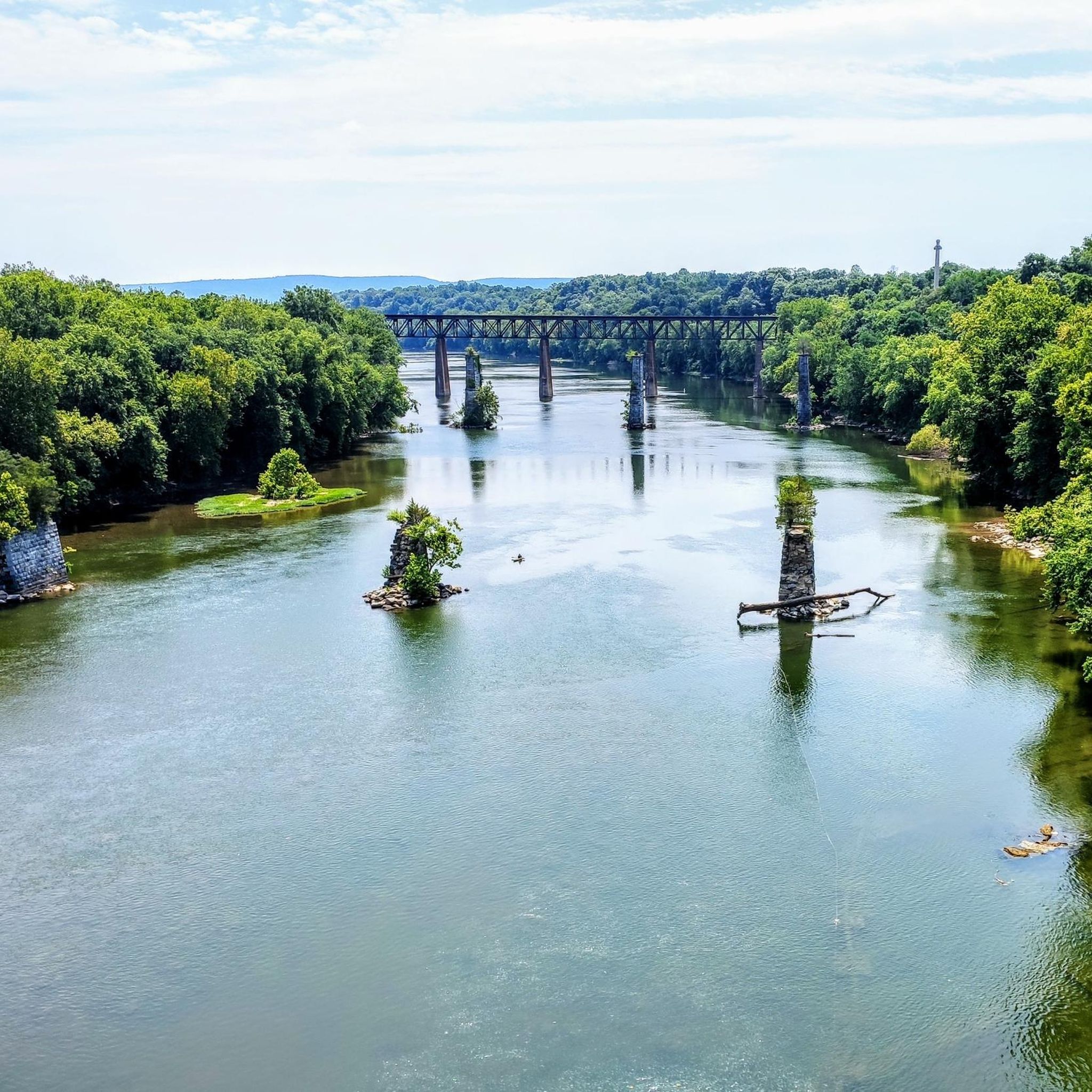
Sharpsburg is rich in history. Many trails lead through or near the Antietam National Battlefield, offering a unique opportunity to combine nature with historical exploration. Along the C&O Canal, you can discover points of interest like Big Slackwater and Dam No. 4. The View of the Potomac River from the Shepherdstown Bridge also offers a scenic vista.
Are there any dog-friendly trails around Sharpsburg?
Many trails in the Sharpsburg area are dog-friendly, especially those along the C&O Canal towpath. Always ensure your dog is on a leash and that you clean up after them. The flat and wide paths of the canal, such as the section from Taylors Landing to McMahon's Mill, are generally suitable for walks with your canine companion.
What is the best time of year to go hiking in Sharpsburg?
Spring and autumn are generally the best times for hiking in Sharpsburg. In spring, the weather is mild, and the landscape comes alive with new growth. Autumn offers comfortable temperatures and stunning fall foliage, particularly in the forested areas. Summer can be warm and humid, while winter hiking is possible but may require appropriate gear for colder conditions.
Are there any longer, more challenging hikes available?
Yes, for those seeking a longer and more challenging experience, the C & O Canal Trail: Shepherdstown to Harpers Ferry offers a difficult-rated hike covering over 21 km. This route provides an extended journey along the historic canal, connecting two notable towns.
What do other hikers enjoy most about hiking in Sharpsburg?
The hiking routes around Sharpsburg are highly rated by the komoot community, with an average score of 5.0 stars. Reviewers often praise the unique blend of natural beauty and rich American history, particularly the well-preserved battlefields and the serene riverside paths along the C&O Canal.
Are there any loop trails in the Sharpsburg area?
While many trails are out-and-back, some sections within the Antietam National Battlefield and local parks offer loop configurations. For instance, the Snavely Ford Antietam National Battlefield Trail provides a comprehensive exploration of the historic grounds, allowing for a circular experience within the battlefield's network of paths.
Where can I find parking for hiking trails in Sharpsburg?
Parking is generally available at key access points for popular trails. For the Antietam National Battlefield, there are designated parking areas throughout the park. Along the C&O Canal Towpath, you can find parking at various access points and landings, such as Taylors Landing, which serves as a starting point for routes like the Taylors Landing to McMahon's Mill hike. It's advisable to check specific trailheads for detailed parking information.
Are there cafes or amenities near the hiking trails?
Sharpsburg and nearby towns like Shepherdstown offer various amenities, including cafes, pubs, and accommodation options. While specific cafes might not be directly on every trailhead, you'll find places to refresh and refuel within a short drive from most hiking areas, especially when exploring routes that pass through or near settlements like Shepherdstown.
Most popular routes around Sharpsburg
Most popular attractions around Sharpsburg

Get inspired with the komoot mobile app


Explore more
Browse the best Hikes in other regions.
