The 5 Most Amazing Peaks around Viniegra De Arriba
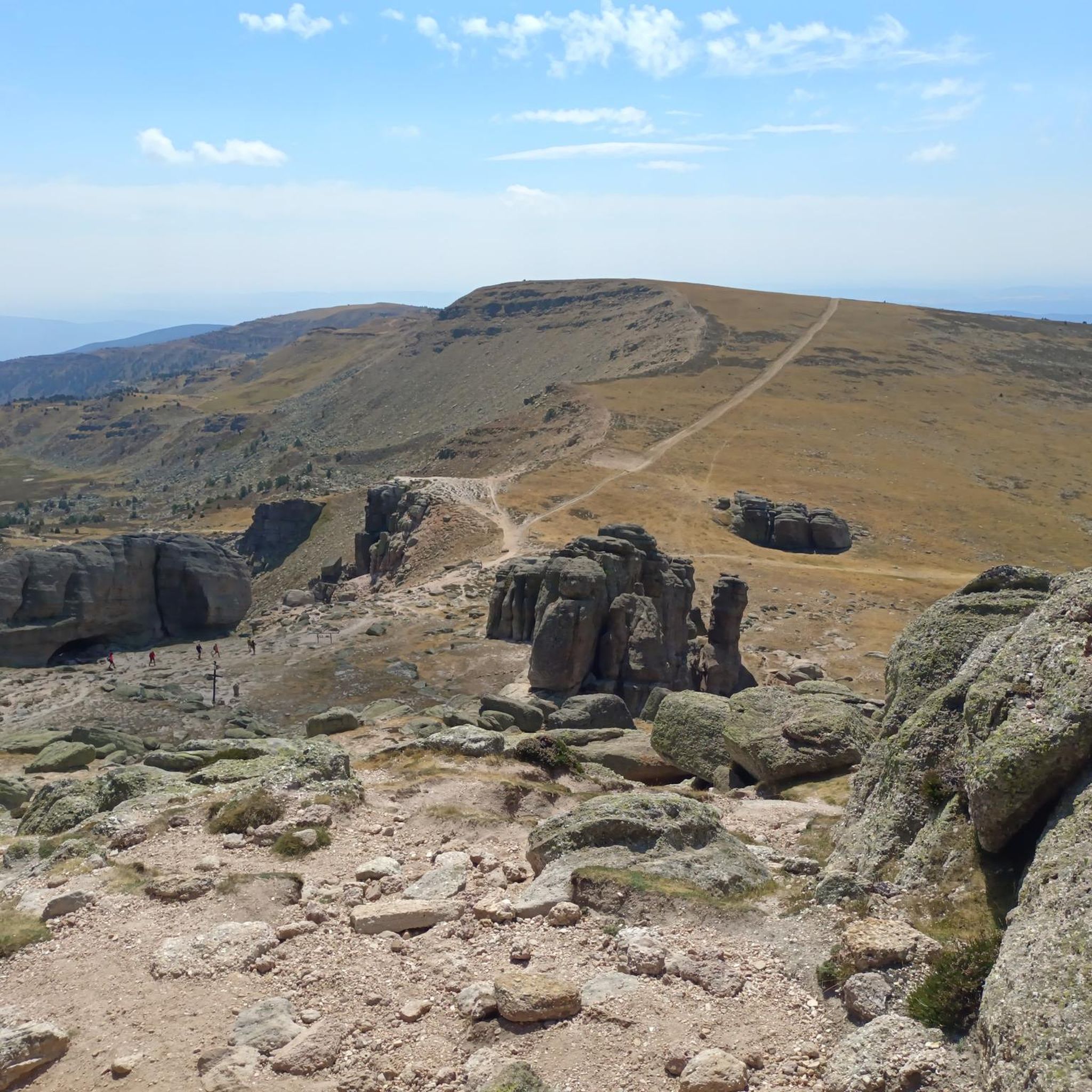
Best mountain peaks around Viniegra De Arriba are found within the Picos de Urbión, a significant part of the Sistema Ibérico mountain range. Viniegra De Arriba is situated near Pico Urbión, which stands at 2,228 meters and marks a natural border between Soria, Burgos, and La Rioja. This region features landscapes sculpted by glaciers, including several lakes and the source of the Duero River. The area offers diverse terrain, from dense forests to high-mountain environments.
Best mountain peaks around Viniegra…
Last updated: July 4, 2026
Pico de Urbión
Highlight • Summit
Translated by Google •
Tip by

Picacho del Camperón (2,101 m)
Highlight • Summit
Translated by Google •
Tip by

Sign up now to discover places like this
Get recommendations on the best single tracks, peaks, & plenty of other exciting outdoor places.
Sign up for free
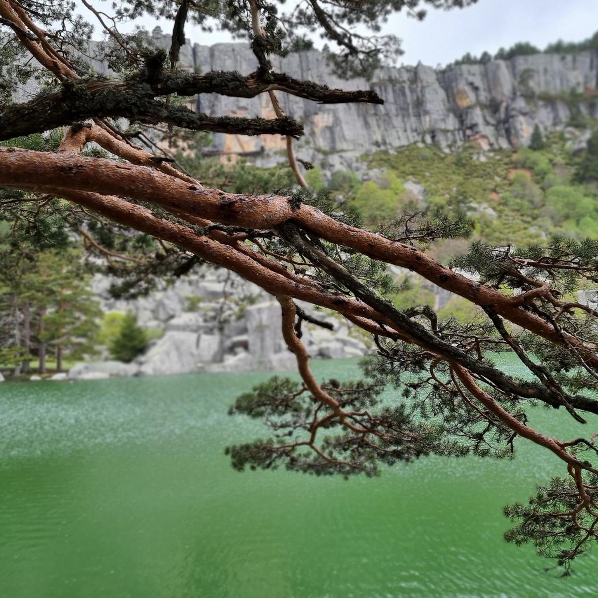
Laguna Negra, Pico de Urbión, and Source of the Duero River
Highlight • Lake
Translated by Google •
Tip by

Castillo de Vinuesa (2,083 m)
Highlight • Summit
Translated by Google •
Tip by

Access to Pico de Urbión
Highlight • Trail
This point symbolizes the access to reach it.
Translated by Google •
Tip by

Sign up for free to discover even more peaks around Viniegra De Arriba.
Sign up for free
Already have an account?
Start today with a free account
Your next adventure awaits.
Login or Signup
Tips from the Community

Picacho del Camperón is an impressive peak located in the Sierra de Urbión, on the border between Soria and La Rioja. At the top of Picacho del Camperón, you'll find an ice axe stuck in a rock, resembling the sword in Excalibur.
1
0

Nice area for outdoor activities.
0
0
Pico de Urbión is an ideal destination for hiking lovers. It is located between the autonomous community of La Rioja and the provinces of Soria and Burgos (Castilla y León). It limits to the north with the Najerilla valley, to the south with the Duero valley, to the west with the Neila mountain range, and to the east with the Cebollera mountain range.
3
0

A very nice hike to the source of the famous Rio Duero...
0
0

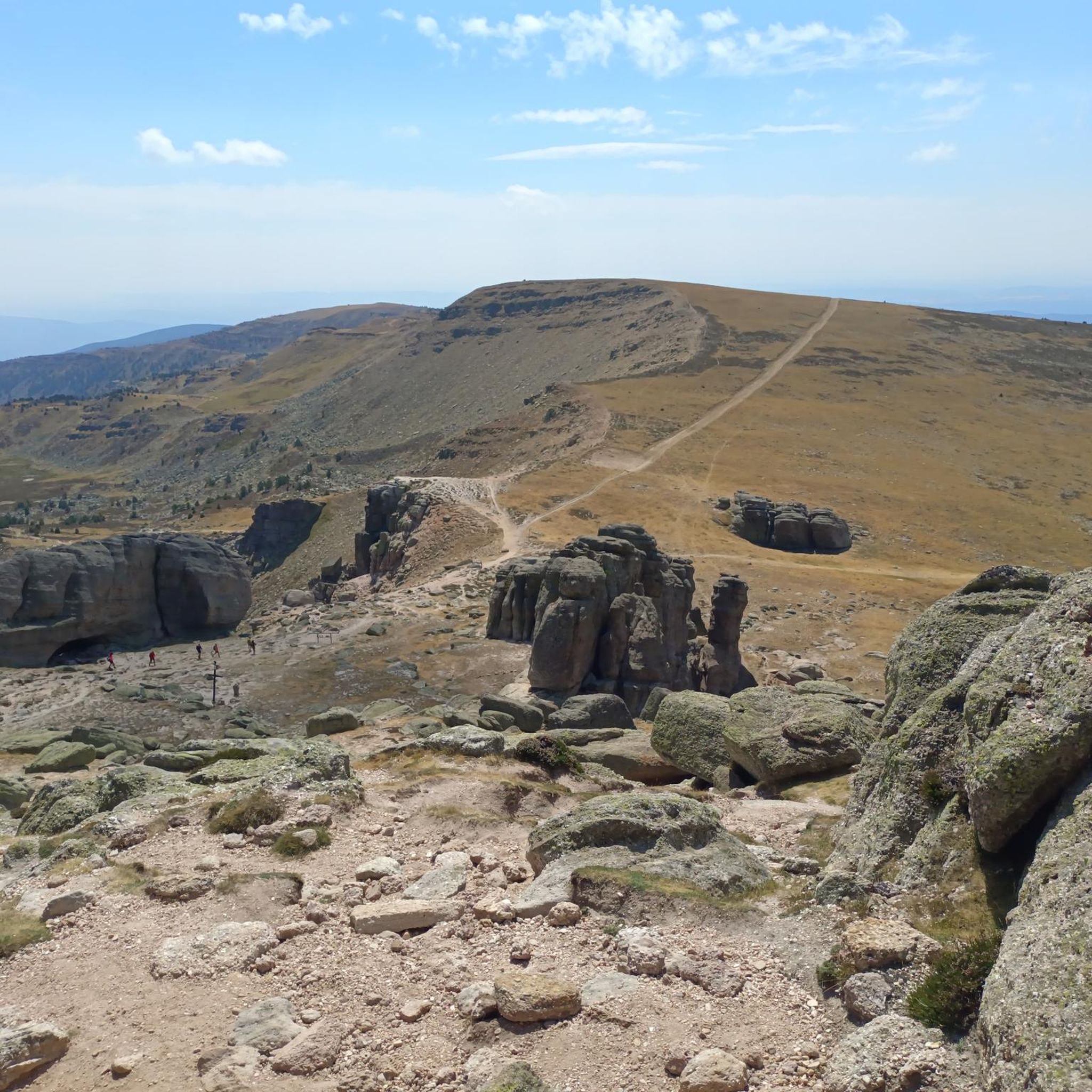
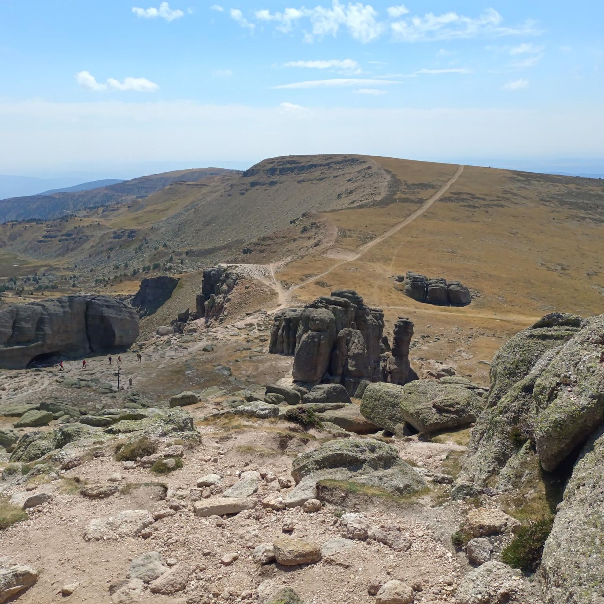
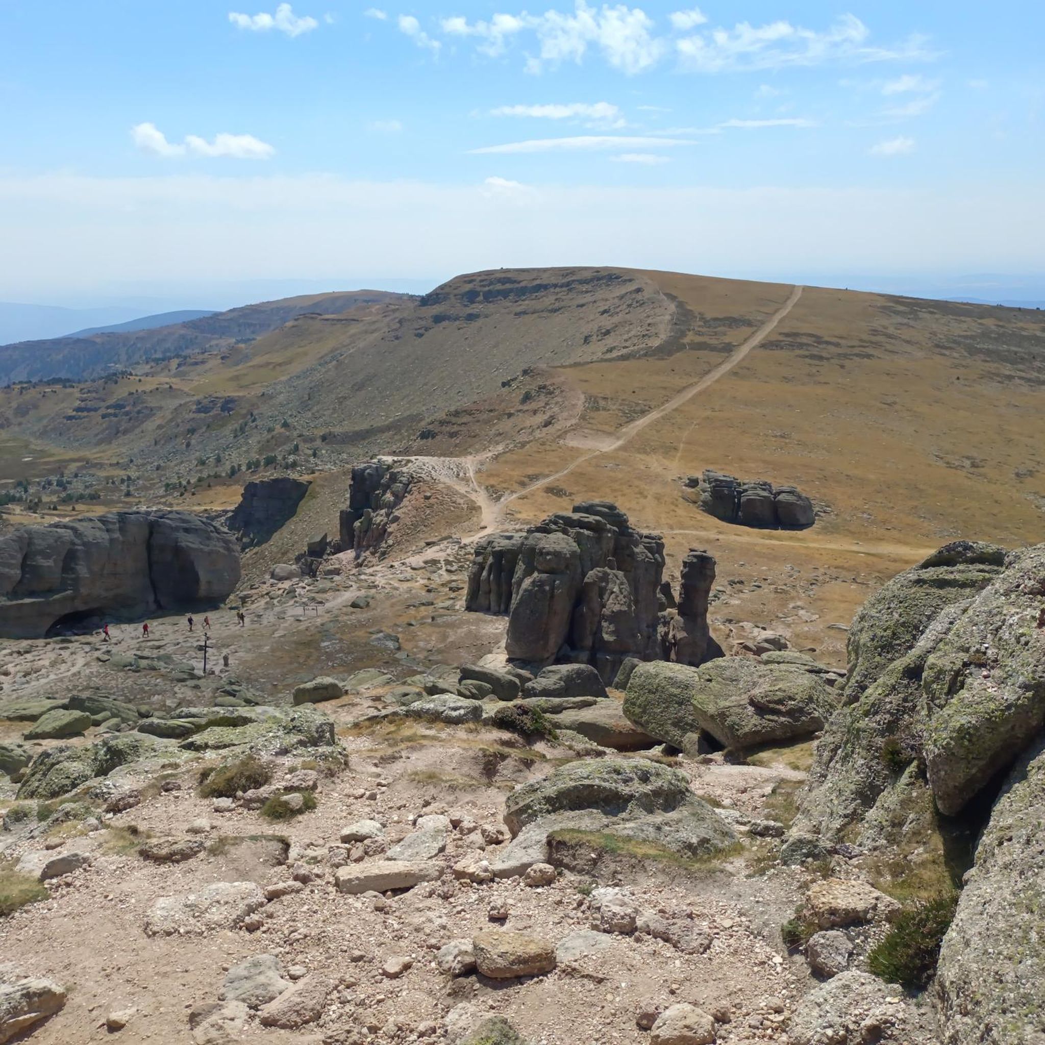
The first part of the climb is easy to follow, there are meadows and clearings between the trees, then cliffs and stony areas appear and it is better to walk around the mountain to the north and reach the eastern slope of the Castillo de Vinuesa. The summit is an elongated north/south massif and the main summit is some rocky turrets on the south side, you have to follow the paths that skirt the east face and at the end the cliff appears where the summit sculpture is. The views are magnificent and the top has a particular sensation of vertigo surrounded by small precipices. The Sierra de la Demanda, the Picos de Urbión, the Sierra Cebollera, the Cameros and the rest of the massifs of the central sector of the Iberian System stand out on all sides. The trail descends from the summit in the same place, skirts the mountain again and enters the main path that runs along the mountain range, between the port of Santa Inés and the summit of Pico Cebollera.
0
1

The Urbión peak is in one of the highest mountains in the Iberian System, at 2,228 meters. This point symbolizes the access to reach it.
0
0

At this point we are at the highest peak in the province of Soria. Pico Urbión, located at 2,228 meters above sea level, offers excellent panoramic views wherever we look. All the trails that bring us to the top are great for running and hiking.
1
1
Cresting by the Urbión Peaks, at 2,101 masl we find ourselves in the Picacho del Camperón with magnificent panoramic views of the places that surround us. At the top, a curiosity awaits us, an ice ax nailed to a rock in the style of the Sword of Excalibur.
2
1
Frequently Asked Questions
What are the most challenging mountain peaks to hike near Viniegra De Arriba?
For experienced hikers seeking a challenge, Pico de Urbión is a rewarding ascent, known for its spectacular views and diverse routes. Another challenging option is Castillo de Vinuesa (2,083 m), which offers magnificent views and a particular sensation of vertigo due to its rocky turrets and precipices. Both peaks are categorized as challenging.
What natural attractions can I find when exploring the peaks around Viniegra De Arriba?
The region is rich in natural beauty, featuring landscapes sculpted by glaciers. You can visit glacial lakes such as Laguna Negra, Laguna Helada, and Laguna Larga. The source of the Duero River is also located in these mountains, offering a very nice hike. The area is characterized by dense forests of Scots pine and beech trees, and high-mountain environments.
When is the best time of year to hike the mountain peaks near Viniegra De Arriba?
The best time for hiking is generally from late spring to early autumn (June to September) when the weather is milder and trails are clear of snow. However, Pico Urbión and the surrounding Picos de Urbión can be covered in snow between October and May, offering opportunities for winter hiking for those with alpine experience.
Can I find circular hiking routes among the peaks near Viniegra De Arriba?
Yes, there are several circular routes available. For example, the 'Pico Urbión Loop from Laguna Negra' is a difficult running trail that can also be adapted for hiking. Many routes in the Picos de Urbión are designed to explore the diverse landscapes and return to a starting point, often passing by glacial lakes and viewpoints.
What unique features can I expect to see on the summits around Viniegra De Arriba?
On the summit of Picacho del Camperón (2,101 m), you'll find a curious ice ax nailed to a rock, reminiscent of the Sword of Excalibur. From Pico de Urbión, you can enjoy spectacular panoramic views of the Sierra de la Demanda, the plains of Soria, and the Sierra Cebollera on clear days.
Are there opportunities for winter hiking in the Picos de Urbión?
Yes, the Picos de Urbión, including Pico de Urbión, are often covered in snow from October to May. This provides opportunities for winter hiking, though it requires good physical fitness and alpine experience due to the challenging conditions and varied terrain.
Where does the Duero River originate, and can I visit it?
The Duero River, one of Spain's most important rivers, has its source in the Picos de Urbión mountains. You can visit this area, which is often combined with a hike to Laguna Negra and Pico de Urbión, offering a very scenic experience.
What other outdoor activities are available near the mountain peaks of Viniegra De Arriba?
Beyond hiking, the area around Viniegra De Arriba offers various cycling opportunities. You can find touring bicycle routes like the 'Embalse de Mansilla – circular by Viniegra de Abajo' or road cycling routes such as the 'Montenegro, Peña Hincada, and Santa Inés Passes Loop'. For more details, explore the Cycling around Viniegra De Arriba or Road Cycling Routes around Viniegra De Arriba guides.
Are there any beginner-friendly mountain routes around Viniegra De Arriba?
While many routes to the main peaks like Pico de Urbión are considered intermediate to challenging, the region also offers trails through dense forests and around glacial lakes that are less strenuous. For easier walks, consider exploring the areas around Laguna Negra, which provide beautiful scenery without the extreme elevation gain of summit ascents.
What do visitors enjoy most about the mountain peaks near Viniegra De Arriba?
Visitors particularly appreciate the spectacular panoramic views from summits like Pico de Urbión. The natural beauty of the Sierra de Urbión, including its glacial lakes and the source of the Duero River, also offers excellent opportunities for photography and immersive nature experiences. The diverse landscapes and challenging yet rewarding hiking routes are frequently highlighted.
Is there parking available for mountain hikes in Viniegra De Arriba?
Routes to the Picos de Urbión often begin from points like "Ambos Ríos" (or "Trambosrios"), located between Viniegra de Arriba and Viniegra de Abajo. While specific parking details for every trailhead are not provided, these common starting points usually have designated areas for vehicles to accommodate hikers accessing the mountains.
What kind of ecosystems and vegetation can I expect to see in the Picos de Urbión?
The Picos de Urbión region is home to important ecosystems, characterized by diverse landscapes. You'll find extensive forests of Scots pine and beech trees at lower and mid-altitudes, transitioning to high-mountain vegetation as you ascend. The area also features unique glacial ecosystems around its numerous lakes, such as Laguna Negra, which is protected as a Natural Park.
Most popular attractions around Viniegra De Arriba

Get inspired with the komoot mobile app


Explore more
See even more amazing summits around Viniegra De Arriba with these guides:
