The best walks and hikes around Glendollach Lough
4.6
(21)
184
hikers
12
hikes
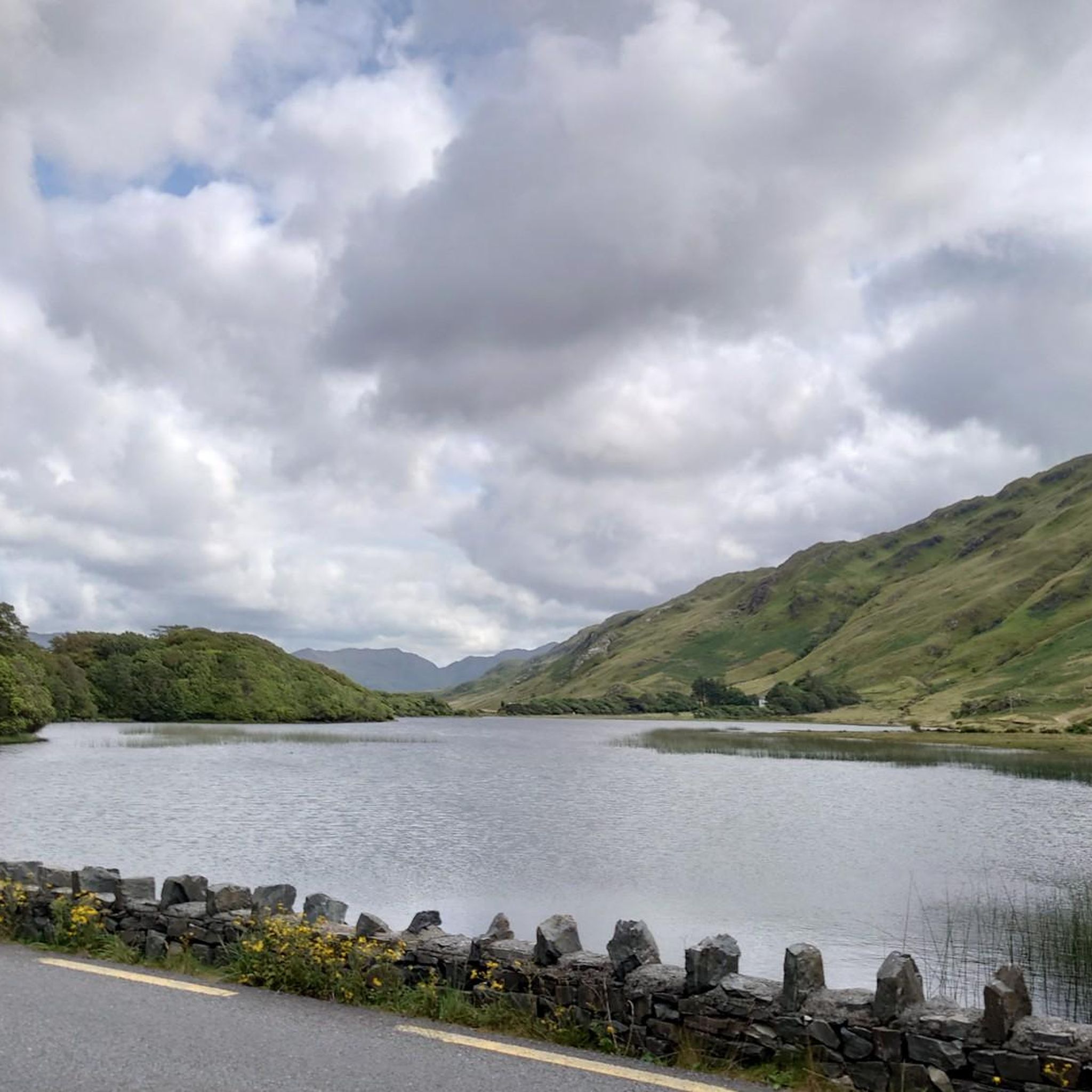
Hiking around Glendollach Lough offers exploration within a U-shaped glacial valley, characterized by its two prominent glacial lakes. The area is surrounded by high mountains, providing dramatic backdrops for trails, and features well-preserved native broadleaved woodlands. This landscape supports diverse flora and fauna, making it a notable destination for outdoor activities.
Best hiking trails around Glendollach Lough
- The most popular hiking route is Binn Doire Chláir / Derryclare and Binn Chorr / Bencorr from Derryclare Nature Resereve — County Galway…
Last updated: July 1, 2026
2
hikers
11.5km
03:39
850m
850m
Hard hike. Good fitness required. Sure-footedness, sturdy shoes and alpine experience required.
5.0
(1)
17
hikers
6.03km
03:12
600m
600m
Hard hike. Good fitness required. Sure-footedness, sturdy shoes and alpine experience required.

Sign up for free
5.0
(1)
9
hikers
Hard hike. Good fitness required. Sure-footedness, sturdy shoes and alpine experience required.
1
hikers
14.1km
04:41
860m
860m
Moderate hike. Good fitness required. Easily-accessible paths. Suitable for all skill levels.
4.7
(7)
57
hikers
3.55km
01:23
160m
160m
Moderate hike. Great for any fitness level. Mostly accessible paths. Sure-footedness required.
Get access to more routes and recommendations from other explorers.
Sign up for free
Already have an account?
Our route recommendations are based on thousands of hikes, rides, and runs completed by other people on komoot.
Start today with a free account
Your next adventure awaits.
Login or Signup
Popular around Glendollach Lough
Tips from the Community

From here to the top of Derryclare and Bencorr is a strenuous mountain walk. The trail is steep and tough, with a mix of rock and bog sections. In the wet the rock can be very treacherous. Proper mountain hiking equipment, in particular footwear, is a must. In addition, make sure you have your food and fluids. There is very little by way of footpaths or waymarks, so the ability to navigate in the mountains, in particularly poor weather, is also a must. The trail gives you a rough outline and is best suited for the more experienced hikers out there with good fitness levels. Even then, the drier the day, the better experience you will have. You will be rewarded with an exceptional mountain day that has fine views of the 12 Bens from the tops and between the two summits, but you will certainly have to work for it.
0
0
Barrlugrevagh at 558 metres high makes for a small, scenic summit between Knocknahillion and Letterbreckaun. It has a decent size cairn and makes for a great vantage point to look down the ridge connectingh these two peaks.
0
0
Letterbreckaun is the second highest peak in the Maumturk Mountains here in Connemara at 667 metres high. It is the endmost northern mountain of the Central Maumturks area. It is connected to its lower sister hill of Knocknahillion by a long winding, undulating rocky ridge. From here you have great views out over Lough Inagh and towards Derryclare and Bencorr,
0
0
Cnoc na hUilleann, or Knocknahillion, which is 607 metres high, is a gem of a mountain in the central Maumturks area. It is not that high, but it is big in attitude, and if you follow the spectacular undulating ridge north, you will reach the slightly higher point of Letterbreckaun, which is 667 metres high. On the way you will be able to take in the stunning views of the 12 Bens and the beautiful Lough Inagh Valley.
0
0
Derryclare is 673 metres high and sits just south of its bigger neighbour Bencorr, and both of them form two of the ’12 Bens of Connemara’. They are connected by a rocky ridge that offers great views in all directions.
1
0
At 711 metres, Bencorr is the second highest peak of the ’12 Bens of Connemara’, which has some of the finest walking in Ireland. The mountains are not very high, the highest being only 730 metres, but they offer wonderful hiking opportunities with super scenery and are a feast for the eyes. As with all mountains, however, treat them with respect and ensure you are properly equipped at all times.
0
0


A great walk with kids. Plenty of place for them to run around, climb boulders etc. My kid loves it. Plan for rain jacket; it often rains there! Being the Connemara and all that! 🙈😂
1
0
Frequently Asked Questions
What kind of terrain can I expect when hiking around Glendollach Lough?
Glendollach Lough is nestled within a spectacular U-shaped glacial valley, offering a diverse hiking experience. You'll encounter trails winding around two prominent glacial lakes, through well-preserved native broadleaved woodlands, and up into high mountains, with some summits reaching over 650 meters (2132 feet). Expect varied terrain, from tranquil lakeside paths to steep, challenging ascents.
Are there any family-friendly hiking options in Glendollach Lough?
Yes, Glendollach Lough offers several trails suitable for families. There are 6 easy routes available, perfect for a leisurely stroll. While specific family-friendly routes aren't detailed in the guide, the extensive network of nine waymarked trails includes options for various fitness levels, ensuring there's something for everyone.
Can I bring my dog on the hiking trails in Glendollach Lough?
The Wicklow Mountains National Park, which encompasses Glendollach Lough, generally welcomes dogs, but they must be kept under control, preferably on a lead, to protect wildlife and livestock. Always check local signage for any specific restrictions on certain trails or areas within the park.
What natural features or landmarks can I see while hiking in Glendollach Lough?
Glendollach Lough is rich in natural beauty and historical landmarks. You can explore the two stunning glacial lakes (Upper and Lower), discover the beautiful Poulanass waterfall, and find hidden rock pools. The area is also home to the world-famous Monastic Site founded by St. Kevin in the 6th century, featuring a well-preserved Round Tower and several ancient churches. The historic Miners' Village, accessible via the Miners' Way, offers a glimpse into the area's industrial past.
Are there any circular hiking routes available around Glendollach Lough?
Yes, there are several circular routes. For example, the Central Maumturks loop — County Galway is a moderate 14 km (8.7 miles) trail that offers a comprehensive experience of the mountainous terrain. Another option is the Maumeen Chapel loop from Recess, a shorter moderate route.
What is the best time of year to go hiking in Glendollach Lough?
Glendollach Lough is beautiful year-round, but the best time often depends on your preferences. Spring and autumn offer vibrant colours and milder temperatures, while summer provides longer daylight hours. Be prepared for changeable weather in the Wicklow Mountains, regardless of the season. Always check local forecasts before heading out.
How many hiking trails are there in Glendollach Lough, and what are their difficulty levels?
There are 12 hiking trails available around Glendollach Lough. These routes cater to various abilities, with 6 easy trails for casual walkers, 3 moderate routes for those seeking a bit more challenge, and 3 difficult trails for experienced hikers looking for significant ascents and rugged terrain.
What do other hikers enjoy most about hiking in Glendollach Lough?
The area is highly rated by the komoot community, with an average score of 4.5 stars from over 17 reviews. Hikers frequently praise the stunning glacial landscapes, the picturesque Upper and Lower Lakes, and the dramatic mountain backdrops. The combination of natural beauty and historical sites, like the Monastic City, also receives high acclaim.
Is public transport available to reach the hiking areas in Glendollach Lough?
Public transport options to Glendalough are available, typically via bus services from Dublin. It's advisable to check the latest timetables and routes from providers like St. Kevin's Bus Service, which specifically caters to visitors heading to Glendalough. This allows for convenient access without a car.
Are there opportunities for wild swimming in Glendollach Lough?
While the glacial lakes are beautiful, the region research mentions that stunning rock pools hidden within the valley are popular for swimming. Always exercise caution, be aware of water conditions, and respect local regulations regarding swimming in natural bodies of water.
Where can I find information about the Wicklow Mountains National Park, which includes Glendollach Lough?
For comprehensive information about the Wicklow Mountains National Park, including things to do and general visitor guidelines, you can visit the official website: nationalparks.ie. This resource provides valuable context for your visit to Glendollach Lough.
What are some of the more challenging hikes in Glendollach Lough?
For experienced hikers, challenging routes include Binn Doire Chláir / Derryclare and Binn Chorr / Bencorr from Derryclare Nature Resereve — County Galway, a 11.5 km (7.1 miles) trail with significant elevation gain across two prominent peaks. Another difficult option is Binn Doire Chláir / Derryclare from Derrynavglaun — County Galway, which involves a substantial ascent to the summit of Derryclare.
Most popular routes around Glendollach Lough

Get inspired with the komoot mobile app


Explore more
Browse the best Hikes in other regions.
