The best waterfall hikes and walks around Untere Havel Nord
4.5
(828)
3,538
hikers
5
hikes
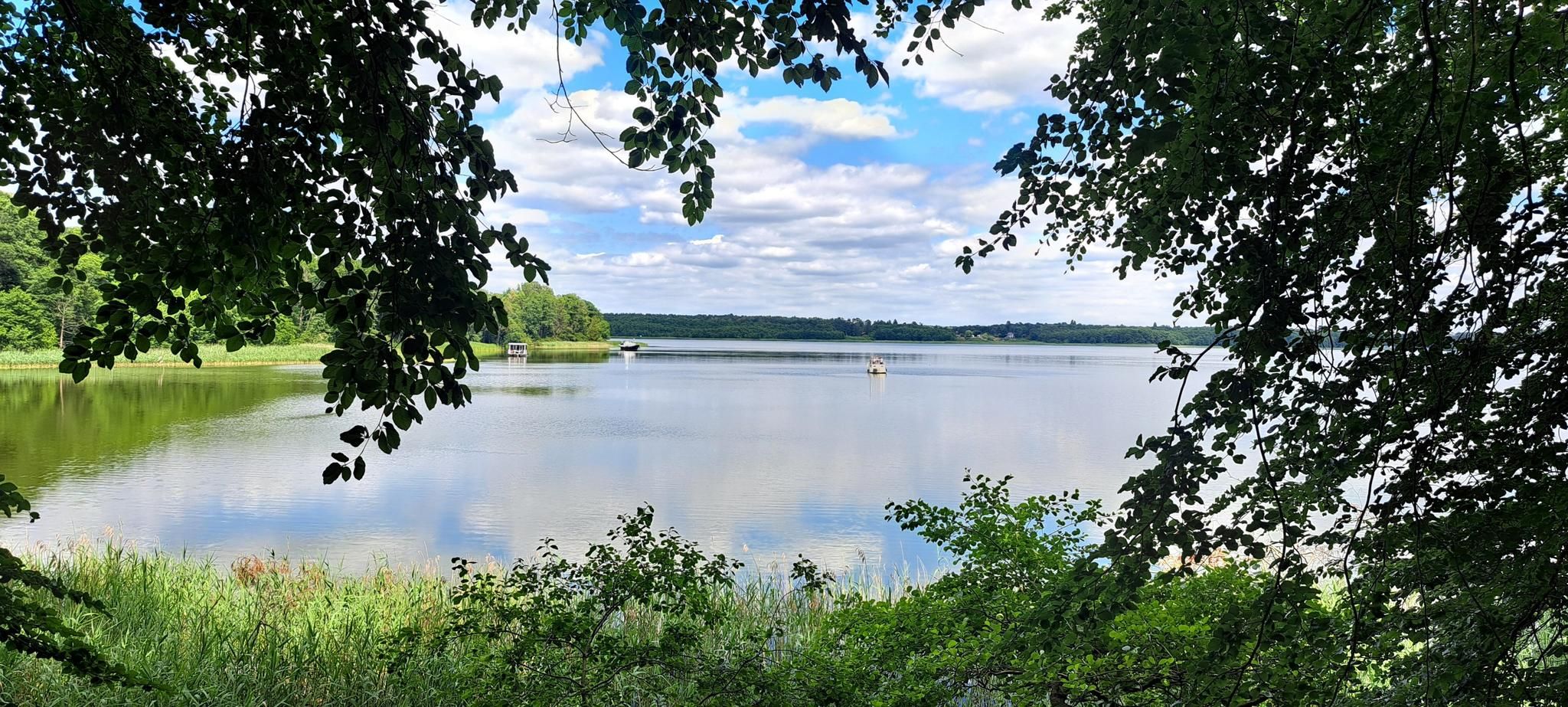
Waterfall hiking trails around Untere Havel Nord traverse a unique natural landscape characterized by extensive floodplains, wetlands, and the intricate network of the Havel River. This region, part of the Westhavelland Nature Park, features slow-flowing waterways, oxbow lakes, and riparian forests. Hikers can explore diverse ecosystems, often encountering notable natural features like the Hegensteinbach stream, where beaver activity is visible, and various lakes. The terrain is generally flat, offering accessible routes through a rich natural environment.
Best waterfall hiking trails around Untere Havel Nord
- The most popular waterfall hiking route is Kümmernitz Waterfall – Bridge over the Königsfließ loop from Kümmernitz, a 4.8 miles (7.8 km) trail that takes 1 hour 59 minutes to complete. This easy route features the Kümmernitz Waterfall and crosses a bridge over the Königsfließ.
- Another top favourite among local hikers is Kümmernitz Waterfall loop from Kümmernitz, an easy 2.0 miles (3.2 km) path. This shorter loop offers direct access to the Kümmernitz Waterfall, winding through the surrounding natural landscape.
- Local hikers also love the Kümmernitz Waterfall – Maria Magdalena Church Breddin loop from Kümmernitz, a 4.7 miles (7.5 km) trail leading through varied terrain including the Kümmernitz Waterfall and towards the historic Maria Magdalena Church, often completed in about 1 hour 55 minutes.
- Hiking around Untere Havel Nord is defined by extensive floodplains, diverse wetlands, and tranquil river landscapes. The network offers easy options suitable for various ability levels, focusing on natural observation.
- The routes in Untere Havel Nord are highly rated by the komoot community with an average score of 4.5 stars from over 800 reviews. More than 3500 hikers have used komoot to explore Untere Havel Nord's varied terrain.
Last updated: July 6, 2026
5.0
(4)
25
hikers
Easy hike. Great for any fitness level. Easily-accessible paths. Suitable for all skill levels.
4
hikers
3.20km
00:50
20m
20m
Easy hike. Great for any fitness level. Easily-accessible paths. Suitable for all skill levels.
5.0
(2)
3
hikers
Easy hike. Great for any fitness level. Easily-accessible paths. Suitable for all skill levels.
Get access to more routes and recommendations from other explorers.
Sign up for free
Already have an account?
Our route recommendations are based on thousands of hikes, rides, and runs completed by other people on komoot.
Start today with a free account
Your next adventure awaits.
Login or Signup


Tips from the Community

Nice place at the entrance to the forest. There is also a well-located rest area with tables and benches directly at the waterfall.
0
0

Very nice surroundings, Buchenwald, Breddiner Switzerland
0
0

The Maria Magdalena Church in Breddin is a single-nave, originally rectangular field stone building with a west transverse tower the width of the ship; the altar was officially consecrated in 1273. In 1847 there was a cross-shaped romanizing extension to the east to a semicircular apse made of field stone with brick edges, enlargement of the nave windows with basket arch and sound openings in the probably Romanesque upper part of the tower. - Interior from the renovation period (around 1847), restored after 1963. For the 2020 permanent exhibition in the church, historical documents were digged deeply. It came to light that the church was consecrated as Maria Magdalena Church in earlier times. The application for renaming was granted, and so the church has recently been officially called "Maria Magdalena Church Breddin". Church history: Parish since 1273, mother church / inspection Havelberg-Dom in 1562, Havelberg superintendent since 1868, Havelberg-Wilsnack parish since 1878, Kyritz-Wusterhausen parish since 1997. Since 2016 church district Prignitz. From 1646 until now (2004) the list of pastors consisted of 18 names without any gaps. The patronage was from 1284 to 1819 with the Havelberg Cathedral Chapter, from 1819 to 1945 with the Treasury (Office Havelberg). Sophiendorf and Kümmernitz were churched in the 19th century. https://www.kirchenkreis-prignitz.de/breddin.html
1
0
The border between Brandenburg and Saxony-Anhalt cuts through the Breddiner Schweiz. On the Brandenburg side, Breddiner Switzerland belongs to the Ostprignitz-Ruppin region. In the small community of Kümmernitz, attentive visitors can spot the sign saying "Wasserfall". The waterfall is hidden in the forest, but with a little sense of direction you can find it quickly. The waterfall is a human-made construction, but it is still worth seeing. A notice board describes it as the highest waterfall of its kind in northern Germany. Whether the water falls or not is decided by the weather conditions and the beavers that live on the Königsfließ. In dry years or when the Nagezahn family has dammed the Königsfließ further up, the waterfall turns into a pathetic trickle. Even if the water doesn't rush into the depths, you don't have to be disappointed as a visitor. A walk along the Königsfließ or a hike through Breddiner Switzerland, which is covered with mighty beeches, is worthwhile at any time of the year. https://brandenburger.land/haben-orte/23-das-koenigsfliess-bei-kuemmernitz.html
3
0

The waterfall was already protected in the GDR as a monument of production and traffic history. It is fed by the stream with the current name "Königsfließ". In 1876, the bottom of the sill was fixed to allow a controlled drainage. The waterfall is considered the highest in northern Germany. Source: sign on the spot
3
0
Here is a very old stone church, and by a spectacular find in 1846, the date of consecration is known, however, very accurate. In a so-called Sepulcrum (reliquary grave) in the altar structure was the original consecration of the Havelberg bishop from the year 1273.
3
0
Frequently Asked Questions
How many waterfall hiking trails are available in Untere Havel Nord?
There are 5 dedicated waterfall hiking trails in Untere Havel Nord, all rated as easy, making them accessible for most hikers.
What is the best time of year to experience the waterfalls in Untere Havel Nord?
The waterfalls, particularly the Kümmernitz Waterfall, are often at their most impressive during spring after snowmelt or heavy rainfall, and in autumn when the surrounding foliage adds vibrant colors to the landscape. While accessible year-round, water flow can vary with seasons.
Are there any easy or family-friendly waterfall hikes in the region?
Yes, all 5 waterfall hikes in Untere Havel Nord are rated as easy, making them suitable for families and those looking for a relaxed walk. A great option is the Kümmernitz Waterfall loop from Kümmernitz, which is just over 3 km long.
Can I bring my dog on the waterfall trails?
Most trails in the Untere Havel Nord region, including those around the Kümmernitz Waterfall, are dog-friendly. However, it's always recommended to keep your dog on a leash, especially in nature protection areas, and to be mindful of other hikers and wildlife.
Are there circular routes that include waterfalls?
Absolutely! Many of the waterfall hikes are designed as circular routes, allowing you to start and end at the same point. For example, consider the Kümmernitz Waterfall – Bridge over the Königsfließ loop from Kümmernitz, which offers a scenic round trip.
What other natural attractions can I explore near the waterfall trails?
Beyond the waterfalls, the region is rich in natural beauty. You can explore areas like the Path Through the Fields of Westhavelland or visit the Viewpoint in Westhavelland Nature Park for expansive views. The entire Untere Havel Nord area is part of the Westhavelland Nature Park, known for its extensive floodplains, wetlands, and diverse ecosystems.
What do other hikers enjoy most about the waterfall hikes in Untere Havel Nord?
The komoot community highly rates the hiking experiences here, with an average score of 4.5 out of 5 stars from over 800 reviews. Hikers often praise the peaceful natural setting, the accessibility of the trails, and the unique charm of the Kümmernitz Waterfall.
Are there any longer waterfall hikes for a full day out?
For a longer adventure, the Kümmernitz Waterfall – Maria Magdalena Church Breddin loop from Kümmernitz offers a pleasant hike of about 7.5 km, combining the waterfall experience with cultural sights.
Is it possible to combine multiple waterfalls into a single hike?
While the Kümmernitz Waterfall is the primary waterfall attraction in this specific area, the longer loop trails often provide different perspectives and approaches to it, allowing for a more extended experience of the waterfall and its surroundings. The region's focus is more on the extensive river landscape rather than numerous distinct waterfalls.
Are there any specific viewpoints or notable features along the waterfall trails?
The trails often lead directly to the Kümmernitz Waterfall, offering close-up views. Additionally, routes like the Kümmernitz Waterfall – Bridge over the Königsfließ loop from Kümmernitz incorporate features like bridges over streams, providing varied perspectives of the water-rich landscape.
What kind of terrain can I expect on these waterfall hikes?
The terrain around the Kümmernitz Waterfall and in Untere Havel Nord generally consists of easy, well-maintained paths through forests, along riverbanks, and across open fields. Expect mostly flat or gently undulating ground, characteristic of the river landscape.
Most popular routes around Untere Havel Nord
Most popular attractions around Untere Havel Nord

Get inspired with the komoot mobile app


Explore more
Browse the best Hikes in other regions.
