The best running trails in Upper Qualicum River Woodlands
5.0
(1)
67
runners
5
runs
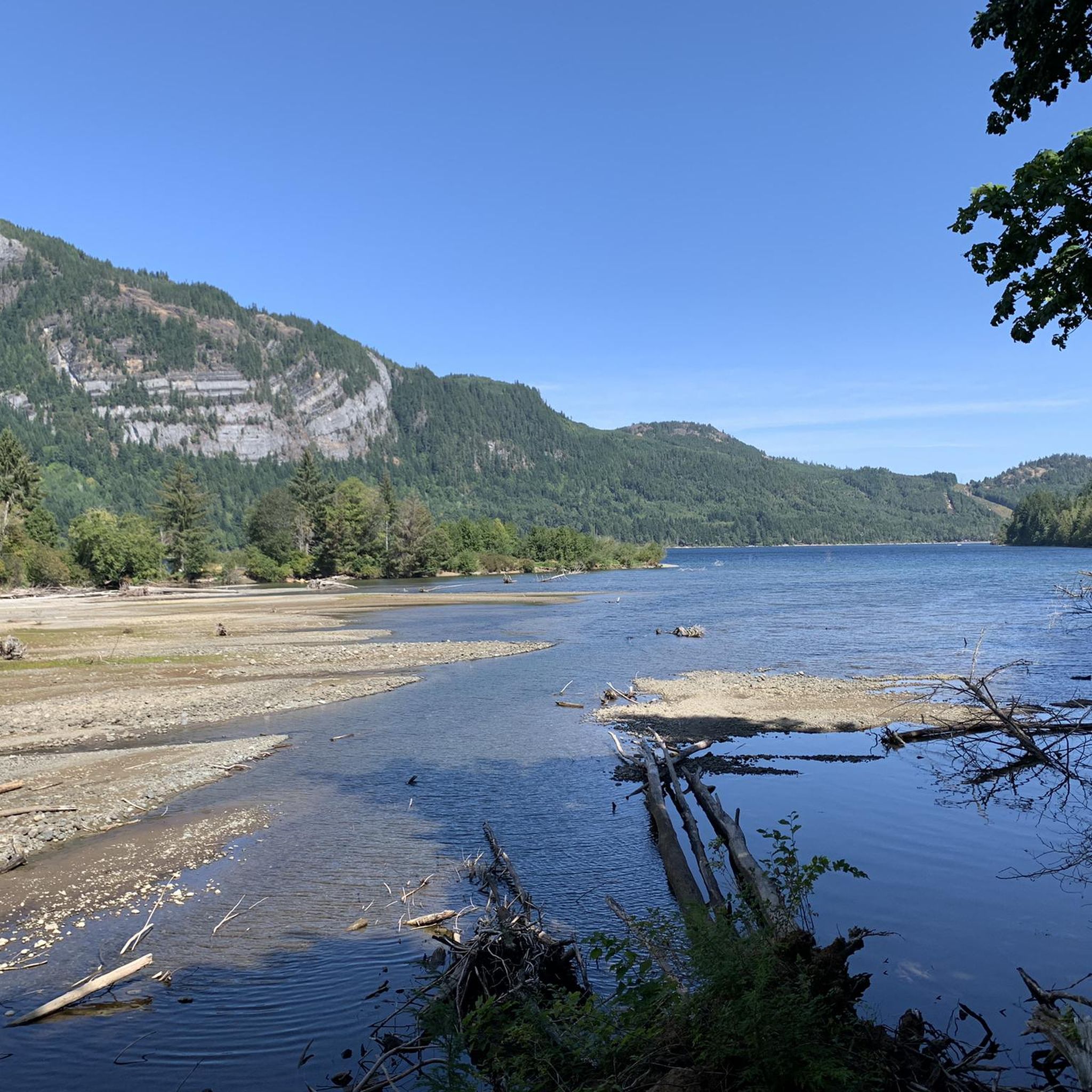
Jogging in Upper Qualicum River Woodlands offers diverse landscapes characterized by lush forests, river systems, and varied terrain. The region features well-maintained trails that navigate through woodland environments and along rivers. Elevation changes are generally moderate, with some routes offering gentle inclines. Natural features include the Little Qualicum River and its waterfalls, providing scenic backdrops for running.
Best jogging routes in Upper Qualicum River Woodlands
- The most popular jogging route is L.167 loop from McLean Mill National Historic Site,…
Last updated: May 24, 2026
16
runners
9.46km
00:59
70m
70m
Moderate run. Good fitness required. Mostly paved surfaces. Suitable for all skill levels.
16
runners
13.7km
01:26
100m
100m
Moderate run. Good fitness required. Mostly paved surfaces. Suitable for all skill levels.

Sign up for free
5.0
(1)
13
runners
Moderate run. Good fitness required. Mostly paved surfaces. Suitable for all skill levels.
11
runners
9.57km
01:08
180m
180m
Moderate run. Good fitness required. Mostly paved surfaces. Suitable for all skill levels.
11
runners
4.53km
00:28
40m
40m
Easy run. Great for any fitness level. Mostly paved surfaces. Suitable for all skill levels.
Our route recommendations are based on thousands of hikes, rides, and runs completed by other people on komoot.
Start today with a free account
Your next adventure awaits.
Login or Signup
Popular around Upper Qualicum River Woodlands
Tips from the Community

Lions Community Park is a neighborhood park with a parking lot, a playground, picnic tables, benches, a water fountain, and the Lighthouse Community Center. There is also access to the Lighthouse Country Regional Trail.
0
0
Best hiked from April to October, the Nile Creek Trail heads southwest uphill alongside Nile Creek. It weaves through vibrant green forests and ends at waterfalls and a swimming hole.
0
0
Frequently Asked Questions
How many running routes are available in Upper Qualicum River Woodlands?
There are 5 dedicated jogging routes in Upper Qualicum River Woodlands, offering a variety of experiences. These trails navigate through lush forests and along river systems, providing diverse options for runners.
What kind of terrain can I expect on the running trails?
The terrain in Upper Qualicum River Woodlands is diverse, featuring lush forests, riverside paths, and varied woodland environments. You'll find well-maintained trails, some with mostly paved surfaces, and others with gravel or natural paths. Elevation changes are generally moderate, with some routes offering gentle inclines, making them suitable for various fitness levels.
Are there options for different fitness levels?
Yes, the Upper Qualicum River Woodlands offers running options for various fitness levels. You can find easy, family-friendly routes like the Upper Falls loop from Little Qualicum Falls - Upper Campground, which is great for beginners. There are also more challenging moderate runs, such as the L.167 loop from McLean Mill National Historic Site, which require good fitness.
Are there any waterfalls along the jogging paths?
Absolutely! A prominent feature of the area is the Little Qualicum Falls Provincial Park, where the Little Qualicum River carves its path through a rocky canyon, creating a series of rushing waterfalls. The Upper Falls loop from Little Qualicum Falls - Upper Campground will take you close to these stunning natural features.
What natural features or landmarks can I see while running?
While running in Upper Qualicum River Woodlands, you can experience riverside tree canopies, mossy glades, and breathtaking views of the Little Qualicum River. The area is home to ancient, moss-covered trees, including old-growth Douglas firs. You might also encounter the Big Qualicum River Salmon Hatchery, especially in the fall when salmon spawning can be observed, and the southern shore of Cameron Lake.
Are there any scenic viewpoints on the trails?
Yes, for panoramic vistas, Little Mountain Lookout offers incredible views of green forests and towering mountains like Mount Arrowsmith. Within Little Qualicum Falls Provincial Park, viewing areas are available at both the Upper and Lower Falls, including a fenced rocky viewpoint at the Upper Falls and a bridge for different perspectives.
Are the running routes in Upper Qualicum River Woodlands suitable for families?
Many routes in Upper Qualicum River Woodlands are suitable for families. The Little Qualicum Falls Provincial Park, for example, offers an easy 3.4 km loop trail that covers both the Upper and Lower Falls, often described as relatively easy with steps to assist with elevation changes. This park also provides amenities like picnic areas, making it convenient for family outings.
Can I bring my dog on the trails?
While specific regulations can vary by trail, many provincial parks and regional trails in British Columbia allow dogs on leash. It's always best to check the specific rules for each trail or park you plan to visit to ensure a dog-friendly experience. Generally, dogs are welcome on many of the natural trails, but always keep them on a leash and clean up after them.
Is parking available near the trailheads?
Yes, parking is generally available. For instance, Little Qualicum Falls Provincial Park, a popular starting point for several routes, offers extensive free parking. Other trailheads may have designated parking areas as well, making access convenient for runners.
What is the best time of year to go running in this area?
Upper Qualicum River Woodlands offers a fantastic setting for running year-round due to its temperate climate. Spring and fall provide comfortable temperatures and vibrant scenery, with fall offering the added bonus of observing salmon spawning at the Big Qualicum River Salmon Hatchery. Summer is also popular, with potential swimming holes along the river for a refreshing stop. Winter running is possible, though some trails might be wet or muddy.
Are there any circular running routes?
Yes, many of the running routes in Upper Qualicum River Woodlands are designed as loops, providing a varied experience without retracing your steps. Examples include the L.167 loop from McLean Mill National Historic Site and the Lions Community Park loop from Island Hwy W AT Lion's Way (SB), both offering excellent circular options.
What do other runners say about the trails in Upper Qualicum River Woodlands?
The running routes in Upper Qualicum River Woodlands are highly rated by the komoot community, with an average score of 5.0 stars. Runners often praise the diverse landscapes, the serene woodland environment, and the well-maintained paths that cater to various fitness levels. The scenic backdrops, including the Little Qualicum River and its waterfalls, are frequently highlighted as a major draw.
What are some longer distance running trails in the area?
For those seeking longer runs, the Upper Qualicum River Woodlands has several moderate options. The McLean Mill Log Pond – L.167 loop from Maplehurst Park is a substantial 8.5 miles (13.7 km) path featuring forested sections with gentle elevation gains. Another great choice is the Lions Community Park loop from Island Hwy W AT Lion's Way (SB), which covers 6.7 miles (10.7 km) through forested paths and open areas.
Most popular routes in Upper Qualicum River Woodlands

Get inspired with the komoot mobile app


Explore more
Browse the best Running Trails & Routes in other regions.
