The best walks and hikes around Kootenay Lake
4.2
(6)
58
hikers
3
hikes
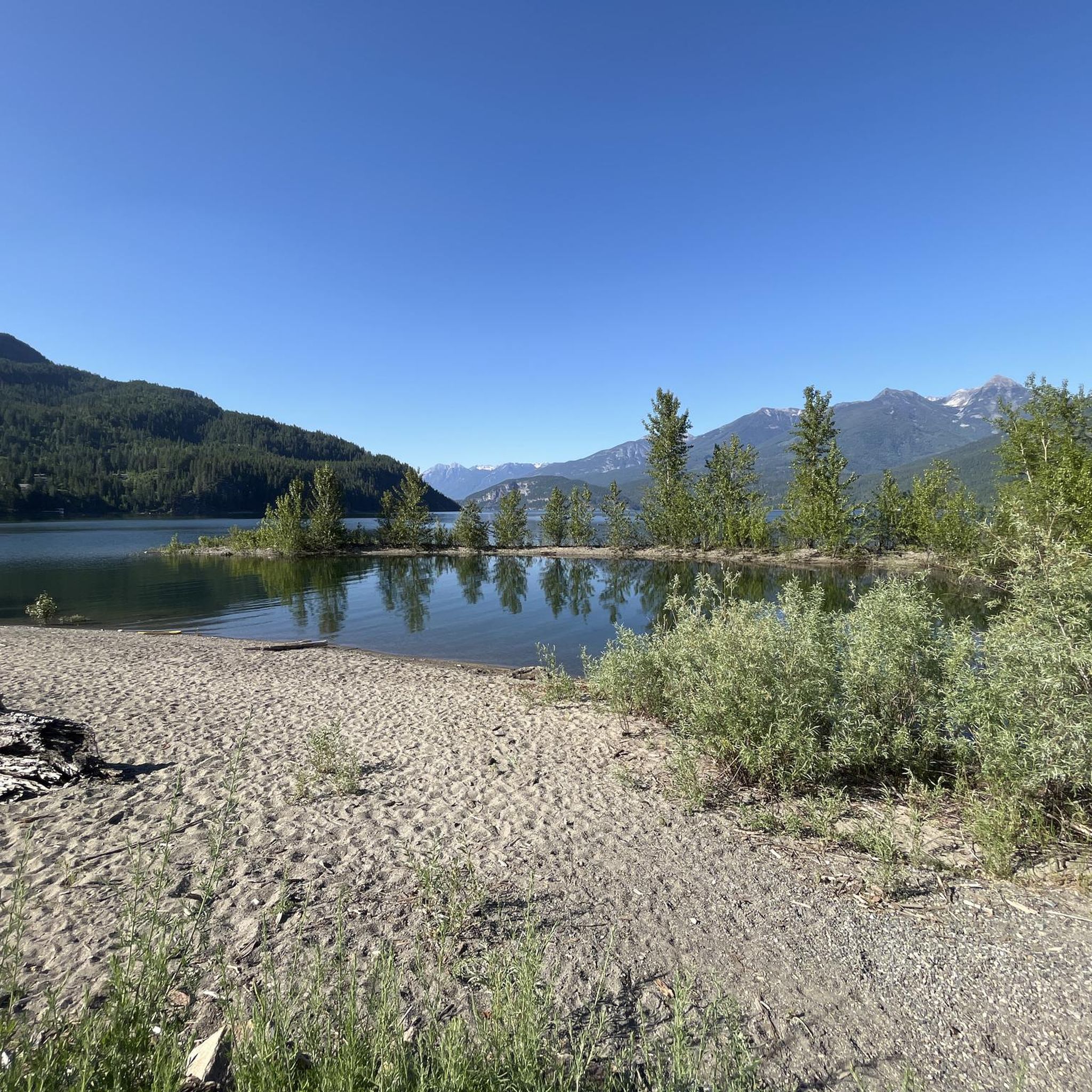
Hiking around Kootenay Lake offers diverse terrain nestled between the Selkirk and Purcell mountain ranges in British Columbia. The region features a long, narrow, fjord-like lake, surrounded by old-growth forests and alpine meadows. Glaciation has shaped the landscape, creating a variety of trails from valley bottoms to higher elevations.
Best hiking trails around Kootenay Lake
- The most popular hiking route is Stone Sculptures in the Forest loop from Kaslo, a 2.0 miles (3.2 km) trail that takes about 55 minutes to complete. This easy loop explores forested paths near Kaslo.
- Another top favourite among local hikers is Kaslo City Hall – Stone Sculptures in the Forest loop from Kaslo, an easy 3.4 miles (5.4 km) path. It offers a longer exploration of the local forest and sculptures.
- Local hikers also love the Hiking loop from YRB Highway Maintenance Yard, a 3.6 miles (5.7 km) trail leading through varied terrain, often completed in about 2 hours 10 minutes.
- Hiking around Kootenay Lake is defined by its fjord-like lake, surrounding Selkirk and Purcell Mountains, and extensive old-growth forests. The network offers options for easy walks and moderate trails.
- The routes in Kootenay Lake are highly rated by the komoot community with an average score of 3.3 stars from over 5 reviews. More than 39 hikers have used komoot to explore Kootenay Lake's varied terrain.
Last updated: November 12, 2026
3.7
(3)
32
hikers
3.39km
00:58
80m
80m
Easy hike. Easily walkable paths.
4.0
(1)
10
hikers
9.79km
02:45
200m
200m
Moderate hike. Good fitness required. Easily walkable paths.

6
hikers
10.7km
04:49
1,020m
1,020m
Hard hike. Very good fitness required. Easily walkable paths.
5.0
(2)
10
hikers
6.18km
02:17
400m
400m
Moderate hike. Good fitness required. Easily walkable paths.
Our route recommendations are based on thousands of hikes, rides, and runs completed by other people on komoot.
Start today with a free account
Your next adventure awaits.
Popular around Kootenay Lake
Tips from the Community

Located in British Columbia's West Kootenay region, the Kaslo River is a stunning waterway that serves up picturesque views around every bend. The river makes its short 58-kilometre run from the mountains to Kootenay Lake at the town of Kaslo. It's here, near the mouth, where you'll find the family friendly Kaslo River Trail, which is a must do short loop that's fun for all ages.
0
0
A number of statues, known as Koots, are dotted along the Kaslo River Trail. Some of them are quite obvious while others are a bit more hidden. Keep your eyes peeled as you walk along the river and through the forest, you never know what you might see looking back at you.
0
0
This picturesque covered bridge is one of two that cross over the Kaslo River on the Kaslo River Trail. This is the closest one to town, so even if you don't have time to do the full trail, it's worth it to come out here to see the fairytale like setting.
0
0

The Loki-Baldur Trail is steep and leads through the woods, then opens up to a meadow where the trail mellows out. The trail climbs again, reaching Portman’s Notch, and Mount Loki comes into sight. Once above the treeline, the class 2-3 scramble will begin.
0
0
The summit of Mount Loki sits at 2779 meters and provides 360-degree views from this rocky peak high above the treeline. The views are fantastic, even breathtaking, but the summit push is a scramble and not recommended for kids or beginners.
0
0
The Loki-Baldur Trail involves a class 2-3 scramble just before the summit. Typically the route is easy to follow, but it can get tricky during this rocky scramble. The scramble is on a ridgeline and involves a few false summits. No technical gear is required, and the views from the false summits are beautiful, but if the weather takes a turn or if the scramble makes you uncomfortable, turn back.
0
0

A short but beautiful tour. Highly recommended!
0
0

Frequently Asked Questions
What kind of terrain can I expect when hiking around Kootenay Lake?
The Kootenay Lake region, nestled between the Selkirk and Purcell mountain ranges, offers diverse terrain. You'll find everything from fertile valley bottoms and extensive old-growth forests with towering cedars and hemlocks, to wide-open alpine meadows bursting with wildflowers. The landscape is shaped by glaciation, featuring dramatic peaks, numerous creeks, and the deep, fjord-like Kootenay Lake itself.
Are there easy hiking trails suitable for beginners or families?
Yes, Kootenay Lake offers several easy trails perfect for beginners or families. Options like the Riondel Heritage Trail, Crawford Creek Regional Park and Wetlands Trails, and the Pilot Bay Lighthouse Trail provide accessible walks with scenic beauty. The Stone Sculptures in the Forest loop from Kaslo is an easy 3.2 km route that explores forested paths.
What are some notable natural features or viewpoints to look for on hikes?
Hikers can discover stunning natural features and viewpoints. The region is known for its majestic Selkirk and Purcell Mountains, prominent glaciers in areas like Kokanee Glacier Provincial Park, and expansive alpine meadows such as Monica Meadows. You'll also encounter magnificent old-growth forests, numerous waterfalls fed by deep snowpacks, and breathtaking views over Kootenay Lake from trails like Pulpit Rock or Toad Mountain.
Are there any circular hiking routes available?
Yes, there are circular routes to enjoy. For example, the Stone Sculptures in the Forest loop from Kaslo is an easy 3.2 km trail. A slightly longer option is the Kaslo City Hall – Stone Sculptures in the Forest loop from Kaslo, which is 5.4 km and also easy. For a moderate challenge, consider the Hiking loop from YRB Highway Maintenance Yard, a 5.7 km trail.
What is the best time of year to go hiking around Kootenay Lake?
The Kootenay Lake region is beautiful throughout the warmer months. Spring brings vibrant wildflowers to alpine meadows, while fall offers stunning larch trees and the opportunity to see Kokanee salmon spawning in creeks, particularly in Kokanee Creek Provincial Park. Summer provides ideal conditions for exploring the full range of trails, from valley walks to higher alpine routes.
What kind of wildlife might I encounter on the trails?
The unique inland temperate rainforest and diverse ecosystems around Kootenay Lake support a variety of wildlife. Hikers might spot grizzly bears, otters, ospreys, and eagles. The region's rich forests and waterways are home to many species, making wildlife spotting a rewarding part of the hiking experience.
How do other hikers rate the trails in Kootenay Lake?
The hiking trails around Kootenay Lake are generally well-regarded by the komoot community, with an average rating of 3.3 out of 5 stars from over 5 reviews. Hikers often appreciate the diverse landscapes, from serene old-growth forests to challenging mountain ascents, and the stunning views of the lake and surrounding peaks.
Are there any trails that feature waterfalls?
Yes, the Kootenay Lake region is known for its numerous creeks and streams, many of which feature waterfalls, especially fed by the deep snowpacks of the Selkirk and Purcell mountains. While specific trails are not detailed here, areas like Kokanee Glacier Provincial Park and the Lockhart Creek Trail are known for their lush, water-rich environments where waterfalls are a common sight.
Are there any trails that lead to alpine lakes?
Yes, the region offers trails that lead to beautiful alpine lakes. For instance, the Kokanee Lake Trail, which is the main access into Kokanee Glacier Provincial Park, meanders through forests and meadows to the idyllic Kokanee Lake, known for its crystal-clear glacier waters. Other areas like Monica Meadows also provide access to stunning alpine environments.
What are some of the more challenging or moderate hikes available?
For those seeking a more challenging experience, the Kootenay Lake area offers moderate to difficult trails. The Hiking loop from YRB Highway Maintenance Yard is a moderate 5.7 km trail. Other more ambitious options in the wider region include Lockhart Creek Trail, which leads through old-growth forests up to ridge lines and Baker Lake, and high alpine treks like Jumbo Pass or Mount Crawford & Plaid Lake Trail.
What kind of forests can I expect to see while hiking?
The Kootenay Lake region is home to magnificent old-growth forests, particularly in places like Kokanee Glacier Provincial Park and along the Lockhart Creek Trail. These forests feature towering cedars and hemlocks, creating mossy, fertile wonderlands nourished by alpine streams. The area also boasts a rare inland temperate rainforest, characterized by ancient trees, lush ferns, and diverse lichens and mosses.
Most popular routes around Kootenay Lake

Get inspired with the komoot mobile app


Explore more
Browse the best Hikes in other regions.
