Top 20 Bike Parks around Stein
Best bike parks around Stein are situated in a region characterized by rolling hills and diverse natural landscapes, offering varied terrain for cycling enthusiasts. This area provides a mix of technical trails, challenging climbs, and dedicated facilities for mountain biking. The landscape includes forests and open areas, making it suitable for different riding experiences.
Best bike parks around Stein
- The most popular bike parks is Shimano Valkenburg MTB Route – Downhill Section, a mtb_park that features a light technical…
Last updated: May 13, 2026
Shimano Valkenburg MTB Route – Downhill Section
Highlight (Segment) • MTB Park
The technical part is mainly in the differences in height that are sometimes bridged in a short …
Translated by Google •
Tip by

Shimano Experience Center
Highlight • Rest Area
Tip by

Sign up now to discover places like this
Get recommendations on the best single tracks, peaks, & plenty of other exciting outdoor places.
Sign up for free
Steep Climb and Descent on Gravel Path
Highlight • Climb
Translated by Google •
Tip by

Route board mountain bike route
Highlight • Rest Area
Translated by Google •
Tip by

Singletrack along Kikbeekbron
Highlight (Segment) • MTB Park
Translated by Google •
Tip by

Sign up for free to discover even more bike parks around Stein.
Sign up for free
Already have an account?
Start today with a free account
Your next adventure awaits.
Login or Signup
Other adventures around Stein

Tips from the Community

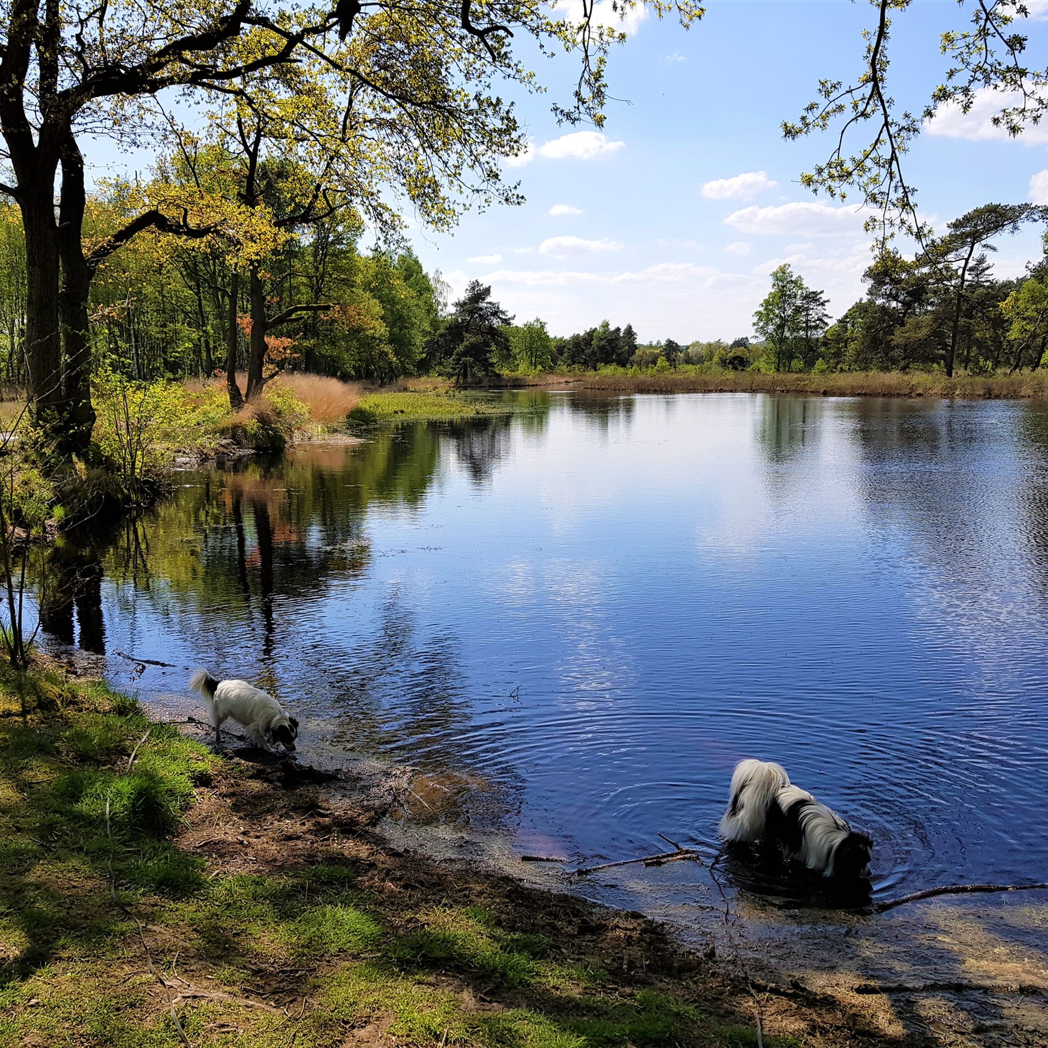
The Singektrack along the Kikbeekbron in the Hoge Kempen National Park near Maasmechelen is part of the trails through the Kikbeekbron Valley, a nature reserve that has become one of the park's most attractive landscapes since the conversion of a former sand and gravel quarry into a nature reserve. This area is characterized by a tranquil pond, heathlands, marshlands, and forests with a rich ecology that is home to typical flora and fauna such as dragonflies, heathland vegetation, grazing fjord ponies, and a variety of birds and insects. The area around the Kikbeekbron is part of the larger network of hiking and mountain bike trails in the national park, which showcases Flanders' natural diversity and is part of the official hiking and cycling trails that lead visitors through forests, heathlands, fens, and valleys. The Singektrack and surrounding trails are generally part of regular hiking networks and are also incorporated into long-distance routes such as the National Park Trail, a route of over 105 kilometers that passes the park's most beautiful spots. The section around the Kikbeekbron has a temporary route change due to nature management work. Due to roadworks and nature restoration, a section of this trail, including a section near and around the Kikbeekbron, will be temporarily closed or diverted, meaning that certain paths will be inaccessible to recreational users while these works continue. For example, the National Park Trail will be closed for minor roadworks in the valley between August 1 and December 31, 2025, for which detours will be signposted to minimize the impact on nature and protect vulnerable zones. In addition to these specific temporary updates, the park's accessibility regulations state that certain areas within the national park, including the valley around the Kikbeekbron and other vulnerable zones, are legally designated as restricted zones, meaning that access is only permitted via the designated paths and route networks. Beyond these trails, access to sensitive natural areas is only permitted with the park manager's permission or under the guidance of a certified ranger, as the park prioritizes nature conservation and ecological integrity. In practice, this means that the Singek Track and other trails around the Kikbeekbron are currently officially closed or heavily restricted for recreation, especially in areas where new nature restoration or management projects are underway. Visitors are asked to follow the designated alternative routes and detours and to respect the sensitive areas to avoid disturbing flora and fauna—something the park managers strictly monitor. Nevertheless, some visitors, like myself, report sneaking into the area despite the closures and construction. These kinds of personal experiences occur when trails aren't completely blocked, or when visitors ignore the signage to enjoy the trail and views offered by the Singek Track. Such experiences are understandable from the perspective of nature and outdoor enthusiasts who want to experience the scenic beauty of the Kikbeek source, but they technically fall outside the park's permitted access regulations, especially because management works and nature restoration are underway there, and vulnerable nature is recovering. The park emphasizes that access to closed areas is prohibited to prevent damage to the landscape and disturbance of species, and such zones are regularly designated as inaccessible. The Singektrack itself, before the works and restrictions, was popular for the natural diversity of the Kikbeek valley. It allowed you to walk along water features, through heathland, over soft woodland, and enjoy panoramic views of the valley. Its positioning within the network of hiking trails made it a logical, varied route for those who wanted to explore the area, showcasing the transition between open landscape, water, and forest that is characteristic of the Hoge Kempen region. However, since the announced works and new management plans, the valley around the Kikbeekbron has been designated a vulnerable zone. Managers are carrying out restoration and management projects to improve water levels, vegetation structure, and habitats, among other things. This has a temporary impact on the recreational accessibility of trails such as the Singektrack.
0
0
The mountain bike route sign marks the start of a technically challenging and natural trail. For many cyclists, this sign is more than just a signpost: it signals the start of a ride full of adrenaline, physical exertion, and pure nature experience. These signs are designed to guide mountain bikers safely and smoothly through the landscape, whether it's steep climbs, singletrack through the forest, rapid descents, or technical sections among roots and boulders. Many mountain bike routes in Belgium and the Netherlands are part of an extensive network of trails. The route sign serves as a junction, allowing you to easily: • switch to another loop, • combine with gravel routes, • or extend your ride by connecting multiple segments. The routes are often maintained by local clubs or nature organizations, ensuring they remain in good condition. This sign is where your ride truly begins. It symbolizes: • effort, • challenge, • pushing boundaries, • and enjoying technology and speed in nature. Whether you're a recreational rider or an experienced biker, the route sign is always a moment of focus.
0
0

Mountain bikers will also find what they are looking for here
1
0

Nice single track on the ridge and along the fence of the Kikbeekbron nature reserve. A short and steep climb to get to the top, but after that just a nice track.
0
0

blackberries, nettles, other mtb ers
0
0

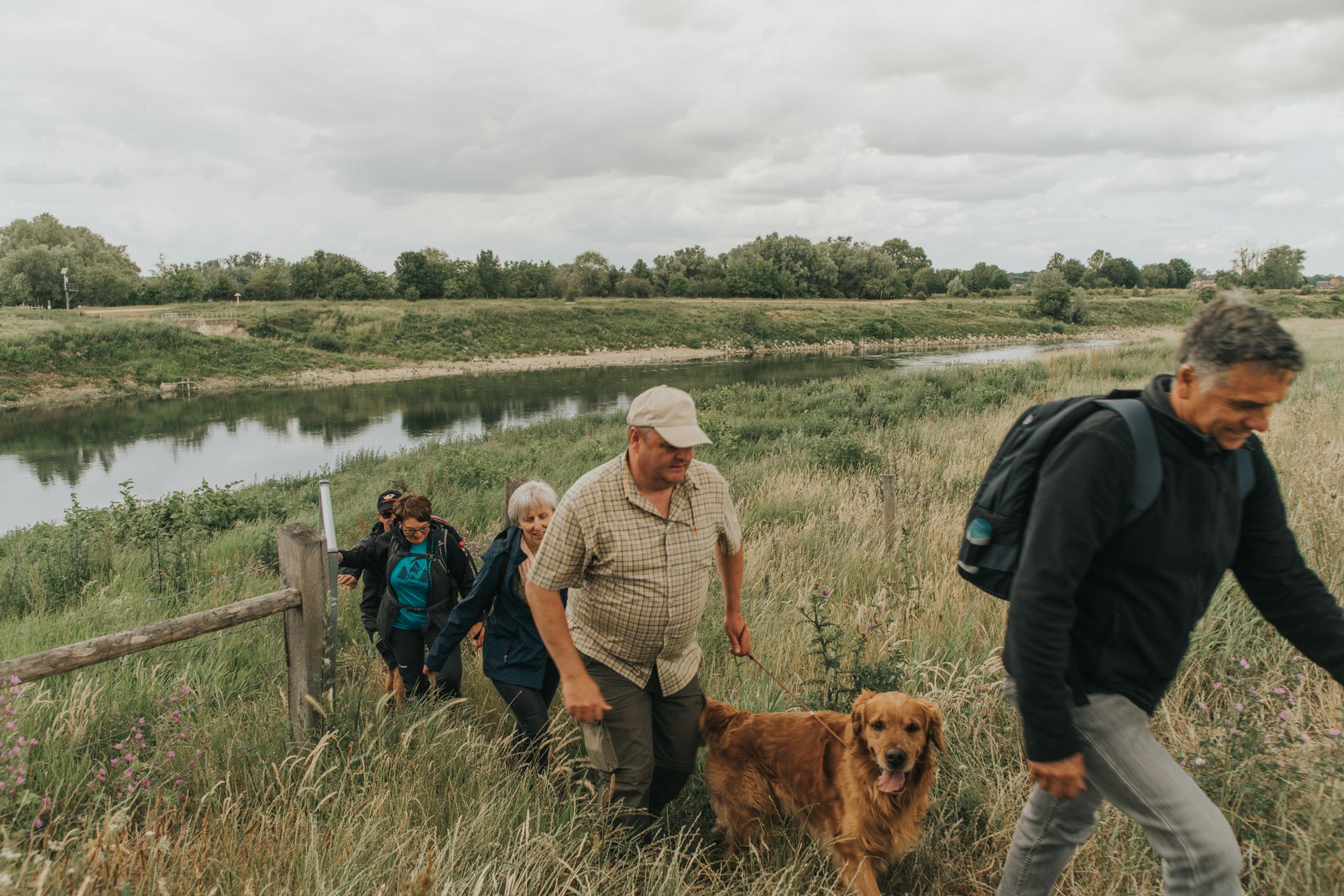
This is quite a tough climb (maximum part 25% according to my Garmin) on fairly loose gravel. On the other hand, a year ago it was still the Prorail diversion for cyclists when the level crossings were closed for work, so according to them it should be doable for everyone and their granny bike. Personally, I think it's on the edge for a gravel bike, rather MTB terrain.
0
0

Revisted the place today. Love it still and even more than before. Must visit on your trip doen AGR-land 💙
6
0

In order to be able to follow the development of bicycles, you should definitely visit this exhibition.
18
0
Frequently Asked Questions
What kind of bike parks can I expect around Stein?
The bike parks around Stein offer a mix of technical trails, challenging climbs, and dedicated facilities. You'll find sections like the Shimano Valkenburg MTB Route – Downhill Section, known for its light technical demands and elevation changes within the forest. The region's landscape, characterized by rolling hills, forests, and open areas, provides varied terrain for different riding experiences.
Are there challenging trails for experienced riders near Stein?
Yes, experienced riders can find challenging sections such as the Steep Climb and Descent on Gravel Path, which features a sharp descent and ascent on a gravel surface. The Shimano Valkenburg MTB Route – Downhill Section also presents technical demands with short, steep climbs and elevation changes.
Are there any family-friendly bike facilities or areas around Stein?
The Shimano Experience Center is a family-friendly hub in South Limburg. While not a bike park itself, it offers bike rentals and serves as an ideal starting point for cycling adventures, including routes suitable for families. It's a great place to explore the latest cycling technology and enjoy a coffee.
What facilities are available at the bike parks or nearby cycling hubs?
The Shimano Experience Center acts as a central cycling hub, offering access to the latest cycling technology, historical exhibits, bike rentals, and a café. It's a popular spot for events and a great place to start your cycling adventures in Limburg. Additionally, you might find information boards like the Route board mountain bike route which provides details on various cycling routes in the area.
What do visitors enjoy most about the bike parks around Stein?
Visitors appreciate the diverse terrain and the well-maintained trails. Many enjoy the technical sections, the scenic forest paths, and the overall cycling experience. The Shimano Experience Center is also highly valued as a central point for cycling enthusiasts, offering amenities and a place to gather.
Can I find singletrack trails near Stein?
Yes, you can find singletrack trails, such as the Singletrack along Kikbeekbron. This trail offers a nice ride on the ridge and along the fence of the Kikbeekbron nature reserve, though it may involve a short, steep climb to reach the top.
Are there other outdoor activities or routes available near the bike parks?
Absolutely! Besides bike parks, the region around Stein offers a variety of outdoor activities. You can explore numerous MTB Trails, including routes like 'View of the Geuldal Valley' or 'Mechelse Heide'. There are also many Road Cycling Routes and Running Trails, such as the 'Woodhenge of Meers loop' or routes with views of the Albert Canal.
What kind of natural landscapes will I encounter on the trails?
The trails around Stein traverse diverse natural landscapes, including rolling hills, dense forests, and open areas. You'll experience elevation changes, scenic views, and areas like the Kikbeekbron nature reserve, which features tranquil ponds, heathlands, and marshlands, providing a rich ecological backdrop to your ride.
Are there any specific tips for navigating the trails around Stein?
When tackling sections like the Steep Climb and Descent on Gravel Path, be cautious on sharp descents, especially in wet conditions. For the Shimano Valkenburg MTB Route – Downhill Section, note that the direction of travel is towards the west, and cycling freely outside the designated path is not allowed.
Where can I find information about different cycling routes in the area?
You can often find information boards, such as the Route board mountain bike route, which display various cycling routes that you can follow or connect to form a larger ride. These boards are helpful for both mountain bikers and other cyclists looking to explore the region.
What are the general characteristics of the mountain biking trails near Stein?
The mountain biking trails around Stein are known for their varied difficulty, ranging from intermediate sections with light technical demands to challenging climbs and descents. Many trails wind through forests, offering a mix of natural surfaces and designed features, catering to different skill levels and preferences.
Most popular attractions around Stein

Get inspired with the komoot mobile app


Explore more
Still looking for your perfect bike park? Check out our guides in these places:
