The best road cycling routes in Otzolotepec
4.8
(79)
73
riders
6
rides
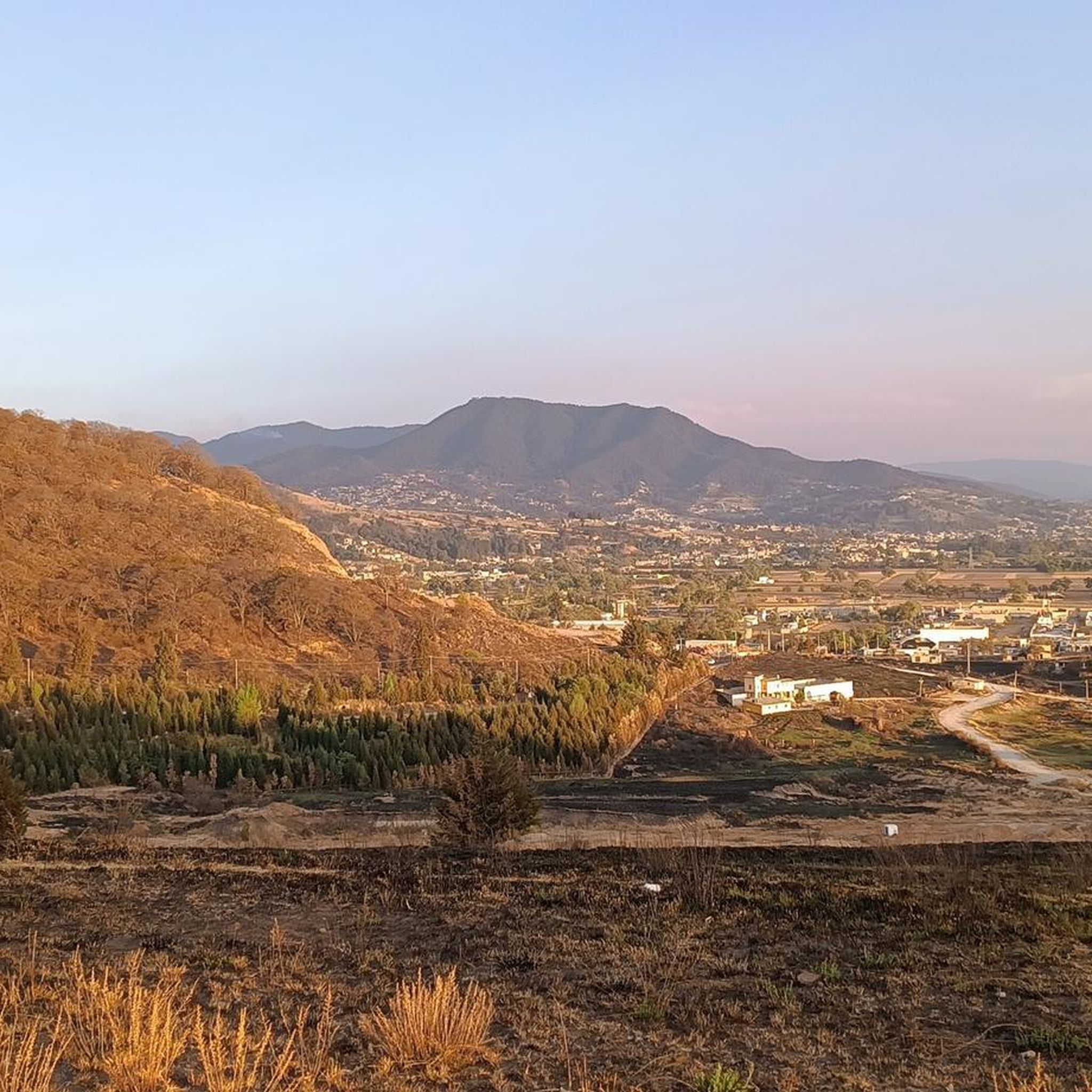
Road cycling in Otzolotepec, located in Mexico State, offers routes through a high-elevation, hilly, and mountainous landscape. The region's average elevation of 2,589 meters (8,494 feet) provides varied gradients and winding paths. Cyclists can expect challenging climbs and descents, often with panoramic views. The area's topography, including potential pine forests and dramatic mountain backdrops, contributes to a diverse cycling experience.
Best road cycling routes in Otzolotepec
- The most popular road cycling route is Iturbide Dam – Valle de las Palomas…
Last updated: June 26, 2026
47
riders
104km
05:57
2,400m
2,400m
Hard road ride. Very good fitness required. Mostly well-paved surfaces and easy to ride.
4.8
(79)
16
riders
53.3km
02:30
670m
670m
Moderate road ride. Good fitness required. Mostly well-paved surfaces and easy to ride.

Sign up for free
5
riders
58.5km
03:18
1,230m
1,230m
Hard road ride. Very good fitness required. Some segments of this route may be unpaved and difficult to ride.
1
riders
60.7km
03:29
1,260m
1,260m
Hard road ride. Very good fitness required. Mostly well-paved surfaces and easy to ride.
3
riders
58.2km
03:05
1,100m
1,100m
Hard road ride. Very good fitness required. Mostly well-paved surfaces and easy to ride.
Our route recommendations are based on thousands of hikes, rides, and runs completed by other people on komoot.
Start today with a free account
Your next adventure awaits.
Login or Signup
Popular around Otzolotepec
Tips from the Community

These are the ruins of a shopping plaza, which for some reason went bankrupt. Now in ruins, access is prohibited, but it's worth a visit.
0
0

A cycling classic! Getting here requires effort and enjoyment due to its mountainous landscapes and long, steep climbs. No matter where you arrive, you'll have to climb. There's food outside and even an ancestral spirit (pulque), so there's plenty of supplies for all visitors. The place is wonderful to explore; it has a museum, ceremonies, picnic areas, and just exploring the area is fascinating.
1
0
Going up towards the CCO or Jiquipilco you will find this accumulation of water of dark blue color and greenish tones that can be seen among the trees of the wooded road full of green mountains, cold wind and the sounds of nature, of course cars pass by on the road but it is the least of it if you look at how beautiful the place is. Enjoy the trip!
2
0
The Valley of the Pigeons where there are no pigeons, only Cows! Obliged to reach the Otomí Ceremonial Center (CCO) or Jiquipilco. Be prepared for the wind either head or cross. There are almost always puddles of water and it is usually cold. Surrounded by green mountains, an area to eat and rest to continue with the descent or the return. Enjoy your way.
1
0

After a strenuous effort going up to this place, you will find a beautiful and wide valley with cows and horses grazing on both sides of the road. During the weekend, and depending on the time you arrive here, you will see people doing different activities, from enjoying a picnic, tasting delicious quesadillas, groups of cyclists recovering energy and sometimes (unfortunately) fans to cars and motorcycles breaking the peace with their noisy engines. When they are not there, all is peace and the air is quite fresh and pure. One thing that surprises me every time I come to this place is to approach the ponds that are on both sides of the road and hear millions of frogs croaking in chorus. Sound simply grabs you and invites you to enjoy it.
0
0
Places to enjoy the local gastronomic delights you will find many along the way. However, in my opinion, this post is the best I've had on this tour. My recommendation: some huitlacoche quesadillas with a natural pulque. You will surely regain strength to continue on your way.
0
0
After a strenuous effort going up to this place, you will find a beautiful and wide valley with cows and horses grazing on both sides of the road. During the weekend, and depending on the time you arrive here, you will see people doing different activities, from enjoying a picnic, tasting delicious quesadillas, groups of cyclists recovering energy and sometimes (unfortunately) fans to cars and motorcycles breaking the peace with their noisy engines. When they are not there, all is peace and the air is quite fresh and pure. One thing that surprises me every time I come to this place is to approach the ponds that are on both sides of the road and hear millions of frogs croaking in chorus. Sound simply grabs you and invites you to enjoy it.
0
0
This dam is located in the middle of the forest, making it the ideal place to get away from the hustle and bustle of the city. It is possible to carry out different recreational activities around it and it is possible to camp in the area. And although swimming is prohibited, being in a place facing the water and with trees around you is quite refreshing.
1
0
Frequently Asked Questions
What kind of terrain can I expect when road cycling in Otzolotepec?
Otzolotepec is characterized by its high elevation, averaging 2,589 meters (8,494 feet), which means you'll encounter a predominantly hilly and mountainous landscape. Cyclists can expect varied gradients, winding paths, and challenging climbs and descents, often rewarded with panoramic views. The region's topography includes potential pine forests and dramatic mountain backdrops, offering a diverse and engaging cycling experience.
Are there road cycling routes suitable for beginners in Otzolotepec?
While Otzolotepec is known for its challenging, high-elevation terrain, there are some moderate routes available. For instance, the Otomí Ceremonial Center – Cerro Melesio loop from San Andres Coexcotitlan is a moderate 53 km path that offers a balanced ride through varied landscapes. However, most routes in the area are classified as difficult due to significant elevation changes.
What is the best time of year for road cycling in Otzolotepec?
Given its high elevation, Otzolotepec's weather can vary. Generally, the region experiences a temperate climate. It's advisable to check local weather forecasts, especially for rain or cooler temperatures at higher altitudes, before planning your ride. The dry season typically offers more stable conditions for cycling.
Are there any long-distance road cycling routes in Otzolotepec?
Yes, Otzolotepec offers routes that provide a significant challenge for long-distance cyclists. The Iturbide Dam – Valle de las Palomas loop from Tlazala De Fabela is a notable example, covering 104 km (64.4 miles) with substantial elevation gain, typically taking around 6 hours to complete. This route is classified as difficult and is ideal for experienced riders seeking a demanding journey.
What do other road cyclists say about the routes in Otzolotepec?
The road cycling routes in Otzolotepec are highly regarded by the komoot community, holding an average rating of 4.8 stars from over 70 reviews. Cyclists frequently praise the challenging climbs, the rewarding panoramic views, and the varied, winding paths that make for an engaging ride through the region's mountainous terrain.
Can I find circular road cycling routes in Otzolotepec?
Yes, many of the road cycling routes in Otzolotepec are designed as loops, allowing you to start and end at the same point. Examples include the Otomí Ceremonial Center – Cerro Melesio loop from San Andres Coexcotitlan and the Barranca San Miguel – Loma la Arboleda loop from Bodega La Palma, which offer diverse experiences while bringing you back to your starting location.
Are there any specific landmarks or points of interest along the road cycling routes?
Some routes pass near significant cultural sites. For instance, the Otomí Ceremonial Center – Cerro Melesio loop from San Andres Coexcotitlan offers views near the Otomí Ceremonial Center, providing a cultural highlight amidst the natural scenery. The region's natural beauty, including potential pine forests and dramatic mountain views, also serves as a constant point of interest.
What is the typical duration for road cycling routes in Otzolotepec?
The duration of road cycling routes in Otzolotepec varies significantly based on distance and difficulty. Moderate routes like the Otomí Ceremonial Center – Cerro Melesio loop can take around 2.5 hours. More difficult and longer routes, such as the Iturbide Dam – Valle de las Palomas loop, can require up to 6 hours to complete due to their length and considerable elevation gain.
How many road cycling routes are available in Otzolotepec?
There are several road cycling routes documented in Otzolotepec, with a total of 7 tours available on komoot. These routes cater to various difficulty levels, with 2 moderate and 5 difficult options, ensuring there's a challenge for most road cyclists.
Are there any routes that are particularly good for training with significant climbs?
Absolutely. Otzolotepec's mountainous terrain is excellent for training, offering sustained climbs and descents. The route named Good slope for training – Paseo de las Marinas Bike Path loop from Bodega La Palma is explicitly designed for this purpose, providing an 82 km difficult ride with substantial elevation changes perfect for building endurance and climbing strength.
What is the elevation gain like on the more challenging routes?
The more challenging routes in Otzolotepec feature significant elevation gains, characteristic of the region's high-altitude and hilly landscape. For example, the Iturbide Dam – Valle de las Palomas loop involves over 2,400 meters of elevation gain, providing a demanding experience for even seasoned road cyclists.
Most popular routes in Otzolotepec

Get inspired with the komoot mobile app


Explore more
Browse the best Road cycling routes in other regions.
