The best MTB trails in La Montaña Malinche O Matlalcuéyatl
4.8
(8)
23
riders
6
rides
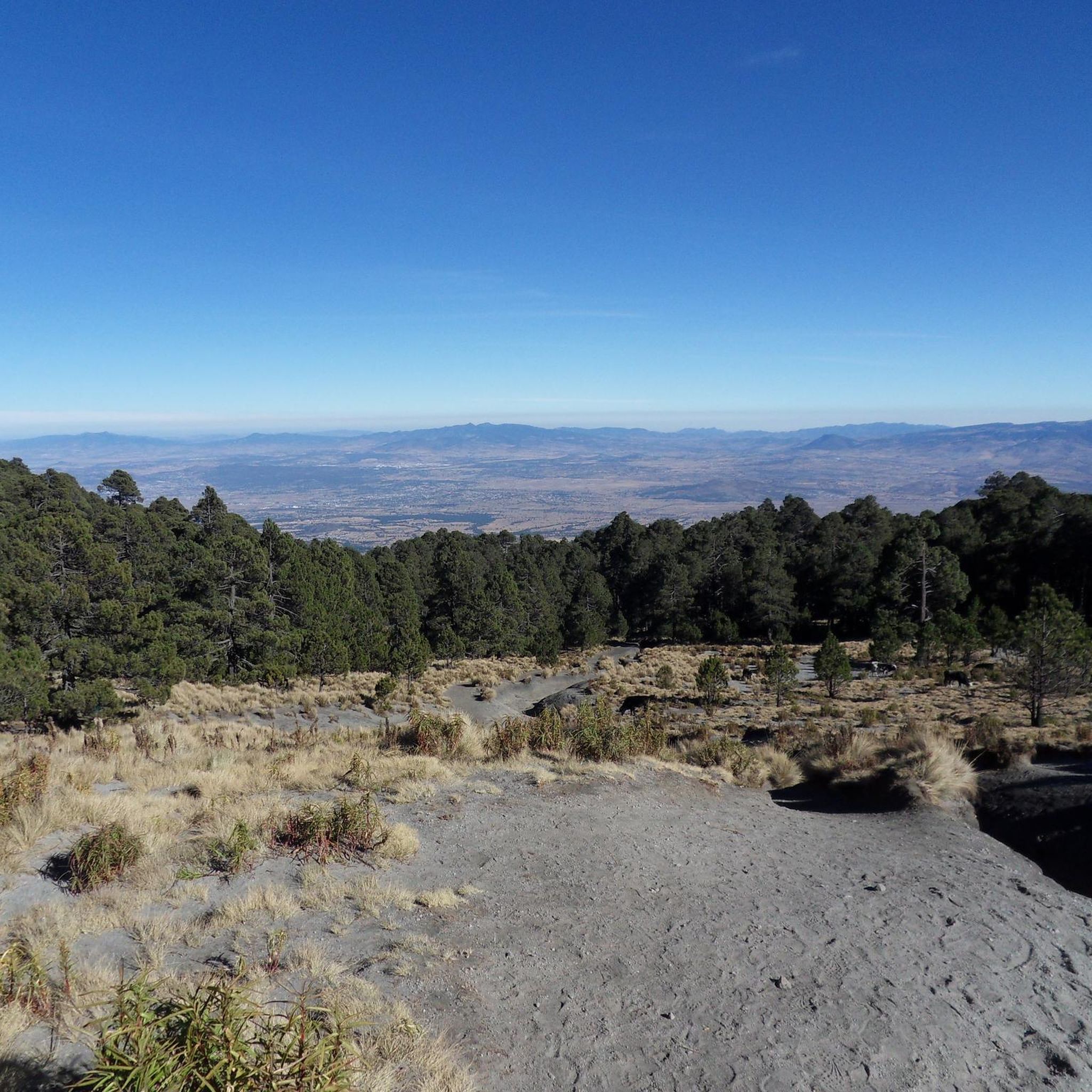
Mountain biking in La Montaña Malinche O Matlalcuéyatl offers diverse terrain across a majestic volcanic landscape. The region is characterized by high-altitude slopes, extensive coniferous forests of pine, oak, and oyamel trees, and varied surfaces. Riders can expect a mix of volcanic dirt trails and some paved sections, with significant elevation changes. Panoramic views of surrounding volcanoes like Popocatépetl and Pico de Orizaba are accessible from higher elevations.
Best mountain bike trails in La Montaña Malinche O Matlalcuéyatl
- The most…
Last updated: July 1, 2026
5.0
(1)
5
riders
Moderate mountain bike ride. Good fitness required. Suitable for all skill levels.
4.3
(3)
2
riders
25.4km
01:43
400m
400m
Moderate mountain bike ride. Good fitness required. Suitable for all skill levels.

Sign up for free
5
riders
20.6km
01:52
570m
570m
Moderate mountain bike ride. Good fitness required. Suitable for all skill levels.
5
riders
30.6km
02:40
690m
690m
Moderate mountain bike ride. Good fitness required. Suitable for all skill levels.
5.0
(3)
3
riders
33.1km
02:38
540m
540m
Moderate mountain bike ride. Good fitness required. Suitable for all skill levels.
Our route recommendations are based on thousands of hikes, rides, and runs completed by other people on komoot.
Start today with a free account
Your next adventure awaits.
Login or Signup
Popular around La Montaña Malinche O Matlalcuéyatl
Tips from the Community

To all those who are looking for a good route to squeeze their legs, you have to know this route 👍, bring a good sandwich 🫡and good luck warrior
0
0

Located at km 18. This plain allows you to see the volcano's majesty from the front, it is located next to a wide dirt and gravel road. Definitely a great place to take a picture with your friends or regroup.
0
0
They start at km 16. A local group of mountain bikers has placed yellow wooden signs, with different motivational phrases and that with a great sense of humor encourage you to go up the road. Undoubtedly a plus that adds a lot of value and support when climbing.
0
0

Excellent place
0
0

Frequently Asked Questions
How many mountain bike trails are available in La Montaña Malinche O Matlalcuéyatl?
There are several mountain bike trails in La Montaña Malinche O Matlalcuéyatl, with komoot featuring 6 routes. These include 1 easy and 5 moderate trails, offering diverse options for riders.
What kind of terrain can I expect on the mountain bike trails?
You can expect a varied terrain characterized by volcanic dirt trails and some paved sections. The region features high-altitude slopes and extensive coniferous forests of pine, oak, and oyamel trees, providing a mix of surfaces and significant elevation changes. Some routes may require very good fitness due to challenging segments.
What are the difficulty levels of mountain bike trails in La Montaña Malinche O Matlalcuéyatl?
The trails range from easy to moderate, with some sections offering more technical challenges. While komoot lists 1 easy and 5 moderate routes, the region is known for diverse options, including some that can be rated as black diamond difficulty, featuring singletrack and significant descents.
Are there any circular mountain bike routes in the area?
Yes, all the featured mountain bike routes in La Montaña Malinche O Matlalcuéyatl are circular. For example, you can explore the Telpuchac – Plain with a View of La Malinche loop from Santa Cruz Quilehtla, a moderate 16.0-mile (25.7 km) trail offering views of La Malinche.
Are there family-friendly mountain bike trails in La Montaña Malinche O Matlalcuéyatl?
While many trails are moderate, there is at least one easy mountain bike route available, which could be suitable for families or those looking for a less strenuous ride. It's always recommended to check the specific route details for elevation and technical sections to ensure it matches your family's skill level.
What are the best times of year for mountain biking in La Montaña Malinche O Matlalcuéyatl?
The dense coniferous forests provide shaded trails, making for a cooler experience. However, given the high altitude of La Malinche (up to 4,461 meters), the highest peaks can be covered in snow, especially during winter. Spring and autumn generally offer pleasant conditions, but always check local weather forecasts before heading out.
Are there any viewpoints or natural features to see along the trails?
Absolutely. From the upper sections and the summit, you can enjoy spectacular panoramic views of the surrounding landscape, including other prominent Mexican volcanoes like Popocatépetl, Iztaccíhuatl, and Pico de Orizaba, as well as the valleys of Puebla and Tlaxcala. The extensive coniferous forests themselves are a significant natural feature.
Where can I find parking for mountain biking in La Montaña Malinche O Matlalcuéyatl?
The Centro Vacacional IMSS La Malintzi, located within the National Park, serves as a convenient base for outdoor enthusiasts and typically offers parking facilities. It's a good starting point for many trails in the area.
Are there places to stay or eat near the mountain bike trails?
Yes, the Centro Vacacional IMSS La Malintzi provides amenities such as cabins, a camping area, shops, and a restaurant. This makes it a convenient spot for refreshments or overnight stays when exploring the mountain bike trails.
What do other mountain bikers say about the trails in La Montaña Malinche O Matlalcuéyatl?
The routes in La Montaña Malinche O Matlalcuéyatl are highly rated by the komoot community, with an average score of 4.8 stars from several reviews. Riders often praise the diverse terrain, the challenge of the volcanic landscape, and the impressive views from higher elevations.
Can I bring my dog on the mountain bike trails in La Montaña Malinche O Matlalcuéyatl?
As La Montaña Malinche is part of a National Park, regulations regarding pets on trails can vary. It's advisable to check with the park authorities directly or look for specific signage at trailheads regarding dog-friendly policies to ensure compliance.
What is a good moderate route for mountain biking in the region?
A popular moderate option is the Xotecomac – Poxcatzi loop from San Pablo del Monte. This 15.8-mile (25.4 km) path navigates through varied terrain with an elevation gain of over 1,300 feet, offering a rewarding ride.
Are there any longer mountain bike routes for experienced riders?
For a longer, moderate challenge, consider the Cacaloteyo – Poza del Diablo Ravine loop from Amozoc de Mota. This route spans 33.6 km (20.9 miles) with significant elevation changes, providing an extended adventure through the diverse landscape.
Most popular routes in La Montaña Malinche O Matlalcuéyatl

Get inspired with the komoot mobile app


Explore more
Browse the best MTB trails in other regions.
