The best road cycling routes in Stølsheimen Landskapsvernområde
5.0
(2)
25
riders
3
rides
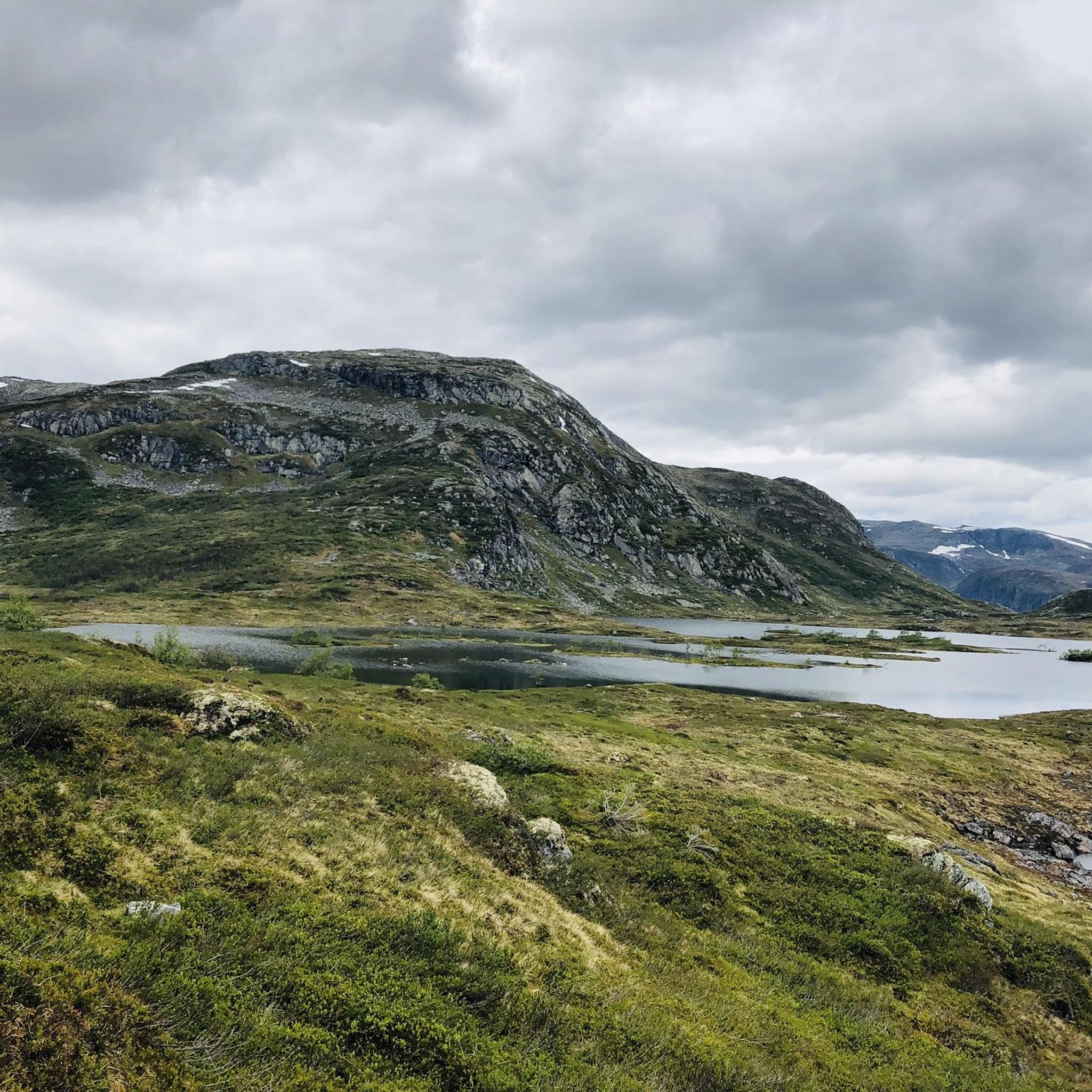
Road cycling in Stølsheimen Landskapsvernområde offers routes through a diverse and dramatic landscape, stretching from fjord-side roads to mountainous ascents. The region is characterized by wide valleys, treeless mountains, and a distinctive fjord environment, including arms of the Sognefjord. Cyclists encounter a hilly, mountainous area featuring numerous valleys, basins, streams, and lakes, with high mountain areas reaching 1200 to 1300 meters above sea level. Old farm roads provide less-trafficked, picturesque routes for road cyclists.
Best road cycling routes in Stølsheimen Landskapsvernområde
- The most popular road cycling route is Langhamrane – Klypeseggi loop from Hopperstad stavkyrkje, a 79.1 miles (127.3 km) trail that takes 7 hours 27 minutes to complete. This difficult route features significant elevation changes through mountainous terrain.
- Another top favourite among local road cyclists is Parking with beautiful view – View of Vikøyri and the Sognefjord loop from Hopperstad stavkyrkje, a difficult 61.6 miles (99.2 km) path. This route offers views of Vikøyri and the Sognefjord.
- Local road cyclists also love the Parking with beautiful view – View of Vikøyri and the Sognefjord loop from Myrkdalen Fjellandsby, a 48.8 miles (78.5 km) trail leading through varied landscapes with views of lakes and fjords, often completed in about 4 hours 50 minutes.
- Road cycling in Stølsheimen Landskapsvernområde is defined by fjord-side roads, mountainous ascents, and wide valleys. The network offers options for different ability levels, from moderate loops to challenging mountain routes.
- The routes in Stølsheimen Landskapsvernområde are highly rated by the komoot community with an average score of 5.0 stars from over 2 reviews. More than 26 road cyclists have used komoot to explore Stølsheimen Landskapsvernområde's varied terrain.
Last updated: July 1, 2026
5.0
(2)
12
riders
77.0km
04:46
1,940m
1,940m
Hard road ride. Very good fitness required. Some segments of this route may be unpaved and difficult to ride.
10
riders
99.2km
05:46
2,120m
2,120m
Hard road ride. Very good fitness required. Some segments of this route may be unpaved and difficult to ride.

Sign up for free
3
riders
Hard road ride. Very good fitness required. Mostly well-paved surfaces and easy to ride.
Our route recommendations are based on thousands of hikes, rides, and runs completed by other people on komoot.
Start today with a free account
Your next adventure awaits.
Login or Signup
Popular around Stølsheimen Landskapsvernområde
Tips from the Community

Myrkdalen valley, in summer, is a vibrant landscape of green pastures and winding rivers, popular for hiking and biking, offering a perfect blend of peaceful scenery and outdoor activity. In winter, it transforms into a snow-sure paradise for skiers, with wide, uncrowded slopes and majestic views of snow-covered mountains.
0
0
The view of Vikøyri and Sognefjord captures a great landscape where a small village is nestled along the shore of a majestic fjord. The traditional white houses of Vikøyri contrast with the deep blue waters and the towering mountains that rise dramatically from the water's edge.
1
0

Beautiful old burial mounds
1
0

Very nice parking lot
1
0
A beautiful village... great scenery! 🤩
2
0
Great panorama! 🤩
1
0

Base station of the Myrkdalen lift – easy access to the slopes, trails, and all the mountain action.
0
0

Beautiful view in the valley and on the water, up to the waterfall.
0
0
Frequently Asked Questions
What is the general difficulty level of road cycling routes in Stølsheimen Landskapsvernområde?
Stølsheimen Landskapsvernområde offers a range of road cycling routes, predominantly featuring challenging terrain. Out of the four routes listed, three are rated as 'difficult', and one is 'moderate'. This reflects the region's hilly and mountainous landscape, with significant elevation changes. For example, the Langhamrane – Klypeseggi loop from Hopperstad stavkyrkje involves over 2,600 meters of ascent.
Are there any beginner-friendly or less strenuous road cycling options in Stølsheimen Landskapsvernområde?
While many routes are challenging, there is a moderate option available. The Vetlavatnet loop from Vinje is a 26.8 km trail with around 688 meters of elevation gain, typically completed in about 1 hour 35 minutes. This route leads through valleys and past lakes, offering a less demanding experience compared to the more difficult mountain ascents.
What kind of landscapes and natural features can I expect to see while road cycling in Stølsheimen?
Road cycling in Stølsheimen Landskapsvernområde immerses you in a beautiful, varied, and dramatic protected landscape. You'll encounter wide valleys, treeless mountains, and a distinctive fjord landscape, including arms of the Sognefjord like Finnafjorden and Arnafjorden. The region is characterized by numerous valleys, basins, streams, and lakes, with high mountain areas reaching 1200 to 1300 meters above sea level. Expect lush vegetation and impressive waterfalls, especially during snowmelt, as it's one of Western Norway's wettest areas.
Are there any notable cultural or historical landmarks along the road cycling routes?
Yes, Stølsheimen is rich in cultural heritage. The landscape is dotted with traditional mountain summer farms (støl), such as Solrenningen and Selhamar, showcasing centuries of farming history. You might also find traces of Iron Age soapstone pot production and ancient wild reindeer trapping sites. The village of Ortnevik, though potentially off the main cycling routes, is known for its distinctive Dragon Style church, claimed to be the world's smallest stave church.
What is the best time of year for road cycling in Stølsheimen Landskapsvernområde?
Given the region's mountainous terrain and status as one of Western Norway's wettest parts, the best time for road cycling is typically during the warmer, drier months, generally from late spring through early autumn. This period offers more stable weather conditions and ensures that higher mountain passes are clear of snow, allowing access to the full network of routes.
What do other road cyclists say about their experience in Stølsheimen Landskapsvernområde?
The road cycling routes in Stølsheimen Landskapsvernområde are highly rated by the komoot community, with an average score of 5.0 stars from over 2 reviews. Cyclists often praise the varied terrain, from fjord-side roads to challenging mountain ascents, and the picturesque nature of the old farm roads that offer less-trafficked options.
Are there options for parking near the road cycling trailheads?
While specific parking locations for each trailhead are not detailed, the presence of villages like Vinje and Vikøyri, and starting points like Hopperstad stavkyrkje, suggests that parking facilities are available in or near these access points. For routes like the Parking with beautiful view – View of Vikøyri and the Sognefjord loop from Myrkdalen Fjellandsby, parking is explicitly mentioned as part of the route name, indicating designated spots.
Can I find amenities like cafes or accommodation along the road cycling routes?
Stølsheimen Landskapsvernområde is a protected area with a focus on natural and cultural landscapes. While specific cafes or pubs directly on the routes are not detailed, villages and hamlets within or bordering the area, such as Ortnevik or Vikøyri, may offer limited amenities. The region also features mountain cabins managed by the Norwegian Trekking Association, which could provide accommodation options for longer tours, though these are primarily aimed at hikers.
Are there any specific regulations or permits required for cycling in the protected landscape?
Cycling is generally permitted on trails and roads within the protected landscape. However, it's important to note that motorized traffic, including electric bikes, is typically not allowed in the protected areas without special permission. Always respect local signage and regulations to preserve the natural environment.
What wildlife might I encounter while cycling in Stølsheimen?
Stølsheimen is a vital habitat for wild reindeer, so you might be lucky enough to spot them. Other wildlife in the area includes red deer, hare, European golden plover, and ptarmigan. Near the fjords, harbor seals and harbor porpoises can sometimes be seen.
Are there any routes that offer particularly scenic views of the fjords?
Many routes in Stølsheimen Landskapsvernområde offer stunning fjord views, as the area borders the Sognefjord. The Parking with beautiful view – View of Vikøyri and the Sognefjord loop from Myrkdalen Fjellandsby explicitly highlights views of Vikøyri and the Sognefjord. The region's characteristic fjord landscape, with arms like Finnafjorden and Arnafjorden, ensures that many routes will provide dramatic vistas of these iconic waterways.
How long does it typically take to complete the road cycling routes?
The duration varies significantly based on the route's length and difficulty. For instance, the moderate Vetlavatnet loop from Vinje takes approximately 1 hour 35 minutes. More challenging routes, such as the Langhamrane – Klypeseggi loop from Hopperstad stavkyrkje, can take around 7 hours 17 minutes to complete due to their extensive distance (127.3 km) and significant elevation.
Most popular routes in Stølsheimen Landskapsvernområde

Get inspired with the komoot mobile app


Explore more
Browse the best Road cycling routes in other regions.
