The best MTB trails in Gámbita
11
riders
2
rides
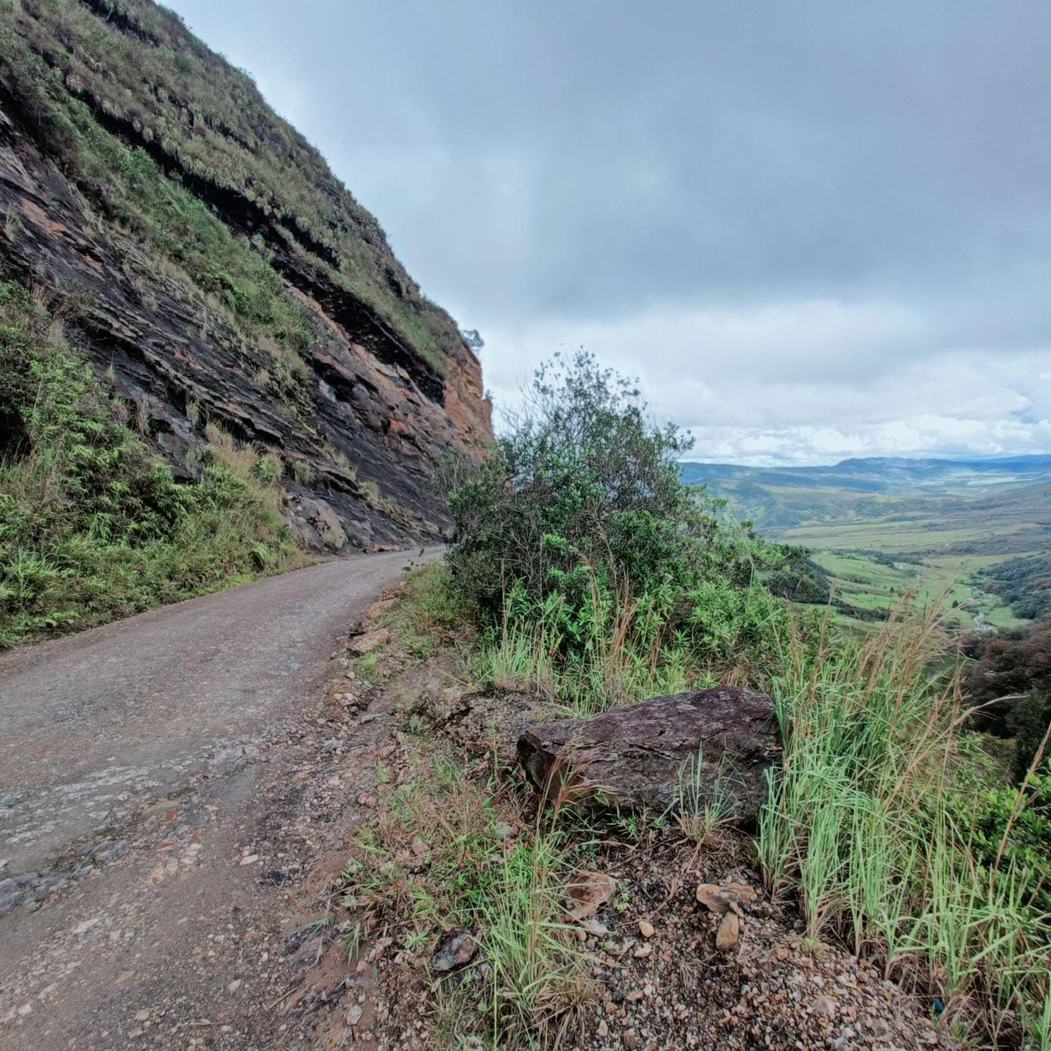
Mountain bike trails in Gámbita offer challenging routes through a landscape characterized by mountainous terrain, deep canyons, and numerous waterfalls. The region's natural heritage provides a setting for ecotourism and adventure, with lush greenery and varied elevations. Mountain biking in Gámbita Colombia involves significant ascents and descents, making it suitable for experienced riders seeking demanding trails.
Best mountain bike trails in Gámbita
- The most popular mountain bike trail is Cucaracha Hill loop from Chitaraque, a difficult 20.0 miles (32.3…
Last updated: June 29, 2026
4
riders
32.5km
03:28
1,020m
1,020m
Hard mountain bike ride. Very good fitness required. Suitable for all skill levels.
4
riders
52.8km
04:57
1,670m
1,670m
Hard mountain bike ride. Very good fitness required. Suitable for all skill levels.

Sign up for free
3
riders
48.1km
04:18
1,120m
1,120m
Hard mountain bike ride. Very good fitness required. Suitable for all skill levels.
Our route recommendations are based on thousands of hikes, rides, and runs completed by other people on komoot.
Start today with a free account
Your next adventure awaits.
Login or Signup
Popular around Gámbita
Tips from the Community

Beautiful place full of magic and nature. Getting there by bike is even more special.
0
0
Getting there is satisfying after a lot of effort, from any direction and then the waterfall is very beautiful, in addition to the surrounding nature.
0
0

Beautiful waterfall next to the road. Segment from Moniquirá and Arcabuco
0
0
Beautiful place. Beautiful landscape. Recommended
0
0
Frequently Asked Questions
What kind of terrain can I expect on mountain bike trails in Gámbita?
Gámbita's mountain bike trails are characterized by impressive mountainous terrain, deep canyons, and lush greenery. You should expect significant ascents and descents, making for challenging and rewarding rides through diverse natural landscapes.
Are there any mountain bike trails that feature waterfalls in Gámbita?
Yes, Gámbita is renowned for its numerous waterfalls. The Serranía El Peligro Waterfall – Alto de la Cumbre Shrine loop from Moniquirá is one such route that passes by natural features like waterfalls. The region also boasts stunning cascades like Manto de La Virgen and La Humeadora, which offer unique natural spectacles.
What is the typical length and elevation gain for mountain bike routes in Gámbita?
The mountain bike routes in Gámbita are generally long and feature substantial elevation changes. For example, the Cucaracha Hill loop from Chitaraque is 32.3 km (20.0 miles) with over 1000 meters of elevation gain, while the Serranía El Peligro Waterfall – Alto de la Cumbre Shrine loop from Moniquirá covers 53.6 km (33.3 miles) with over 1600 meters of ascent.
Are there any circular mountain bike routes available in Gámbita?
Yes, all the mountain bike routes highlighted in this guide are circular loops. This includes the Cucaracha Hill loop from Chitaraque, the Serranía El Peligro Waterfall – Alto de la Cumbre Shrine loop from Moniquirá, and the New Route loop from Togüí, allowing you to start and finish at the same point.
What other natural attractions can be explored in Gámbita besides waterfalls?
Beyond its many waterfalls, Gámbita offers impressive natural features such as the Hondura Canyon, known for its panoramic views from its highest points. The Chocó Cave is another notable natural feature, offering opportunities for exploration. The region is also rich in lush oak forests and unique rock formations with turquoise waters.
Is Gámbita suitable for beginner mountain bikers or families?
The mountain bike routes in this guide are all classified as difficult, featuring significant elevation gains and challenging terrain. This makes them more suitable for experienced riders seeking demanding trails rather than beginners or families with young children.
What is the best time of year for mountain biking in Gámbita?
While specific seasonal data isn't available, Gámbita's climate generally supports outdoor activities. It's advisable to check local weather forecasts before your trip, especially concerning rainfall, as wet conditions can make challenging trails even more demanding.
Are there any cafes or places to refuel near the mountain bike trails in Gámbita?
Gámbita is a municipality with local amenities. While specific cafes directly on the trails are not detailed, you can typically find places to refuel in the main towns or villages near the trailheads, such as Chitaraque, Moniquirá, or Togüí, depending on your chosen route.
What kind of wildlife might I encounter while mountain biking in Gámbita?
Gámbita's lush natural environment, including its forests and diverse landscapes, supports various local wildlife. While specific sightings cannot be guaranteed, you might encounter different bird species and other small animals typical of Colombian mountainous regions. Always respect their natural habitat.
Where can I find parking or access public transport for mountain biking in Gámbita?
Specific parking areas or public transport links for individual trailheads are not detailed in this guide. However, you can generally find parking in the towns where the loops begin, such as Chitaraque, Moniquirá, or Togüí. For public transport, local bus services often connect these towns within the Santander department.
What makes Gámbita a unique destination for mountain biking?
Gámbita stands out for its exceptional natural heritage, offering a blend of challenging mountainous terrain, deep canyons, and an abundance of stunning waterfalls. Its suitability for ecotourism and adventure, combined with lush oak forests and unique geological features, provides a truly immersive and demanding mountain biking experience.
Most popular routes in Gámbita

Get inspired with the komoot mobile app


Explore more
Browse the best MTB trails in other regions.
