The best mountain hikes around Réotier
22
hikers
4
hikes
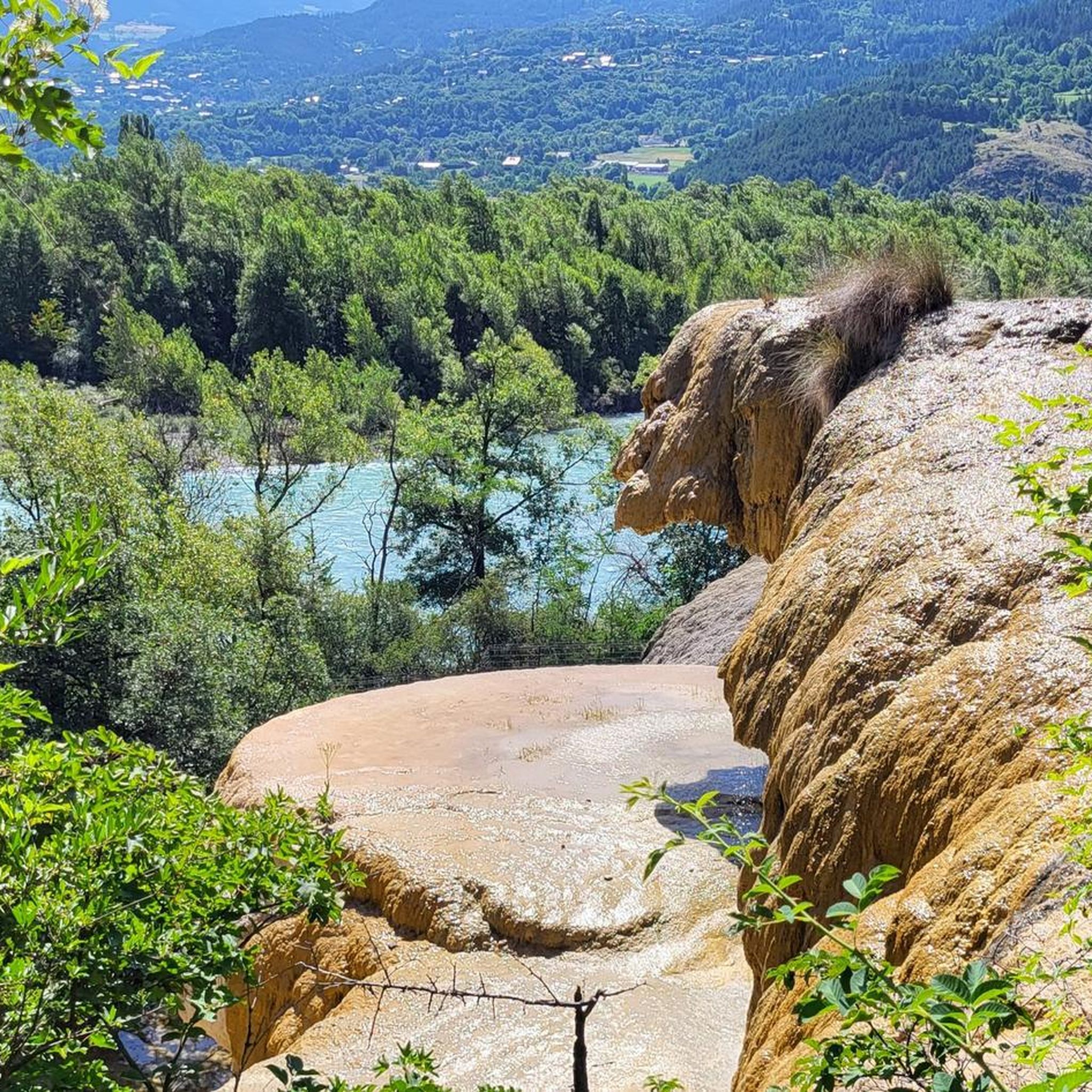
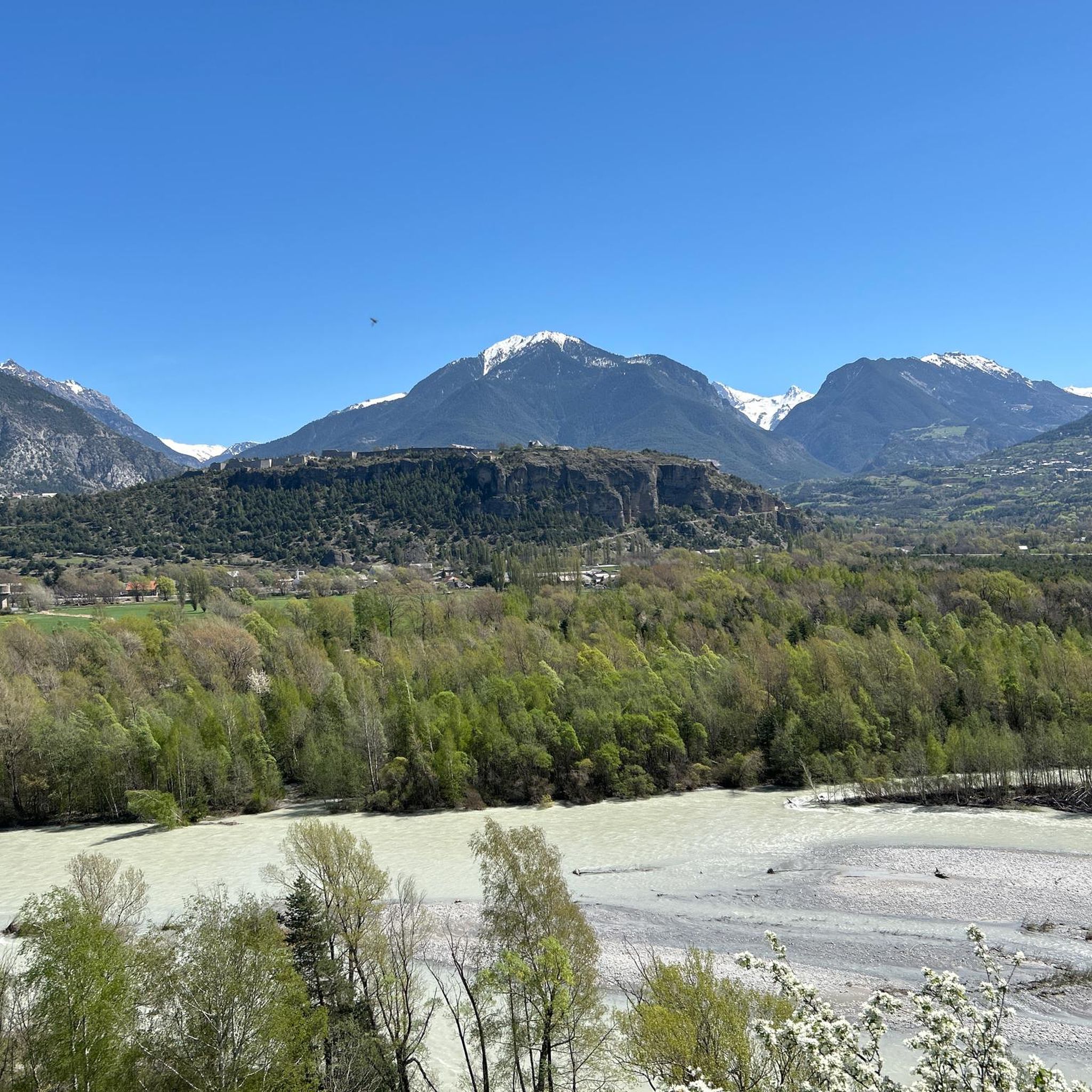
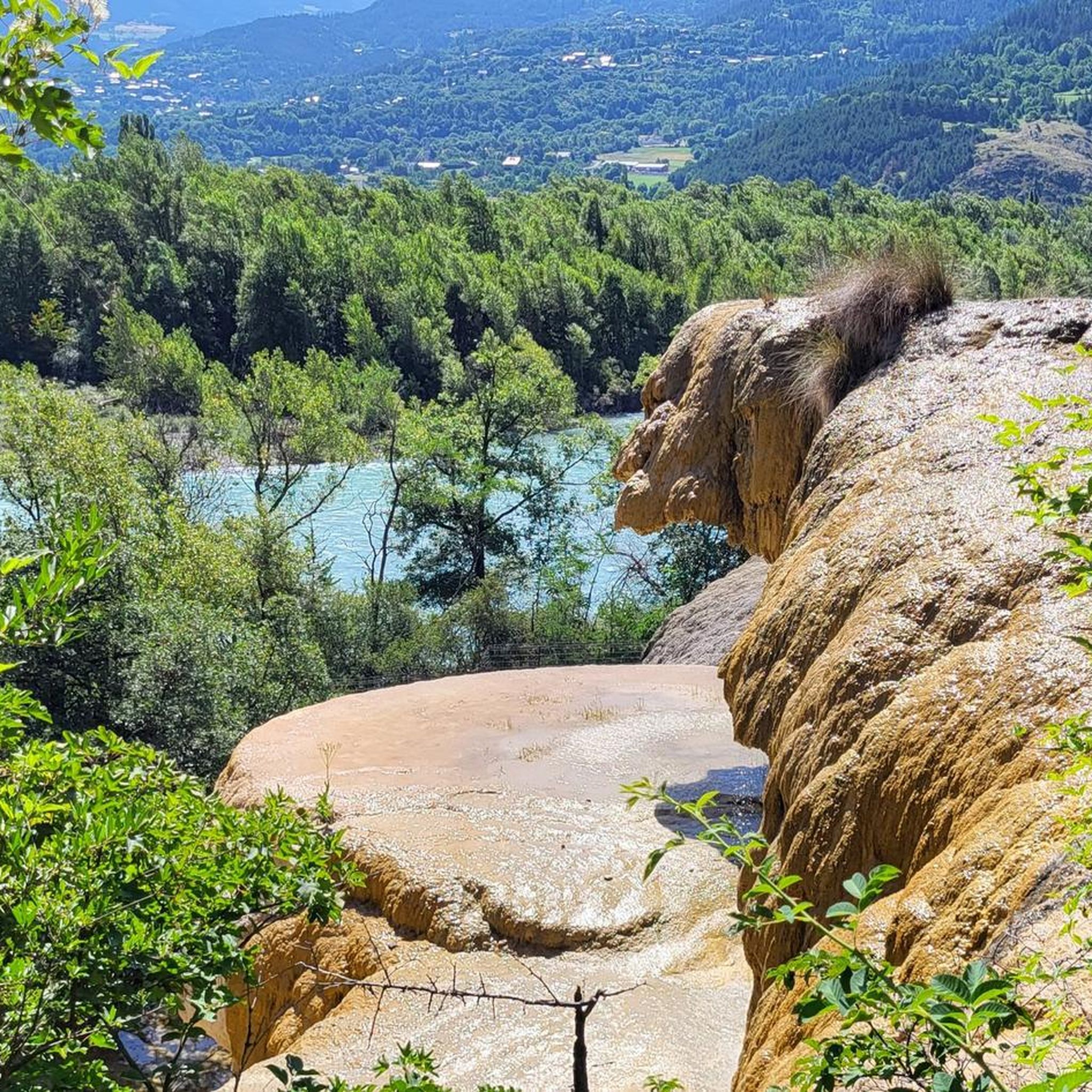
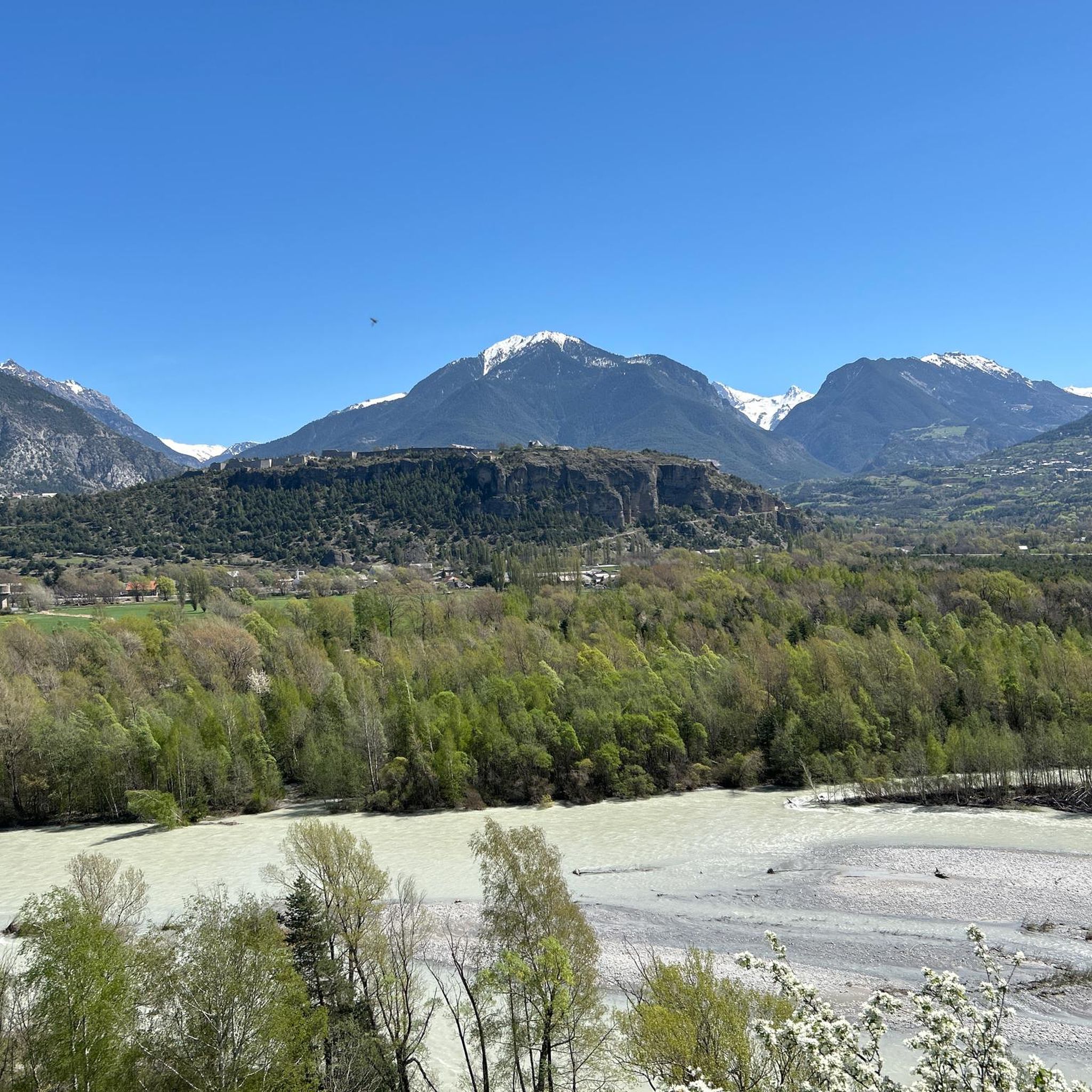
Mountaineering routes around Réotier are situated in the Hautes-Alpes region of France, offering diverse terrain for mountain pursuits. The area is characterized by its proximity to Ecrins National Park and Queyras Regional Natural Park, featuring landscapes from larch forests and flower-filled meadows to high mountain hamlets. Notable peaks like the Tête de Vautisse, rising over 3000 meters, provide challenging ascents and expansive views over the Durance valley. The region's geology includes unique formations such as the Petrified Fountain, a protected…
Last updated: May 23, 2026
9
hikers
3.84km
02:19
350m
350m
Hard mountaineering route. Good fitness required. Sure-footedness, sturdy shoes and alpine experience required.
6
hikers
2.37km
01:14
200m
200m
Hard mountaineering route. Great for any fitness level. Sure-footedness, sturdy shoes and alpine experience required.

Sign up for free
4
hikers
11.2km
05:14
730m
730m
Hard mountaineering route. Very good fitness required. Mostly accessible paths. Sure-footedness required.
3
hikers
Moderate mountaineering route. Good fitness required. Easily-accessible paths. Suitable for all skill levels.
Our route recommendations are based on thousands of hikes, rides, and runs completed by other people on komoot.
Start today with a free account
Your next adventure awaits.
Login or Signup
Tips from the Community

A summit with wonderful views: from the Barre des Ecrins to the Pic de Rochebrune. Reached from Ponteil, towards Cabane de l'Alp, and a portage from 2,700 m along the NE ridge. Technical descent (S3/S4) from the SW ridge.
0
0

A via ferrata course rated blue, traversing a cliff above a spectacular valley of forested peaks.
1
0

On the way to Dormillouse you pass several waterfalls. Search the smallest paths to waterfalls from where you can see the clatter on the stones even better.
0
0
Dormillouse a mountain village located in the Ecrins Mountains. Very remote and only accessible on foot. The village has only a handful of inhabitants and is surrounded by beautiful nature. Gite has been built in the old school and, in addition to good food, also sleeping.
0
0

The Tête de Vautisse peaks at 3,156 meters above sea level. In good weather, you can enjoy a panorama of Mont Blanc, Mont Viso, and Mont Ventoux.
1
0

Cascade de la Byasse, which crosses the village of Dormillouse
0
0
The school in the village of Dormillouse, now transformed into a pleasant gîte. Ideal for a stopover in the last alpine village of Ecrins.
0
0
Frequently Asked Questions
What kind of mountaineering routes can I expect around Réotier?
Réotier offers a variety of mountaineering routes, ranging from moderate ascents to challenging high-altitude trails. You'll find paths through larch forests, flower-filled meadows, and dramatic cliff faces, with some routes leading to high mountain hamlets or summits over 3000 meters. The area is situated in the Hautes-Alpes region, near the Écrins National Park and Queyras Regional Natural Park.
Are there any moderate mountaineering routes in Réotier?
Yes, there is at least one moderate mountaineering route available. Consider the Byasse Waterfall – Dormillouse - School guesthouse loop from Parking du Pont du Laus. This route is approximately 8 kilometers long and takes about 2 hours 38 minutes to complete, offering a less strenuous option while still providing beautiful scenery.
What are some challenging mountaineering routes in the Réotier area?
For those seeking a challenge, Réotier has several difficult routes. The Palluel Lake loop from Parking riverains is a demanding 13.6 km trail that typically takes over 6 hours, offering stunning views of Lake Palluel. Another option is the Tête de Vautisse loop from Cabane de l'Alp, which leads to the summit of Tête de Vautisse, a peak exceeding 3000 meters.
Can I find circular mountaineering routes in Réotier?
Yes, several mountaineering routes in Réotier are circular. Examples include the Palluel Lake loop from Parking riverains, the La Falaise loop from Freissinières, and the Tête de Vautisse loop from Cabane de l'Alp, all designed as loops for convenient exploration.
Are there any waterfalls to see along the mountaineering routes?
Yes, the region features beautiful water elements. The Byasse Waterfall – Dormillouse - School guesthouse loop from Parking du Pont du Laus specifically includes the Byasse Waterfall. Additionally, the Simoust waterfall is a short stroll between Réotier and Eygliers, providing another serene spot.
What unique natural attractions can I discover near Réotier?
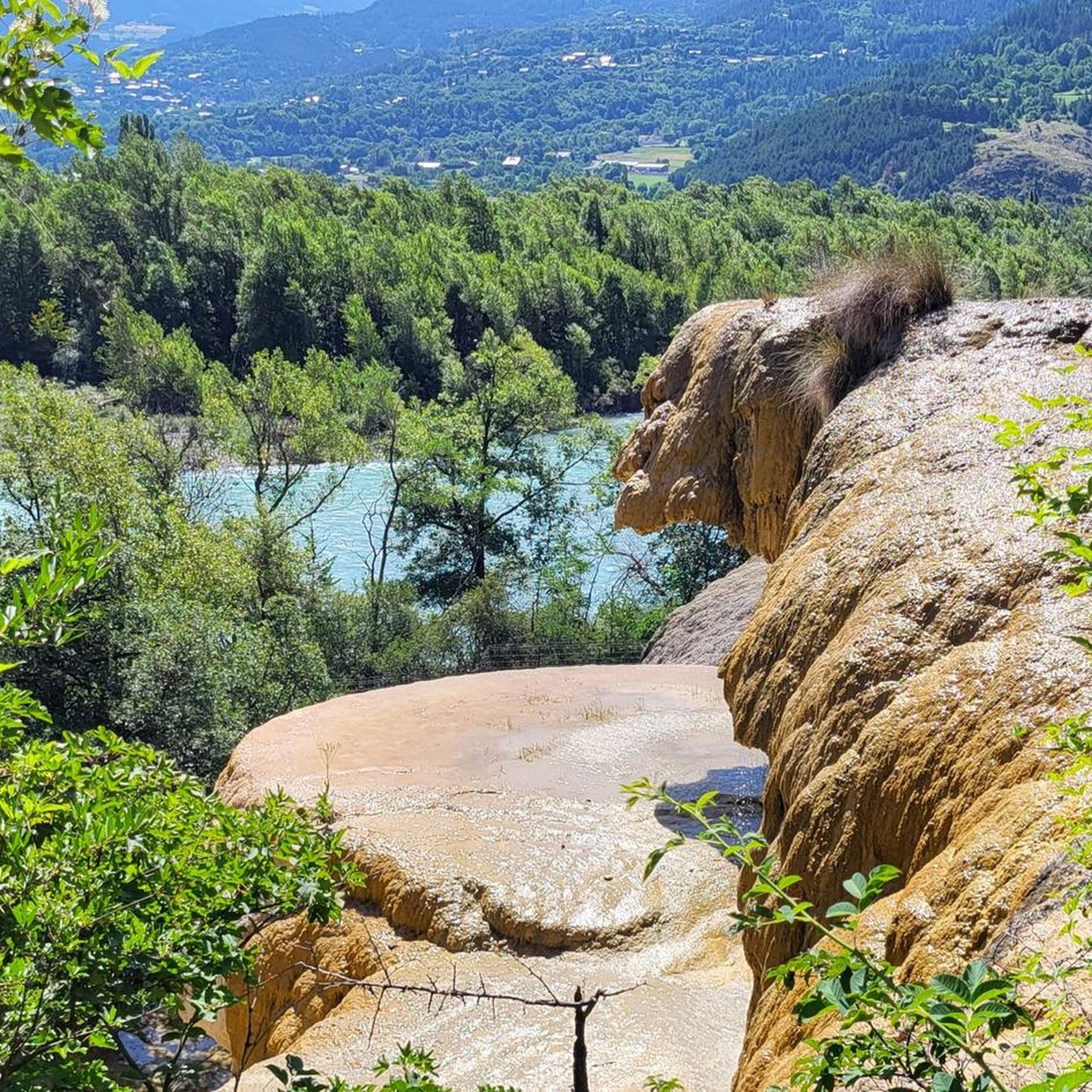
Réotier is home to the fascinating Petrifying Fountain (Fontaine Pétrifiante), a unique geological phenomenon where limestone-laden water creates 'alien rock formations.' This continuously evolving site is a testament to the area's geological wonders. You can learn more about it at Atlas Obscura.
What do other mountaineers say about the routes in Réotier?
The mountaineering routes around Réotier are highly regarded by the komoot community, holding an average rating of 5.0 stars from over 7 reviews. Mountaineers frequently praise the diverse terrain, from high mountain peaks to varied forest trails, and the dramatic cliff faces that define the region's network of paths.
Are there any notable viewpoints or summits accessible via mountaineering routes?
Absolutely. The Tête de Vautisse loop from Cabane de l'Alp leads to the summit of Tête de Vautisse, which offers breathtaking panoramas that can include Mont Blanc, Mont Viso, and Mont Ventoux on clear days. Other viewpoints in the area include Homme de Pierre Viewpoint and View of Mont-Dauphin and the Écrins.
What kind of wildlife might I encounter while mountaineering in Réotier?
The diverse flora and fauna of the Réotier region offer opportunities to spot various wildlife. On higher ground and designated trails, you might have the chance to see marmots, which are common in the alpine environment.
Are there any lakes to visit along or near the mountaineering trails?
Yes, the region is dotted with beautiful lakes. The Palluel Lake loop from Parking riverains offers views of Lake Palluel. Other notable lakes in the vicinity include Lake Peyrol, Eygliers Lake, and Lac Faravel.
What is the best season for mountaineering in Réotier?
While specific conditions vary, the summer months generally offer the most favorable weather for mountaineering in Réotier, with clear days providing expansive views. However, the region's high-altitude terrain means conditions can change rapidly, so always check local forecasts and trail conditions before heading out.
Most popular routes around Réotier
Most popular attractions around Réotier

Get inspired with the komoot mobile app


Explore more
Browse the best Mountain Hikes & Routes in other regions.
