The best MTB trails around Montelapiano
5.0
(1)
27
riders
6
rides
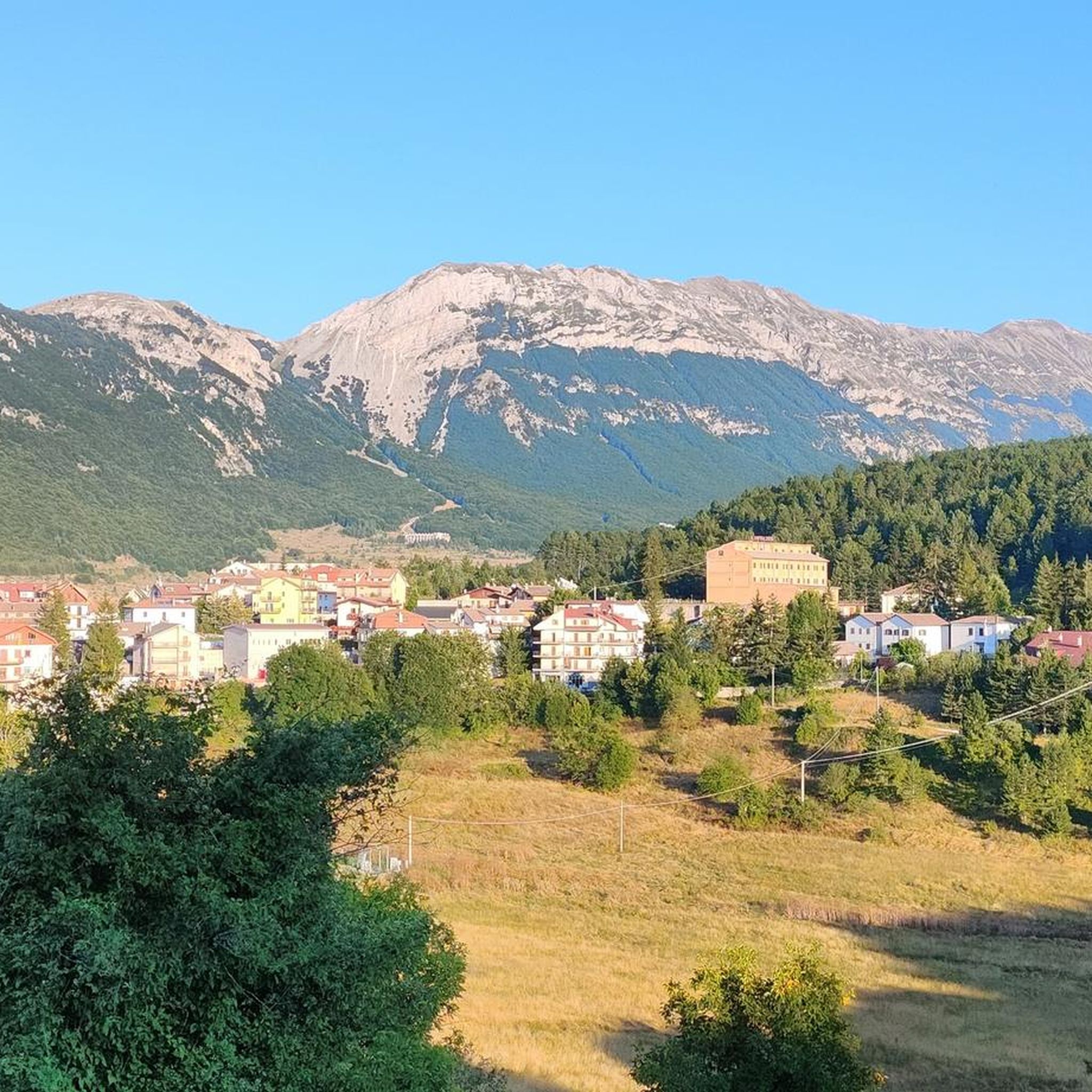
Mountain bike trails around Montelapiano offer a diverse and rugged landscape for riders. The region is characterized by mountainous terrain and rocky ridges, formed by limestone marly rock, providing a naturally varied environment. This area features technical singletracks, challenging climbs, and descents, appealing to mountain bikers seeking engaging rides. Panoramic views of the surrounding peaks and valleys are common along these routes.
Best mountain bike trails around Montelapiano
- The most popular mountain bike trail is Monument to Silvio Spaventa – Megalithic Walls loop from Bomba, a 31.0 miles (49.9 km) trail that takes 3 hours 41 minutes to complete. This difficult route features significant elevation gain through varied terrain.
- Another top favourite among local mountain bikers is Prato Gentile Arch Bridge – Corso Capracotta loop from Roio del Sangro, a difficult 28.3 miles (45.5 km) path. This route offers extensive climbs and descents with wide-ranging views.
- Local mountain bikers also love the Pizzoferrato Rock Formation – Belvedere of Gamberale loop from Pizzoferrato, a 11.1 miles (17.8 km) trail leading through mountainous landscapes, often completed in about 1 hour 35 minutes.
- Mountain biking around Montelapiano is defined by rocky ridges, mountainous terrain, and panoramic viewpoints. The network offers options for moderate to difficult ability levels.
- The guide includes highly-rated routes that showcase the best of the region's landscape. More than 20 mountain bikers have used komoot to explore Montelapiano's varied terrain.
Last updated: May 15, 2026
7
riders
48.7km
03:37
990m
990m
Hard mountain bike ride. Very good fitness required. Suitable for all skill levels.
6
riders
38.6km
04:10
1,380m
1,380m
Hard mountain bike ride. Very good fitness required. Advanced riding skills necessary.

Sign up for free
3
riders
Moderate mountain bike ride. Good fitness required. Advanced riding skills necessary.
5.0
(1)
3
riders
Hard mountain bike ride. Very good fitness required. Suitable for all skill levels.
8
riders
48.1km
03:33
1,030m
1,030m
Hard mountain bike ride. Very good fitness required. Advanced riding skills necessary.
Our route recommendations are based on thousands of hikes, rides, and runs completed by other people on komoot.
Start today with a free account
Your next adventure awaits.
Login or Signup



Tips from the Community

The Gamberale Viewpoint is a breathtaking natural terrace located at the highest point of the village, offering an extraordinary view spanning the Sangro Valley and the rugged peaks of the Majella and neighboring Molise. This panoramic vantage point, suspended between sky and rock, allows you to take in a vast horizon of dense forests and small hilltop villages, offering a sense of absolute peace and a privileged perspective on the wild heart of the Apennines.
0
0

The Guado Liscia refuge is nestled in the woods of Alto Molise, on the pass connecting Agnone and Capracotta, practically on the border with Abruzzo. It's a popular stopping point for hikers, motorcyclists, and cyclists, offering traditional cuisine, a simple yet welcoming atmosphere, and good reviews for the quality of the food. It's open year-round, and in winter, it becomes a strategic shelter along the area's often snow-covered roads, offering refreshment amidst unspoiled nature and mountain views.
0
0

Pescopennataro is a village in upper Molise perched on a beautiful rocky ridge. The town offers enchanting views of the surrounding valleys. You can also enjoy a nature walk in the Pinocchio Park.
0
0
Hermitage set in the rock, tradition has it that it was a place of passage for the evangelist Luke on his journey between Rome and Palestine.
0
0

and an adjoining church which cannot also be visited.
0
0
"hermitage dedicated to the Patron Saint of Pescopennataro. The site opens once a year, during the festival dedicated to him
0
0
Cool place ideal for picnics.
0
0

The Refuge and the Baita Prato Gentile are accommodation facilities in a panoramic area surrounded by nature, close to the cross-country ski runs and hiking trails of Prato Gentile. Various services are available with a bar and restaurant serving typical Molise cuisine, as well as having an area equipped for outdoor picnics.
1
0
Frequently Asked Questions
How many mountain bike trails are there around Montelapiano?
There are over 4 mountain bike trails around Montelapiano, offering a diverse and rugged landscape for riders. These routes have been explored by more than 20 mountain bikers using komoot.
What is the typical difficulty level of mountain bike trails in Montelapiano?
Mountain bike trails around Montelapiano are generally challenging. You'll find 1 moderate route and 3 difficult routes, characterized by significant elevation gain, technical singletracks, and rocky climbs.
What kind of terrain and elevation can I expect on Montelapiano's mountain bike trails?
The terrain around Montelapiano is rugged and varied, defined by rocky ridges and mountainous landscapes composed of limestone marly rock. Expect technical singletracks, challenging climbs, and thrilling descents. For instance, the Prato Gentile Arch Bridge – Corso Capracotta loop from Roio del Sangro features over 1000 meters of elevation gain.
Are there any circular mountain bike trails in Montelapiano?
Yes, many of the mountain bike trails around Montelapiano are circular. For example, the challenging Monument to Silvio Spaventa – Megalithic Walls loop from Bomba is a 49.9 km loop that takes about 3 hours 41 minutes to complete.
What natural features or viewpoints can I see along the mountain bike trails?
The region offers breathtaking panoramic views. From Montelapiano, you can overlook the belvedere surrounding Palazzo Square, and a viewpoint near the war memorial provides incredible vistas spanning from Lake Bomba to the surrounding peaks. You might also encounter the View of the Pescopennataro Crags or the Waterfall in Gola di Pennadomo.
Are there any historical landmarks or attractions near the mountain bike routes?
Yes, you can combine your ride with visits to historical sites. The impressive Castello di Roccascalegna is a significant attraction in the vicinity. You might also pass by the Church of Saint Peter or the Iuvanum Archaeological Park.
What is the longest mountain bike trail available?
The longest mountain bike trail is the Monument to Silvio Spaventa – Megalithic Walls loop from Bomba, which spans 49.9 kilometers and features nearly 989 meters of ascent.
What is the shortest mountain bike trail available?
The shortest mountain bike trail is the Pizzoferrato Rock Formation – Belvedere of Gamberale loop from Pizzoferrato, covering 17.8 kilometers with 381 meters of elevation gain. This moderate route can typically be completed in about 1 hour 35 minutes.
Are there any trails that offer extensive climbs and descents?
Absolutely. The Prato Gentile Arch Bridge – Corso Capracotta loop from Roio del Sangro is a difficult route known for its extensive climbs and descents, featuring over 1000 meters of both ascent and descent over 45.5 kilometers.
What kind of experience do local mountain bikers enjoy most in Montelapiano?
Local mountain bikers appreciate the diverse and rugged landscapes, the challenging nature of the trails, and the rewarding panoramic views. The area's rocky ridges and varied terrain provide an engaging experience for those seeking technical rides and significant elevation changes.
Is there a mountain bike trail that goes through forested areas?
Yes, the Bosco di Monte Fischietto loop from Montazzoli is a difficult 36.9 km route that takes you through the Bosco di Monte Fischietto, offering a forested riding experience with nearly 961 meters of elevation gain.
Most popular attractions around Montelapiano

Get inspired with the komoot mobile app


Explore more
Browse the best MTB trails in other regions.
