The best running trails around Falciano Del Massico
45
runners
10
runs
Jogging around Falciano Del Massico offers diverse natural landscapes for runners. The region is characterized by its position at the foothills of Monte Massico, providing varied terrain from challenging mountain paths to serene lake-side routes. Runners can explore dense woodlands, Mediterranean scrub, and the tranquil environment around Falciano Lake. This area provides a blend of elevation changes and flat sections, catering to different running preferences.
Best jogging routes around Falciano Del Massico
- The most popular jogging route is Baia Domizia…
Last updated: June 27, 2026
1
runners
8.91km
01:10
340m
340m
Hard run. Very good fitness required. Mostly paved surfaces. Suitable for all skill levels.
24
runners
5.13km
00:32
0m
10m
Moderate run. Good fitness required. Mostly paved surfaces. Suitable for all skill levels.

Sign up for free
7
runners
6.28km
00:39
10m
10m
Moderate run. Good fitness required. Mostly paved surfaces. Suitable for all skill levels.
4
runners
8.52km
00:53
50m
50m
Moderate run. Good fitness required. Mostly paved surfaces. Suitable for all skill levels.
3
runners
4.78km
00:30
20m
20m
Easy run. Great for any fitness level. Mostly paved surfaces. Suitable for all skill levels.
Get access to more routes and recommendations from other explorers.
Sign up for free
Already have an account?
Our route recommendations are based on thousands of hikes, rides, and runs completed by other people on komoot.
Start today with a free account
Your next adventure awaits.
Login or Signup
Tips from the Community

The climb to the Castle is quite steep but not very long, the last stretch is not easy to ride on a mountain bike. But the effort and the fatigue are rewarded by an exceptional view. To do ……
0
0

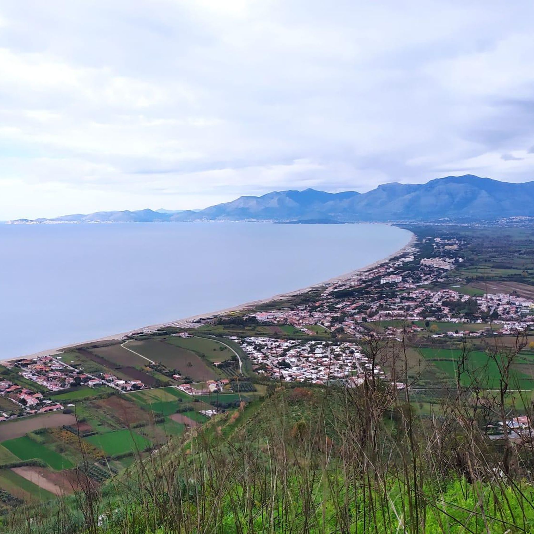
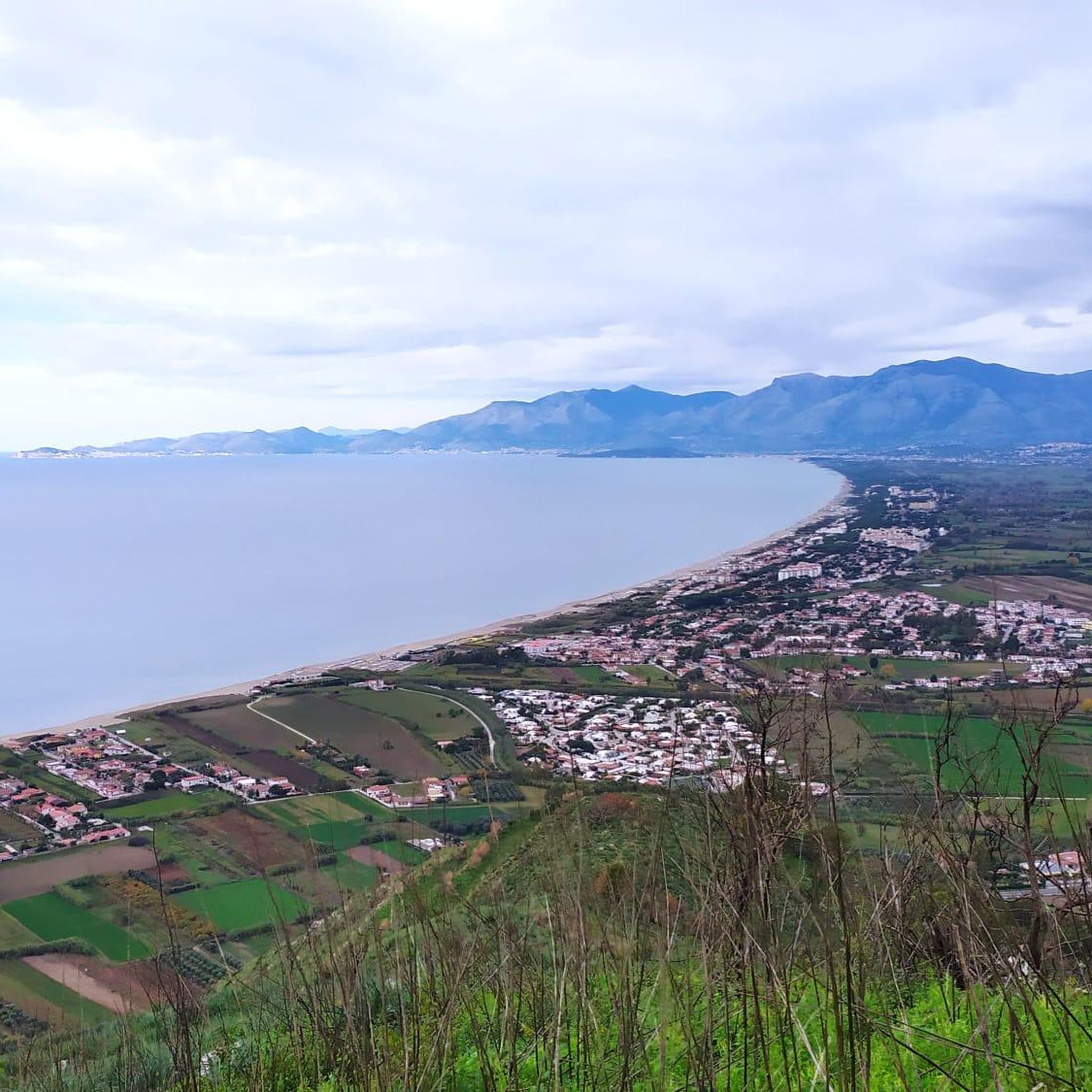
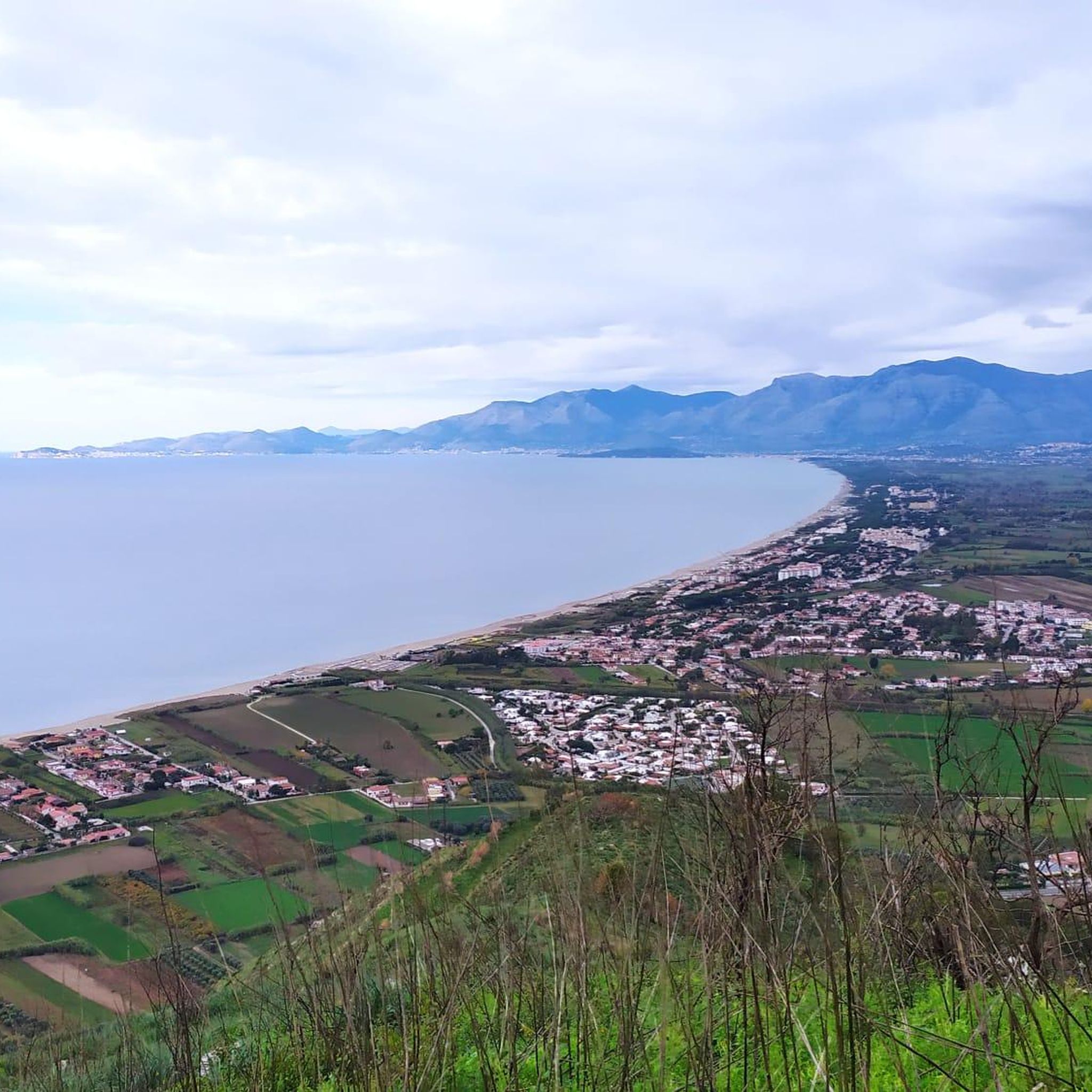
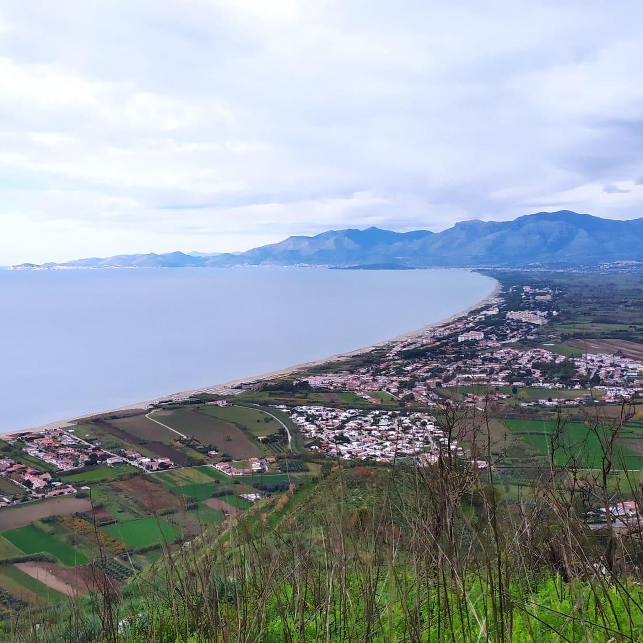
This medieval fortress is located at the top of Monte Petrino, at 412 metres. One of the hypotheses is that the fortress was created by the Longobards, then it was in possession of the Normans, Swabians, Angevins, and finally by the Aragonese.
2
0
From here you can see very well the southern slope of Monte Petrino (412 meters), and you can also see a part of the Rocca Montis Dragone.
1
0
Monte Petrino is a relief that is 412 meters high. At the top is the medieval fortress "Rocca Montis Dragonis". From here the view of the sea and of Mondragone is beautiful.
1
0

Would basically be a beautiful piece of nature, but just - the garbage ....
2
0
Deserted beaches - all tourists gone! If it's not too cold, you can swim undisturbed.
1
0
Frequently Asked Questions
How many running routes are available around Falciano Del Massico?
There are 6 dedicated running routes around Falciano Del Massico documented on komoot. These routes offer a variety of experiences, from easy jogs to more challenging trail runs.
Are there any easy jogging routes suitable for beginners or a relaxed run?
Yes, for an easier and more relaxed run, consider the Running loop from Nocelleto di Carinola. This route is approximately 3 miles (4.8 km) long and features minimal elevation changes, making it ideal for a gentle jog or a recovery run.
What kind of terrain can I expect on the running trails in Falciano Del Massico?
The terrain varies significantly. Around Falciano Lake, you'll find flatter, more tranquil paths, while the slopes of Monte Massico offer hilly terrain with elevation changes, winding through dense woods and Mediterranean scrub. Routes like From Mondragone to Monte Petrino provide a challenging experience with notable ascents and descents.
Are there any running routes with scenic views or landmarks?
Many routes offer scenic views, especially those on Monte Massico, which provide panoramic vistas of the Campania region, including Mount Vesuvius and the sea. For specific landmarks, the Sessa Aurunca – Roman Theater of Sessa Aurunca loop from Sessa Aurunca passes by historical sites. Additionally, you can explore nearby attractions like the Monastery of Saint Anna or the Rocca di Monte Dragonis.
Can I find circular jogging paths in the area?
Yes, several routes are designed as loops, offering a convenient circular experience. Examples include the popular Baia Domizia Beach loop from Baia Domizia, which is a coastal run, and the Running loop from Carano, which winds through the local countryside.
What is the best time of year to go jogging in Falciano Del Massico?
The region is enjoyable for jogging throughout much of the year. Spring and autumn offer pleasant temperatures and lush landscapes. During summer, the Mediterranean macchia provides some shaded areas, but early mornings or late afternoons are recommended to avoid the midday heat. Winter can also be suitable, especially on milder days, with the advantage of fewer crowds.
Are there any challenging running routes for experienced trail runners?
Absolutely. For those seeking a more demanding run, routes on Monte Massico provide significant elevation changes and rugged terrain. The From Mondragone to Monte Petrino route, for instance, is classified as difficult, featuring substantial climbs and descents over its 5.5 miles (8.9 km).
Is Falciano Lake suitable for jogging?
The tranquil environment around Falciano Lake Nature Reserve offers a serene setting for jogging. While specific marked jogging paths around the entire perimeter might not be explicitly detailed, the flat terrains surrounding the lake provide excellent opportunities for peaceful, less strenuous runs amidst diverse flora and fauna, including various bird species.
What do other runners say about jogging in Falciano Del Massico?
Over 40 runners have used komoot to explore Falciano Del Massico's varied terrain. They often praise the region's diverse natural landscapes, from the challenging mountain paths of Monte Massico to the serene lakeside routes, highlighting the blend of elevation changes and flat sections that cater to different running preferences.
Are there any specific rules or considerations for running with dogs on the trails?
While the region is rich in natural areas like the WWF Oasis of Monte Massico and Falciano Lake Nature Reserve, it's always advisable to check local regulations regarding dogs in protected areas. Generally, dogs should be kept on a leash to protect local wildlife and ensure a pleasant experience for all trail users.
Are there options for parking near the trailheads?
Given the natural and somewhat wild character of the area, parking availability can vary. For routes starting from towns or villages like Baia Domizia, Carano, or Sessa Aurunca, you can typically find public parking. For more remote trailheads on Monte Massico, it's recommended to check specific starting points for designated parking areas or suitable roadside spots.
Can I reach the running trails using public transport?
Access to some trailheads, especially those starting from larger towns like Mondragone or Sessa Aurunca, may be possible via local public transport. However, many of the more natural and remote running spots, particularly on Monte Massico, might require private transportation to reach conveniently. It's best to research local bus schedules or train connections to nearby towns and plan accordingly.
Most popular routes around Falciano Del Massico
Most popular attractions around Falciano Del Massico

Get inspired with the komoot mobile app


Explore more
Browse the best Running Trails & Routes in other regions.
