The 6 Most Amazing Peaks around Brachtendorf
Best mountain peaks around Brachtendorf are found within the Eifel region of Rhineland-Palatinate, Germany, where the municipality is situated at an elevation of 300 meters. While Brachtendorf itself features gentle hills rather than prominent peaks, the surrounding Eifel is a low mountain range offering diverse terrain. The broader Rhineland-Palatinate state provides opportunities for exploring various natural features and viewpoints. This region is suitable for those seeking hiking terrain with varied elevation.
Best mountain peaks around Brachtendorf
- The most popular mountain…
Last updated: May 11, 2026
Pinnerkreuz Viewpoint
Highlight • Viewpoint
Translated by Google •
Tip by

Treiser Schock Summit Cross
Highlight • Summit
Translated by Google •
Tip by

Sign up now to discover places like this
Get recommendations on the best single tracks, peaks, & plenty of other exciting outdoor places.
Sign up for free
Sammetzkopf Summit and Panoramic View of Maifeld
Highlight • Summit
Translated by Google •
Tip by

Juckels-Berg Summit
Highlight • Summit
Translated by Google •
Tip by

Trail from Schock Hut to Schock Summit Cross
Highlight (Segment) • Trail
Translated by Google •
Tip by

Sign up for free to discover even more peaks around Brachtendorf.
Sign up for free
Already have an account?
Start today with a free account
Your next adventure awaits.
Login or Signup
Tips from the Community

It goes up and down, but downhill is very dangerous at the moment.
0
0

High atop Pinnerberg Mountain stands the Pinner Cross, a vantage point offering a magnificent view of the Moselle Valley. Its name comes from a shepherd who, while saving one of his lost animals from a fall, lost his life in the process. The cross was erected in his memory. The view of the town of Cochem with its Reichsburg Castle and the entire Moselle loop is impressive.
17
0
The cross is approximately 18 meters high and consists of a cross spire, a shaft, and a base. High up on the Pinnerberg, which is easily accessible by the Cochem chairlift, stands the Pinner Cross, a vantage point with a magnificent view of the Moselle Valley. The name goes back to a shepherd who tried to save one of his lost animals from falling and lost his life in the process. The cross was erected in his memory. Source: https://cochem.de/thema/pinnerkreuz/
16
0

Juckels-Berg is a peak located in Monreal, Rhineland-Palatinate, and has an elevation of 460 meters. The Juckels-Berg is a 3.1-kilometer climb, rising from 299 meters at the beginning to 460 meters at the top, with a total elevation gain of 162 meters. Very beautiful hiking trails and stunning nature.
0
0

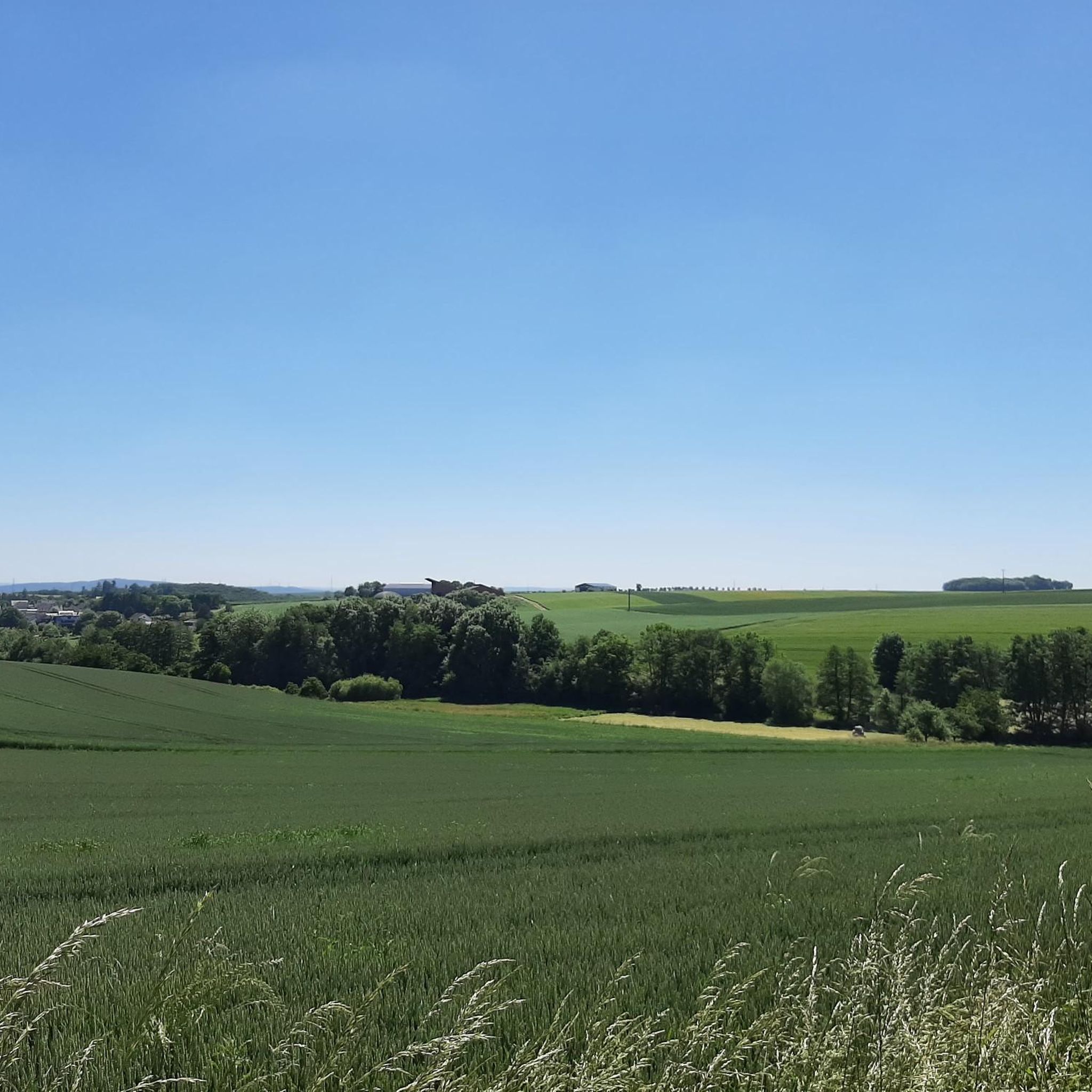
Those exploring the dream trail "Pyrmonter Felsensteig" will reach the highest point of the route on the Sammetzkopf. There, an illuminated summit cross stands prominently, even in the dark. From the Sammetzkopf, an impressive view opens up: It stretches as far as Münstermaifeld with its magnificent collegiate church and further to the volcanoes of the Eastern Eifel. The wide panoramic view over the plateau forms a fascinating yet harmonious contrast to the narrow paths in the Elz Valley.
38
0

The descent from here is OK, the cross itself is, as Danger Willi says, just a cross. The path from the Schockhütte to the cross is barely recognizable.
0
0
Well, the trail is barely recognizable from the run-down hut to the cross, and the trail that leads under the cross is practically non-existent. But once you're at the cross, the trail section towards Treis is quite nice.
0
0

A classic, the shock cross with fine downhill 💨
0
0
Frequently Asked Questions
What are the most popular viewpoints and summits around Brachtendorf?
The region around Brachtendorf, while known for gentle hills, offers several appreciated viewpoints and summits. Among the most popular are the Pinnerkreuz Viewpoint, which provides stunning views over Cochem and Reichsburg Castle, and the Sammetzkopf Summit and Panoramic View of Maifeld, offering wide vistas towards Münstermaifeld and the Eastern Eifel volcanoes. Another notable spot is the Treiser Schock Summit Cross, marking a high point in the area.
Are there family-friendly mountain hikes or viewpoints near Brachtendorf?
Yes, the Sammetzkopf Summit and Panoramic View of Maifeld is considered family-friendly, offering impressive views over the plateau. Generally, the Eifel region's low mountain range provides varied terrain suitable for different activity levels, making many trails accessible for families.
What kind of natural features can I expect to see on the peaks around Brachtendorf?
The peaks and elevated areas around Brachtendorf, situated in the Eifel region, offer diverse natural features. You can expect to encounter dense forests, river valleys like the Moselle, and open plateaus. Many spots, such as the Pinnerkreuz Viewpoint, provide scenic views of the surrounding landscape, including rivers and distant castles.
What is the best time of year to visit the mountain peaks around Brachtendorf?
The Eifel region, where Brachtendorf is located, is pleasant for hiking and exploring its elevated areas from spring through autumn. Spring brings blooming nature, summer offers warmer weather for longer excursions, and autumn provides beautiful foliage. While winter hiking is possible, some trails might be challenging due to weather conditions.
Are there any specific hiking trails that lead to these peaks?
Yes, there are trails leading to the various summits and viewpoints. For instance, the Trail from Schock Hut to Schock Summit Cross is a known path to the Treiser Schock Summit Cross. Many of these peaks are integrated into local hiking networks, offering varied routes for different skill levels.
What outdoor activities can I do near these mountain peaks?
Beyond hiking to the peaks, the area around Brachtendorf offers a variety of outdoor activities. You can find numerous cycling routes, including those for touring bicycles and road cycling. For example, there are routes like the 'Schwanenkirche – Big Bank Möntenich loop' for cycling and 'Eltz Castle – Forest Path to Eltz Castle loop' for mountain hikes. You can explore more options on the Cycling around Brachtendorf, Road Cycling Routes around Brachtendorf, and Mountain Hikes around Brachtendorf guide pages.
Are there any historical or cultural landmarks associated with the peaks?
Yes, some peaks offer views of historical sites. The Pinnerkreuz Viewpoint, for example, provides a magnificent view of the historic Reichsburg Castle in Cochem. The cross at Treiser Schock Summit Cross also serves as a landmark with local historical significance.
What is the elevation and difficulty of the peaks around Brachtendorf?
Brachtendorf itself is at an elevation of 300 meters, surrounded by gentle hills. The Eifel is a low mountain range. Peaks like Juckels-Berg Summit reach about 460 meters, involving moderate climbs. The difficulty of trails leading to these peaks generally ranges from intermediate, with varied elevation gains, making them accessible for hikers with a reasonable fitness level.
Are there parking facilities available for hikers visiting these peaks?
While specific parking details for every single peak are not listed, hiking areas in the Eifel region typically offer designated parking spots near trailheads or in nearby villages. It is advisable to check local signage or online maps for parking options when planning your visit to a specific peak or trail.
Are hiking permits required for the Eifel region around Brachtendorf?
Generally, hiking permits are not required for accessing public hiking trails and natural areas in the Eifel region of Rhineland-Palatinate, Germany. However, always respect private property and any specific local regulations or protected area rules that might apply.
What do visitors enjoy most about the mountain peaks around Brachtendorf?
Visitors particularly enjoy the breathtaking panoramic views offered by many of the elevated spots, such as the Moselle Valley from Pinnerkreuz Viewpoint and the wide vistas over Maifeld from Sammetzkopf Summit. The diverse hiking trails and the natural beauty of the Eifel landscape are also highly appreciated.
Can I bring my dog on the trails to the mountain peaks?
Many hiking trails in the Eifel region are dog-friendly. However, it's always recommended to keep your dog on a leash, especially in nature reserves, near wildlife, or in areas with livestock. Always carry waste bags and ensure your dog is well-behaved around other hikers and animals.
Are there cafes or restaurants near the mountain trails around Brachtendorf?
Brachtendorf and the surrounding villages in the Eifel region offer various cafes, pubs, and restaurants where you can refresh yourself after a hike. While not directly on every peak, you'll find options in nearby settlements like Cochem or Münstermaifeld, which are often starting points or destinations for trails.
Most popular routes around Brachtendorf
Most popular attractions around Brachtendorf

Get inspired with the komoot mobile app


Explore more
See even more amazing summits around Brachtendorf with these guides:
