The best road cycling routes in Tatoosh Wilderness
4.0
(1)
117
riders
6
rides
Road cycling routes in Tatoosh Wilderness provide views of Mount Rainier and the rugged Tatoosh Ridge. The region features significant elevation changes, offering challenging ascents and descents. Cyclists can experience diverse landscapes, including old-growth forests, subalpine meadows, and river valleys. These routes often border the wilderness area, providing access to its natural features.
Best road cycling routes in Tatoosh Wilderness
- The most popular road cycling route is Longmire Historic District – Twin Firs Loop Trail loop from Community Building,…
Last updated: May 17, 2026
2
riders
Moderate road ride. Good fitness required. Some segments of this route may be unpaved and difficult to ride.
9
riders
Moderate road ride. Good fitness required. Some segments of this route may be unpaved and difficult to ride.

Sign up for free
4.0
(1)
32
riders
47.2km
02:36
1,030m
1,030m
Hard road ride. Very good fitness required. Mostly well-paved surfaces and easy to ride.
20
riders
79.9km
04:28
1,650m
1,650m
Hard road ride. Very good fitness required. Some segments of this route may be unpaved and difficult to ride.
12
riders
141km
08:07
3,190m
3,190m
Hard road ride. Very good fitness required. Some segments of this route may be unpaved and difficult to ride.
Our route recommendations are based on thousands of hikes, rides, and runs completed by other people on komoot.
Start today with a free account
Your next adventure awaits.
Login or Signup
Popular around Tatoosh Wilderness
Tips from the Community


Beautiful hike. Crowded. Make sure you bring water as there is no where to fill up. Not even visitor center. No restrooms. Just overstuff porta potties. Come early. Parking difficult. We got here at 310 pm and found some. But there’s a lot of people. We waiting in line to get into park 1 hour! They need a better system!
0
0

Great trail with amazing views of the surrounding mountains and Mt. Rainier.
0
0

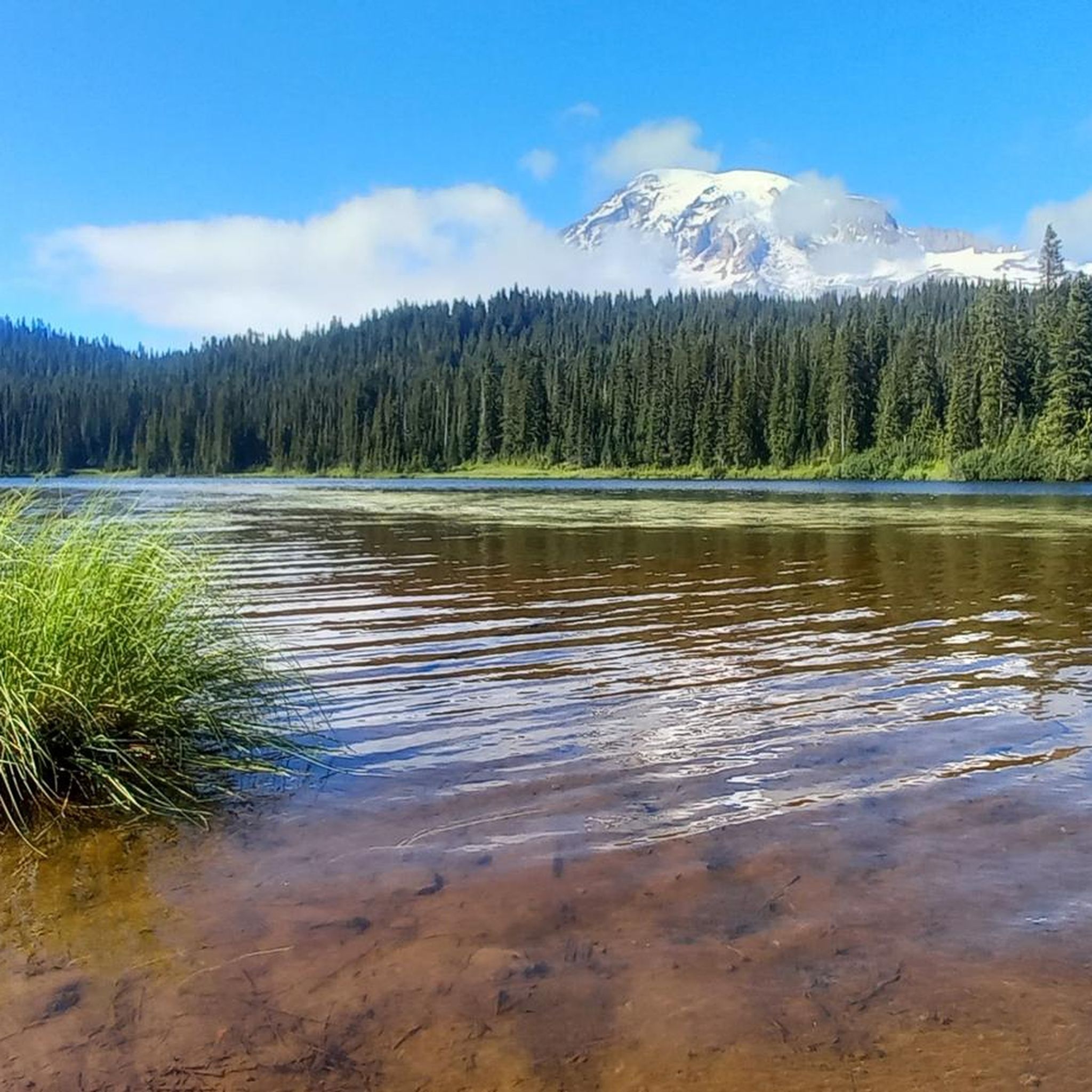
One of the most impressive view points to see Mount Rainier. During sunrise and sunset, when there's no wind or rain, this lake right by the park road reflects the mountain in all of its majesty.
0
0

Longmire is the starting point for many Wonderland Trail adventures and home to the Wilderness Information Center, where you pick up your required permit. It is a key stop to check trail conditions, ask questions, and make any final adjustments before heading into the backcountry. The area also includes the historic 1916 park headquarters, now a small museum, along with the National Park Inn, a restaurant, and a general store.
0
0
This climb is tough, but once you conquer Cayuse Pass, you’ll know you can tackle any ride. Take in the views, catch your breath, and enjoy the feeling of achievement before heading back down.
0
0
At 5,430 ft, Chinook Pass offers stunning mountain along Mather Memorial Parkway. The pass is open mid-May to November—check for seasonal closures before you go.
0
0
Frequently Asked Questions
How challenging are the road cycling routes in the Tatoosh Wilderness region?
The road cycling routes around the Tatoosh Wilderness are generally challenging, featuring significant elevation changes, demanding ascents, and rewarding descents. Komoot identifies 3 moderate and 2 difficult routes in the area. For example, the Longmire Historic District – Twin Firs Loop Trail loop from Packwood is considered difficult, covering nearly 50 miles with over 3,000 feet of elevation gain.
What kind of views can I expect while road cycling around Tatoosh Wilderness?
Cyclists can expect breathtaking panoramic views of Mount Rainier to the north and the dramatic, rugged Tatoosh Ridge itself. The routes often traverse diverse landscapes, including lush old-growth forests, subalpine meadows, and river valleys, all contributing to the scenic beauty of the region.
Are there any waterfalls or natural features to see along the road cycling routes?
Yes, the region is rich with natural features. Routes within Mount Rainier National Park, which border the Tatoosh Wilderness, feature waterfalls like Ruby Falls and Narada Falls. The Narada Falls – Paradise Inn loop from Carter Falls specifically passes by notable waterfalls, offering a scenic experience.
When is the best time of year to go road cycling in the Tatoosh Wilderness region?
The best time for road cycling is typically when park roads are open and free of snow. Conditions often improve for cycling in September and early October. During this period, traffic tends to be lighter, and fall colors are vibrant, enhancing the riding experience. Many park roads are closed during winter due to snow.
What are the road conditions like for cycling in this area?
While many roads are paved, some sections, such as Skate Creek Road, may have potholes and require careful navigation. Roads within Mount Rainier National Park can be steep, narrow, and winding, often with unpaved shoulders. Cyclists should be prepared for varying surfaces and conditions.
Are there any long-distance or all-day road cycling routes available?
Yes, for those seeking a longer challenge, routes like the Longmire Historic District – Twin Firs Loop Trail loop from Packwood cover nearly 50 miles. The 'Ride Around the Tatoosh Range in One Day' (RATROD) is also a highly regarded strenuous route that offers stunning views and can be an all-day endeavor.
Can I find family-friendly or beginner-level road cycling routes?
The region is characterized by significant elevation changes, making most routes challenging. While there are no routes specifically identified as 'easy' in the komoot data, some moderate routes like the Longmire Historic District – Twin Firs Loop Trail loop from Community Building offer moderate elevation gains through scenic park areas, which might be suitable for more experienced families or beginners looking for a challenge.
Where can I park when planning a road cycling trip in the Tatoosh Wilderness area?
Parking is generally available at various trailheads and visitor centers within Mount Rainier National Park and along the forest roads that border the Tatoosh Wilderness. Specific starting points for komoot routes, such as 'from Community Building' or 'from Carter Falls', indicate potential parking areas.
Are there any specific regulations or permits needed for road cycling in the area?
While direct road cycling within the Tatoosh Wilderness boundaries is not typically supported due to its wilderness designation, cycling on paved roads within Mount Rainier National Park is permitted. For detailed information on park regulations and any potential entry fees or permits for Mount Rainier National Park, it's advisable to consult the official park website: nps.gov.
What makes road cycling around Tatoosh Wilderness unique?
The uniqueness comes from the unparalleled views of Mount Rainier and the rugged Tatoosh Range, combined with diverse terrain that offers significant elevation changes. Cyclists can experience everything from old-growth forests to subalpine meadows, often on historic roads like Stevens Canyon Road with its classic stone bridges and tunnels.
How many road cycling routes are there in the Tatoosh Wilderness region?
Komoot currently features 5 road cycling routes in the Tatoosh Wilderness region. These routes offer a mix of moderate and difficult challenges, providing options for various skill levels.
What do other cyclists say about road cycling here?
The road cycling routes in the Tatoosh Wilderness region are highly rated by the komoot community, with an average score of 4.0 stars from one review. Over 50 road cyclists have used komoot to explore the varied and challenging terrain, often praising the stunning views and demanding climbs.
Are there any historical sites or landmarks to explore by bike?
Yes, the region has historical significance. The Tatoosh Ridge was historically used by the Taidnapam (Upper Cowlitz) Indians. Within Mount Rainier National Park, routes like the Nisqually Suspension Bridge – Longmire Historic District loop from Christine Falls pass through the Longmire Historic District, offering a glimpse into the park's past. Stevens Canyon Road also features historic stone bridges and tunnels.
Most popular routes in Tatoosh Wilderness

Get inspired with the komoot mobile app


Explore more
Browse the best Road cycling routes in other regions.
