The best road cycling routes in the Sacramento Mountains
34
riders
5
rides
Road cycling in the Sacramento Mountains offers routes with significant elevation changes, ranging from desert foothills to high mountain peaks. The region features dramatic western escarpments, pine-covered mountains, and deep canyons, providing varied terrain for cyclists. Cyclists can experience transitions from the Chihuahuan Desert floor to cooler, forested mountain air. The Lincoln National Forest covers a large portion of the range, offering a diverse backdrop of mixed-conifer forests and piñon-juniper woodlands.
Best road cycling routes in the Sacramento Mountains
- The…
Last updated: September 28, 2026
9
riders
55.5km
03:23
1,100m
1,100m
Hard road ride. Very good fitness required. Mostly well-paved surfaces and easy to ride.
8
riders
83.9km
04:32
1,060m
1,060m
Hard road ride. Very good fitness required. Mostly well-paved surfaces and easy to ride.

7
riders
41.2km
02:33
1,070m
1,070m
Hard road ride. Very good fitness required. Mostly well-paved surfaces and easy to ride.
5
riders
65.5km
03:43
1,370m
1,370m
Hard road ride. Very good fitness required. Mostly well-paved surfaces and easy to ride.
5
riders
38.0km
01:49
310m
310m
Moderate road ride. Good fitness required. Mostly well-paved surfaces and easy to ride.
Our route recommendations are based on thousands of hikes, rides, and runs completed by other people on komoot.
Start today with a free account
Your next adventure awaits.
Popular around Sacramento Mountains

Tips from the Community


Bring water. No littering please. Enjoy
1
0
Iconic ride in the mountains. Lots of elevation and wonderful views
1
0

Great views of the city of Cloudcroft from this overlook. The Mexican Canyon Trestle can also be seen from here.
0
0
The Sunspot Solar Observatory is a collection of telescopes that studies the Sun. There are a total of five telescope that can be found on the site, with the largest being the Richard B. Dunn Solar Telescope. Visitors to the site can also find a visitors center that will give more information about the studies that take place here.
2
0

Western Town Cloudcroft! Excursion destination of the Americans at the weekend! Small shops and cafes! Is partly also an automobile show 😉
0
0
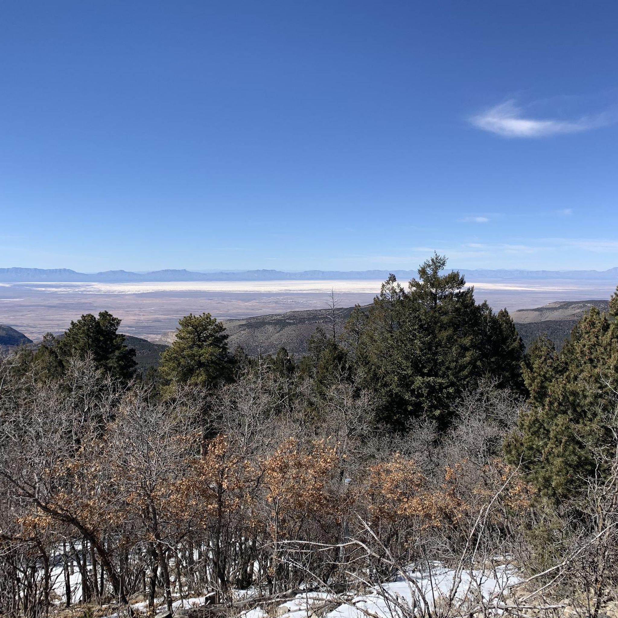
Western town of Cloudcroft near the trail Photo: View of Alamogordo and White Sands from the Sunspot Highway, also near the trail
0
0
Frequently Asked Questions
How challenging are the road cycling routes in the Sacramento Mountains?
The Sacramento Mountains are known for their significant elevation changes, offering challenging climbs ideal for experienced road cyclists. Most routes feature substantial uphill sections, with some climbs like the one up Highway 82 towards Cloudcroft from Alamogordo gaining over 4,000 feet in 14.2 miles with average grades of 5.2%. Out of the five routes available, four are rated as difficult, and one is moderate.
What scenic views or landmarks can I expect on a road cycling route?
The region offers dramatic landscapes, transitioning from desert foothills to pine-covered mountains. You can expect expansive views overlooking the Tularosa Basin and White Sands National Park. Notable landmarks and scenic points include the historic Mexican Canyon Trestle, the Sunspot Solar Observatory, and the Osha Trail, known for its beautiful fall foliage views.
When is the best time of year for road cycling in the Sacramento Mountains?
Roads in the Sacramento Mountains are often ridable year-round, weather permitting. However, the transition from the desert floor to cooler, pine-scented mountain air makes spring and fall particularly pleasant. Cyclists should be mindful of decreasing oxygen levels at higher altitudes, especially during warmer months or if not acclimated.
Are there any good loop routes for road cycling?
Yes, the Sacramento Mountains offer several excellent loop routes. For example, the Sunspot Highway – Sunspot Solar Observatory loop from Cloudcroft is a popular option. Another notable loop is the Old Mill loop from Ruidoso, which is a moderate route.
Are there family-friendly road cycling options in the Sacramento Mountains?
Given the significant elevation changes and challenging nature of most routes, the Sacramento Mountains are primarily suited for experienced road cyclists. The available routes are rated moderate to difficult, making them less ideal for young children or beginners. However, the Old Mill loop from Ruidoso is rated moderate and could be considered for families with older, more experienced riders.
Where can I find parking for road cycling routes?
Many routes start from towns like Cloudcroft or Ruidoso, where public parking is generally available. Specific routes like the Sunspot Highway loop can be accessed from designated areas like Rim Trail Parking 4, and the Ski Apache loop starts near Cedar Creek Ridge Trailhead Parking.
Are there places to stop for refreshments or amenities along the routes?
Towns like Cloudcroft and Ruidoso, which serve as common starting points or pass-throughs for many routes, offer cafes, restaurants, and other amenities. It's advisable to plan your route to include these towns for refreshment stops, especially on longer rides, as services can be sparse in more remote mountain sections.
Can I find less trafficked road cycling routes?
While some main highways can have moderate traffic, many areas in the Sacramento Mountains are described as having low traffic. Routes that utilize maintained U.S. Forest Service roads or less-traveled state highways, such as NM-6563 South, can offer a more serene cycling experience. Always be aware of your surroundings and share the road responsibly.
How much elevation gain can I expect on these routes?
The road cycling routes in the Sacramento Mountains feature substantial elevation gains. For example, the Ski Apache loop from Ruidoso involves over 1,370 meters (4,500 feet) of ascent, and the Ski Apache loop from Cedar Creek Ridge Trailhead Parking has nearly 1,200 meters (3,900 feet) of climbing. Even moderate routes like the Old Mill loop from Ruidoso still include over 310 meters (1,000 feet) of elevation gain.
Are there any waterfalls accessible near the road cycling routes?
Yes, Bridal Veil Falls, one of the few waterfalls in Lincoln National Forest, is accessible via an easy hike along the Grandview Trail. While not directly on a road cycling route, it's a nearby natural attraction worth visiting if you're in the area.
How many road cycling routes are available in the Sacramento Mountains?
There are five road cycling routes available in the Sacramento Mountains, ranging from moderate to difficult in intensity. These routes offer diverse experiences, from challenging climbs to scenic loops through the mountain landscapes.
What are some of the longer road cycling routes in the area?
For cyclists looking for longer rides, the Sunspot Highway loop from Rim Trail Parking 4 covers approximately 83.8 kilometers (52 miles). Another substantial option is the Ski Apache loop from Ruidoso, which is about 65.5 kilometers (40.7 miles) long.
Do I need any permits for road cycling in the Sacramento Mountains?
Generally, no specific permits are required for road cycling on public roads and highways within the Sacramento Mountains or Lincoln National Forest. However, always respect local regulations and private property signs, and be aware of any specific rules if you venture onto trails or into designated wilderness areas.
Most popular routes in the Sacramento Mountains
Most popular attractions in the Sacramento Mountains

Get inspired with the komoot mobile app


Explore more
Browse the best Road cycling routes in other regions.
