The best walks and hikes in Armenia
4.6
(46)
215
hikers
Hiking in Armenia offers diverse landscapes, from high-altitude mountains and volcanic plateaus to dense forests and deep river gorges. The country's terrain features prominent peaks, extensive national parks, and significant bodies of water. Geological formations like basalt columns and numerous waterfalls contribute to varied hiking environments.
Best hiking trails in Armenia
- The most popular hiking route is Cascada Santa Rita desde Boquía — circular, a 4.7 miles (7.6 km) trail that takes 2 hours 20 minutes to complete. This moderate route features a steady ascent and descent through varied terrain.
- Another top favourite among local hikers is Quindío River – Santa Rita Waterfall loop from Salento, a moderate 6.9 miles (11.0 km) path. This trail offers views of river valleys and a waterfall, with an elevation gain of 719 feet (219 m).
- Local hikers also love the Salento Viewpoint Loop, a 2.2 miles (3.5 km) trail leading through scenic viewpoints, often completed in about 58 minutes.
- Hiking in Armenia is defined by mountainous regions, forested national parks, and deep gorges. The network offers options for different ability levels, from easy walks to challenging mountain ascents.
- The routes in Armenia are highly rated by the komoot community with an average score of 4.9 stars from over 40 reviews. More than 190 hikers have used komoot to explore Armenia's varied terrain.
Last updated: July 4, 2026
4.6
(40)
179
hikers
7.59km
02:21
250m
250m
Moderate hike. Good fitness required. Easily-accessible paths. Suitable for all skill levels.
1
hikers
3.49km
00:58
60m
60m
An easy 2.2-mile hike through the charming town of Salento, offering panoramic views from the Salento Viewpoint.

Sign up for free
5.0
(3)
17
hikers
5.48km
01:29
80m
80m
Easy hike. Great for any fitness level. Easily-accessible paths. Suitable for all skill levels.
4.3
(3)
18
hikers
11.7km
03:17
230m
230m
Moderate hike. Good fitness required. Easily-accessible paths. Suitable for all skill levels.
Our route recommendations are based on thousands of hikes, rides, and runs completed by other people on komoot.
Start today with a free account
Your next adventure awaits.
Login or Signup
Tips from the Community

The "Path to the River" refers to a trail leading down from the farm to the Río Quindío. The Finca is located about 4 km (approx. 1 hour on foot or 20 minutes by car/Willy-Jeep) southwest of Salento. A crystal-clear river flows about 300 meters below the farm. A marked path leads through the coffee plantations and a bamboo forest directly to the water. Alternative return route: Hikers often use a flat path along the river, which leads to the village of Boquía in about 35 minutes. From there, you can conveniently take a bus back to Salento to avoid the steep uphill return to the farm. In addition to river access, the farm offers guided tours.
0
0
Boquía is a small town on the road between Armenia and Salento in the Quindío Department. Wanderziel: The path leads from this turn-off to the Santa Rita Nature Reserve (Reserva Natural Santa Rita). Sehenswürdigkeiten: Cascada Santa Rita: An approximately 20-meter-high waterfall with a natural swimming pool. Old Bridge & Tunnel: The path runs along old railway tunnels and a historic yellow bridge over the Rio Quindío. Eintritt: Since the waterfall is on private property, an entrance fee is charged at Finca Santa Rita (approx. 5,000-10,000 COP).
0
0
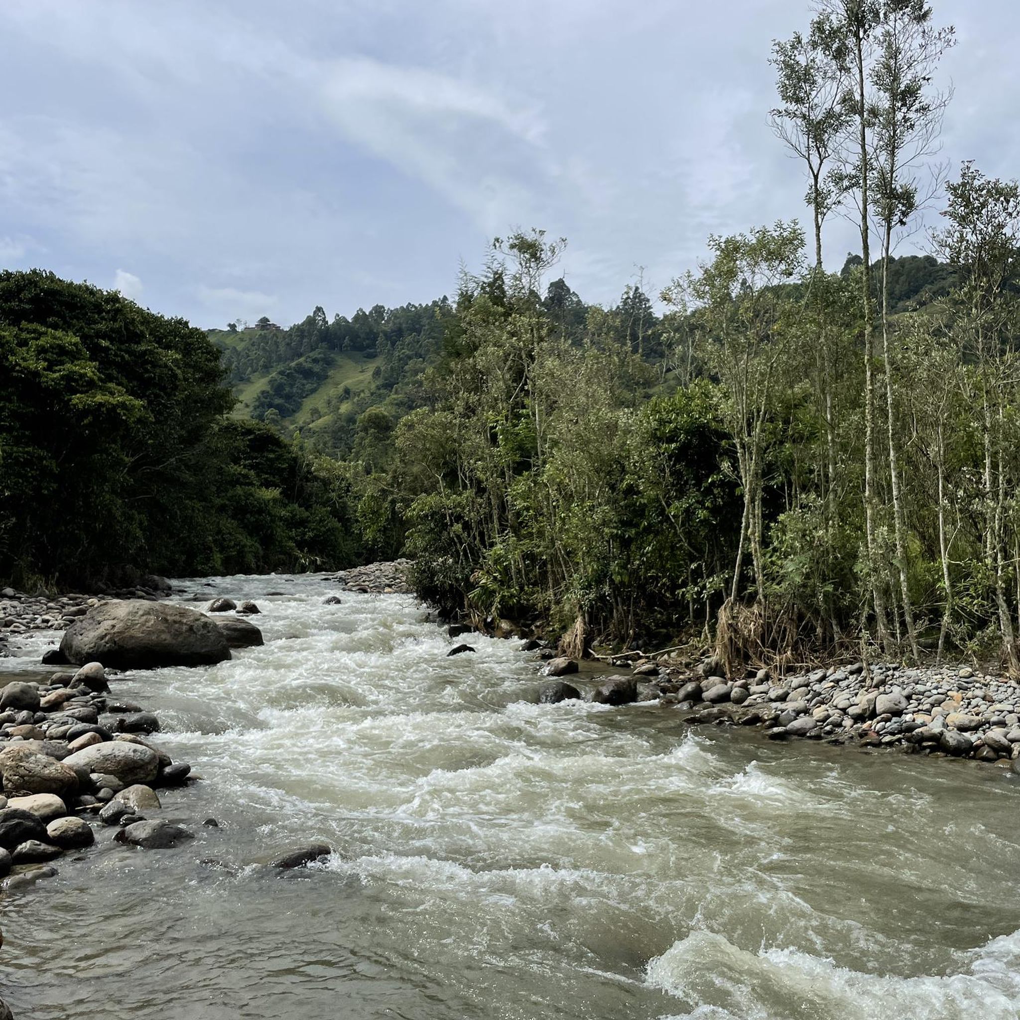
From the coffee farm, a short path leads down to the river.
0
0
The Río Quindío is the main river of the Colombian department of Quindío. It originates in the Los Nevados National Park in the Andes and flows approximately 69 kilometers in a southwesterly direction. The river flows past the picturesque town of Salento and forms the eastern border of the provincial capital, Armenia. It is the vital drinking water source for the majority of the population in the Quindío region. The upper part of the river runs through the Cocora Valley, home to the Quindío wax palm, Colombia's national tree.
0
0
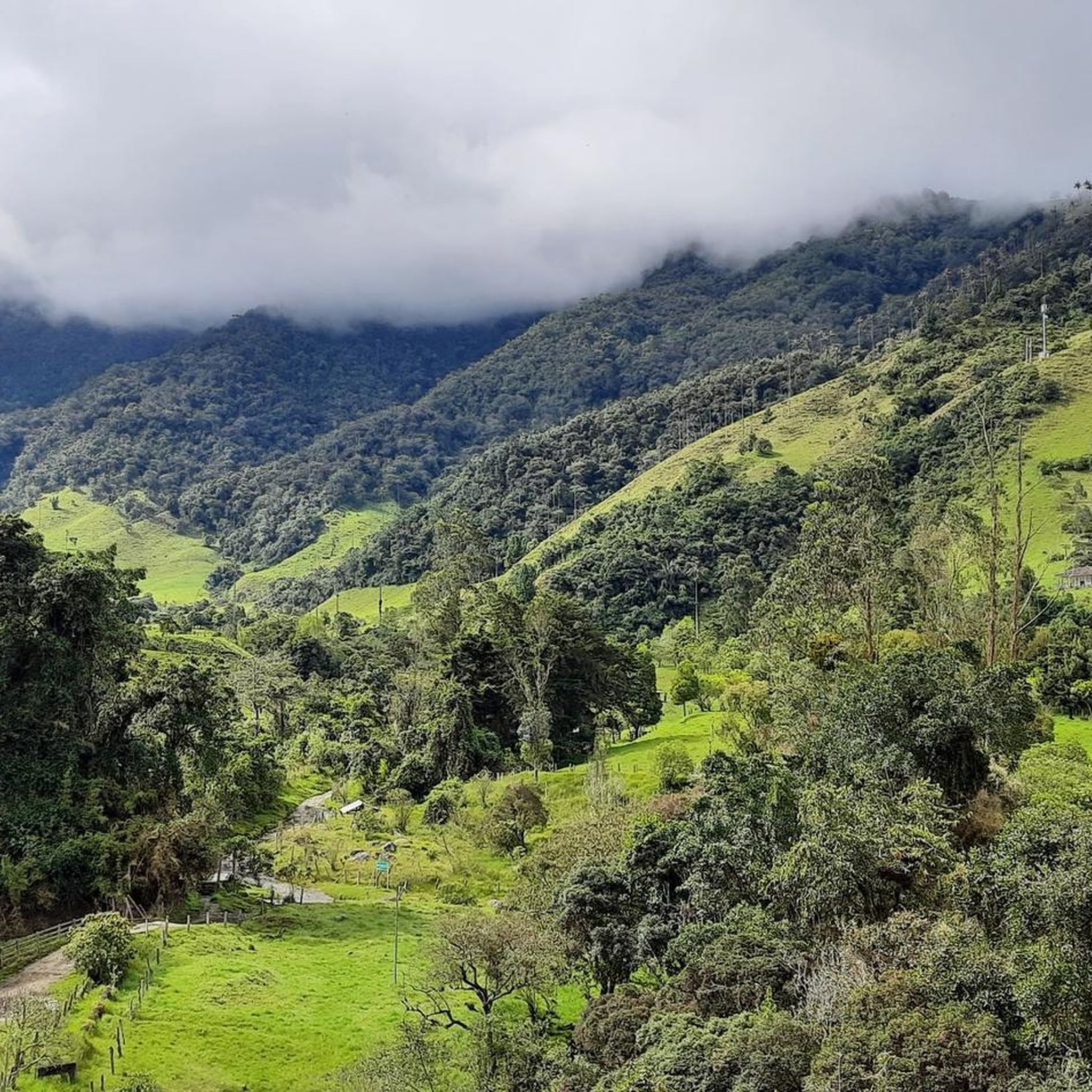
This viewpoint is located in the department of Quindío, in the heart of the Colombian Coffee Triangle. The Mirador is near Salento and offers a panoramic view of the green mountains and coffee plantations of the Quindío Valley.
0
0
The Calle Real (Carrera 6) is the pulsating heart of Salento and is considered one of the most photogenic streets in Colombia. The street is famous for its well-preserved colonial architecture. The two-story houses with their brightly painted balconies, doors, and window frames are the hallmark of the village. On the ground floors, you will find countless small shops selling traditional handicrafts, jewelry made from coffee beans, hand-woven ponchos (Ruanas), and of course, locally roasted specialty coffee.
0
0
This is the viewpoint in Salento, Colombia, which offers a breathtaking view over the valley and the surrounding area. The place is a popular starting point for an easy hike, often referred to as the "Salento Viewpoint Loop". The area is known for the nearby Cocora Valley, which is famous for its tall wax palms. Nearby, there are also traditional coffee farms that offer tours of the production process.
0
0
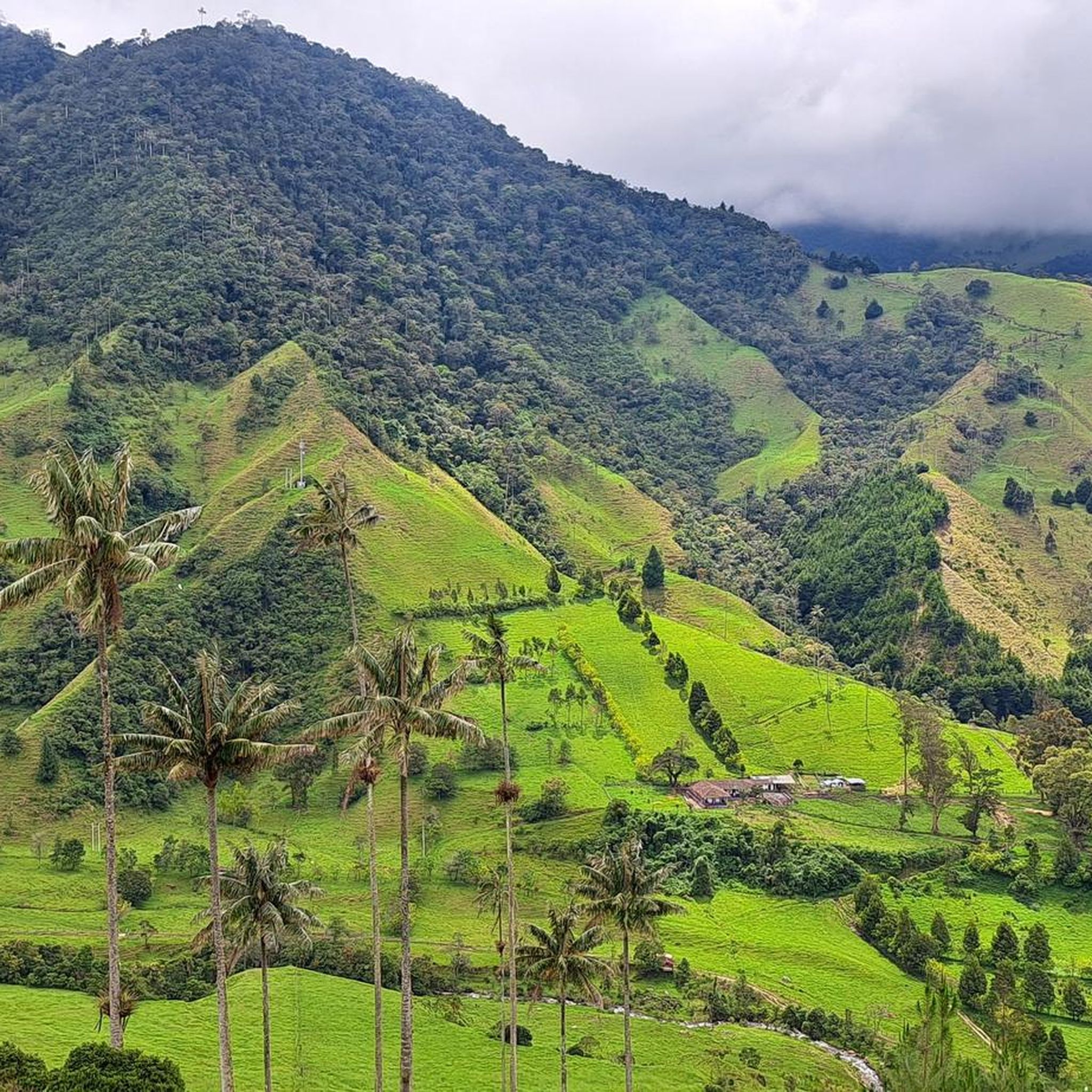
A colorful municipality in the Colombian coffee region (Eje Cafetero), known for its colonial architecture and natural wonders. Famous for the wax palms (national tree of Colombia) up to 60 meters high. Culture: Colorful house facades in the Calle Real and numerous traditional coffee farms (Fincas) offering tours.
1
0
Frequently Asked Questions
What kind of terrain can I expect when hiking in Armenia?
Armenia offers a remarkably diverse landscape for hikers. You'll find majestic mountains like Mount Aragats, lush forests in areas such as Dilijan National Park, sweeping valleys, and high-altitude lakes like Lake Sevan. Dramatic geological formations are common, including deep river gorges with basalt columns, and volcanic plateaus.
Are there any easy, family-friendly hiking options in Armenia?
Yes, there are several options suitable for families. For a gentle walk with scenic views, consider the Salento Viewpoint Loop, which is an easy 3.5-mile (5.6 km) path. Dilijan National Park also offers numerous well-maintained trails through dense forests, many of which are suitable for a relaxed family outing.
What is the best time of year to go hiking in Armenia?
The ideal time for hiking in Armenia is from mid-spring to mid-autumn, specifically from May through October. During these months, the climate is mild, with spring bringing wildflowers and autumn offering vibrant colors. This period avoids the colder winter months and the peak heat of summer at lower elevations, making for comfortable trekking conditions.
Can I find circular hiking routes in Armenia?
Yes, circular routes are available, allowing you to start and end your hike in the same location. An example is the Cascada Santa Rita desde Boquía — circular, a moderate 4.7-mile (7.6 km) trail that takes approximately 2 hours 20 minutes to complete. This route features a steady ascent and descent through varied terrain.
Are there any waterfalls to see on the hiking trails?
Absolutely. Armenia is home to stunning cascades that can be incorporated into your hikes. Notable waterfalls include the Lastiver Caves & Waterfalls and the impressive Trchkan Waterfall, which is the highest in Armenia. You can also explore routes like the Natural Pools – Santa Rita Waterfall loop from Boquía, which offers views of natural pools and a waterfall.
What historical or cultural sites can I visit while hiking?
Armenia's hiking trails often lead to or pass by ancient historical and spiritual sites. You can explore medieval monasteries such as Goshavank, Haghartsin, Tatev, and Sevanavank, many dramatically perched on cliffs or hidden in valleys. Ancient fortifications like Amberd and archaeological sites like Karahunj also offer a unique cultural dimension to your outdoor adventures.
Are there any multi-day hiking opportunities in Armenia?
For long-distance hikers, the Armenian section of the Transcaucasian Trail (TCT) is a major draw, spanning 827 km and showcasing diverse cultural and natural landscapes. Armenia also offers few restrictions on camping and readily available potable water in many areas, making it convenient for planning your own multi-day treks through its varied terrain.
What do other hikers enjoy most about hiking in Armenia?
The hiking routes in Armenia are highly rated by the komoot community, with an average score of 4.7 stars from over 60 reviews. Hikers frequently praise the diverse landscapes, from challenging mountain ascents to serene forest paths, and the seamless integration of ancient historical sites with natural beauty. Many appreciate the well-maintained trails and the opportunity to explore unique geological features.
Are there any trails that offer views of significant landmarks?
Yes, many trails provide stunning vistas of Armenia's natural and historical landmarks. For example, Mount Hatis offers rewarding views of Mount Ararat and the capital city, Yerevan. The coastal trails around Lake Sevan provide consistently beautiful lake views, often with the dramatic Sevanavank Monastery perched on a peninsula. You can also find viewpoints like the Illuminated Hill Viewpoint, Filandia, which offers panoramic scenery.
What kind of natural attractions can I expect to see along the trails?
Beyond mountains and forests, Armenia's trails feature unique natural attractions. You can encounter the striking basalt column formations in Garni Gorge, explore the volcanic landscapes of the Gegham Mountains with their pristine crater lakes, or discover the natural pools along routes like the Natural Pools – Santa Rita Waterfall loop from Boquía. The country's diverse geology provides a constantly changing backdrop for your hikes.
Are there any trails near rivers or with river crossings?
Yes, several trails follow river valleys or feature river crossings. The Quindío River – Santa Rita Waterfall loop from Boquía is a 6.8-mile (11.0 km) trail that leads through river valleys and past waterfalls. Another option is the Quindío River – Quindío River loop from Salento, an easy 3.4-mile (5.5 km) route that explores the river's surroundings.
Most popular attractions in Armenia

Get inspired with the komoot mobile app


Explore more
Browse the best Hikes in other regions.
