The best walks and hikes in McCurtain County
4.8
(3)
78
hikers
11
hikes
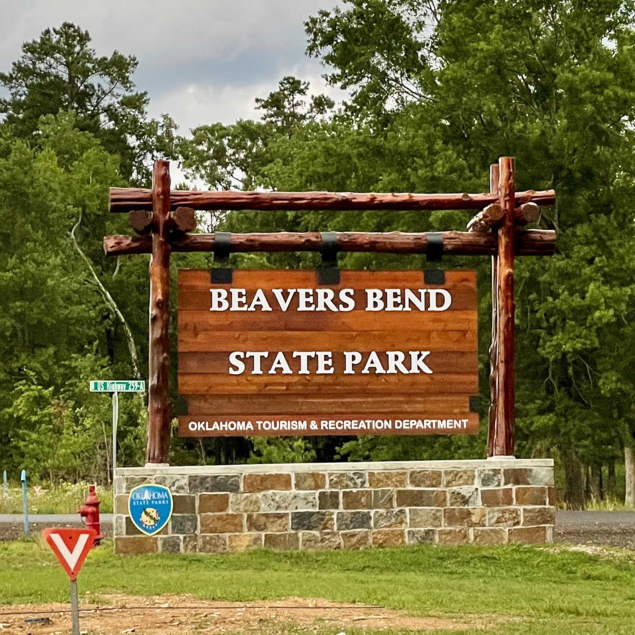
Hiking in McCurtain County, Oklahoma, features diverse landscapes, including extensive wilderness areas and rugged terrain. The region is characterized by dense forests, clear waterways like the Mountain Fork River, and the Ouachita Mountains, offering varied elevation changes. Beavers Bend State Park and the McCurtain County Wilderness Area provide a network of trails through shortleaf pine and hardwood forests.
Best hiking trails in McCurtain County
- The most popular hiking route is Lakeview Lodge Trail loop — Beavers Bend State Park, a 4.0 miles (6.5 km) trail that takes 1 hour 42 minutes to complete. This easy loop offers views of Broken Bow Lake and the surrounding forest.
- Another top favourite among local hikers is Skyline Trail loop — Beavers Bend State Park, a moderate 8.5 miles (13.6 km) path. This trail provides panoramic views of the Ouachita Mountains and Lake Broken Bow.
- Local hikers also love the Skyline Overlook loop via Deer Crossing Trail — Beavers Bend State Park, a 4.1 miles (6.7 km) trail leading through forested hills, often completed in about 1 hour 57 minutes.
- Hiking in McCurtain County is defined by dense forests, clear rivers, and mountainous terrain. The network offers options for different ability levels, from easy nature walks to more challenging moderate routes.
- The routes in Mccurtain County are highly rated by the komoot community with an average score of 4.8 stars from over 3 reviews. More than 70 hikers have used komoot to explore Mccurtain County's varied terrain.
Last updated: June 23, 2026
2.56km
00:41
30m
10m
The Lakeview Lodge Trail Short Loop offers a tranquil and accessible outdoor experience, winding through verdant woodlands dominated by towering pine trees that create a refreshing canopy. You will find well-defined paths of dirt and quartz, with a gentle "roller coaster feel" as you navigate the easy 1.6-mile (2.6 km) hike, which includes about 105 feet (32 metres) of elevation gain and takes around 40 minutes to complete. Keep an eye out for shimmering glimpses of Broken Bow Lake through the trees, adding a scenic touch to your journey.
Planning your visit to this trail is straightforward, as it is well-maintained and located within Beavers Bend State Park. Dogs are typically allowed on a leash, making it a great option for a family outing. For the most pleasant hiking conditions and to enjoy the area's natural beauty, visiting during spring or fall is highly recommended, when temperatures are comfortable and the foliage is at its best.
This short loop is notable for being part of a larger, interconnected trail system, offering versatility for different preferences with other loops providing greater length and difficulty. Its established nature is also evident as it is utilized by mountain bikers. The Lakeview Lodge Trail provides a quick opportunity to immerse yourself in nature and observe local wildlife, such as deer and fawns, making it a rewarding short hike.
21.7km
05:52
270m
320m
The Bee Creek and Dyer Mountain Trail near Broken Bow, Oklahoma, offers a truly immersive experience through the Ouachita National Forest. You'll traverse diverse terrain, from shaded woodlands to rocky paths, with stunning overlooks providing expansive views of Broken Bow Lake. The journey culminates in a magical waterfall and swimming hole, making the effort worthwhile for those who appreciate natural beauty and a sense of discovery.
This difficult 13.5-mile (21.7 km) hike involves 883 feet (269 metres) of elevation gain and typically takes around 5 hours and 52 minutes. The trail is situated about ten minutes north of Hochatown, but be aware that some sections are rugged with loose rocks and water crossings, especially after rainfall. Planning your visit during dry conditions is advisable for a more comfortable and safer trek.
Known as one of the best hikes in the region, this trail is popular for its versatility, attracting both hikers and off-road enthusiasts. Its varied landscape, from challenging climbs to serene lake views and the hidden waterfall, sets it apart. The trail also offers multiple spots for camping and swimming, adding to its appeal as a full-day outdoor adventure.

Sign up for free
4.5
(2)
32
hikers
6.47km
01:42
60m
60m
The Lakeview Lodge Trail offers a delightful journey through a lush pine forest, where towering trees provide ample shade and a tranquil atmosphere. You'll experience a gentle 'roller coaster feel' on the path, which is composed of dirt and quartz, with occasional exposed roots. Keep an eye out for beautiful views of Broken Bow Lake, especially on the sections that wind along the shoreline, adding a picturesque element to this easy 4.0-mile (6.5 km) hike with only 186 feet (57 metres) of elevation gain, typically completed in about 1 hour and 42 minutes.
Planning your visit to the Lakeview Lodge Trail is straightforward, as it's situated in Beavers Bend State Park. The trail is well-maintained and suitable for both hiking and mountain biking, making it a versatile choice. While generally easy, sturdy footwear is recommended due to potential roots and the possibility of muddy sections after heavy rainfall. Dogs are permitted on the trail, provided they are kept on a leash.
What makes this trail particularly notable is its multi-loop system, allowing you to tailor your experience to your desired length and difficulty. It integrates with the larger Indian Nations Trail system, offering options for extended adventures if you're feeling ambitious. The trail's blend of gentle paths, rolling hills, and scenic lake views makes it a popular choice for those seeking a relaxing outdoor experience in the Broken Bow area.
19
hikers
13.6km
04:42
310m
310m
The Skyline Trail in Oklahoma provides a pleasant hiking experience, leading you through the local terrain to notable features like the Skyline Overlook, where you can take in the views. The route also brings you close to the Mountain Fork River, offering a refreshing natural element to your journey. It's a good option for those seeking a moderate outing in the area.
This moderate 8.5-mile (13.6 km) hike involves 1003 feet (306 metres) of elevation gain and typically takes about 4 hours and 41 minutes to complete. The trailhead is located in McCurtain County, and while specific access details are not provided, it's generally open for day use. Always carry enough water and check local weather conditions before you go.
As a moderate trail, it's suitable for hikers with a reasonable fitness level looking for a solid half-day adventure. The presence of the Skyline Overlook and the Mountain Fork River suggests a varied landscape, providing both scenic vistas and riparian interest. It's a straightforward way to explore the natural beauty of this part of Oklahoma.
5.0
(1)
7
hikers
6.66km
01:57
170m
170m
The Skyline Overlook loop via Deer Crossing Trail offers a delightful journey through the diverse landscapes of Beavers Bend State Park. You'll wander through shaded forests of towering pines and hardwoods, with the tranquil Mountain Fork River often in view, before reaching the star attraction: the Skyline Overlook. This viewpoint provides sweeping vistas of the river, rolling hills, and dense woodlands, making it a truly rewarding experience.
This moderate 4.1-mile (6.7 km) loop involves about 546 feet (166 metres) of elevation gain and typically takes just under two hours to complete. While the full Skyline Trail can be quite challenging, this specific loop via Deer Crossing Trail is a more accessible option for experiencing the park's beauty. It's a great choice if you're looking for a substantial hike with significant payoff views without the extreme difficulty of longer routes.
Beavers Bend State Park is known for its natural beauty, and this trail showcases some of its best features. The Deer Crossing Trail itself is a pleasant walk, connecting to other notable paths within the park. This loop is an excellent way to immerse yourself in the clear waters and lush forests of the Mountain Fork River area, offering a taste of the region's wilderness.
2.88km
00:49
60m
60m
The Friends Trail Loop near Broken Bow, Oklahoma, offers a delightful and varied hiking experience that feels longer than its actual length. You'll traverse lush wooded areas filled with towering pine and hardwood trees, then descend to walk alongside the Lower Mountain Fork River, where you can hear the rushing water and admire small waterfalls. Expect a mix of terrain, from narrow paths by the water to steep climbs that lead to scenic overlooks, providing continuous picturesque views of the river and surrounding landscapes.
Planning your trip is straightforward, but a few tips will enhance your experience. Parking at the trailhead requires a fee, and it's wise to purchase your pass in advance, as cell service can be unreliable for on-the-spot transactions. Sturdy hiking shoes are highly recommended to navigate the varied terrain, which can include slick sections, roots, and rocks, especially after rain. Remember to bring plenty of water, as there are no facilities along the 1.8-mile (2.9 km) route.
This easy 48-minute hike, with 194 feet (59 metres) of elevation gain, is notable for being one of the newer and better-maintained trails in Beavers Bend State Park. Despite its relatively short distance, it offers a satisfying workout and a diverse natural encounter, making it a popular choice for those seeking a moderate challenge. Keep an eye out for local wildlife, including white-tailed deer and various songbirds, as you explore this scenic loop.
4
hikers
4.04km
01:10
50m
50m
The Friends Trail Loop is a moderately challenging hike that immerses you in the natural beauty of Beavers Bend State Park. This 2.5-mile (4.0 km) route, with 168 feet (51 metres) of elevation gain, guides you through shaded forests and along the Mountain Fork River, offering continuous views of rushing water and mini-waterfalls. Expect rugged terrain, including rocky sections and a notable steep uphill climb, making it a rewarding experience for those ready for a good workout in about 1 hour and 9 minutes.
When planning your visit, be aware that parking requires a fee, and spotty cell service can sometimes complicate payment at the trailhead. There are no restrooms directly on the trail, so prepare in advance. Sturdy shoes with good grip are essential for navigating the uneven and potentially slippery surfaces, especially after rain, and always carry enough water for your hike.
This popular trail is celebrated for its blend of accessibility, scenic beauty, and moderate challenge, making it a standout in the park. While you enjoy the stunning river and forest views, keep an eye out for local wildlife like white-tailed deer, songbirds, and even bald eagles. It's a great option if you're looking for a trail that feels wild but is still within easy reach.
1.93km
00:30
20m
20m
The Forest Heritage Tree Trail offers a delightful and accessible loop walk through the woods, perfect for a quick escape into nature. This easy 1.2-mile (1.9 km) hike, with only 49 feet (15 metres) of elevation gain, guides you past fascinating informational signs about local trees and history, making it a great family friendly Forest Heritage Tree Trail option. You'll also encounter unique features like a large wooden Native American statue near the start and the ruins of an old settler's house along the way, all within an estimated 30 minutes.
To plan your visit, head to the Forest Heritage Center Museum, where the trail begins. While generally easy, some short, steep sections can be slippery with loose rock and dirt, so wearing proper shoes is highly recommended for the Forest Heritage Tree Trail. The path is well-marked with white tree markers, ensuring you stay on track as you explore this charming loop.
What truly sets this trail apart is its blend of natural beauty and educational value within Beavers Bend State Park. Beyond the trees and creek, you'll discover remnants of the original highway that once ran through the park, adding a layer of historical context to your walk. It's a wonderful way to learn about the region's logging heritage and natural environment while enjoying a peaceful outdoor experience.
3.86km
01:10
130m
130m
The Lookout Mountain Loop offers a refreshing escape into nature, providing a gentle hiking experience that's perfect for unwinding. While the specific natural features of this Oklahoma trail aren't detailed, you can expect a pleasant journey through local woodlands, culminating in potential views from the summit of Lookout Mountain. It's an easy 2.4-mile (3.9 km) route, making it a great option for a quick outdoor adventure.
This easy hike, with its modest 413 feet (126 metres) of elevation gain, is estimated to take just over an hour. It's an excellent choice for beginners or families looking for a manageable outing. As specific parking and trailhead information for this particular Lookout Mountain Loop isn't readily available, it's wise to consult local guides or maps before heading out.
Located in Mccurtain County, Oklahoma, this trail provides a taste of the region's natural beauty. While not as dramatic as some of its namesakes, the Lookout Mountain Loop offers a quiet opportunity to connect with nature. Consider it a solid option if you're seeking a short, accessible hike without the crowds or strenuous effort of more challenging routes.
17
hikers
Moderate hike. Good fitness required. Easily-accessible paths. Suitable for all skill levels.
Our route recommendations are based on thousands of hikes, rides, and runs completed by other people on komoot.
Start today with a free account
Your next adventure awaits.
Login or Signup
Popular around Mccurtain County


Tips from the Community

This relatively flat and easy trail follows the course of Beaver Creek. You'll be surrounded by lush greenery and the gentle sounds of the flowing creek. Keep an eye out for diverse wildlife, including birds, small mammals, and perhaps even a glimpse of aquatic life in the creek.
0
0
This Junction offers hikers, and bikers, a great option for exploring the park's stunning natural beauty. The Indian Nations Trail, a longer, more challenging route, invites adventurers to delve deeper into the wilderness, while the Lakeview Lodge Trail provides a more leisurely option with picturesque views of the surrounding landscape.
0
0
Known for its scenic beauty, the trail winds through a lush forest, providing ample shade for hikers and bikers. Its rolling terrain offers a moderate challenge, making it suitable for various fitness levels. There is a longer and a short option, depending on your preference. One of the trail's highlights is its proximity to Broken Bow Lake, allowing you to enjoy glimpses of the sparkling water throughout the journey.
0
0
Nestled amidst towering pines and verdant foliage, this vantage point provides a stunning perspective of the park's natural beauty. Hikers can enjoy a well-deserved rest while taking in the expansive vistas of rolling hills, Mountain Fork River, and lush forests.
1
0
The Lookout Mountain Trail offers a moderately challenging hike for stunning views. The Heritage Trail provides a different experience, focusing on the park's history and natural features.
0
0
The Forest Heritage Center is a captivating museum dedicated to showcasing the rich history of Oklahoma's forests. It houses an impressive collection of unique displays and large dioramas that transport visitors through time, from prehistoric forests to the modern era of forestry. You can explore the lives of the Caddo Indians, witness the evolution of paper-making, and gain insight into the lumbering industry of the 1940s.
0
0
Renowned for its crystal-clear waters, towering pines, and rugged terrain, the park offers a plethora of outdoor activities for adventurers of all ages. You can enjoy hiking, biking, fishing, boating, and swimming in the pristine waters of Broken Bow Lake.
1
0
One of the trail's highlights is its proximity to the Mountain Fork River, where hikers can often hear the rushing water and enjoy refreshing dips. While the trail is generally considered moderate, it does feature some steeper sections and rocky terrain, making it an adventurous option for those seeking a challenge.
1
0
Frequently Asked Questions
How many hiking trails are available in McCurtain County?
McCurtain County offers a variety of hiking experiences with over 10 trails documented on komoot, ranging from easy strolls to more challenging moderate routes. Six of these are rated as easy, making them accessible for many visitors.
Are there any family-friendly hiking options in McCurtain County?
Yes, McCurtain County has several trails suitable for families. For an easy and scenic walk, consider the Friends Trail loop in Beavers Bend State Park, which is just under 2 miles. Another great option is the Heritage Trail loop, offering a shorter, easy walk through the park's natural beauty.
What is the best time of year to go hiking in McCurtain County?
The fall season is particularly popular for hiking in McCurtain County, as the diverse tree species like sugar maple, red maple, sweet gum, and various oaks create a glorious display of color. Spring also offers pleasant temperatures and blooming wildflowers. Summers can be warm and humid, while winters are generally mild, but always check local conditions.
Are dogs allowed on hiking trails in McCurtain County?
Many areas within McCurtain County, including Beavers Bend State Park, are generally pet-friendly. However, it is always recommended to keep dogs on a leash and to check specific trail regulations before heading out. Always ensure you clean up after your pet.
Are there any trails with waterfalls in McCurtain County?
While not explicitly named, some rugged routes within Beavers Bend State Park, particularly those offering sweeping views of the Ouachita Mountains, are known to reward hikers with views of hidden waterfalls, especially after rainfall. Exploring trails like the Skyline Trail loop might lead to such discoveries.
Do I need a permit to hike in the McCurtain County Wilderness Area?
Yes, for extensive hiking and backpacking on the east side of the McCurtain County Wilderness Area, permits must be secured in advance from the area's biologist. The west side, including a hiking trail, is publicly accessible with a valid Oklahoma fishing or hunting license or an Annual Wildlife Conservation Passport. A self-guided nature trail within the MCWA is open year-round without a specific permit.
What kind of terrain can I expect on McCurtain County hiking trails?
McCurtain County's terrain is diverse, characterized by rugged mountains, dense forests of shortleaf pine and hardwoods, and clear waterways like the Mountain Fork River. Trails often feature varied elevation changes, from gentle slopes on nature loops to more significant climbs on routes like the Skyline Trail loop, which offers panoramic views.
Are there any circular hiking routes in McCurtain County?
Yes, many trails in McCurtain County are designed as loops, offering a convenient hiking experience. Examples include the popular Lakeview Lodge Trail loop, the Skyline Overlook loop via Deer Crossing Trail, and the Lookout Mountain Trail loop, all located within Beavers Bend State Park.
What are some notable landmarks or viewpoints along the trails?
Many trails offer stunning views. The Skyline Trail loop provides panoramic vistas of the Ouachita Mountains and Lake Broken Bow. The Lakeview Lodge Trail loop offers beautiful views of Broken Bow Lake. The McCurtain County Wilderness Area itself is a National Natural Landmark, showcasing an excellent example of a xeric upland oak-pine forest.
Is public transportation available to reach hiking trailheads?
Public transportation options directly to specific hiking trailheads in McCurtain County are limited. Visitors typically rely on personal vehicles to access the various parks and wilderness areas. Parking is generally available at popular trailheads within Beavers Bend State Park.
What do other hikers enjoy most about hiking in McCurtain County?
The hiking experiences in McCurtain County are highly rated by the komoot community, with an average score of 4.8 stars. Reviewers often praise the region's dense forests, clear rivers, and the diverse network of trails that cater to different ability levels, from easy nature walks to more challenging routes with rewarding views.
What wildlife might I encounter while hiking?
McCurtain County is rich in wildlife. Hikers might spot over 100 bird species, including the endangered red-cockaded woodpecker and bald eagle. Other animals such as bobcats, foxes, and turkeys also inhabit the area. Always maintain a respectful distance and avoid disturbing wildlife.
Most popular routes in McCurtain County

Get inspired with the komoot mobile app


Didn’t find what you were looking for?
Check out more Hikes throughout Mccurtain County below and find the perfect route in your destination.
Explore more
Browse the best Hikes in other regions.
