The best MTB trails around Pommerieux
4.7
(45)
127
riders
10
rides
Mountain bike trails around Pommerieux are set within a rural landscape in the Mayenne department of France. The region is characterized by extensive agricultural land, including arable fields and prairies, with the Hière river meandering through the countryside. While the commune itself has a modest altitude range, the surrounding area features rolling terrain with elevation gains on routes reaching over 1,500 feet. This environment provides a mix of open country and wooded sections, reflecting its historical connection to apple orchards.
Best mountain bike trails around Pommerieux
- The most popular mountain bike trail is La Rincerie Pond – Pond observatory loop from Craon, a 26.9 miles (43.4 km) trail that takes about 2 hours 44 minutes to complete, featuring water views and an observatory.
- Another top favourite among local mountain bikers is Renazé – Forêt renaze loop from Livré-la-Touche, a moderate 29.1 miles (46.8 km) path. This route leads through forested areas, offering varied terrain.
- Local mountain bikers also love the Craon, the old town – Craon, the old town loop from Craon, a 42.9 miles (69.2 km) trail leading through the historic town area, often completed in about 3 hours 59 minutes.
- Mountain biking around Pommerieux is defined by rural landscapes, agricultural fields, and river valleys. The network offers options for both easy and moderate ability levels.
- The routes in Pommerieux are highly rated by the komoot community with an average score of 4.4 stars from more than 30 reviews. More than 150 mountain bikers have used komoot to explore Pommerieux's varied terrain.
Last updated: July 4, 2026
5.0
(2)
14
riders
37.2km
02:23
310m
310m
Moderate mountain bike ride. Good fitness required. Suitable for all skill levels.
5.0
(1)
11
riders
50.4km
03:06
400m
400m
Moderate mountain bike ride. Good fitness required. Suitable for all skill levels.

Sign up for free
10
riders
46.1km
02:52
380m
380m
Moderate mountain bike ride. Good fitness required. Suitable for all skill levels.
7
riders
58.0km
03:39
440m
440m
Moderate mountain bike ride. Good fitness required. Advanced riding skills necessary.
4.5
(4)
8
riders
38.0km
02:14
210m
210m
Moderate mountain bike ride. Good fitness required. Suitable for all skill levels.
Get access to more routes and recommendations from other explorers.
Sign up for free
Already have an account?
Our route recommendations are based on thousands of hikes, rides, and runs completed by other people on komoot.
Start today with a free account
Your next adventure awaits.
Login or Signup



Tips from the Community

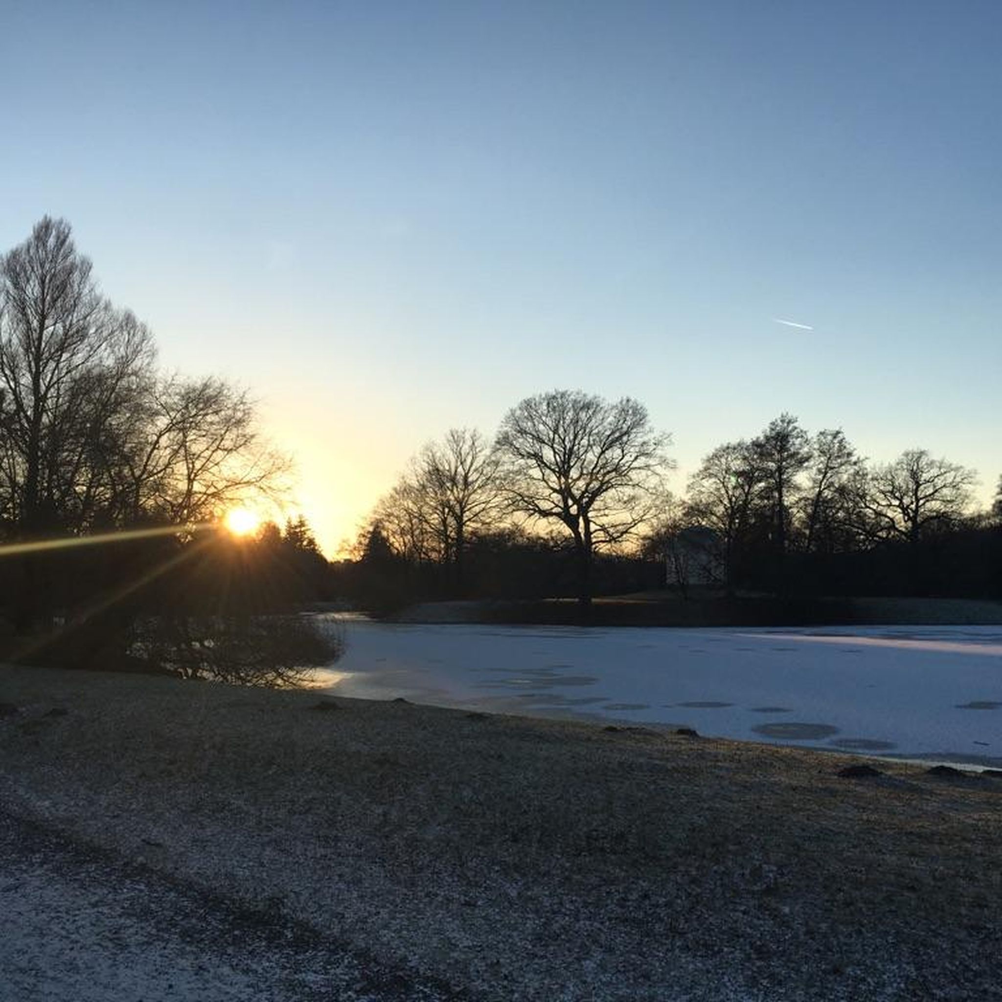
A much larger photo gallery with further images of this beautifully situated pond has been uploaded by various hikers at the highlight (corresponding to this sport). Their photos of the "Etang de St. Aubin" can be found via the following link =>> https://www.komoot.com/de-de/highlight/6116353/gallery
0
0

Magnificent viaduct, the largest in Mayenne, blends in very well with the landscape.
0
0

Atypical work of art (a little special all the same in this green setting on the banks of the Mayenne) with a staircase under the deck which allows you to cross the Mayenne.
0
0


The Saint-Aubin pond, fed by the Verzée, is a pond located in the French commune of Pouancé, in the department of Maine-et-Loire. Probably before the 12th century, the Saint-Aubin pond, covering 42 hectares, is divided into the Saint-Aubin pond, the Saint-Jacques pond and the Pouancé pond. history : From the twelfth century, the priory of Madeleine had fishing tithe rights on the Pouancé ponds. At the beginning of the 13th century, the lord of Pouancé, William III, decided to establish a dike on the Verzée, thus creating the Pouancé pond, at the foot of the medieval castle[3]. A pier was built on the Saint-Aubin pond to allow the parishioners of Pouancé to access the parish church of Saint-Aubin de Pouancé. This levee is, however, often submerged[4]. In 1977, the commune of Pouancé developed the body of water into a nautical base by building a beach and a campsite nearby. source: https://fr.m.wikipedia.org/wiki/%C3%89tang_de_Saint-Aubin
0
0

The Saint-Aubin pond offers a peaceful and natural landscape. This body of water, surrounded by lush greenery, is a haven for local species and migratory birds. Ideal for a stopover!
0
0

It is the castle which gave its name to the town. Only the fortifications remain. These ramparts are more than a thousand years old and were built in the 11th century.
0
0
Frequently Asked Questions
What is the general difficulty level of mountain bike trails around Pommerieux?
The mountain bike trails around Pommerieux are primarily suited for easy and moderate ability levels. Out of 13 available tours, 4 are classified as easy and 9 as moderate, with no difficult trails identified. This makes the area accessible for a wide range of riders.
Are there any family-friendly mountain bike trails in Pommerieux?
Yes, Pommerieux offers several family-friendly mountain bike trails, particularly those rated as easy. The rural landscape with its modest altitude range and gentle terrain is well-suited for less experienced riders or families looking for a pleasant outing. Look for routes with shorter distances and minimal elevation gain.
What kind of terrain can I expect on mountain bike trails in Pommerieux?
You can expect a rural landscape characterized by extensive agricultural land, including arable fields and prairies. The Hière river meanders through the countryside, and the area features rolling terrain with elevation gains on routes reaching over 1,500 feet. You'll find a mix of open country and wooded sections, reflecting the region's historical connection to apple orchards.
What are some scenic highlights or landmarks I might encounter on mountain bike routes near Pommerieux?
While mountain biking, you might encounter several interesting points. For instance, the route La Rincerie Pond – Pond observatory loop from Craon features water views and an observatory. Other notable attractions in the wider area include La Rincerie Pond itself, the historic area of Craon, the old town, and Saint-Ouen Castle, Chemazé.
Are the mountain bike trails in Pommerieux suitable for beginners?
Yes, Pommerieux has several mountain bike trails suitable for beginners. There are 4 routes classified as easy, offering a good starting point for those new to mountain biking. These trails typically feature gentler gradients and less technical terrain, allowing beginners to enjoy the rural scenery comfortably.
What is the typical length and duration of mountain bike trails in this region?
The mountain bike trails in Pommerieux vary in length and duration. For example, the La Rincerie Pond – Pond observatory loop from Craon is about 26.9 miles (43.4 km) and takes approximately 2 hours 44 minutes. Longer routes, like Craon, the old town – Craon, the old town loop from Craon, can be up to 42.9 miles (69.2 km) and take around 3 hours 59 minutes.
Are there any mountain bike trails that pass through forested areas?
Yes, some mountain bike trails in the region lead through forested areas. For instance, the Renazé – Forêt renaze loop from Livré-la-Touche is a moderate route that specifically leads through wooded sections, offering varied terrain and a different riding experience.
What do other mountain bikers say about the trails in Pommerieux?
The mountain bike trails around Pommerieux are highly rated by the komoot community, with an average score of 4.4 stars from more than 30 reviews. Over 150 mountain bikers have used komoot to explore the varied terrain, often praising the rural landscapes, agricultural fields, and river valleys that define the network.
Are there any circular mountain bike routes available in Pommerieux?
Yes, all the highlighted mountain bike routes in the Pommerieux area are designed as circular loops. This includes popular options like La Rincerie Pond – Pond observatory loop from Craon and Saint-Aubin Pond loop from Craon, allowing you to start and finish at the same point.
Is Pommerieux a good destination for mountain biking with dogs?
Given the rural and agricultural nature of Pommerieux, many trails are likely suitable for mountain biking with dogs, provided they are well-behaved and kept under control, especially when passing through farmlands or near livestock. Always ensure you carry water for your dog and check local regulations regarding pets on trails.
What is the best time of year to go mountain biking in Pommerieux?
The best time of year for mountain biking in Pommerieux, like much of rural France, is typically during the spring (April to June) and autumn (September to October). During these seasons, the weather is generally mild, and the natural scenery is at its most vibrant, with comfortable temperatures for riding. Summer can also be pleasant, but be mindful of potential heat during midday.
Are there any advanced mountain bike trails in Pommerieux?
Based on the available data, there are no trails classified as difficult in the Pommerieux area. The routes are predominantly easy or moderate, suggesting that the region is better suited for recreational riders and those looking for less technical challenges rather than advanced mountain biking.
How many mountain bike trails are available in the Pommerieux region?
There are 13 mountain bike tours available in the Pommerieux region, offering a variety of routes through its rural landscapes. These include 4 easy trails and 9 moderate trails, catering to different skill levels.
Most popular routes around Pommerieux
Most popular attractions around Pommerieux

Get inspired with the komoot mobile app


Explore more
Browse the best MTB trails in other regions.
