The best running trails around Nantillois
28
runners
9
runs
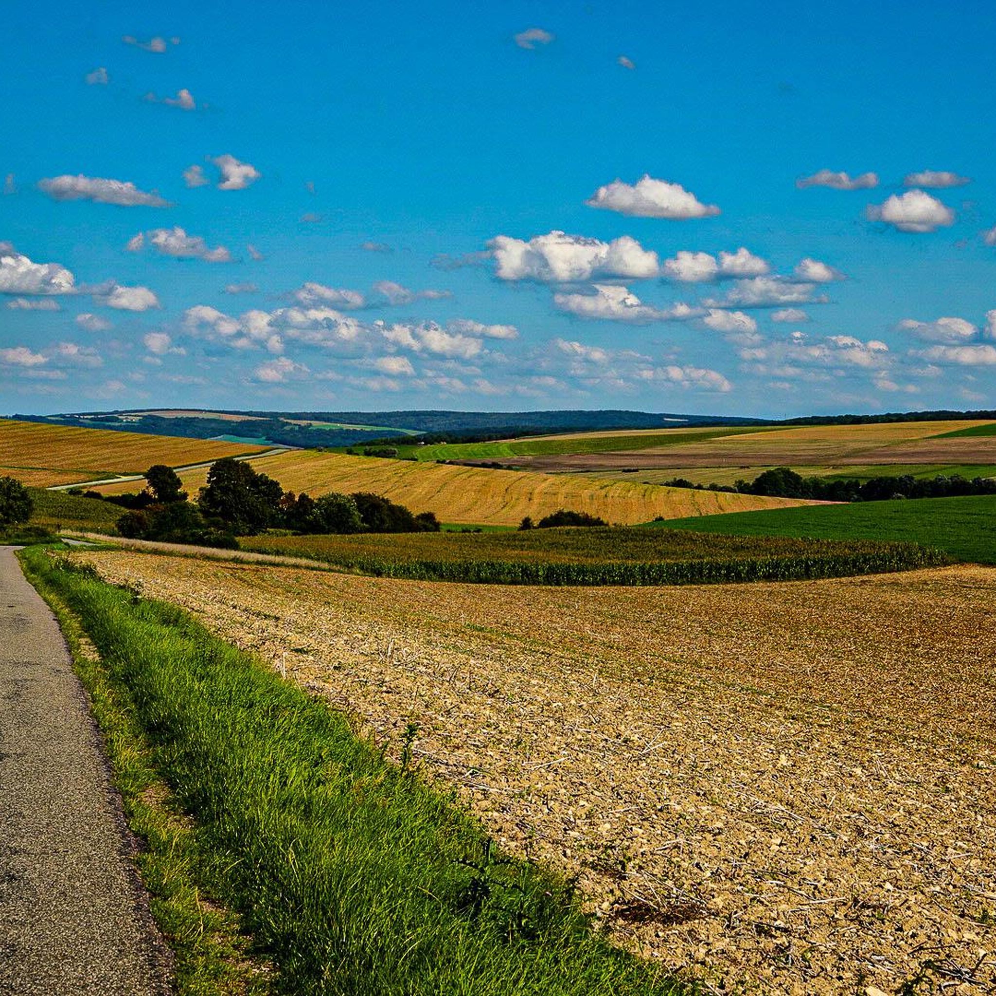
Jogging around Nantillois provides an opportunity to explore the region's varied landscape. The area features a mix of open fields and woodlands, with gentle elevation changes suitable for running. Terrain often includes well-maintained paths and some unpaved sections, offering a natural running experience. The routes primarily traverse the countryside surrounding the village, characterized by rolling hills and agricultural land.
Best jogging routes around Nantillois
- The most popular jogging route is Running loop from Cheppy, a 8.2 miles (13.3 km)…
Last updated: July 4, 2026
3
runners
7.68km
00:48
60m
60m
Moderate run. Good fitness required. Mostly paved surfaces. Suitable for all skill levels.
2
runners
13.3km
01:23
120m
120m
Moderate run. Good fitness required. Mostly paved surfaces. Suitable for all skill levels.

Sign up for free
1
runners
9.31km
01:09
100m
100m
Moderate run. Good fitness required. Mostly paved surfaces. Suitable for all skill levels.
2
runners
16.7km
01:45
180m
180m
Hard run. Very good fitness required. Mostly paved surfaces. Suitable for all skill levels.
2
runners
16.7km
01:48
270m
270m
Hard run. Very good fitness required. Mostly paved surfaces. Suitable for all skill levels.
Get access to more routes and recommendations from other explorers.
Sign up for free
Already have an account?
Our route recommendations are based on thousands of hikes, rides, and runs completed by other people on komoot.
Start today with a free account
Your next adventure awaits.
Login or Signup
Popular around Nantillois

Tips from the Community

Place of commemoration.
2
0

The American military cemetery in Romagne-sous-Montfaucon contains the graves of 14,246 soldiers who died during the First World War in northwest France. It is the largest American military cemetery in Europe. The cemetery site is located in the old front line of the Meuse-Argonne offensive that took place between September 26 and November 11, 1918. The plot of land was used as a cemetery on October 14, 1918 after it had been occupied by the American forces just before. 32nd Infantry Division. The site was given on permanent loan to the US by the French government. The 14,246 graves are spread over eight fields. There are lime trees surrounding the fields, the fields themselves are covered with grass. Each grave has its own stone. For Jewish graves, the top of the stone is shaped like a Star of David. The text on each stone states the soldier's name, rank, division, state and date of death. Of the 14,246 graves, 486 soldiers have not been identified. The stones of the unidentified soldiers bear the text: Here rests in honored glory an American soldier known but to god. On the south side of the cemetery is a memorial building, designed by the architectural firm York and Sawyer from New York. The center of the memorial gives access to a chapel containing the flags of the US and the other allied countries. The stained glass windows show the insignia of the various divisions that operated in the region. The two loggias outside the chapel display the names of 954 missing soldiers. The visitors building is located on the north side of the cemetery. There is a book here in which a visit can be registered. The entrance to the cemetery, both on the west and east sides, is 'guarded' by two white towers with the American eagle on top. There is a large pond in the middle of the site. The maintenance and management of the cemetery is the responsibility of the American Battle Monuments Commission.
5
0

Frequently Asked Questions
How many running routes are available around Nantillois?
There are 6 dedicated running routes around Nantillois listed in this guide. These include 5 moderate and 1 difficult trail, offering options for various fitness levels.
Are there any easy running routes for beginners in Nantillois?
While there are no routes explicitly categorized as 'easy,' the region offers several moderate trails that are suitable for runners looking for a less strenuous experience. The landscape generally features gentle elevation changes, making many of the moderate routes accessible.
What are the most challenging running trails near Nantillois?
For a more challenging run, consider the Running loop from Gesnes-en-Argonne. This 10.4-mile (16.7 km) difficult route features the highest elevation gain among the listed trails, providing a demanding workout through varied landscapes.
Are there any circular running routes in the Nantillois area?
Yes, all the running routes featured in this guide are circular loops, allowing you to start and finish at the same point. Examples include the Running loop from Varennes-en-Argonne and the Running loop from Montblainville.
What kind of terrain can I expect on the running trails around Nantillois?
The running trails around Nantillois feature a mix of open fields and woodlands. You can expect well-maintained paths interspersed with some unpaved sections, offering a natural running experience across rolling hills and agricultural land.
What interesting sights or landmarks can I see along the running routes?
The region around Nantillois is rich in history. Along or near some routes, you might encounter significant landmarks such as the Meuse-Argonne American Cemetery, the Montfaucon American Monument, or the Pershing Bridge of Dun-sur-Meuse. These offer points of interest during your run.
Are the running trails in Nantillois suitable for families?
The moderate routes with gentle elevation changes are generally suitable for active families. However, as there are no routes specifically marked 'easy,' families with younger children or those new to running might prefer shorter distances like the Running loop from Varennes-en-Argonne, which is 4.8 miles (7.7 km).
Are dogs allowed on the running trails in Nantillois?
Most natural trails in France, including those around Nantillois, are generally dog-friendly, especially if your dog is kept on a leash. However, it's always advisable to check local signage for any specific restrictions, particularly in nature reserves or agricultural areas.
What is the best time of year for running in Nantillois?
The region's varied landscape of fields and woodlands makes it pleasant for running during spring, summer, and autumn. Spring offers blooming scenery, summer provides longer daylight hours, and autumn brings beautiful foliage. Winter running is possible, but conditions may vary with weather.
Are there any cafes or places to stop for refreshments near the running routes?
Nantillois is a small village, and while specific cafes directly on the trails are not common, you may find options in nearby towns or villages like Varennes-en-Argonne or Montblainville, which serve as starting points for some routes. It's recommended to carry your own hydration and snacks.
What do other runners enjoy most about jogging in Nantillois?
The komoot community frequently praises the varied terrain, which includes a mix of open fields and dense woodlands. Runners appreciate the natural experience offered by the well-maintained paths and the opportunity to explore the rolling hills and agricultural landscapes of the region.
Is parking available at the trailheads for running routes in Nantillois?
Parking is generally available in the villages that serve as starting points for these routes, such as Varennes-en-Argonne, Cheppy, Montblainville, and Gesnes-en-Argonne. Look for public parking areas within these communities.
Can I reach the running trails around Nantillois using public transport?
Public transport options directly to the trailheads in Nantillois and surrounding small villages may be limited. It is generally recommended to travel by car to access these running routes, especially for flexibility in reaching specific starting points.
Most popular attractions around Nantillois

Get inspired with the komoot mobile app


Explore more
Browse the best Running Trails & Routes in other regions.
