The best walks and hikes around Snillfjord
4.8
(30)
177
hikers
14
hikes
Hiking around Snillfjord offers diverse terrain within Norway's Trøndelag county, characterized by its quintessential fjord landscape. The region features the 14-kilometer Snillfjorden, fed by rivers, providing waterside trails and elevated viewpoints. Hikers can explore varied natural environments, including moorlands, forests, and hills, with the highest point reaching 791.7 meters. This topography creates a blend of natural wilderness and cultural landscapes.
Best hiking trails around Snillfjord
- The most popular hiking route is Sverdalen Moor and Lake – Lake View with Rest…
Last updated: October 26, 2026
4
hikers
3.35km
01:03
130m
130m
Easy hike. Easily walkable paths.
5.0
(2)
17
hikers
4.70km
01:58
380m
380m
Moderate hike. Good fitness required. Mostly walkable paths. Sure-footedness required.

5.0
(3)
26
hikers
11.4km
03:41
510m
510m
Moderate hike. Good fitness required. Easily walkable paths.
4.5
(2)
7
hikers
8.95km
03:13
530m
530m
Moderate hike. Good fitness required. Easily walkable paths.
9
hikers
6.80km
02:19
350m
350m
Moderate hike. Good fitness required. Easily walkable paths.
Get access to more routes and recommendations from other explorers.
Already have an account?
Our route recommendations are based on thousands of hikes, rides, and runs completed by other people on komoot.
Start today with a free account
Your next adventure awaits.
Popular around Snillfjord
Tips from the Community

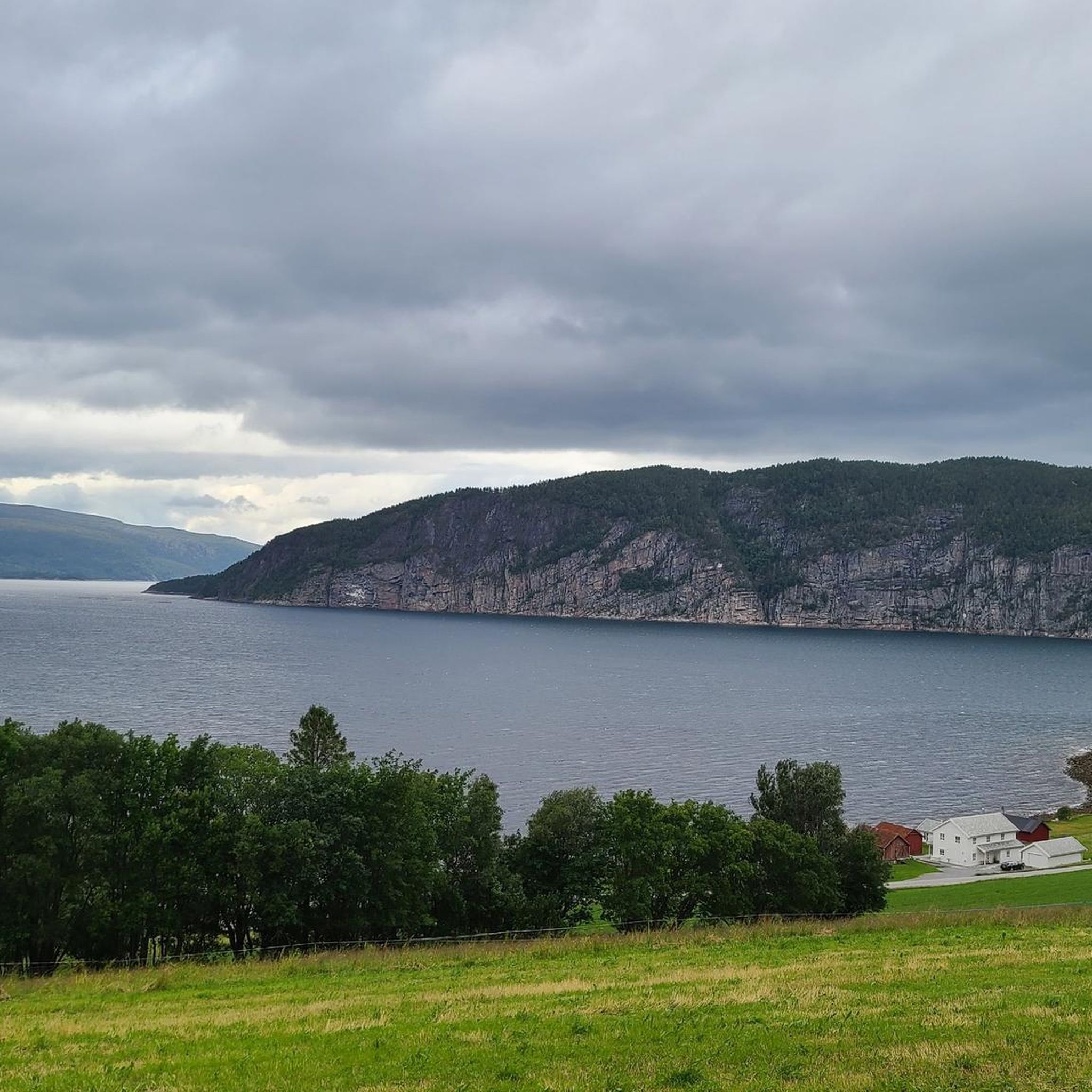
The open viewpoint overlooks the fjord, Storvatnet and the surrounding coastal landscape. On the way up, wooden boardwalks carry you across the wetter sections of the trail.
0
0

Frequently Asked Questions
What types of landscapes can I expect to see while hiking in Snillfjord?
Snillfjord is characterized by its quintessential Norwegian fjord landscape. You'll encounter the tranquil expanse of the 14-kilometer Snillfjorden, fed by rivers, offering picturesque waterside trails and elevated viewpoints. The region also features diverse natural environments such as moorlands, forests, and hills, with the highest point reaching 791.7 meters.
Are there any easy hiking trails suitable for beginners in Snillfjord?
Yes, Snillfjord offers several easy trails. An excellent option is the Sverdalen Moor and Lake – Lake View with Rest Area loop from Hardmoen. This 2.6 km route takes about 45 minutes and provides pleasant lake views with designated rest areas.
What do other hikers enjoy most about the trails in Snillfjord?
The hiking routes in Snillfjord are highly rated by the komoot community, with an average score of 4.75 stars from over 20 reviews. Hikers frequently praise the region's diverse fjord scenery, varied forests, and open moorlands, noting the options available for different ability levels.
Are there any circular hiking routes in Snillfjord?
Yes, many trails in Snillfjord are designed as loops. For example, the Djupåvatnet – Short climb loop from Fossmyra is a moderate 4.7 km path that includes a short climb, offering elevated perspectives of the surrounding landscape.
Are there any longer or more challenging hikes available?
For those seeking a more strenuous experience, the Kattlislættet – Skoglifjellet loop from Våøyan is a moderate 11.4 km trail. It leads through varied natural environments and typically takes around 3 hours 40 minutes to complete.
What is the highest point accessible by hiking in the Snillfjord area?
The highest point in the former Snillfjord municipality is Gråurda, reaching 791.7 meters (2,597 feet). While specific trails to its summit may vary, the region's topography offers opportunities for challenging ascents and expansive views across the fjord landscape.
Are there any hikes that offer scenic mountain lake views?
Yes, the Scenic Mountain Lake loop from Hardmoen provides beautiful mountain lake views. This moderate 11.8 km route offers options suitable for various skill levels, from shorter excursions to more extensive hikes.
What kind of natural features can I expect to see along the trails?
Beyond the fjord itself, trails in Snillfjord often feature a blend of natural wilderness and cultural landscapes. You can expect to see moorlands, dense forests, and hills, with rivers like Snildalselva and Bergselva feeding into the fjord, enhancing the scenic beauty.
Are there any moderate hikes with significant elevation gain?
The Tømmerskardet loop from Belsvik is a moderate 8.9 km hike with an elevation gain of over 500 meters. This route provides a good challenge and rewarding views.
How many hiking routes are there in total around Snillfjord?
There are 12 hiking routes available around Snillfjord, ranging from easy strolls to moderate ascents, ensuring options for various fitness levels and preferences.
Is Snillfjord suitable for family-friendly hikes?
Yes, Snillfjord offers trails suitable for families. The region has easy options like the Sverdalen Moor and Lake – Lake View with Rest Area loop from Hardmoen, which is short, relatively flat, and provides rest areas, making it ideal for outings with children.
Most popular routes around Snillfjord
Most popular attractions around Snillfjord

Get inspired with the komoot mobile app


Explore more
Browse the best Hikes in other regions.
