The best cycling routes around Vangsmjøse
4.1
(5)
49
riders
5
rides
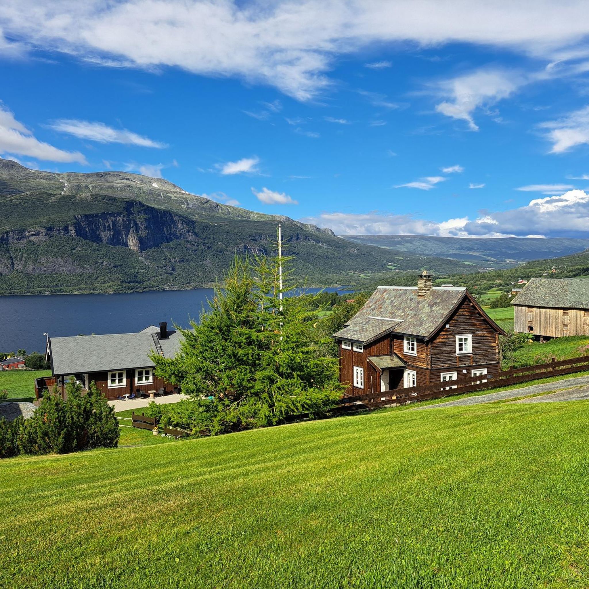
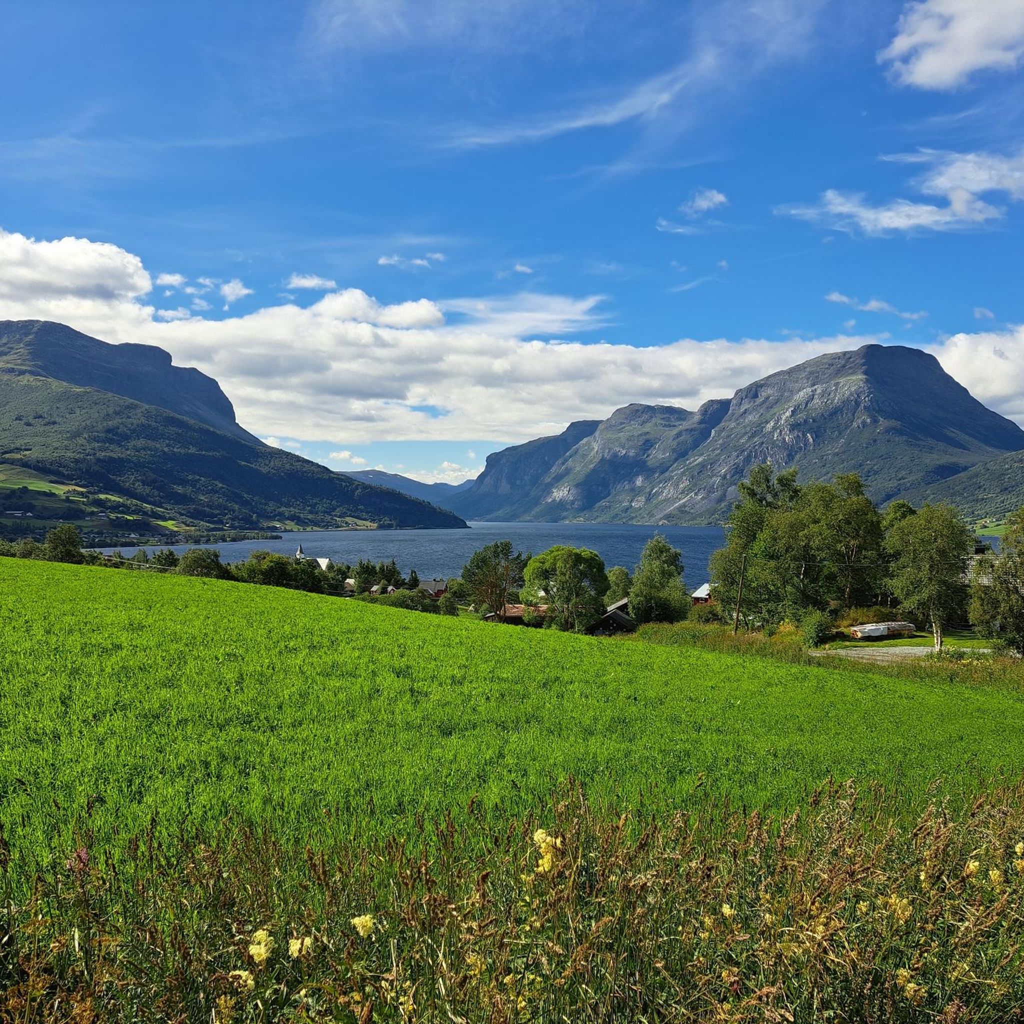
Touring cycling around Vangsmjøse features routes along the lake's shores, offering expansive views of the water and surrounding landscapes. The terrain includes both asphalt and gravel roads, with varied elevation gains ranging from moderate climbs to significant ascents. Cyclists can experience vistas of Jotunheimen, steep cliff faces, and tranquil birch forests, alongside cultural landscapes with old farmsteads. The lake itself is situated at 466 meters (1,529 ft) above sea level, providing a central feature for many routes.
Best touring cycling…
Last updated: June 27, 2026
4.7
(3)
13
riders
47.8km
03:13
660m
660m
Hard bike ride. Very good fitness required. Mostly paved surfaces. Suitable for all skill levels.
3.5
(2)
2
riders
14.5km
01:11
340m
340m
Moderate bike ride. Good fitness required. Mostly paved surfaces. Suitable for all skill levels.

Sign up for free
16
riders
75.7km
05:15
1,360m
1,360m
Hard bike ride. Very good fitness required. Mostly paved surfaces. Suitable for all skill levels.
11
riders
56.6km
03:55
720m
720m
Hard bike ride. Very good fitness required. Mostly paved surfaces. Suitable for all skill levels.
7
riders
53.9km
04:09
1,010m
1,010m
Hard bike ride. Very good fitness required. Mostly paved surfaces. Suitable for all skill levels.
Our route recommendations are based on thousands of hikes, rides, and runs completed by other people on komoot.
Start today with a free account
Your next adventure awaits.
Login or Signup
Other adventures around Vangsmjøse

Tips from the Community

Here we can take a break to refuel, eat a sandwich, and rest while enjoying some incredible views.
0
0


At Riddergaarden, a Mjølkevegen Partner accommodation, cyclists sleep with style. You'll find a wellness department with swim out, an Italian restaurant and bicycle storage and charging possibilities in the basement. The closest neighbour is the Beitostølen Trail area (trail cycling, downhill, bicycle lift).
0
0
The rest shelters by Mjølkevegen along the route are called "Mjølkerampe" in Norwegian, referring to the stands where milk buckets were placed to be collected by the passing milk vehicle. This one is located centrally at Vaset. Enjoy your break, and please do not litter.
0
0
Vasetsenteret is a Mjølkevegen Partner. You'll find a large, well-sorted Joker supermarked and a campground with an area for tents as well as sanitary and kitchen facilities. Check-in is in the supermarked.
0
0
Vasetstølen is a Mjølkevegen Partner offering accommodation in cabins and great home made food. They are famous for their rømmegrøt - the traditional Norwegian sour cream porridge!
0
0
Slettefjellkiosken is a Mjølkevegen Partner and a great place to reload batteries - for both e-bikes and people! Enjoy a waffle and a soda or a cup of coffee. Here at the southern end of the Slettefjellet mountain pass the two main route alternatives, via Slettefjellet and via Tyin, meet. Also, if you're headed towards Rogn Camping you're exiting the route here to join in back later. For opening hours, see https://facebook.com/Slettefjellvegane
0
1
Frequently Asked Questions
What types of terrain can I expect on touring cycling routes around Vangsmjøse?
The touring cycling routes around Vangsmjøse feature a diverse mix of terrain. You'll find both asphalt and gravel roads, offering varied experiences. Some routes wind through tranquil birch forests, while others traverse cultural landscapes with old farmsteads along the water. Expect varied elevation gains, from moderate climbs to significant ascents, especially on routes leading towards the mountains.
Are there any easy or moderate touring cycling routes suitable for less experienced cyclists?
Yes, while many routes are challenging, there is a moderate option available. The Søflaten Camping – Nausthaugen loop from Vang kyrkje is a 14.5 km path that features a mix of asphalt and gravel roads, winding through the scenic cultural landscape near the lake. For those seeking easier rides, the region also offers family-friendly options like an 11 km tour through birch forests or a flat 12 km route from Vang center along Vangsmjøsa, which includes a traffic-free return on a quiet gravel road.
What kind of views can I expect while cycling around Vangsmjøse?
Cyclists around Vangsmjøse are treated to magnificent vistas. Routes often run alongside the lake's shores, providing expansive lake views. You'll also encounter dramatic mountain scenery, including views of Jotunheimen, Northern Europe's highest mountain range, and the steep cliff faces of Vennisfjell and Skutshorn.
Are there any challenging long-distance touring cycling routes in the Vangsmjøse area?
Absolutely. For experienced and fit cyclists, Vangsmjøse offers several challenging routes. The Høre Stave Church – Slettefjell Kiosk loop from Heensåsen kyrkje is a difficult 75.7 km trail leading through varied mountain scenery. Another demanding option is the Galden – Søflaten Camping loop from Vang kyrkje, a 47.8 km route with significant elevation gain and expansive views. The region is also part of the challenging 430 km Jotunheimen Rundt marathon, which includes over 5340 meters of elevation gain.
What historical or cultural sites can I visit while touring cycling in Vangsmjøse?
The Vangsmjøse area is rich in history and culture. You can visit the historic Øye Stave Church, located at the west end of Vangsmjøse, which dates back to the late 1100s. Another notable site is the Høre Stave Church, known for its medieval dragon and lion carvings. Additionally, some cycling paths, like the 'Vangsmjøsa rundtur', pass through cultural landscapes with old farmsteads.
What do other touring cyclists say about the routes in Vangsmjøse?
The touring cycling routes in Vangsmjøse are highly rated by the komoot community, with an average score of 4.1 stars from over 5 reviews. Cyclists often praise the varied terrain, from lake shores to mountain vistas and birch forests, and the options available for different ability levels.
Are there any circular touring cycling routes around Vangsmjøse?
Yes, circular routes are a popular way to explore the area. The 'Vangsmjøsa rundtur' is an easy to moderate 28 km loop around the lake, featuring a mix of asphalt and gravel roads with mountain and lake views. Many of the komoot routes, such as the Søflaten Camping – Nausthaugen loop from Vang kyrkje, are also designed as loops, offering convenient starting and ending points.
Can I find routes that are part of national cycling networks in Vangsmjøse?
Yes, the Vangsmjøse area is connected to larger cycling networks. Part of the National Bike Route 5, also known as Mjølkevegen, runs through the region. This route is designed to keep cyclists away from busy traffic roads and offers a multi-day experience showcasing Norwegian mountains, pastures, wildlife, and authentic farm life.
What are some other outdoor activities available in the Vangsmjøse region besides cycling?
Beyond cycling, the Vangsmjøse region offers a variety of outdoor activities. Fishing is popular in Lake Vangsmjøse, known for its trout, and is accessible from both the shore and by boat. Hiking is also a prominent activity, with numerous opportunities to explore Norway's stunning fjords, forests, and mountains.
How many touring cycling routes are available to explore in Vangsmjøse?
There are over 5 touring cycling routes around Vangsmjøse documented on komoot, catering to various skill levels. These include one moderate route and four difficult routes, ensuring options for both casual riders and those seeking a significant challenge.
Are there any routes that offer a historical cycling experience?
Yes, for a unique historical cycling experience, consider the 'Kongevegen over Filefjell' (The King's Road over Filefjell). This challenging 55 km gravel route is known as Norway's first roadway from the 1790s and offers dramatic mountain scenery and waterfalls along its path.
What is the elevation of Vangsmjøse and how does it affect cycling?
Vangsmjøse is situated at an elevation of 466 meters (1,529 ft) above sea level. This elevation contributes to the region's stunning mountain vistas and means that while some routes offer manageable elevation gains, others, particularly those leading towards areas like Tyinkrysset or Jotunheimen, will involve significant climbs, such as a 550-meter ascent over 32 km.

Get inspired with the komoot mobile app


Explore more
Browse the best Cycling routes in other regions.
