The best running trails around Trysunda
5.0
(1)
26
runners
5
runs
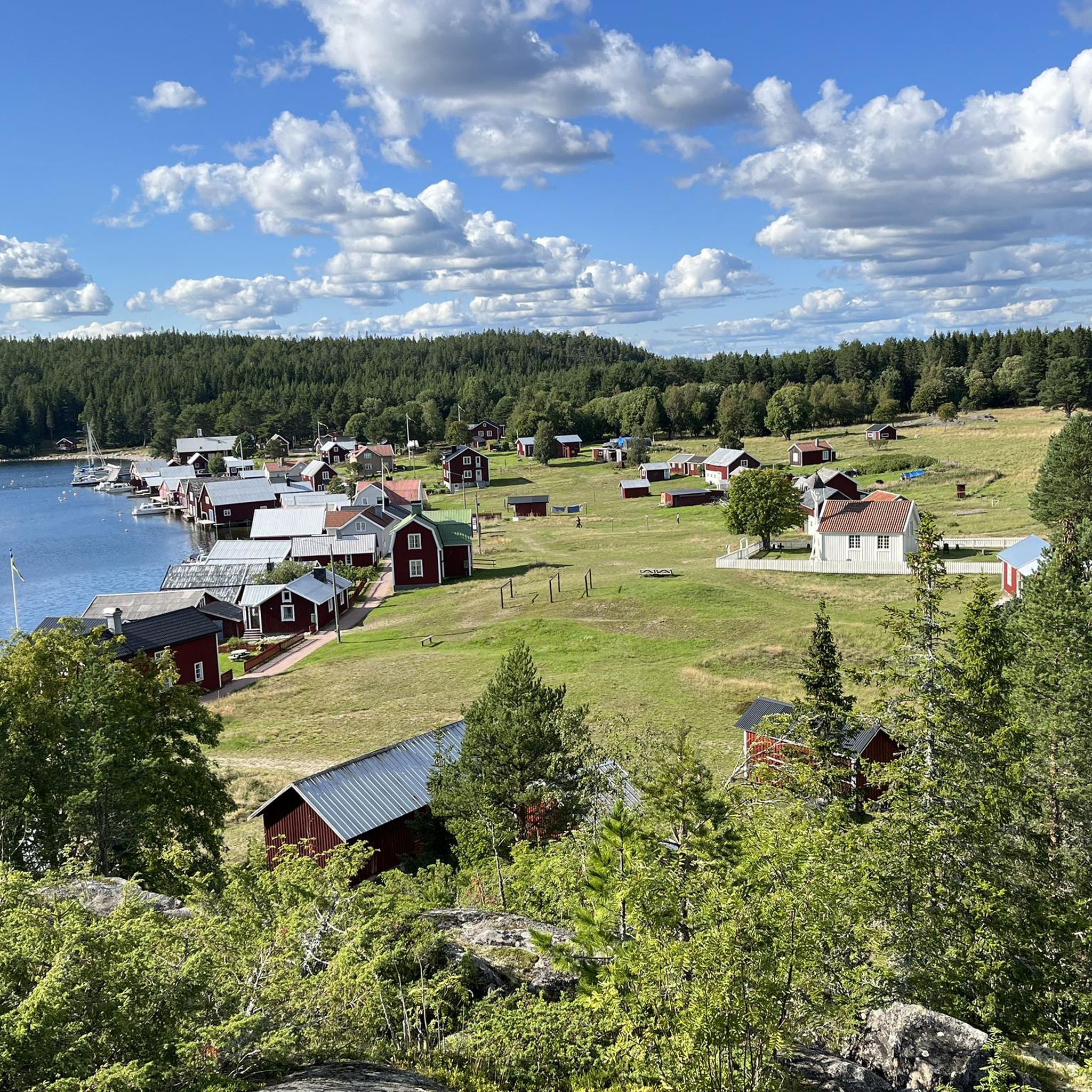
Jogging routes around Trysunda traverse a nature reserve, offering a diverse natural landscape characterized by well-marked trails. The island's geology, shaped by volcanic and glacial activity, provides varied terrain including forest paths, open meadowland, and coastal sections. Runners can experience a mix of environments, from tranquil wooded areas to scenic shorelines, with opportunities to encounter unique geological features and ascend hills for panoramic views. The island is part of the Höga Kusten archipelago, known for its unique landscape.
Best jogging routes around Trysunda
- The most popular jogging route is Running loop from Ögeltjärn, a 5.8 miles (9.3 km) trail that takes 1 hour 9 minutes to complete. This moderate route winds through the island's varied natural landscapes.
- Another top favourite among local runners is Balestjärnen – Balesudden loop from Sandlågan, a difficult 6.7 miles (10.9 km) path. This route offers a mix of forest trails and coastal views, leading to elevated points.
- Local runners also love the Balestjärn – View from Balesudden loop from Hålviken, an 8.3 miles (13.3 km) trail leading through forested areas and towards higher ground, often completed in about 1 hour 49 minutes.
- Jogging around Trysunda is defined by diverse geographical landscapes, picturesque nature trails, and coastal scenery. The network offers options for different ability levels, from moderate paths to more challenging routes with significant elevation gain.
- The routes in Trysunda are highly rated by the komoot community with an average score of 5.0 stars from over 2 reviews. More than 20 runners have used komoot to explore Trysunda's varied terrain.
Last updated: June 26, 2026
5.0
(1)
5
runners
9.31km
01:09
150m
150m
Moderate run. Good fitness required. Mostly paved surfaces. Suitable for all skill levels.
7
runners
13.5km
01:49
380m
380m
Hard run. Very good fitness required. Mostly paved surfaces. Suitable for all skill levels.

Sign up for free
5
runners
7.82km
00:55
60m
60m
Moderate run. Good fitness required. Mostly paved surfaces. Suitable for all skill levels.
5
runners
13.3km
01:49
400m
400m
Hard run. Very good fitness required. Mostly paved surfaces. Suitable for all skill levels.
4
runners
5.05km
00:43
190m
190m
Moderate run. Good fitness required. Mostly paved surfaces. Suitable for all skill levels.
Our route recommendations are based on thousands of hikes, rides, and runs completed by other people on komoot.
Start today with a free account
Your next adventure awaits.
Login or Signup
Popular around Trysunda

Tips from the Community

Nice cabin but cold in low temperatures as the wood burner has been removed.
2
0

After climbing through the pine and spruce forest, you arrive at the rocky plateau of Balesudden: a headland with a magnificent view over the landscape of the High Coast.
1
0

Big stuga (8 beds with matrasses) and several places to pitch a tent. There were around 8 tents when we slept there. Drinking water can be found a few hundred meters furter up North.
0
0

Everything you need is available. Water (a little further), toilet, many beds and a heater. We were there with 6 other people during a thunderstorm.
0
0

Beautiful woodland lake with crystal clear water perfect for a swim
1
0

There is fire wood, fire places, a toilet and, of course, the hut. It is the perfect place to stay before starting for the last section of the Höga Kustenleden. Water can be found a bit uphill. Make sure to boil or filter it.
1
0

Spacious cabin for 8 people on the High Coast Trail. Large table, two benches, a stove, and four bunk beds are available. Camping is also possible outside. Water is available from a nearby spring along the trail. Please leave the cabin clean and tidy, and take your trash with you to ensure its longevity.
1
0

Lake with crystal clear water, suitable for diving and swimming.
1
0
Frequently Asked Questions
What kind of terrain can I expect on Trysunda's running trails?
Trysunda offers a diverse natural landscape for runners. You'll find well-marked trails traversing a nature reserve, with terrain shaped by volcanic and glacial activity. Expect a mix of environments, including tranquil forest paths, open meadowland, and scenic coastal sections. Some routes may feature unique red beaches or stony areas like Storviken, and you can also encounter challenging inclines leading to viewpoints.
How many running routes are available in Trysunda?
Trysunda features 6 dedicated running routes. These trails offer a variety of distances and difficulty levels, allowing you to explore the island's unique landscapes at your own pace.
Are there any running routes suitable for beginners or those looking for an easier run?
While there are no routes specifically classified as 'easy' in Trysunda, many of the trails are considered moderate. For example, the Running loop from Ögeltjärn is a moderate 5.8-mile (9.3 km) trail that winds through varied natural landscapes, offering a good option for those seeking a less strenuous experience compared to the more difficult routes.
What are the typical distances and durations for running routes in Trysunda?
The running routes in Trysunda vary in length and time. You can find trails ranging from approximately 4.8 miles (7.8 km) to 8.9 miles (14.3 km). A moderate 5.8-mile (9.3 km) route might take around 1 hour 9 minutes, while a longer 8.9-mile (14.3 km) trail could take about 1 hour 48 minutes, depending on your pace and the elevation.
Are there any challenging running routes with significant elevation gain?
Yes, Trysunda offers routes with significant elevation gain for those seeking a challenge. For instance, the Balestjärnen – Balesudden loop from Sandlågan is classified as 'difficult' and features over 320 meters of ascent, providing a demanding workout amidst stunning scenery.
Can I find circular running routes in Trysunda?
Yes, many of the running trails in Trysunda are designed as loops, allowing for convenient circular runs. Examples include the Running loop from Ögeltjärn, which offers a scenic circular experience through forests and open areas, and the Ögeltjärn loop from Ögeltjärn.
What kind of scenic views or landmarks can I expect along the running trails?
Trysunda's trails offer breathtaking views of the High Coast and the Örnsköldsvik archipelago. You can run through lush forests, along rugged shorelines, and past unique geological features like red beaches and the spherical rocks of Storviken Beach. A short, steep path behind the old church leads to Utsiktsberget, the island's highest point, providing panoramic vistas that are a rewarding stop during a run.
What do other runners enjoy most about jogging in Trysunda?
The running routes in Trysunda are highly rated by the komoot community, with an average score of 5.0 stars. Runners often praise the diverse geographical landscapes, picturesque nature trails, and the constant changes in scenery from tranquil wooded paths to expansive sea views. The well-marked trails and varied terrain are frequently highlighted as key attractions.
Are the running trails in Trysunda suitable for families?
While specific 'family-friendly' classifications aren't provided, the island's well-marked nature trails and diverse landscapes can be enjoyable for active families. Consider routes with moderate difficulty and shorter distances, such as the Running loop from Ögeltjärn, and adjust your pace to suit all family members. The blend of forests and coastal scenery offers engaging exploration for all ages.
Is Trysunda a good place for dog-friendly running?
Trysunda's extensive network of nature trails and forest paths makes it a great location for running with dogs. The diverse terrain, from open meadowland to coastal sections, provides plenty of sensory experiences for your canine companion. Always ensure your dog is kept on a leash and that you follow local regulations for nature reserves.
What is the best time of year for running in Trysunda?
Trysunda's natural beauty can be enjoyed throughout much of the year. The island's diverse landscapes, including forests and coastal paths, offer varied experiences depending on the season. While specific seasonal recommendations for running aren't detailed, the High Coast region is generally popular for outdoor activities from spring through autumn, when the weather is milder and trails are clear.
Are there any wild swimming spots near the running trails?
Yes, Trysunda is known for its beautiful beaches, which can be accessed from the running trails. Björnviken Beach, the largest sandy beach on the island, is reachable via a forest path through the nature reserve and offers a refreshing spot for a swim after your run. Storviken Beach, while stony, also provides coastal access.

Get inspired with the komoot mobile app


Explore more
Browse the best Running Trails & Routes in other regions.
