Easy hikes and walks around Windgfällweiher
4.6
(55663)
218,547
hikers
1,023
hikes
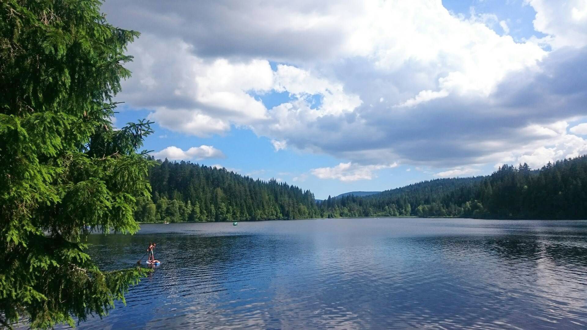
Easy hiking trails around Windgfällweiher explore a picturesque reservoir nestled in the High Black Forest, formed in a hollow by ice age glaciation. The area is characterized by heavily wooded shores, providing a tranquil atmosphere, and its status as a landscape protection area since 1950 safeguards remarkable biodiversity. At approximately 1000 meters above sea level, the lake offers a refreshing environment for outdoor activities. The terrain features gentle gradients around the lake and extends into surrounding Black Forest woodlands.
Best easy hiking trails around Windgfällweiher
- The most popular easy hiking route is Railway Line at Windfällweiher – Windgfällweiher loop from Altglashütten, a 1.3 miles (2.1 km) trail that takes 32 minutes to complete. This route follows a gentle path along the historic railway line and the tranquil lake shore.
- Another top favourite among local hikers is Windgfällweiher – View of Feldberg loop from Altglashütten, an easy 3.7 miles (6.0 km) path. This route offers views towards Feldberg and traverses varied woodland, with an elevation gain of over 100 meters.
- Local hikers also love the Feserstegweg – Windgfällweiher loop from Altglashütten, a 4.4 miles (7.1 km) trail leading through varied forest and along the lake, often completed in about 1 hour 56 minutes.
- Hiking around Windgfällweiher is defined by a picturesque reservoir, heavily wooded shores, and surrounding Black Forest trails. The network offers options for different ability levels, with many easy hiking trails suitable for all.
- The routes in Windgfällweiher are highly rated by the komoot community with an average score of 4.6 stars from over 48,000 reviews. More than 190,000 hikers have used komoot to explore Windgfällweiher's varied terrain.
Last updated: June 30, 2026
4.7
(123)
588
hikers
Easy hike. Great for any fitness level. Easily-accessible paths. Suitable for all skill levels.
4.7
(106)
504
hikers
Easy hike. Great for any fitness level. Easily-accessible paths. Suitable for all skill levels.

Sign up for free
4.5
(8)
35
hikers
5.97km
01:39
110m
110m
Easy hike. Great for any fitness level. Easily-accessible paths. Suitable for all skill levels.
4.4
(8)
35
hikers
7.14km
01:57
110m
110m
Easy hike. Great for any fitness level. Easily-accessible paths. Suitable for all skill levels.
4.5
(8)
42
hikers
3.56km
00:57
40m
40m
Easy hike. Great for any fitness level. Easily-accessible paths. Suitable for all skill levels.
Get access to more routes and recommendations from other explorers.
Sign up for free
Already have an account?
Our route recommendations are based on thousands of hikes, rides, and runs completed by other people on komoot.
Start today with a free account
Your next adventure awaits.
Login or Signup
Popular around Windgfällweiher
Other adventures around Windgfällweiher

Tips from the Community

This is a tunnel under the railway track. With a stream of water in the middle, very special Nice to walk under it
0
0

Looks very nice, but today at 37° C, it was of course quite busy 😬
0
0

Free parking and plenty of space.
0
0

A gorgeous reservoir lake near Schluchsee with a swimming area and pebbly beach. Perfect for a refreshing swim or just relaxing by the clear water on a warm day.
0
0

Very nice for a break by or in the water
1
0

Beautiful circular route, but be careful, the parking lot at the lake is subject to a fee: €3 for the first hour and €1 for each additional hour.
1
0
Beautiful circular route, but be careful, the parking lot at the lake is subject to a fee: €3 for the first hour and €1 for each additional hour.
1
0
The circular route around the Wingefelweiher pond is very beautiful.
1
0
Frequently Asked Questions
How many easy hiking trails are available around Windgfällweiher?
There are over 480 easy hiking trails around Windgfällweiher, offering a wide variety of options for all skill levels. The komoot community has explored over 1,000 routes in total in the area.
What kind of terrain can I expect on easy hikes around Windgfällweiher?
Easy hikes around Windgfällweiher feature gentle paths along the lake's heavily wooded shores and extend into the surrounding Black Forest woodlands. The terrain generally has minimal elevation gain, making it accessible for most hikers. For example, the Railway Line at Windfällweiher – Windgfällweiher loop has less than 10 meters of elevation gain.
Are there any circular routes suitable for easy hiking around Windgfällweiher?
Yes, many of the easy trails around Windgfällweiher are circular routes. A popular option is the Windgfällweiher – Windgfällweiher loop from Altglashütten, which is about 3.7 km long and takes approximately an hour to complete, offering continuous views of the lake.
What are some interesting natural features or landmarks to see on easy hikes?
The primary natural feature is the picturesque Windgfällweiher itself, a tranquil reservoir surrounded by dense forests. You can also explore the soft forest trail around the pond, which is part of a beaver reserve, or discover the weir at Windgefällweiher.
Are the easy hiking trails around Windgfällweiher suitable for families with children?
Yes, the easy hiking trails are generally very suitable for families. The gentle gradients and well-maintained paths make them ideal for children. The circular walk around the lake is particularly popular for its manageable length and scenic views, providing a refreshing outdoor experience for all ages.
Can I bring my dog on the easy hiking trails?
Most easy hiking trails around Windgfällweiher are dog-friendly, allowing you to enjoy the natural beauty with your canine companion. Always ensure your dog is on a leash, especially in protected areas, and be mindful of other hikers and wildlife.
How long do easy hikes around Windgfällweiher typically take?
The duration of easy hikes varies. Shorter loops, like the Railway Line at Windfällweiher – Windgfällweiher loop, can be completed in about 30 minutes. Longer easy routes, such as the Feserstegweg – Windgfällweiher loop (7.1 km), might take around 2 hours, depending on your pace.
What is the best time of year to go hiking around Windgfällweiher?
Windgfällweiher is beautiful year-round. Spring and autumn offer pleasant temperatures and vibrant colors, while summer is ideal for combining hiking with swimming in the lake. In winter, the frozen lake can be used for ice skating, and nearby cross-country skiing trails are available, making it a versatile destination.
Are there options for parking near the easy hiking trails?
Yes, there are parking options available in the vicinity, particularly in Altglashütten, which serves as a common starting point for many trails around Windgfällweiher. These parking areas provide convenient access to the various hiking routes.
How can I reach Windgfällweiher using public transport?
Windgfällweiher is accessible by public transport. The historic Three Lakes Railway, built between 1920 and 1926, runs along the eastern shore of the lake, providing a charming and convenient way to reach the area and access various trailheads.
What do other hikers enjoy most about hiking in Windgfällweiher?
The area is highly rated by the komoot community, with an average score of 4.6 stars from over 48,000 reviews. Reviewers often praise the tranquil atmosphere, the picturesque lake views, and the well-maintained, easy paths that make it enjoyable for all ages and fitness levels. The serene beauty and biodiversity are frequently highlighted.
Are there any viewpoints offering panoramic vistas on easy trails?
While many easy trails focus on the immediate lake surroundings, routes like the Windgfällweiher – View of Feldberg loop offer glimpses towards the majestic Feldberg. For broader panoramic views, the nearby Hochfirst (1,199 meters) provides magnificent vistas over Lake Titisee, Feldberg, and even the Alps on clear days, though reaching it involves more challenging routes.
Are there places to eat or get refreshments near the trails?
Yes, the region around Windgfällweiher has cozy inns where visitors can enjoy regional delicacies after their hike. These establishments offer a chance to relax and refuel, adding a culinary dimension to your outdoor adventure.
Most popular routes around Windgfällweiher
Most popular attractions around Windgfällweiher

Get inspired with the komoot mobile app


Explore more
Browse the best Hikes in other regions.
