Easy hikes and walks around Eschbachtalsperre
4.6
(40662)
138,407
hikers
1,384
hikes
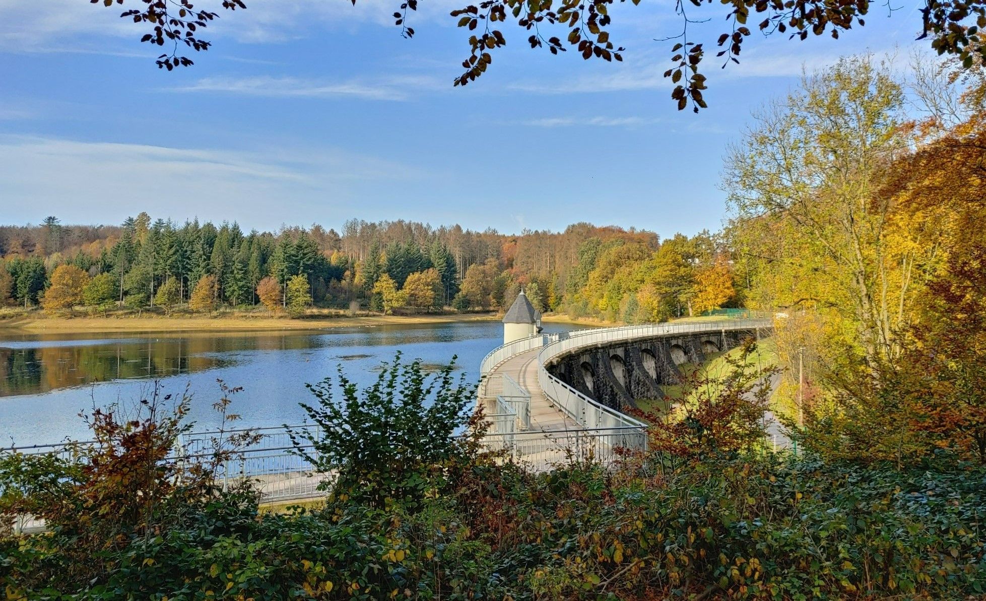
Easy hiking trails around Eschbachtalsperre traverse a landscape characterized by lush greenery and tranquil waters. The Eschbach valley features the meandering Eschbach river, deepening into picturesque gorges. Enchanting forests surround the reservoir, offering diverse natural settings for outdoor activities. The area is defined by its historic dam and the serene environment of Germany's first drinking water dam.
Best easy hiking trails around Eschbachtalsperre
- The most popular easy hiking route is Eschbach Reservoir – View of the Eschbachtalsperre loop from Tenter…
Last updated: August 10, 2026
4.7
(491)
1,830
hikers
Easy hike. Great for any fitness level. Easily-accessible paths. Suitable for all skill levels.
4.7
(427)
1,679
hikers
Easy hike. Great for any fitness level. Easily-accessible paths. Suitable for all skill levels.

Sign up for free
4.2
(10)
44
hikers
Easy hike. Great for any fitness level. Easily-accessible paths. Suitable for all skill levels.
4.2
(21)
70
hikers
5.55km
01:34
110m
110m
Easy hike. Great for any fitness level. Easily-accessible paths. Suitable for all skill levels.
5.0
(1)
18
hikers
Easy hike. Great for any fitness level. Easily-accessible paths. Suitable for all skill levels.
Get access to more routes and recommendations from other explorers.
Sign up for free
Already have an account?
Our route recommendations are based on thousands of hikes, rides, and runs completed by other people on komoot.
Start today with a free account
Your next adventure awaits.
Login or Signup
Popular around Eschbachtalsperre

Other adventures around Eschbachtalsperre

Tips from the Community

The dog that is actually a wolf(f).
0
0
Small but beautiful memorial trail with numerous QR codes that lead to various facts about forests and forestry.
0
0
Beautifully situated place for a rest - amazingly clean and well-maintained.
0
0

Here we go a bit on the Way of St. James - coming from Schwelm towards Wermelskirchen
1
0

The Stone Cross is the common name for the memorial located very close to the Way of St. James, where the old military road from Cologne to Dortmund once ran. It bears the weathered inscription: "Pray for the soul of Mr. Josef Weizel, for whose attack this cross was erected, in remembrance of October 17, in the year of our Lord 1554." Further details: https://de.wikipedia.org/wiki/Steinernes_Kreuz
2
0

Worth a short stop for a nice photo and a view of the water on the other side
0
0

One of the "tributaries" of the Eschbach Dam.
3
0
The circular trail at the Remscheid Eschbach Dam provides insights into the work of the Remscheid forestry administration, which is helping to shape the forest of the future with numerous natural forest care measures. The trail is around 1.5 kilometers long and has various themed stations, inviting you to learn more about the mission: future forest. Source and information at: wolffsweg.de
2
0
Frequently Asked Questions
How many easy hiking trails are available around Eschbachtalsperre?
There are over 900 easy hiking trails around Eschbachtalsperre, offering a wide range of options for all skill levels. In total, the region features nearly 1400 hiking routes.
What is the best time of year to hike around Eschbachtalsperre?
The best time for hiking around Eschbachtalsperre is generally from late spring to early autumn (May to September). During these months, the weather is mild, and the lush greenery of the Eschbach valley and surrounding forests is at its peak. For a more tranquil experience, consider visiting in the early mornings.
Are there any circular easy hiking routes around the Eschbachtalsperre?
Yes, many easy trails around Eschbachtalsperre are circular. For example, the Eschbach Reservoir – View of the Eschbachtalsperre loop is a popular 5 km route offering views of the reservoir and nature. Another option is the View of the Eschbachtalsperre – Eschbach Dam loop, a 3.5 km path providing close views of the historic dam wall.
What interesting landmarks or attractions can I see on an easy hike?
Easy hikes around Eschbachtalsperre offer several points of interest. You can explore the historic Eschbach Dam, Germany's first drinking water dam. The Eschbachtalsperre Loop Trail itself is a highlight, and you might encounter the Steinernes Kreuz Memorial, a historic stone cross with a fascinating story.
Are the easy hiking trails suitable for families with children?
Yes, the serene landscapes and well-maintained forest paths around Eschbachtalsperre are ideal for families. Many easy routes, like the View of Birgden – Parking area above Birgden loop, are short and offer gentle terrain, perfect for a peaceful retreat with children. Packing a picnic is also encouraged for an al fresco lunch.
Where can I find parking for the easy hiking trails?
Parking is available at various points around Eschbachtalsperre. For instance, the Parking area above Birgden – Stöcker Brook loop starts directly from a parking area, making access convenient for hikers.
What do other hikers enjoy most about the easy trails in Eschbachtalsperre?
The easy trails around Eschbachtalsperre are highly rated by the komoot community, with an average score of 4.6 stars from over 35,000 reviews. Hikers frequently praise the tranquil waters, lush greenery, and enchanting forests that define the area, making it a perfect escape into nature.
Are there any viewpoints along the easy hiking routes?
Yes, several easy routes offer scenic viewpoints. The Eschbach Reservoir – View of the Eschbachtalsperre loop provides excellent views of the reservoir. Additionally, you can find a dedicated Viewpoint with a View of the Dam, offering picturesque vistas of the historic structure and surrounding landscape.
What is the typical duration for an easy hike in this area?
The duration for easy hikes varies, but many can be completed within 1 to 1.5 hours. For example, the View of the Eschbachtalsperre – Eschbach Dam loop takes approximately 56 minutes, while the Eschbach Dam – Eschbach Dam loop is around 1 hour 33 minutes.
Are there any less crowded easy hiking options?
To experience less crowded trails, consider hiking early in the morning, especially on weekdays. While the main circular trail around the dam is popular, exploring routes that venture deeper into the Eschbach valley or the forested areas, such as the Parking area above Birgden – Stöcker Brook loop, can offer a more secluded experience.
Can I bring my dog on the easy hiking trails?
The trails around Eschbachtalsperre are generally dog-friendly, allowing you to enjoy the natural beauty with your canine companion. However, always ensure your dog is under control, especially around wildlife and other hikers, and be mindful of local regulations regarding leashes.
Most popular routes around Eschbachtalsperre
Most popular attractions around Eschbachtalsperre

Get inspired with the komoot mobile app


