Easy hikes and walks around Gelmersee
4.7
(842)
7,521
hikers
81
hikes
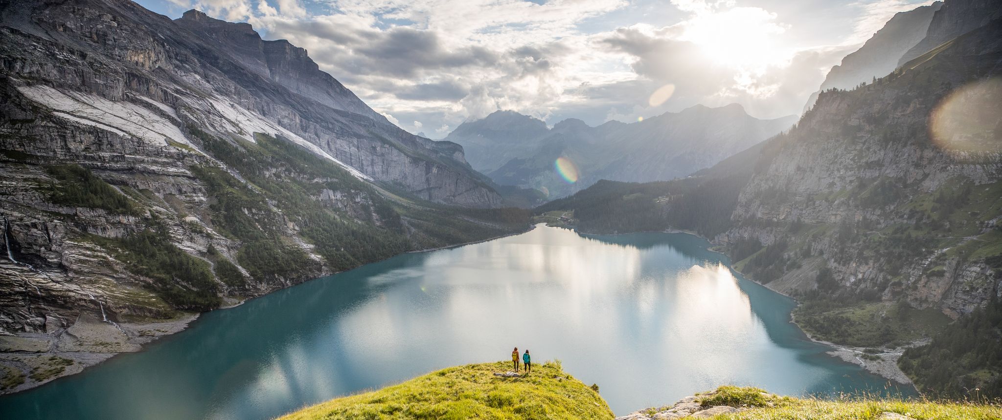
Easy hiking trails around Gelmersee explore a high-alpine hydroelectric reservoir in the Bernese Oberland. The region is characterized by deep blue to turquoise waters, surrounded by rugged mountains and impressive rock slabs. Numerous waterfalls feed the lake, and the landscape offers wide views across the Grimsel Valley.
Best easy hiking trails around Gelmersee
- The most popular easy hiking route is Gelmerbahn Valley Station – Handeggfall Bridge loop from Gelmersee, a 1.1 mile (1.8 km) trail that takes 30 minutes…
Last updated: June 30, 2026
4.7
(3)
12
hikers
Easy hike. Great for any fitness level. Easily-accessible paths. Suitable for all skill levels.
5.0
(11)
133
hikers
1.61km
00:28
40m
40m
Easy hike. Great for any fitness level. Easily-accessible paths. Suitable for all skill levels.

Sign up for free
5.0
(3)
57
hikers
Easy hike. Great for any fitness level. Easily-accessible paths. Suitable for all skill levels.
10
hikers
Easy hike. Great for any fitness level. Easily-accessible paths. Suitable for all skill levels.
4.5
(2)
7
hikers
6.07km
01:57
260m
260m
Easy hike. Great for any fitness level. Easily-accessible paths. Suitable for all skill levels.
Get access to more routes and recommendations from other explorers.
Sign up for free
Already have an account?
Our route recommendations are based on thousands of hikes, rides, and runs completed by other people on komoot.
Start today with a free account
Your next adventure awaits.
Login or Signup
Popular around Gelmersee
Other adventures around Gelmersee

Tips from the Community

very pretty here, very pretty
0
0
very pretty here, very pretty
0
0

This farm shop has a lot to offer (cash or twinnt)
0
0

The Hotel Belvédère at the Furka Pass is arguably the most famous mountain pass hotel in the world. Built in 1882 by the Valais hotelier family Seiler, it was built in a striking hairpin bend on the new Furka Road, offering stunning views of the Valais and Bernese Alps and, most importantly, in the immediate vicinity of the Rhone Glacier, the main attraction.
1
0

The Rhone Glacier (sometimes also called Rotten Glacier) is a valley glacier in the source area of the Rhone in the extreme northeast of the canton of Valais in the central Alps of Switzerland. It is almost eight kilometers long, has an average width of about two kilometers and covers an area of about 15 km². The glacier was a major tourist attraction, especially in the 19th and early 20th centuries, due to its tongue, which at that time still extended far down into the valley near Gletsch.
1
0
The Hammer. The hotel stands there as if painted from a book. Truly a must for everyone who comes by.
1
0

Village of Oberwald in Obergoms VS Oberwald is the first village on the Rhone and was first mentioned in documents in 1386. Visit "Toni's Ski Museum" right next to the house or take part in the community's activities. The spacious playground and barbecue areas invite you to linger with family and friends. Text / Source: ferien-oberwald https://ferien-oberwald.ch/lage/
12
0
Frequently Asked Questions
How many easy hiking trails are available around Gelmersee?
While the Gelmersee region offers a wide network of over 80 hiking routes, this guide specifically highlights several easy trails. These routes are generally short, with minimal elevation changes, making them accessible for a broad range of hikers.
What kind of terrain can I expect on easy hikes around Gelmersee?
Easy hikes around Gelmersee feature varied terrain, from relatively flat paths to some sections with gentle inclines. You'll encounter stunning alpine landscapes, often with impressive rock slabs and views of the deep blue to turquoise waters of the lake. Some paths, like the circular trail around Gelmersee, might have narrow or slightly exposed sections, but these are generally equipped with supports for safety.
Are there any waterfalls or unique natural features to see on easy trails?
Yes, the Gelmersee area is known for its natural beauty. You can expect to see several picturesque waterfalls feeding the lake. Additionally, the region boasts unique features such as a natural rock archway along the Gelmersee trail and the impressive Diechterbach Stream. The Gelmerbahn Valley Station – Handeggfall Bridge loop also offers views of the Handeckfall Bridge and its waterfall.
Can I bring my dog on easy hikes around Gelmersee?
Generally, dogs are welcome on hiking trails in the Swiss Alps, but it's always best to keep them on a leash, especially in areas with livestock or wildlife. Be mindful that some sections of trails, particularly those with narrow or exposed paths, might be challenging for dogs. Always carry enough water for your pet.
Are the easy trails suitable for families with children?
Many easy trails around Gelmersee are suitable for families. The 4.5 km loop around Gelmersee itself is a popular choice, offering a relatively flat path with beautiful views. However, some sections can be narrow and exposed, so close supervision of children is essential. The unique experience of the Gelmerbahn funicular can also be a highlight for families accessing the lake.
How do I get to the easy hiking trailheads, especially if I'm using public transport?
Access to the Gelmersee area is possible via public transport. The Gelmerbahn funicular, one of Europe's steepest, provides direct access to the lake from the Handegg area. From there, various trailheads for easy hikes are accessible. Check local bus schedules to Handegg for connections to major transport hubs.
Is parking available for easy hikes near Gelmersee?
Yes, parking is available at Handegg, near the valley station of the Gelmerbahn funicular. From here, you can either take the funicular up to Gelmersee or access trails in the lower valley. It's advisable to arrive early during peak season as parking can fill up quickly.
What is the best time of year to enjoy easy hikes around Gelmersee?
The best time for easy hikes around Gelmersee is typically from late spring to early autumn (June to October). During these months, the snow has usually melted, wildflowers are in bloom, and the weather is generally mild. The deep blue waters of the lake are particularly vibrant in summer. Always check current weather and trail conditions before heading out, as alpine weather can change rapidly.
Are there any circular easy hikes around Gelmersee?
Yes, a popular option is the circular hike around Gelmersee itself, which is approximately 4.5 km long and takes about 1.5 to 2 hours. This trail offers continuous stunning views of the lake and surrounding mountains. Another easy loop is the Hiking loop from Obergoms, which is about 4.6 km.
What are some interesting viewpoints or landmarks I can find on easy hikes?
Easy hikes around Gelmersee offer numerous viewpoints. The View of Lake Gelmer (Gelmersee) is a highlight in itself. You can also find a narrow path along Lake Gelmer offering unique perspectives. The Rhone Glacier loop provides access to glacial features and high-alpine views.
What do other hikers say about the easy trails in Gelmersee?
The hiking routes in Gelmersee are highly rated by the komoot community, with an average score of 4.7 stars from over 800 reviews. Hikers frequently praise the stunning turquoise lake, the dramatic alpine scenery, and the well-maintained paths, even on easy routes. Many also highlight the unique experience of the Gelmerbahn funicular.
How long do easy hikes typically take around Gelmersee?
The duration of easy hikes varies. For instance, the Gelmerbahn Valley Station – Handeggfall Bridge loop can be completed in about 30 minutes. The 9-Hole Golf Course – Obergoms Region - Tradition loop takes approximately 1 hour 25 minutes. The popular circular hike around Gelmersee usually takes 1.5 to 2 hours at a leisurely pace.
Can I find places to eat or drink near the easy hiking routes?
While the immediate area around Gelmersee is primarily natural, there are amenities available. Near the Handegg area, where the Gelmerbahn funicular starts, you can find options for refreshments. It's always a good idea to pack snacks and drinks, especially for longer hikes, as facilities might not be directly on the trail.
Most popular routes around Gelmersee
Most popular attractions around Gelmersee

Get inspired with the komoot mobile app


Explore more
Browse the best Hikes in other regions.
