Easy hikes and walks in the Talkeetna Mountains
4.6
(13)
236
hikers
28
hikes
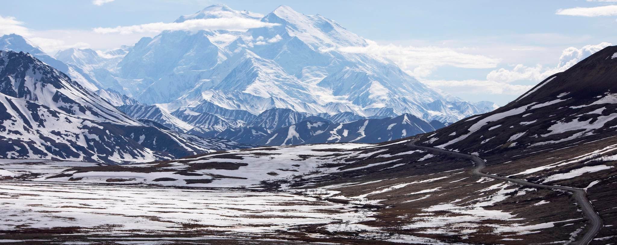
Hiking in the Talkeetna Mountains offers access to diverse landscapes, including alpine tundra, carved valleys, and mountain lakes. The region features significant glaciers, such as the Matanuska Glacier, and transitions from spruce-poplar forests in river valleys to shrubland and alpine tundra at higher elevations. Numerous rivers like the Talkeetna River traverse the area, providing varied habitats and corridors. This environment supports a range of easy hiking trails suitable for exploring the natural features.
Best easy hiking trails in the Talkeetna Mountains
- The most popular easy hiking route is Edge Nature Trail, a 1.1 mile (1.8 km) trail that takes 30 minutes to complete. This route offers views of the surrounding landscape with minimal elevation gain.
- Another top favourite among local hikers is Gold Cord Lake Trail, an easy 0.9 mile (1.4 km) path. This trail leads to a glacial lake, providing scenic views of the water and surrounding hills.
- Local hikers also love the Fiddlehead Trail, a 3.0 mile (4.8 km) trail leading through varied terrain, often completed in about 1 hour 20 minutes.
- Hiking in the Talkeetna Mountains is defined by alpine tundra, glaciated valleys, and spruce-poplar forests. The network offers options for different ability levels, with a focus on accessible easy trails.
- The routes in Talkeetna Mountains are highly rated by the komoot community with an average score of 4.7 stars from over 20 reviews. More than 400 hikers have used komoot to explore Talkeetna Mountains's varied terrain.
Last updated: July 7, 2026
26
hikers
1.76km
00:31
50m
40m
The Edge Nature Trail offers a delightful, easy hike through a forest that opens up to spectacular glacial vistas. This 1.1-mile (1.8 km) route, with a gentle 148 feet (45 metres) of elevation gain, guides you past groves of quaking aspen and unique geological features like a rock glacier and silt deposit. It's a perfect, quick outing, taking only about 30 minutes, ideal for those seeking big views without a strenuous climb.
Planning your visit is straightforward; the trail is accessible and well-suited for all skill levels, including families. While specific parking information isn't detailed, arriving earlier in the day is often a good strategy for popular spots. You can enjoy the trail year-round, with winter providing a distinct, snowy perspective of the Matanuska Glacier, so be sure to check local conditions before you go.
This trail is notable for showcasing the ecological recovery following the Matanuska Glacier's recession, offering a living lesson in nature's resilience. It provides stunning views of the glacier and surrounding landscape, including the Haultain Glacier Viewpoint, making it a high-reward option for minimal effort. It's a fantastic choice if you're looking for a family-friendly hike with impressive scenery near the Matanuska Glacier.
5.0
(1)
12
hikers
2.62km
01:04
250m
150m
Embark on a journey through the scenic Hatcher Pass on the Hatch Peak and April Bowl Trail, where you'll quickly ascend into an alpine wonderland. The path winds through switchbacks before revealing the breathtaking April Bowl, home to picturesque blue and turquoise tarns. As you continue towards Hatch Peak, the terrain transitions to rockier sections, but the continuous, expansive views above the treeline make every step worthwhile, offering a true taste of Alaska's rugged beauty.
Accessing this popular route is straightforward, with parking available at the Hatcher Pass (April Bowl Trailhead). Given its popularity, especially during peak season, arriving early is a smart move to secure a spot. The trail is best enjoyed during the summer months when conditions are optimal for hiking and the alpine flora is in full bloom, providing a vibrant backdrop to your adventure. While rated easy overall, be prepared for some steep, rocky sections, particularly as you approach Hatch Peak.
This trail is a standout for its accessibility to impressive mountain scenery without requiring an overly long commitment. It's situated in the historically rich Hatcher Pass area, known for its stunning alpine landscapes and old mining sites. Keep an eye out for local wildlife, such as marmots, which often make an appearance. The opportunity for 360-degree panoramic views from Hatch Peak, encompassing the Talkeetna and Chugach Mountains, truly sets this hike apart.

Sign up for free
9
hikers
2.34km
00:40
50m
50m
The Mill Loop and Hard Rock Trail offers a delightful blend of Alaskan nature and history, making it one of the more popular routes for a relaxed outing. This easy 1.5-mile (2.3 km) hike takes you through a scenic landscape, featuring a pleasant dirt path and a charming wooden footbridge spanning Fishhook Creek. You'll also pass by old mill buildings, providing a unique glimpse into the region's past, all within a comfortable 40 minutes and just 170 feet (52 metres) of elevation gain.
Planning your visit to this family-friendly trail is straightforward, as it's situated within Independence Mine State Historical Park. While specific parking information isn't detailed, the park environment typically provides ample space for visitors. It's an ideal choice for those seeking a gentle walk with historical interest, and its easy difficulty makes it suitable for hikers of all experience levels.
The primary appeal of this trail lies in its rich historical context, allowing you to explore the mining heritage of the area through the presence of old mill buildings. The Mill Loop section itself sits at an elevation of approximately 3,470 feet, adding to the sense of being in a truly Alaskan landscape. The distinctive wooden footbridge over Fishhook Creek is another memorable feature, enhancing the trail's natural charm.
2
hikers
4.78km
01:19
80m
70m
The Fiddlehead Trail offers a delightful and accessible hiking experience, perfect for a leisurely outing. This easy 3.0-mile (4.8 km) route, which takes about 1 hour and 18 minutes to complete, guides you through a mix of shaded forests and open meadows, showcasing lush ferns and a vibrant array of wildflowers like columbines and paintbrush, especially in summer. With only 277 feet (84 metres) of elevation gain, it's a gentle walk that provides scenic views of the surrounding mountains, making it an ideal Fiddlehead Trail for beginners.
When planning your visit, remember that the Fiddlehead Trail is part of the Buffalo Pass Recreation Area and is subject to an annual closure from May 15 to June 15 to protect wild elk calving grounds. This multi-use trail is well-signed, making navigation straightforward, and it's often recommended to visit during summer for the wildflowers or in autumn for the beautiful fall colors. Check for Fiddlehead Trail parking and trailhead information before you go, as it's a popular spot.
This trail stands out as a collaborative effort between the US Forest Service, the City of Steamboat Springs, and the Steamboat Trails Alliance, ensuring its upkeep and accessibility. Its gentle nature and diverse scenery make it a truly family-friendly Fiddlehead Trail hike, offering a chance to enjoy nature without a strenuous climb. The protection of elk calving grounds highlights the area's commitment to wildlife, adding a unique ecological aspect to your hike.
1.41km
00:30
140m
0m
Hike the Gold Cord Lake Trail, an easy 0.9-mile route in Hatcher Pass, Alaska, leading to a stunning jewel-blue glacial lake.
1
hikers
4.82km
01:31
190m
190m
The Lane Basin Loop offers a truly magical hiking experience in Alaska's Archangel Valley, providing stunning views of jagged mountains, mossy streams, and fairy pools. This easy 3.0 miles (4.8 km) loop, with 623 feet (190 metres) of elevation gain, can be completed in about 1 hour and 30 minutes, making it a fantastic option for those seeking a less crowded alternative to other popular trails in Hatcher Pass.
Accessing the trailhead requires navigating Archangel Road, which is notoriously rough and often demands a high-clearance vehicle. You might need to park further down and walk an additional one to two miles to reach the actual start of the trail. Be prepared for muddy sections, especially earlier in the season, though alternative dirt trails can help you avoid the worst of it. Dogs are permitted on the trail, making it a great family-friendly activity.
This trail stands out for its comparable beauty to the more heavily trafficked Reed Lakes Trail, but with the advantage of being significantly quieter. You'll encounter unique features like the Monument rock formation and the remote Lane Hut, which offers striking views. For those looking for a longer adventure, the hike can be extended by climbing over two passes to reach the Snowbird Glacier overlook, adding another layer of exploration to your Hatcher Pass visit.
2.07km
00:49
260m
0m
Hike the easy 1.3-mile Rae-Wallace Mine Trail in Independence Mine State Historical Park, gaining 837 feet for mountain views and wildflower
1.31km
00:28
130m
0m
Hike the easy 0.8-mile Lane Basin Trail in Hatcher Pass, Alaska, to discover alpine scenery, fairy streams, and mountain lakes.
4
hikers
6.03km
01:56
270m
270m
Hike the Gold Cord Lake Trail in Hatcher Pass for an easy 3.7-mile (6.0 km) journey to a jewel-blue glacial lake with historic mining views.
4
hikers
1.99km
00:41
110m
110m
Hike the easy 1.2-mile April Bowl Trail in Hatcher Pass for stunning alpine views, blue lakes, and wildlife in just 41 minutes.
Get access to more routes and recommendations from other explorers.
Sign up for free
Already have an account?
Our route recommendations are based on thousands of hikes, rides, and runs completed by other people on komoot.
Start today with a free account
Your next adventure awaits.
Login or Signup
Popular around Talkeetna Mountains
Other adventures in the Talkeetna Mountains

Tips from the Community

Ascending Hatch Peak from the east is a pretty easy hike up a narrow ridge trail. If you choose to make a full loop and continue back down into the bowl along the western ridgeline, be prepared for hiking on big pieces of loose rock and large, jagged scree.
0
0
The Independence Mine parking area, just on the other side of the road from here, is behind a gate that is closed in the evening. It usually requires a modest fee (it seems to change every few years, but tends to be around $5-$10 per vehicle). If the gate is open you can save some distance by parking here, but otherwise you'll need to walk from the parking lot further down the road.
0
0
This pretty alpine lake sits in a mountain bowl, surrounded by boulders — but the approach itself is pretty mild, with just a bit of rocky trail to deal with. This is a very popular destination for families.
1
0
April Bowl is a shallow tundra basin that, in a typical year, contains three small lakes. It's also a great place to see ptarmigan (Alaska's state bird), and if you walk to the edges of the bowl you get some pretty views of the mountains around you. If you want to keep hiking, you can follow a rough trail up the ridgeline of Hatch Peak, which looms over the bowl.
1
0
A small sign marks the actual pass here, and there is a small parking area with just enough room for a few cars. Just on the other side of the gravel road you'll find a trailhead for the family-friendly hike up to April Bowl, which in a normal year contains three small lakes. If you're feeling rugged, you can also hike up a rocky ridgeline to the obvious summit of Hatch Peak, which looms over the bowl.
1
0
Frequently Asked Questions
How many easy hiking trails are available in the Talkeetna Mountains?
The Talkeetna Mountains offer a wide selection of easy hiking trails, with over 15 routes specifically categorized as easy. In total, there are more than 30 hiking routes across various difficulty levels in the region.
What kind of terrain can I expect on easy hikes in the Talkeetna Mountains?
Easy hikes in the Talkeetna Mountains typically feature varied terrain, transitioning from spruce-poplar forests in river valleys to shrubland and alpine tundra at higher elevations. You'll find carved valleys, pristine mountain lakes, and often minimal elevation gain, making them accessible for most hikers. Trails like the Edge Nature Trail offer panoramic views with gentle slopes.
Are there any family-friendly easy hikes in the Talkeetna Mountains?
Yes, many easy trails in the Talkeetna Mountains are suitable for families. The Fiddlehead Trail is a good option, offering varied terrain over 3 miles. Shorter options like the Edge Nature Trail are also excellent for younger children due to their short distance and minimal elevation.
Can I bring my dog on the easy hiking trails?
Many trails in the Talkeetna Mountains are dog-friendly, but it's always best to check specific trail regulations before heading out. Generally, dogs are welcome on leash. Be mindful of wildlife, especially bears and moose, which are common in the region.
What natural features or landmarks can I see on easy hikes?
Easy hikes often lead to stunning natural features. The Gold Cord Lake Trail, for instance, takes you to the beautiful Gold Cord Lake. You might also encounter views of glaciers, such as those accessible from areas within Hatcher Pass, or explore historic sites like Independence Mine State Historical Park, which is located within the scenic Hatcher Pass State Recreation Area.
Are there any easy loop hikes in the Talkeetna Mountains?
Yes, there are several easy loop options. The Lane Basin Loop is an easy 3-mile (4.8 km) trail that offers a circular route through scenic Alaskan landscapes. Another option is the Mill Loop and Hard Rock Trail, which provides a shorter loop experience.
What is the best time of year for easy hiking in the Talkeetna Mountains?
The best time for easy hiking is typically during the summer months, from June to September, when trails are clear of snow and wildflowers are in bloom. Fall also offers beautiful foliage. Always check current trail conditions, especially in spring and late fall, as snow can linger at higher elevations.
How long do easy hikes in the Talkeetna Mountains typically take?
The duration of easy hikes varies depending on the trail length and your pace. Shorter routes like the Edge Nature Trail can be completed in about 30 minutes, while longer easy trails such as the Fiddlehead Trail might take around 1 hour 20 minutes.
Are permits required for easy hiking trails in the Talkeetna Mountains?
Generally, permits are not required for day hiking on most easy trails in the Talkeetna Mountains, especially within state recreation areas like Hatcher Pass. However, it's always advisable to check with the specific park or land management agency for any updates or special regulations, particularly if you plan to venture into more remote areas or stay overnight.
What do other hikers enjoy most about the Talkeetna Mountains?
The Talkeetna Mountains are highly rated by the komoot community, with an average score of 4.7 stars from over 20 reviews. Hikers frequently praise the diverse landscapes, from alpine tundra to glaciated valleys, and the accessibility of trails that offer stunning views without extreme difficulty. The region's natural beauty and varied terrain are often highlighted as key attractions.
Where can I find parking for easy hiking trails?
Many popular trailheads, especially within areas like Hatcher Pass State Recreation Area and Talkeetna Lakes Park, offer designated parking facilities. For example, the Hatcher Pass (April Bowl Trailhead) is a known starting point with parking. Always arrive early during peak season to secure a spot.
What should I bring for an easy day hike in the Talkeetna Mountains?
Even on easy trails, it's wise to be prepared. Essential items include water, snacks, layers of clothing (weather can change quickly), rain gear, sun protection, a map or GPS device, and bear spray. Sturdy hiking shoes are recommended, and binoculars can enhance wildlife viewing opportunities.
Are there any easy trails that offer views of glaciers?
While many easy trails offer distant mountain views, some provide access to glacial landscapes. The region is known for glaciers like the Matanuska Glacier, which is vehicle-accessible. Within Hatcher Pass, trails can offer views into glaciated interiors. For a closer look at a glacial lake, consider the Gold Cord Lake Trail.
Most popular routes in the Talkeetna Mountains
Most popular attractions in the Talkeetna Mountains

Get inspired with the komoot mobile app


Explore more
Browse the best Hikes in other regions.
