Easy hikes and walks around Altlay
4.6
(6380)
22,888
hikers
343
hikes
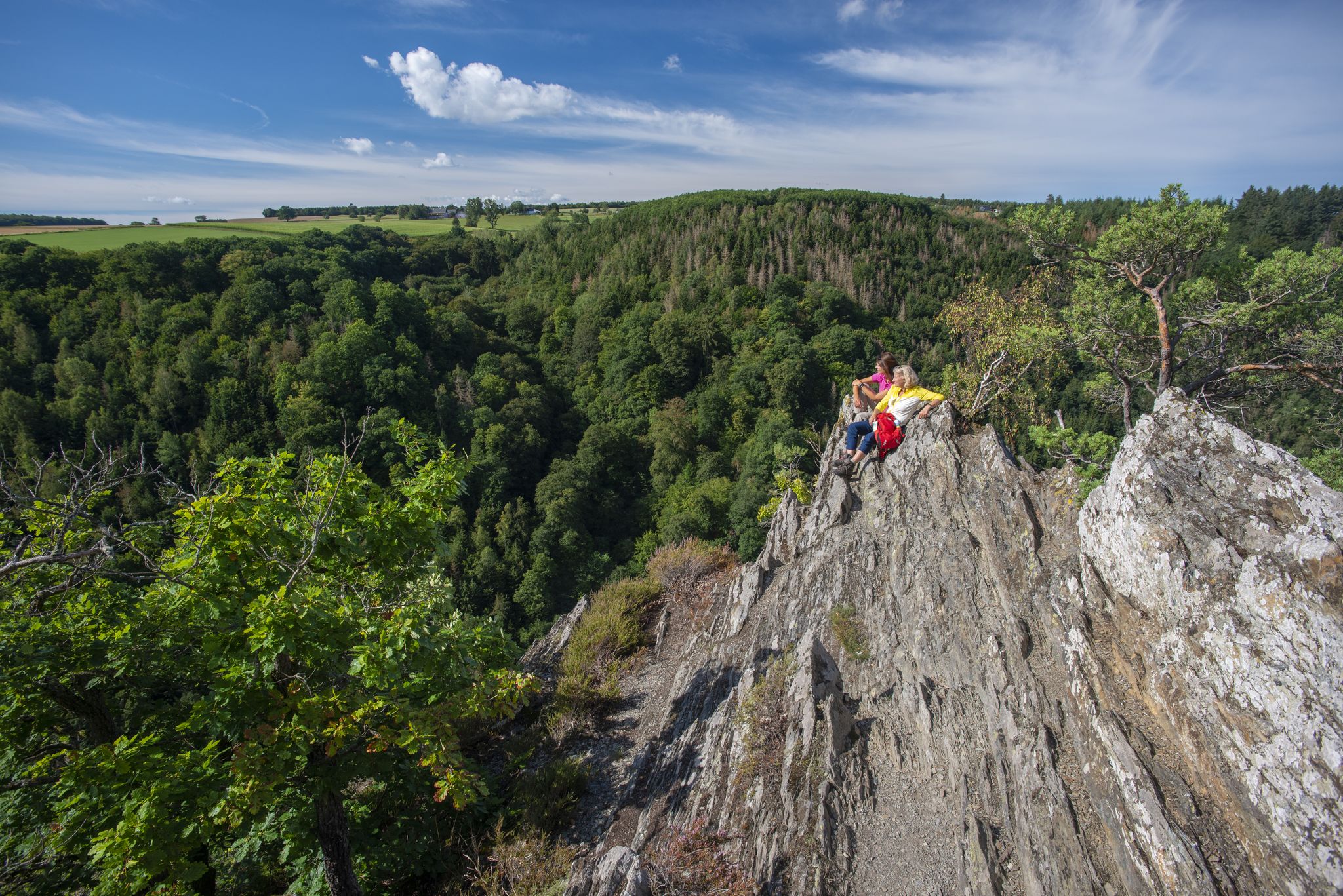
Easy hiking trails around Altlay lead through a landscape shaped by rugged slate rocks, winding forest paths, and idyllic stream valleys. The region, situated on the fringe of the Hunsrück, features rolling hills, dense woodlands, and panoramic views over the deeply carved Hitzelbach Valley. Proximity to the Mosel Valley also offers picturesque views of vineyards. These easy routes provide accessible ways to explore Altlay's unique geological formations and natural beauty.
Best easy hiking trails around Altlay
- The most popular easy…
Last updated: August 17, 2026
4.5
(20)
90
hikers
5.28km
01:30
120m
120m
Easy hike. Great for any fitness level. Easily-accessible paths. Suitable for all skill levels.
4.9
(9)
18
hikers
5.40km
01:32
120m
120m
Easy hike. Great for any fitness level. Easily-accessible paths. Suitable for all skill levels.

Sign up for free
5.0
(3)
12
hikers
6.44km
01:55
190m
190m
Easy hike. Great for any fitness level. Easily-accessible paths. Suitable for all skill levels.
5.0
(2)
6
hikers
6.32km
01:39
50m
50m
Easy hike. Great for any fitness level. Easily-accessible paths. Suitable for all skill levels.
7
hikers
3.57km
00:58
50m
50m
Easy hike. Great for any fitness level. Easily-accessible paths. Suitable for all skill levels.
Get access to more routes and recommendations from other explorers.
Sign up for free
Already have an account?
Our route recommendations are based on thousands of hikes, rides, and runs completed by other people on komoot.
Start today with a free account
Your next adventure awaits.
Login or Signup



Tips from the Community

If you like rugged rock formations, are sure-footed and not afraid of narrow rocky paths, this is the right place for you. Pure nature to enjoy.
0
0
Great rock formations and sometimes beautiful views in the Hunsrück.
0
0
Great dream loop, especially in summer, as it often goes through the shady forest. The slate rocks are quite impressive.
0
0


A very beautiful hiking trail, but there are also some sections where surefootedness is required. Great paths, fantastic views, and lots of nature. Highly recommended.
0
0
Historically interesting, sure, but it's just a "dark hole."
1
1
Beautiful view of the surrounding forests.
2
0
Frequently Asked Questions
How many easy hiking trails are available in Altlay?
Altlay offers a wide selection of easy hiking trails, with over 200 routes specifically categorized as easy. These trails allow you to explore the region's unique landscapes at a comfortable pace.
What kind of terrain can I expect on easy hikes around Altlay?
Easy hikes in Altlay feature varied terrain, including winding forest paths, idyllic stream valleys, and areas with rugged slate rocks, particularly in the 'Altlayer Schweiz'. You'll also find rolling hills and dense woodlands characteristic of the Hunsrück region. While generally easy, some sections might be uneven due to the natural rock formations.
Are there any easy circular walks in Altlay?
Yes, Altlay is known for its excellent circular routes. For example, the Viewpoint – Hitzelbach Valley loop from Altlay is an easy 3.3-mile (5.3 km) circular trail offering scenic views. Another popular option is the Altlayer Schweiz Rocky Outcrop – View of Altlay loop from Altlay, which is 3.4 miles (5.4 km) long and explores the distinctive rocky outcrops.
Are the easy hiking trails in Altlay suitable for families?
Many easy hiking trails in Altlay are suitable for families, offering accessible paths through natural beauty. The nearby Baybach Valley, for instance, features the well-marked 'Baybachklamm Nature Trail' which is particularly suitable for families and provides educational insights into local flora and fauna.
Can I bring my dog on the easy trails in Altlay?
Generally, dogs are welcome on the hiking trails around Altlay. The region's diverse landscapes, from forest paths to open fields, provide a great environment for walks with your canine companion. Always ensure your dog is on a leash and that you clean up after them to preserve the natural environment for everyone.
What natural features or viewpoints can I see on easy hikes?
Easy hikes in Altlay offer numerous natural features and panoramic viewpoints. You can explore the rugged slate rocks and impressive rock passages of the 'Altlayer Schweiz' and enjoy expansive views over the deeply carved Hitzelbach Valley. The Stahlkreuz vantage point provides breathtaking vistas of Altlay and surrounding villages. You might also encounter the Hindenburglay Viewpoint and Shelter or the View of the Moselle bend at Kröv from the Rabenwerk shelter.
Are there any historical sites or attractions along the easy routes?
Yes, Altlay's history, particularly its mining heritage, is reflected in several sites. You can find information boards along certain trails detailing the area's past. The Forest Chapel 'Zum Bildchen' – Large Slate Tunnel loop from Altlay leads past historical features. Other nearby attractions include the Apollo Mine and Shelter and various castle ruins like Dill Castle Ruins.
What is the best time of year to go on easy hikes in Altlay?
The Mosel Valley's proximity ensures pleasant temperatures for summer hikes, making it an ideal time to visit. However, the region's beauty can be enjoyed throughout the year, with spring offering lush greenery, autumn showcasing vibrant foliage, and winter providing a serene, quiet atmosphere for those prepared for cooler weather.
How can I get to the easy hiking trails in Altlay using public transport?
While Altlay is a smaller village, public transport options may be limited. It's advisable to check local bus schedules in advance, as services might connect to larger towns in the Hunsrück or Mosel regions. Planning your route with a combination of public transport and short walks or taxis might be necessary to reach specific trailheads.
Is parking available near the easy hiking trails in Altlay?
Yes, parking is generally available in and around Altlay, often near trailheads or in the village center. Look for designated parking areas, especially if you're starting a popular loop trail. Specific parking details for individual routes can often be found on komoot tour pages.
What do other hikers enjoy most about hiking in Altlay?
The easy hiking trails in Altlay are highly rated by the komoot community, with an average score of 4.6 stars from over 2,900 reviews. Hikers often praise the region's unique geological formations, the peaceful forest paths, and the stunning panoramic views, especially those overlooking the Hitzelbach Valley and the Mosel.
Are there any places to eat or drink near the easy hiking trails?
Altlay and its surrounding villages offer options for refreshments after your hike. You can find guesthouses like the Nils Müller guesthouse in Altlay itself, which often provide food and drink. Exploring nearby towns in the Mosel or Hunsrück regions will also yield a variety of cafes, pubs, and restaurants.
Can I combine an easy hike with a visit to the Moselsteig Trail?
Yes, Altlay's proximity to the Mosel Valley makes it easy to combine your easy hikes with sections of the renowned Moselsteig Trail. This 365 km long-distance trail offers diverse stages through forests, vineyards, and charming wine villages. For more information on the Moselsteig, you can visit en.visitmosel.de.
Most popular attractions around Altlay

Get inspired with the komoot mobile app


Explore more
Browse the best Hikes in other regions.
