Easy hikes and walks around Bühlertann
4.6
(2524)
10,915
hikers
80
hikes
Easy hiking trails around Bühlertann traverse a landscape characterized by rolling hills, dense forests, and expansive fields. The region features scenic paths along the Kocher River and through the Fischach valley, offering varied natural settings. Hikers can explore protected natural areas and routes that pass by historical structures like Tannenburg Castle. The terrain generally includes gentle gradients, making it suitable for accessible walks.
Best easy hiking trails around Bühlertann
- The most popular easy hiking route is Greeting Barrels in Bühlertann – View of Tannenburg loop from Bühlertann, a 2.2 miles (3.6 km) trail that takes 55 minutes to complete. This route offers views towards Tannenburg Castle.
- Another top favourite among local hikers is View of Tannenburg loop from Bühlertann, an easy 2.2 miles (3.6 km) path. This trail provides further perspectives of the historic Tannenburg.
- Local hikers also love the Dock on Treibsee – Treibsee loop from Alter Pflanzgarten, a 3.0 miles (4.8 km) trail leading through varied natural scenery, often completed in about 1 hour 17 minutes.
- Hiking around Bühlertann is defined by its rolling hills, river valleys, and dense woodlands. The network offers options for different ability levels, with a focus on accessible paths.
- The routes in Bühlertann are highly rated by the komoot community with an average score of 4.7 stars from over 100 reviews. More than 700 hikers have used komoot to explore Bühlertann's varied terrain.
Last updated: May 19, 2026
5.0
(7)
23
hikers
Easy hike. Great for any fitness level. Easily-accessible paths. Suitable for all skill levels.
5.0
(5)
17
hikers
3.58km
01:00
70m
70m
Easy hike. Great for any fitness level. Easily-accessible paths. Suitable for all skill levels.

Sign up for free
4.8
(4)
13
hikers
4.83km
01:17
50m
50m
Easy hike. Great for any fitness level. Easily-accessible paths. Suitable for all skill levels.
5.0
(1)
14
hikers
5.21km
01:25
70m
70m
Easy hike. Great for any fitness level. Easily-accessible paths. Suitable for all skill levels.
5.0
(4)
17
hikers
Easy hike. Great for any fitness level. Easily-accessible paths. Suitable for all skill levels.
Get access to more routes and recommendations from other explorers.
Sign up for free
Already have an account?
Our route recommendations are based on thousands of hikes, rides, and runs completed by other people on komoot.
Start today with a free account
Your next adventure awaits.
Login or Signup

Other adventures around Bühlertann


Tips from the Community

Great view from Tannenburg Castle. Beautiful courtyard and a lovely place for a rest.
4
0

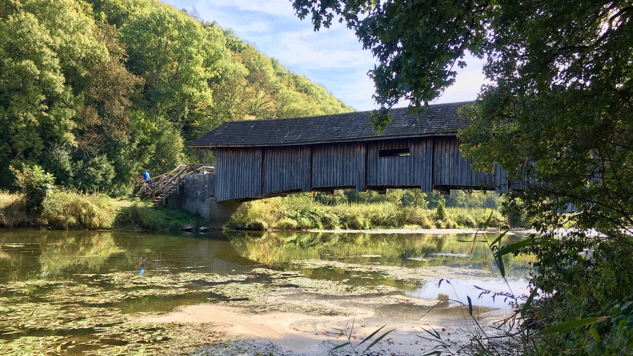
There are many beaver construction sites on the north bank
3
0

Very beautiful path in a mossy valley
0
0

One of the most beautiful spots on the Bühlersteig.
0
0

Very nice idyllic section of the Bühlersteig. Here you can hike well even in the heat.
1
0
The Landgasthof zum Sternn in Bühlertann is ideal for an overnight stay after the second stage of the Bühlersteig. The restaurant and beer garden are open Friday to Tuesday from 5 p.m. and Sunday from 11 a.m. Here you can eat delicious.
0
0

Small lake in the middle of the forest. There are benches where you can have a nice picnic and break!
4
0
Frequently Asked Questions
How many easy hiking trails are available in Bühlertann?
Bühlertann offers a wide selection of easy hiking trails, with over 40 routes specifically categorized as easy. These trails are designed to be accessible and enjoyable for various fitness levels.
What is the best time of year for easy hikes in Bühlertann?
The best seasons for easy hiking in Bühlertann are spring and autumn. During these times, nature displays its most beautiful colors, and the mild climate is ideal for long, comfortable walks. Spring also brings the blooming of spring snowflakes near Hambacher Mill.
Are there any easy circular hiking routes in Bühlertann?
Yes, many easy routes in Bühlertann are circular, allowing you to start and end at the same point. A popular option is the View of Tannenburg loop from Bühlertann, which is 2.2 miles (3.6 km) long and offers scenic perspectives of the historic Tannenburg.
Can I find easy hikes with good viewpoints in Bühlertann?
Absolutely. The region is known for its picturesque vistas. The "Panoramaweg" offers breathtaking views of the surrounding landscape, and the lookout tower on Altenberg provides an explained panorama. You can also enjoy views towards Tannenburg Castle on the Greeting Barrels in Bühlertann – View of Tannenburg loop from Bühlertann trail.
Are there any easy hiking trails that pass by historical sites?
Yes, Bühlertann's easy trails often combine natural beauty with historical interest. You can explore routes that pass by historical buildings such as the half-timbered town hall and various churches. The Tannenburg Castle – Halden Village Well loop from Bühlertann is an easy 2.9 miles (4.6 km) route that takes you past the notable Tannenburg Castle.
Are there easy hikes suitable for families with children?
Bühlertann is well-suited for family-friendly easy hikes. The diverse terrain includes easily-accessible paths with gentle gradients, making them perfect for children and beginners. The short distances and varied scenery keep young hikers engaged.
What kind of natural features can I expect to see on easy hikes around Bühlertann?
Easy hikes around Bühlertann showcase diverse natural features, including rolling hills, dense forests, and expansive fields. You'll find scenic paths along the charming Kocher River and through the wide meadows of the Fischach valley. There are also nature reserves with rare plants, such as those found on routes leading over the Galgenberg.
Are there any waterfalls or lakes accessible via easy trails?
While Bühlertann itself is not directly known for large waterfalls on its easy trails, the wider region offers several. You can explore nearby attractions like the Waterfall in Naturpark Schwäbisch-Fränkischer Wald or the Nägelesbach Waterfall. For lakes, the Dock on Treibsee – Treibsee loop from Alter Pflanzgarten is an easy 3.0 miles (4.8 km) trail that leads you to the scenic Treibsee.
What do other hikers say about the easy trails in Bühlertann?
The easy hiking trails in Bühlertann are highly rated by the komoot community, with an average score of 4.7 stars from over 100 reviews. Hikers often praise the varied natural scenery, the well-maintained paths, and the accessibility of the routes, making them enjoyable for all skill levels.
Are there options for parking near the easy hiking trails?
Yes, many easy hiking trails in Bühlertann offer convenient parking options at their starting points. It's always recommended to check the specific route details on komoot for precise parking information before you head out.
Can I reach easy hiking trails in Bühlertann using public transport?
Bühlertann is an accessible community, and some trailheads may be reachable via local public transport. For specific routes, it's advisable to consult local bus schedules or plan your journey using public transport apps to find the most convenient access points.
What is the typical duration for an easy hike in Bühlertann?
The duration for easy hikes in Bühlertann varies, but many can be completed within 1 to 2 hours. For example, the View of Tannenburg – View of Tannenburg loop from Bühlertann is an easy 3.2 miles (5.2 km) trail that typically takes about 1 hour and 25 minutes to complete.
Most popular routes around Bühlertann
Most popular attractions around Bühlertann

Get inspired with the komoot mobile app


Explore more
Browse the best Hikes in other regions.
